
Yesterday’s Weather
Arizona, Northern Mexico, and the western two thirds of New Mexico were quiet as the dry air aloft put a “lid” on convection. Mixing of the high surface dew points and dry air aloft cooled the lower atmosphere, keeping afternoon temperatures down. The eastern third of New Mexico was active, as Gulf of Mexico moisture interacted with a cold front to produce thunderstorms. The National Weather Service issued a flash flood watch for that area, and this will continue in southeast New Mexico and the burn scar areas in the mountains.
Analysis
A tropical upper tropospheric trough (TUTT) has weakened as it dropped southwest into the Pacific and is not expected to regenerate. An active TUTT is in the central Gulf of Mexico moving slowly westward, with another TUTT well north of the Windward Islands, east of Florida.

The center of the high at 250mb is in the Pacific Ocean southwest of San Diego with it’s ridge axis shifted south to Brownsville. The ridge has been pushed south due to the trough along the front range of the Rocky Mountains from New Mexico north to Colorado then into the Dakotas. A ridge on the east coast is just off South Carolina’s coast. The TUTT east of Florida is getting squeezed between the two highs, becoming a trough axis instead of a closed low.
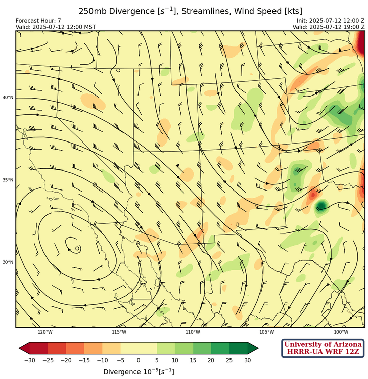
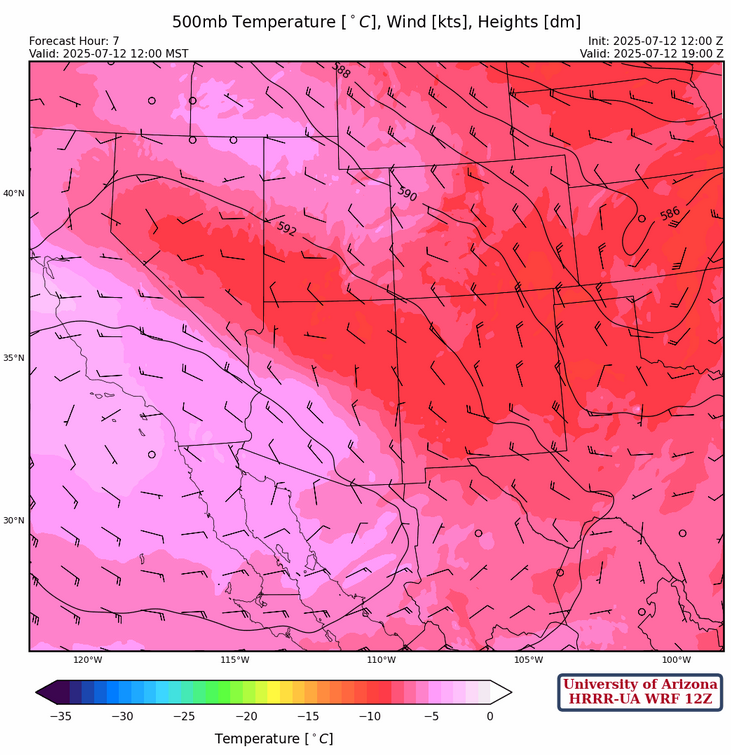
At 500mb, the center of the ridge is near San Diego and the ridge axis extends eastward to the Texas Big Bend area. Winds are westerly 10 to 20mph, and very warm temperatures are north of the ridge axis in Arizona.
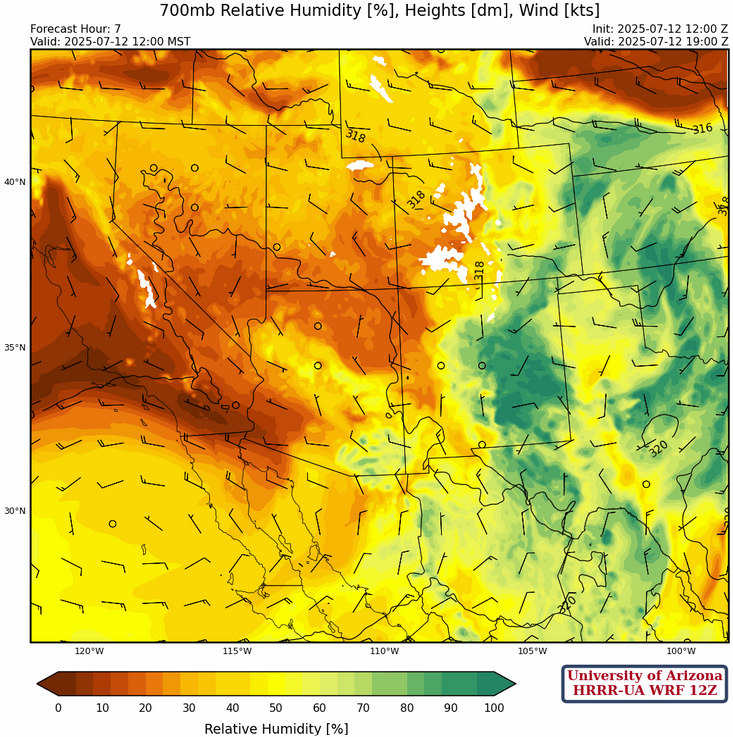
The ridge axis at 700mb is even further south across northern Mexico. Strongest winds are from the west at 15 mph across southern Arizona, but the flow is northwest in New Mexico with a low over southeast Colorado. The flow of dry air from off the west coast is weaker now as the flow is weak across central and northern Arizona.
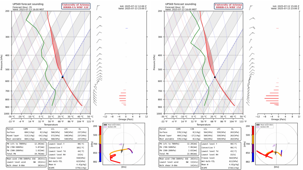
Today
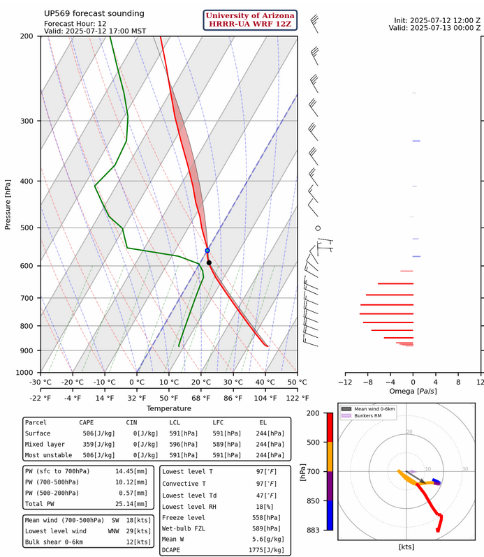
Today is going to be a transition day, with a different weather pattern starting tomorrow. The forecast sounding for San Simon this evening shows enough CAPE for storms. In the lower right corner of the forecast sounding, is the hododgraph with the black arrow showing the mean wind from the surface to 6km (10 knots to the southeast) and the pink arrow showing the Bunkers Relative Motion (5 knots to the east). Bunkers calculates thermal wind (relative to storm motion) between the lower 500 meters of the atmosphere and a layer around 500mb. Thermal wind is a change of wind speed with height (wind shear), and blowing to the east shows the north-to-south increasing temperature gradient.
The HRRR-UA WRF 12Z forecast radar shows storms just to the north in Greenlee County and in New Mexico from the early afternoon to early evening. Note that the low deserts do not dry out too much today leaving moisture in place for thunderstorm potential on Sunday.
Tomorrow
San Simon sounding for the afternoon shows a northeast wind and both mean wind and thermal wind now indicate the storms will move southwest to west. DCAPE across southeast Arizona and southern New Mexico would support outflow winds of 35 to 40mph.
Dust storms are therefore expected with the microbursts, as shown by the 10-meter wind speed forecast on the right below.
And, finally, rain in some of the buckets.

Outlook
This pattern continues into next week with precipitation mainly in the eastern third of the state as well as on the Mogollon Rim and White mountains. The heaviest rain will be in Cochise and Santa Cruz Counties.

But the future still does not look great as neither of the long-range forecast models (GFS, nor the ECMWF) show enough precipitation to get us near normal monthly totals by the end of July. Maybe August will be better if everybody washes their car.
Discussion written by Pat Holbrook