
Yesterday’s Weather
Yesterday, thunderstorms began firing mainly after 2pm with storms at maximum intensity at 5pm in the White Mountains and eastern portion of the Mogollon Rim the spreading southward though Graham and Cochise Counties by 7pm. Thunderstorms propagated to the southwest and began dying off by midnight.
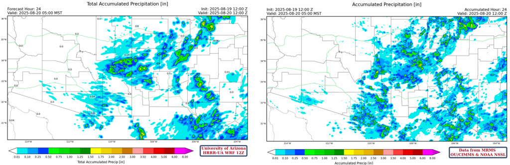
MRMS 24-hour accumulated precipitation, shown below on the right, is consistent with the satellite images. There was precipitation from northern New Mexico southwest to the White Mountains then south across Graham and Cochise counties. Some precipitation made it into eastern Pima and Santa Cruz Counties though not as much as forecast (below, left). The skew-T forecasts from yesterday for Tucson and Phoenix showed no Convective Available Potential Energy (CAPE) and that verified.
Analysis
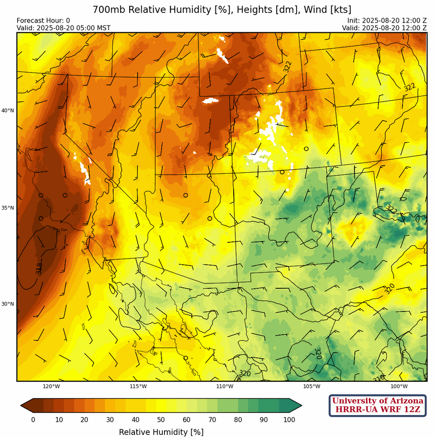
Looking at surface dew point temperatures for this morning, there’s not much change since yesterday except where it rained in eastern Arizona in the White Mountains.
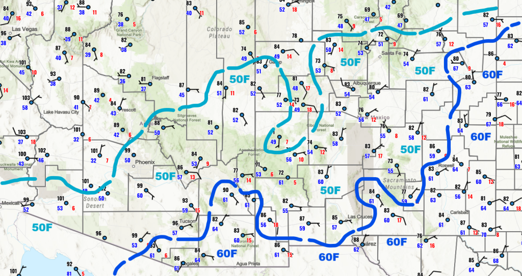
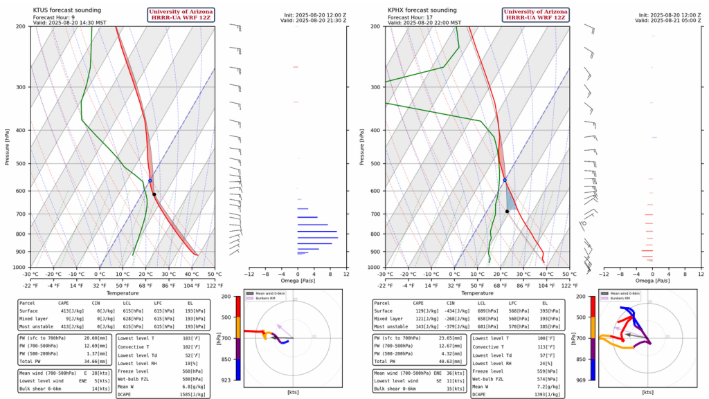
Even though Phoenix has a 50°F dewpoint temperature the sounding shows that once the boundary layer becomes mixed during the heat of the day the dewpoint temperature will drop to about 40°F. With no CAPE due to a very dry atmosphere below 700mb any thunderstorms will have to move in from the east. The moist layer of 700mb is the moisture that moved in from eastern Arizona overnight.

The morning low-level water vapor shows the mid clouds that were over the region rotating around the circulation of the high pressure located in northwest New Mexico.

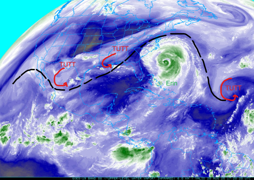
Hurricane Erin is producing dangerous surf rip and currents, as well as storm surges on the North Carolina coast as it swings northeast of the Atlantic coast. There may be some tropical storm conditions on the Virginia coast on Thursday. The tropical upper tropospheric trough (TUTT) is being pushed way to the north due to the anticyclone and in a day or so will reform further south.
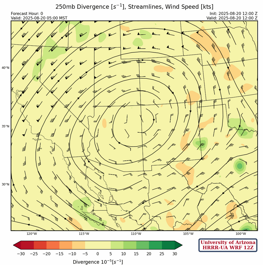
At 250mb, the high-pressure ridge is parked over the four corners, typically a favored spot to cause good flow for monsoon storms. The TUTT low south of Texas will move to the southern Gulf of California with the TUTT extending east into the Gulf of Mexico in a few days.
The ridge at 500mb is a little north of its 250mb location and easterlies across the region should help move thunderstorm that develop to move west towards the low deserts. The flow is strong enough that the storms will move further west than yesterday before dissipating.
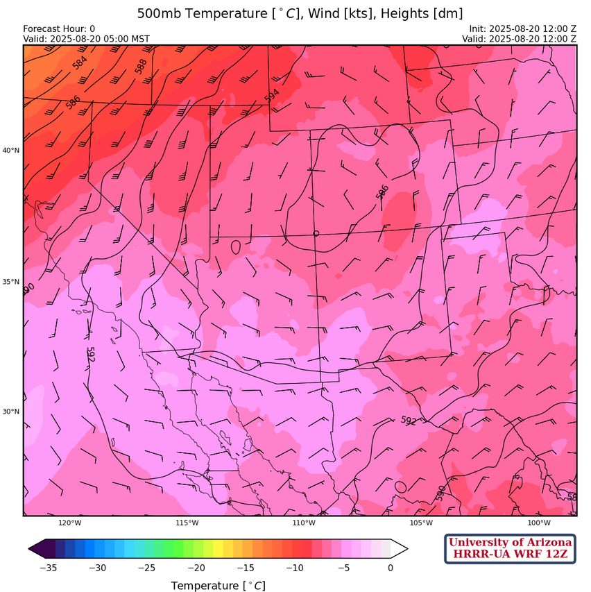
At 700mb, there’s a slight increase in moisture across the region, in particular eastern New Mexico. Easterly winds will help guide the storms off the mountains.
Today
The forecast sounding for Tucson this afternoon at 2:30pm (below, left) indicates thunderstorms form in the early afternoon from Tucson to Nogales and move west to Sells before running into dry air. The forecast sounding for Phoenix tonight at 10pm shows CAPE above the boundary layer, similar to the Tucson forecast. Storms moving off the White Mountains will slowly dissipate as they move west into the desert, but they could reach the Phoenix area in the late evening and there is enough CAPE for light precipitation.
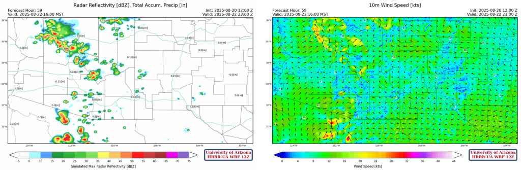
The HRRR-UA WRF 12Z radar reflectivity forecast supports a similar interpretation. The precipitation starts around 2pm in the southern Arizona and about an hour later in the northern part of the state. Storms will move west to the edge of the desert before dissipating after midnight.
Tomorrow
Tomorrow will be similar to today with another Rim Shot aimed at Phoenix more than Tucson. Note that Phoenix is forecast to get some precipitation in the rain bucket. Far southern Arizona will have to contend with dry low-level air moving in from the east. Thunderstorms may have wind gusts to 45 mph, altough there is not a broad area with gusty winds, so any blowing dust will be localized.
Outlook
Model forecasts show another similar day on Friday with the radar reflectivity and wind gusts much like today. In the Tucson area, activity will be later in the evening with just isolated storms forming before due to low-level dry air. But, once the boundary layer disconnects from the mid-levels activity will develop.
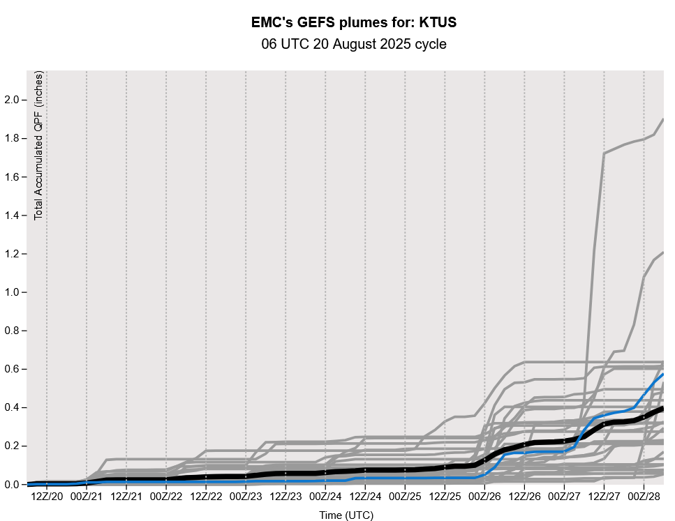
GEFS plume forecasts shows the next ramp up for Tucson isn’t until August 26th. The good and bad news is that both the ECMWF and GFS show a fair amount of precipitation due troughs/baroclinicity interacting with monsoon moisture the first week of September. Both models hint at the monsoon ending by September 5th.
Discussion written by Pat Holbrook and Patrick Bunn