
Yesterday’s Weather
Mostly quiet across New Mexico and Arizona yesterday as the atmosphere was suppressed by the ridge across the region. Still a few storms developed on the sky islands, but were rather weak and dissipated away from the mountains. The real action was once again along the spine of the Sierra Madre mountains with thunderstorms moving westward to the Gulf of California. Thunderstorm outflow has moved into Arizona overnight with dewpoint temperatures returning back to the 60s.
Analysis
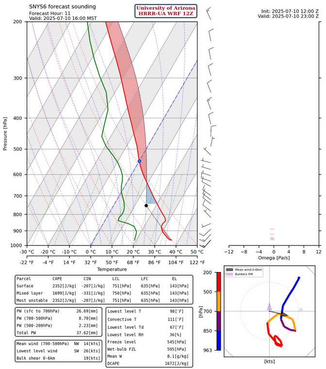
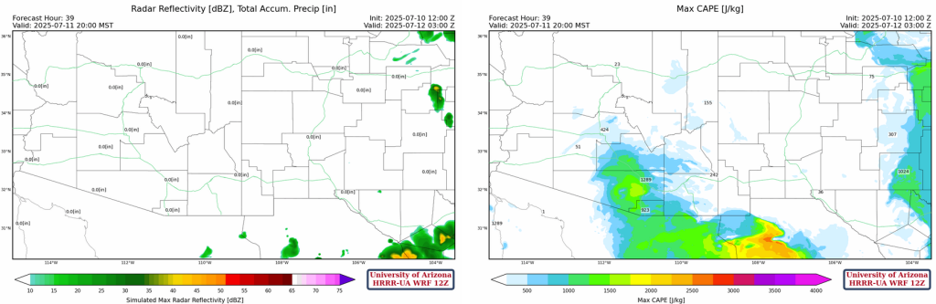
The 4 pm forecast sounding for Lukeville, AZ below shows the dilemma we face with the forecast for today. Thunderstorm outflows from Mexico will produce cooling in the sounding below 800 mb such that the 2300 J/kg convective available potential energy (CAPE) is offset by 246 J/kg of convective inhibition (CIN). It’s possible that there will be enough lift for thunderstorms to form in the mountains of central Pima county this evening.
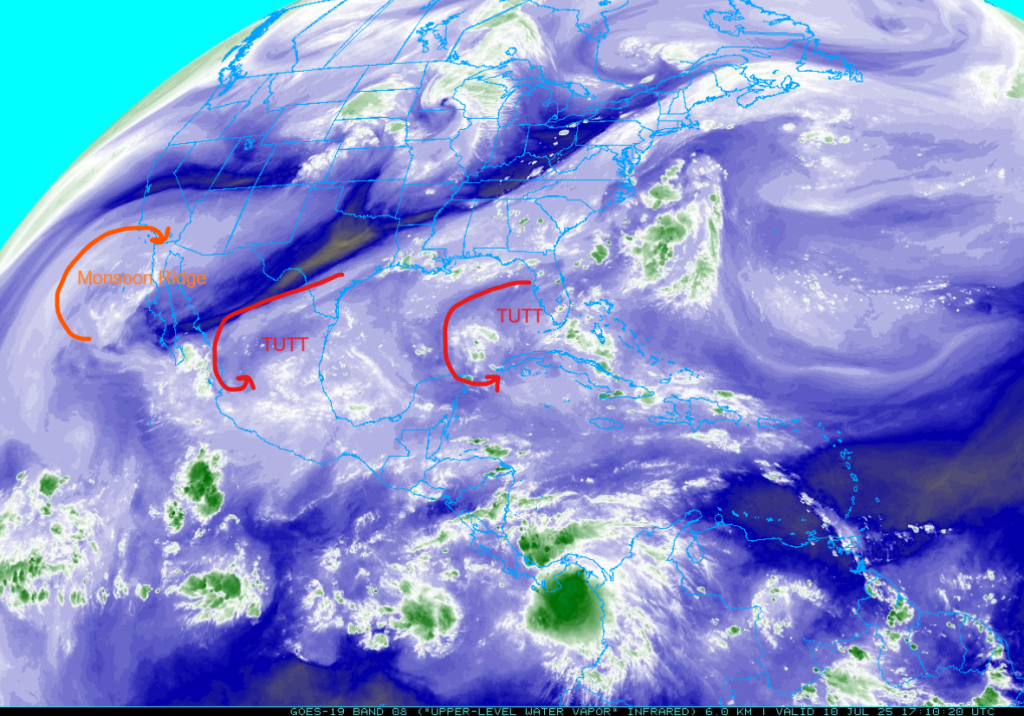
At 250mb, a tropical upper tropospheric trough (TUTT) is still moving southwest across central Mexico. Dry air is pulling around the TUTT from Texas to central Baja California. Another TUTT is over western Cuba and continues to move west.
There has not been much change in the position of the ridge off the east coast and the col in Louisiana but the ridge in northwest Mexico yesterday has moved westward into northern Baja. The trough in northern California has moved eastward rather quickly to Wyoming and is further north than model forecasts.

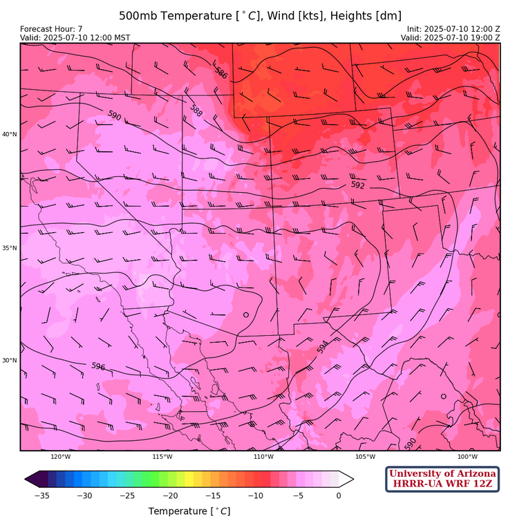
The high pressure ridge at 500mb is in southern California, and the ridge axis extends into central Oklahoma. Temperatures have warmed some in Arizona, which is not good for deep convection.
700mb westerly winds have dried out northern Arizona and northwest New Mexico, as the ridge has shifted to near Puerto Penasco.
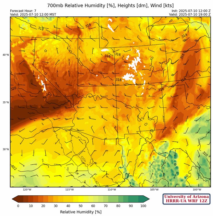
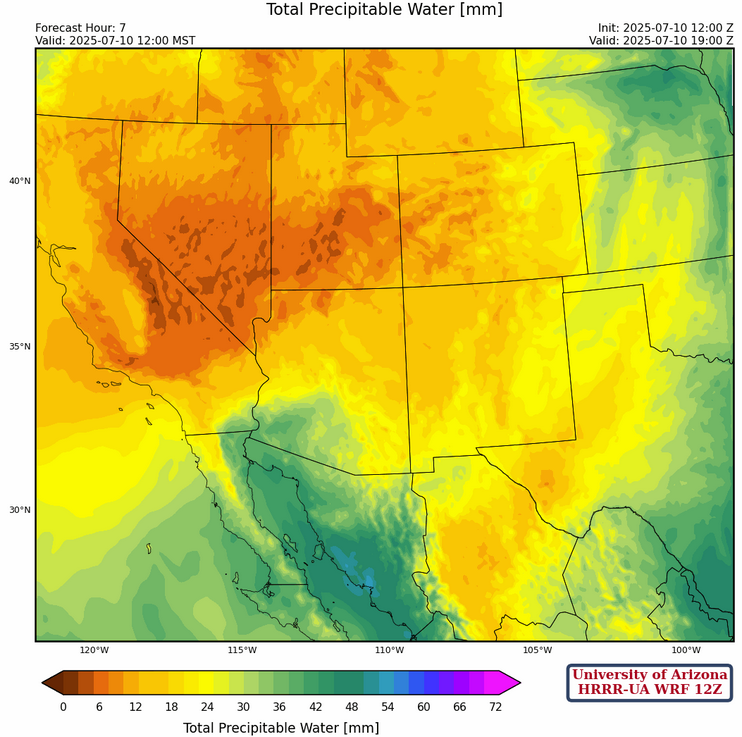
A tight gradient of moisture is in southern Arizona with the 0C dew point temperature from Yuma to Albuquerque.
Today
The trough that was potentially providing dynamic lifting in New Mexico thunderstorms has moved further north than forecast yesterday. Storms will occur primarily in northeastern New Mexico, with some in southwestern New Mexico also. Microbursts may be associated with stronger storms, especially in southwestern New Mexico. A push of moisture will make its way into Arizona in the late afternoon to evening hours. This moisture will also bring in strong CAPE values, which could fire off some storms in central Pima and Santa Cruz counties over the mountains. Some of these storms could drift off the mountains into the valleys, but strong CIN in the atmosphere will make this difficult. There is a lot of uncertainty about any storms firing in the evening over Arizona, and the model forecast does not have any storm forecast, so it is a coin flip as to whether or not storms will fire.
Tomorrow
A similar, but weaker, pattern of storms is expected over New Mexico tomorrow. Storms will form over the mountains of northeastern and southwestern New Mexico. Arizona is also expected to experience a similar pattern, but alongside that comes a similar amount of uncertainty. Another push of moisture will arrive around the late afternoon to the evening, which will bring strong CAPE into the region. There is a chance of storms firing off in Pima, Santa Cruz, and Cochise counties, but this will need to be evaluated again tomorrow given the morning forecasts.
Outlook
Long-range forecasts for New Mexico show it will likely become more active early next week. There are differences in the model forecast systems on when the monsoon moisture will move back into Arizona. Below is the 10-day total accumulated precipitation from the GFS and ECMWF model systems, with the GFS a tad more optimistic in Tuscon. If the pattern does not change to a more typical monsoon pattern, this would represent below normal precipitation for the month of July.

Discussion written by Pat Holbrook