
Yesterday’s Weather
Isolated storms were mainly in the mountains of southern New Mexico yesterday, extending west to the Chiricahua Mountains in Arizona then south into Mexico. The high-level cirrus clouds from the storms shown below were moving northward while the actual storm movement was to the south feeding into higher Convective Available Potential Energy (CAPE) in northwest Mexico. Overnight mid-level clouds and showers were south of the border and are now moving westward spreading the clouds back into southeast Arizona.
The location of precipitation was forecast about right yesterday, with underestimation of most intense totals in eastern New Mexico and some northern Sonora Mexico. Yesterday’s HRRR-UA WRF 12Z 24-hour accumulated precipitation forecast is on the left and equivalent observations from MRMS on the right.

Analysis
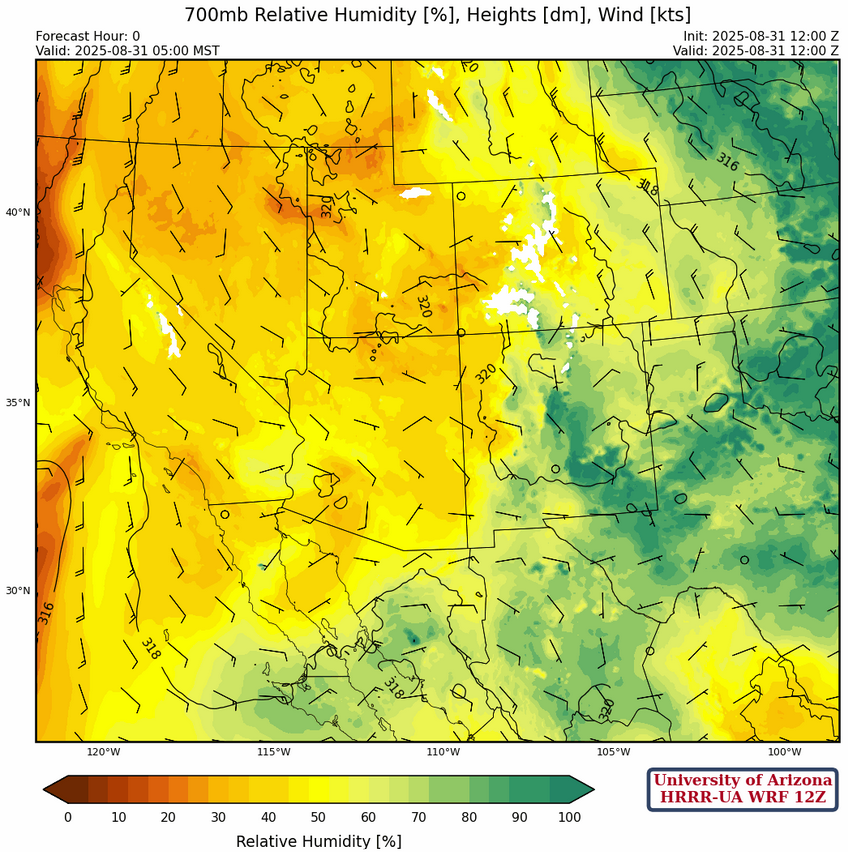
Surface dewpoint temperatures from this morning show it is still drying out in northern Arizona and northwest New Mexico. 30-40°F dewpoints have are now across a broad area of the Colorado Plateau. Southwest Arizona and the Colorado River valley have lower dewpoint temperatures than the past week, with Yuma now at 57°F.

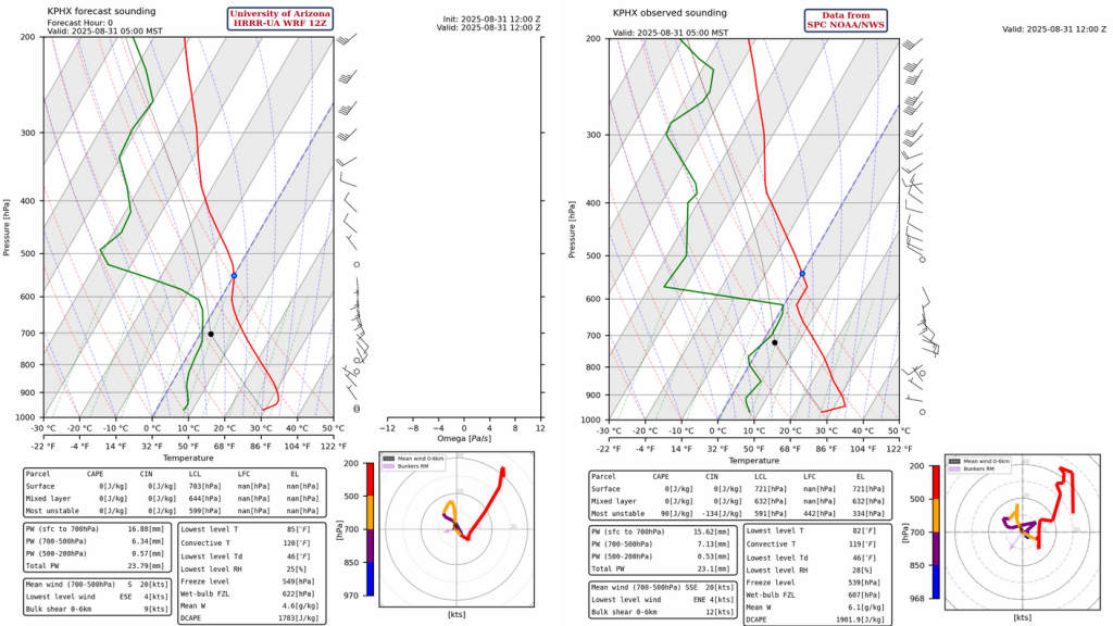
The observed sounding from Phoenix at 5am and the corresponding forecast initialization from HRRR-UA WRF 12Z are below. The sounding shows the boundary layer inversion near 600mb has persisted from yesterday to today. Moisture between the 700 and 600mb level looks to be marginally underestimated by the forecast initialization, though it’s a negligible difference when considering total column precipitable water. Otherwise the forecast initialization is good.
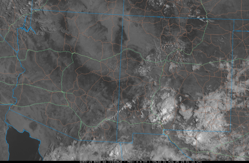
The GEOS19 visible satellite image from 8am this morning shows a few showers and thunderstorms over southern New Mexico moving slowly east. Other storms are in northern Mexico southeast of Douglas moving west. Most of Arizona is cloud free, though southeast Arizona has some cirrus that shouldn’t inhibit surface heating much.
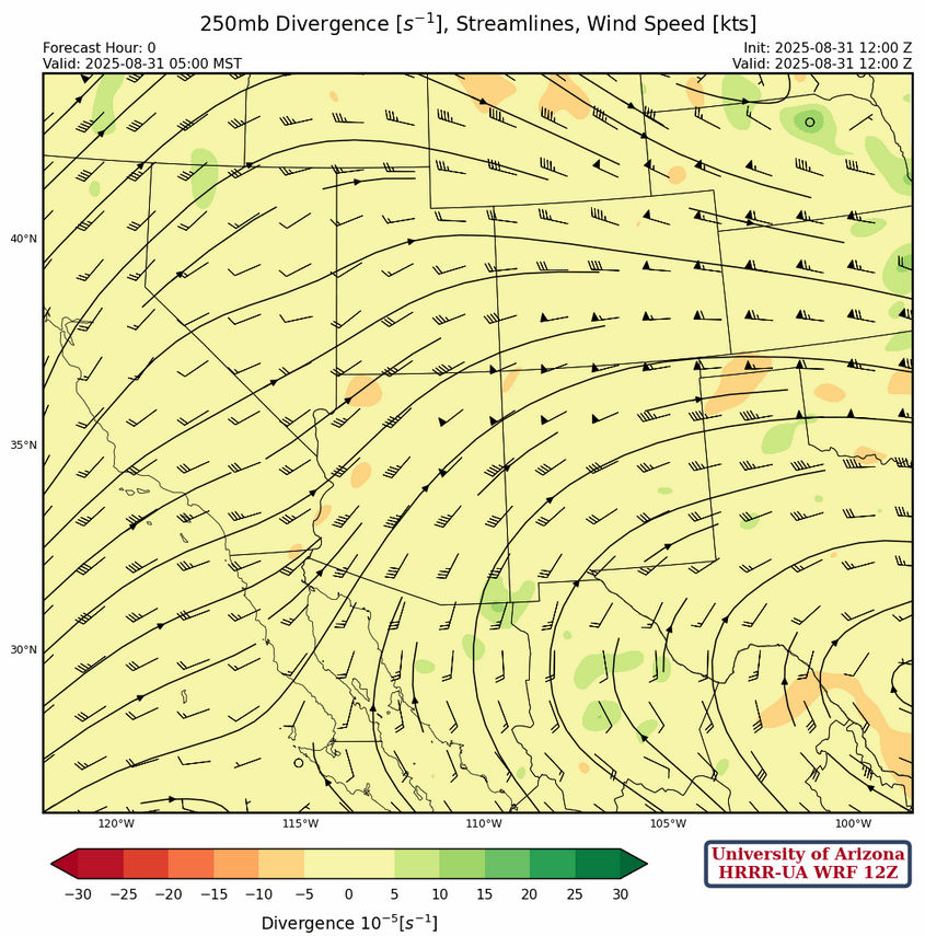
The center of the sub-tropical high-pressure ridge is in south Texas at 250mb, with a ridge axis extending west to the northern Gulf of California. The trough that was over the Rocky Mountains has now moved into the Great Plains, with another trough over the west coast. Over Arizona and New Mexico, winds are from the southwest with speeds around 35 knots. Some divergence is indicated over southeast Arizona and southern New Mexico north of the ridge axis.
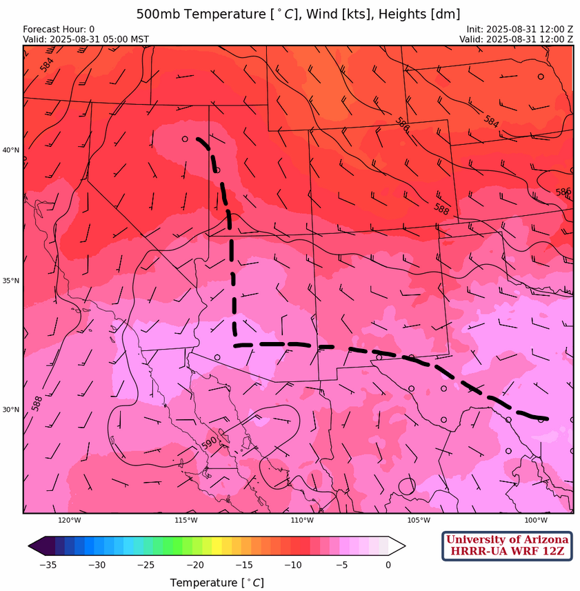
There are multiple centers of the ridge and the axes are annotated on the 500mb temperature forecast initialization below. The trough over the Great Plains will push the ridge over Texas south while the ridge in Arizona drifts to the north.
At 700mb, the ridge is centered along the Utah/Colorado border. Initially, moist air from New Mexico will move into Arizona over the next few days, but the circulation around the ridge will bring drier air into most of the region by the middle of the week.
Today
The forecast sounding for San Simon at 1pm (below, left) shows a decent amount of CAPE for thunderstorm development this afternoon. Storms should move west at 15mph, although this motion will be influenced by outflow boundaries. The forecast sounding for Tucson at 7pm (below, right) shows no significant CAPE, though there is very little Convective Inhibition (CIN) in the most unstable part of the sounding around 600mb. Not an environment favorable for convective initiation in Tucson then, but more importantly not a inhibiting environment for outflows moving into the area. The wind shear profile is good with easterly mid-level flow, and southerly high-level wind; meaning storms that do form will travel west (San Simon to Tucson), while their anvils will blow north.

This afternoon thunderstorms will develop in the White Mountains eastward into New Mexico and move west/southwest getting to I-10 by evening. Dust storms are possible along I-10 in both Arizona and New Mexico. HRRR-UA WRF 12Z forecast radar reflectivity show that storms will reach the Vail area not Tucson, but this is too close to call. Whether it rains or not, the outflow will move across the Tucson area. Wind gusts in Tucson are predicted to only be about 30mph, although some dust from Cochise County may be accompany with the winds.
Tomorrow
The HRRR-UA WRF 12Z forecast predicts a Rim Shot bringing strong winds into Phoenix, but that may be overestimating what might occur since the storms in Pinal and Graham counties tomorrow are a little too weak for the type of winds shown by the forecast. What is more important for tomorrow’s forecast is the easterly wind flow across southern New Mexico into southern Arizona. This will spread dry air into the state with no significant storms in southeast Arizona.
Outlook
Only isolated storms are forecast for northern Arizona and New Mexico for Tuesday, with a few dotted over the mountains in southern Arizona.

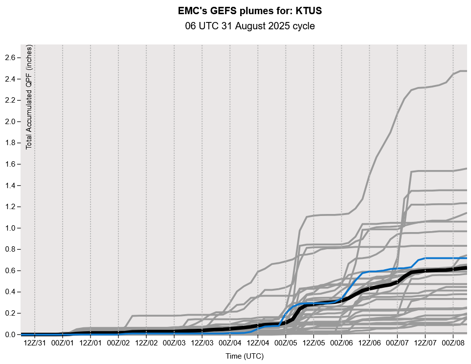
The GEFS plume forecasts have been very consistent ramping up precipitation later next week, though these are coarse resolution long-range forecasts with significant uncertainty. Monsoon moisture is predicted to be drawn northward into the Arizona by a trough along the west coast. Accumulated precipitation totals remain low at least until next weekend.
Discussion written by Pat Holbrook and Patrick Bunn