
Yesterday’s Weather
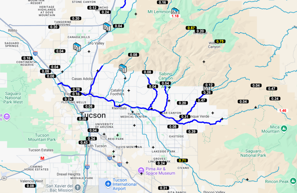
It’s always a wonder with monsoon thunderstorm activity and yesterday was no different. For the most part in Tucson and Phoenix the storms were close to the mountains as surface-based CAPE was not enough to create storms over the valleys without some other help such as outflow boundaries. Below is the precipitation gauge data from the Pima County Flood Control District which shows 0.5 to 1 inch rain in and near the mountains and similar data from Rainlog.org shows the precipitation in the Phoenix metro area. Most of the rain in the cities appeared to be anvil rain which is quite common during the monsoon. There was flash flooding in spots especially around Buckeye and on the Tohono O’odham nation.

Not a clip for the “best of” reel, but good to see some updrafts on the Catalinas in Tucson.
Analysis
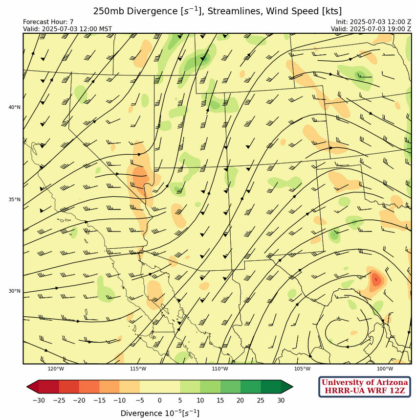
At 250mb, a tropical upper tropospheric trough (TUTT) has weakened and moved northward into the Carolinas while another TUTT is in the southern Gulf of Mexico.
Anticyclonic flow continues across central Mexico. The trough along the west coast is lifting out as the jet max is now east of the trough axis. Strongest winds are in western Arizona at 50 knots weakening to 25 knots over New Mexico. Strong divergence is noted in northern Arizona.
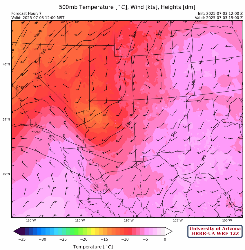
At 500mb, the four corners high has been pushed eastward by the low over Nevada and is now centered in Kansas. Flow over both New Mexico and Arizona is from the southwest at 10 to 15 knots.
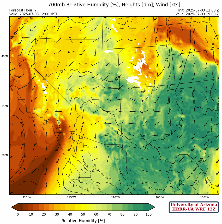
A 700mb, the western third of Arizona is drying but a large area of +6C dew point temperatures remains over the eastern third of Arizona and, southern New Mexico, and west Texas. Flow is only about 5 to 10 knots.
Today
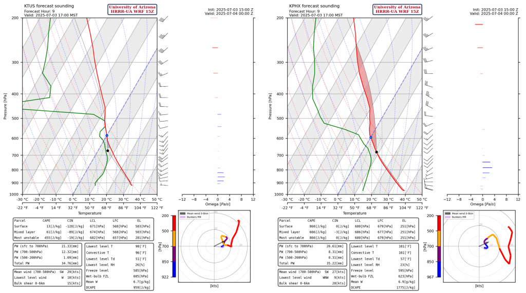
Forecast soundings for Tucson and Phoenix show an inverted v signature, but Tuscon has high CIN and low CAPE. This Phoenix sounding shows a very strong likelihood of microbursts.
Storms are expected to start over the mountains of Arizona this afternoon. Any rainfall in the valleys will likely be from the stratiform anvil drifting off the mountains and around 0.15″ or less. Due to weak flow, these storms are not expected to move very quickly. Microbursts may be associated with some of the stronger storms in northwestern Arizona, north of Flagstaff. There is a slight chance of localized heavy rainfall in some areas, especially near the mountains. Another round of storms are also expected to form over the mountains after sunset as the trough axis with the coolest 500mb temperatures will swing from the southwest in a line parallel to Flagstaff / Tucson.
New Mexico will have some rain today also, in a similar pattern to Arizona, though precip totals should remain below 0.25″.
Tomorrow
Some weaker storms may form over the mountains of southern Arizona and these storms are not expected to move into the valleys. There will still be moisture in the valleys, but temperatures will not rise enough to produce any convection. New Mexico shows one or two thunderstorm cells but rain is unlikely. That said, fireworks are expected across both states!
Outlook
Significant drying is expected for the weekend as the ebb and flow of monsoon moisture ebbs out of the region until next week. Thunderstorms are possible, but will be isolated in nature and mainly near the mountains. Below is the radar for the region for Saturday.
Discussion written by Pat Holbrook