
Yesterday’s Weather
Model forecasts were decent yesterday. The only significant fault was underestimating winds in Deming, NM and Guthrie, AZ which had 70 mph wind gusts and visibilities dropped to near zero along I-10. Tucson had 40 mph wind gusts with visibility at the airport dropping to 2.5 miles, and the NWS issued a dust storm warning for eastern Pima, Cochise, and Santa Cruz counties. Watch the haboob sweep into Tucson here…
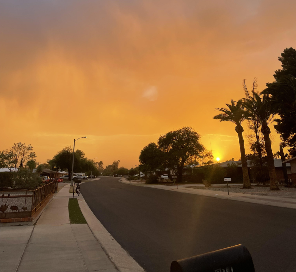
Although there was a wind gust over 50 mph at Horse Camp Canyon (between Oracle and Globe), the model forecasts were too aggressive with wind gusts in the Phoenix area. Dust from the Tucson storms did move into the Phoenix metro area this morning, leading to air quality issues. Rainfall was mostly light, and was not enough to limit the dust storm potential. The second picture is looking west from Golf Links as the dust was suspended in the atmosphere.
Analysis
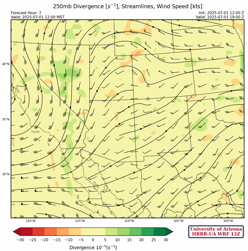
At 250mb, there are still strong westerlies aloft. There is also a ridging pattern over the region.
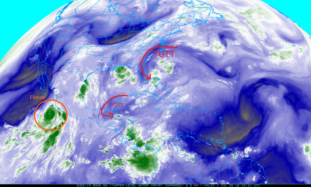
The tropical upper tropospheric troughs (TUTT) described in previous discussion have dissipated, leaving one over Florida. More TUTTs are forming though, with one forming south of the Yucatan Peninsula. The eye of Flossie is visible from this satellite image too!
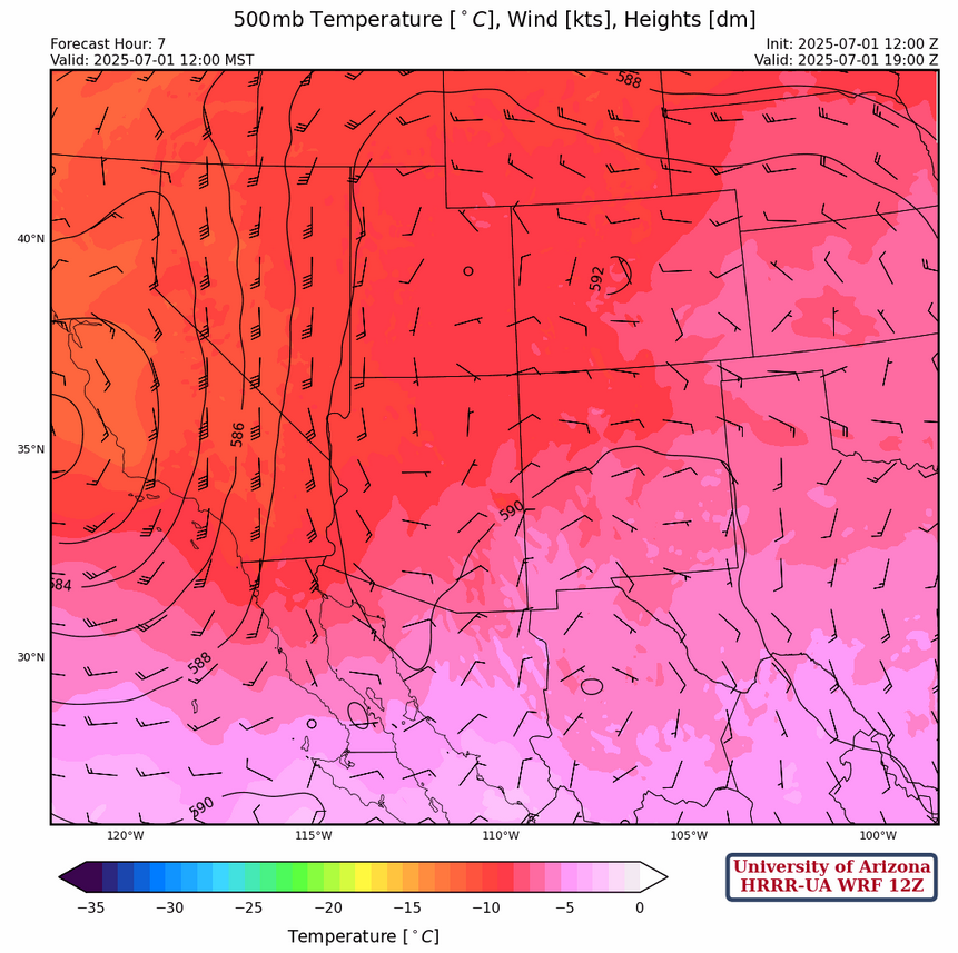
At 500mb, there is a cutoff low right off the coast of California. The monsoon ridge and its associated clockwise flow is still over the four corners region, though it is being disturbed by the approaching low. Temperatures aloft have warmed up by around 2 degrees over Arizona and have warmed up to -5°F over El Paso, Texas.
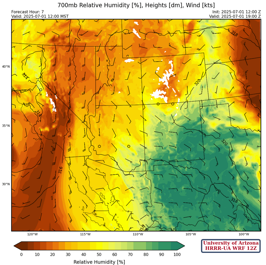
At 700mb, easterly winds are pushing moisture more to the west, with higher dewpoints in eastern Arizona. Temperatures over both states have cooled by around 2 degrees C.
Today
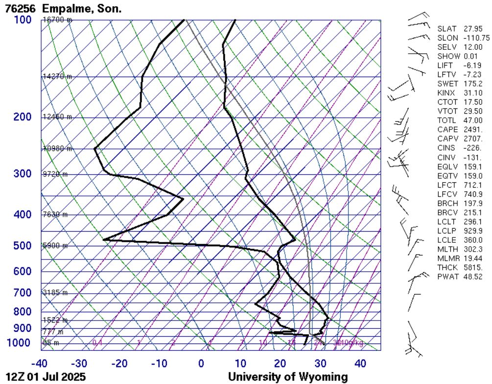
The Empalme, Sonora (Guaymas) sounding showed the gulf surge there this morning, but it will only move northward into Arizona tomorrow.
I prefer the 12Z HRRR-UA WRF model forecast this morning as it has a better handle on the west coast low than the GFS-UA WRF. The low-level easterly winds this morning will limit convection to the mountains today as this type of flow tends to dry the low levels. Note the HRRR and GFS forecast precipitation for this afternoon along with the surface winds at the same time.
The reason I prefer the 12Z HRRR-UA WRF is that I have seen this happen before making me lean towards the HRRR forced forecast. Phoenix is a problem because the storms along the Mogollon rim will be better than yesterday and may generate significant blowing dust. Will there be a strong microburst there or not? Still leaning towards the HRRR-UA WRF solution.
Tomorrow
As the upper low moves eastward, the dynamics (differential vorticity advection) from the upper low will aid vertical motion and create strong storms with heavy precipitation. Once again, the HRRR-UA WRF 12Z seems to have a better handle on this with heavy rain in the mountains from Kingman southeast to Phoenix area with 0.4 of an inch of precipitation in the Phoenix metro seems reasonable. This event has the potential for flash flooding!
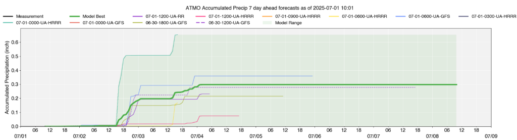
Of course…to confuse the situation the GFS-UA WRF only has .01 inches in Phoenix, so there is signficant spread of model forecasts. To the south, Tucson storms will fire earlier in the day, around 1 pm, and move westward. There is some potential for flash flooding in eastern Pima county also. UA WRF enesemble mean precipitation forecasts for Tucson (UofA campus) show 0.2 of an inch for tomorrow.
Outlook
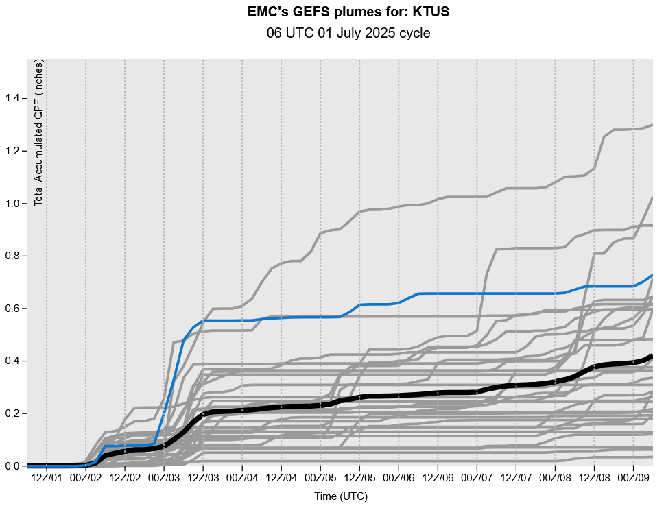
An upper-level trough is expected to approach this area around Thursday, which will start drying everything out again over the weekend. Before that, this upper-level trough will continue to bring dynamic lifting into the area, bringing the potential for strong but isolated thunderstorms. There will still be plenty of moisture in the valleys to fire off these storms. Temperatures are also expected to decrease throughout the week. The GEFS plumes for Tucson forecasts show low precipitation totals (about 0.2 inches) until Thursday, though most members agree on some precipitation for the area.
Discussion written by Pat Holbrook