
Yesterday’s Weather
Thunderstorms were mainly concentrated from the eastern part of the Mogollon Rim to the White Mountains and then extending east into New Mexico. Other storms were in southeast Arizona and near the international border. A wind gust of 58 mph was recorded east of Sierra Vista.
Rainlog.org data below shows the precipitation was more widespread than Tuesday with the westward extent from Nogales to Tucson.
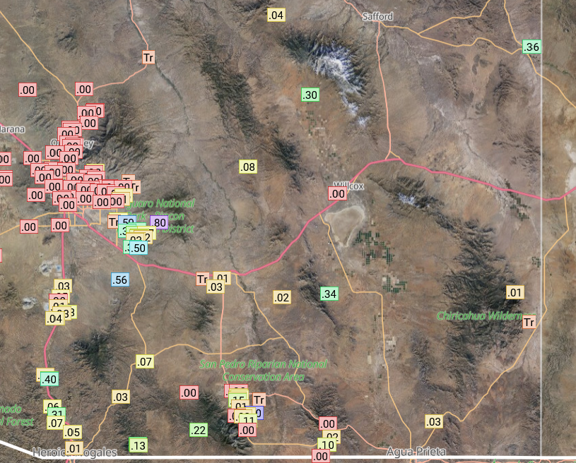
Most of the rain in the valleys was light and mountains had a half to an inch of rain.

The cloud camera looking east from UofA campus captured some downbursts over the Rincon mountains.
Analysis
A tropical upper tropospheric trough (TUTT) is west of the southern tip of the Baja Peninsula and may be aiding outflow of tropical storm Gil. The TUTT low in the Gulf of Mexico yesterday has moved onshore, south of Brownsville. A much smaller TUTT low has moved from Jamaica to just east of the Yucatan Peninsula.

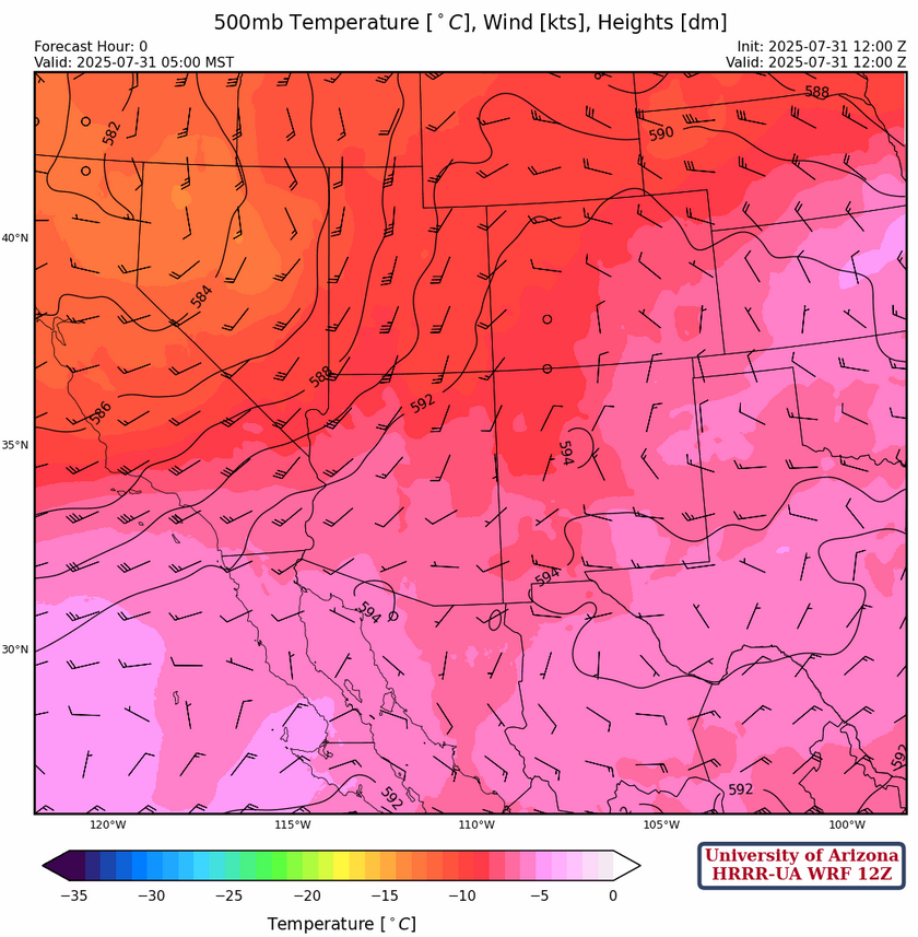
The trough on the west coast at 250mb has moved northward with a strong jet stream extending from southern California to northwestern Colorado. Wind speeds in northern Arizona are 50 to 60 knots from the west decreasing to 15 to 20 knots in southeast Arizona. A col is between the east coast ridge and a ridge far to the west of the central Baja Peninsula in northern Mexico south of Douglas, indicated by the low wind speeds (circles on graphic below). The flow of the TUTT south of Brownsville is being kept to the south of the ridge axis.

The center of the 500mb ridge is near Fort Worth and the ridge axis extends eastward to central Florida and southwest into the Big Bend region of Texas then west across northern Mexico. The west coast low is centered over northern California. Wind flow in Arizona is mainly from the southwest at 10 to 15 knots but becoming light westerly in southeast Arizona. A low in southeast Kansas has a trough axis extending into north central New Mexico. With northerly winds behind the trough and westerly winds to the south of the trough. A ridge will begin building over southern Arizona centered near Ajo by Sunday.
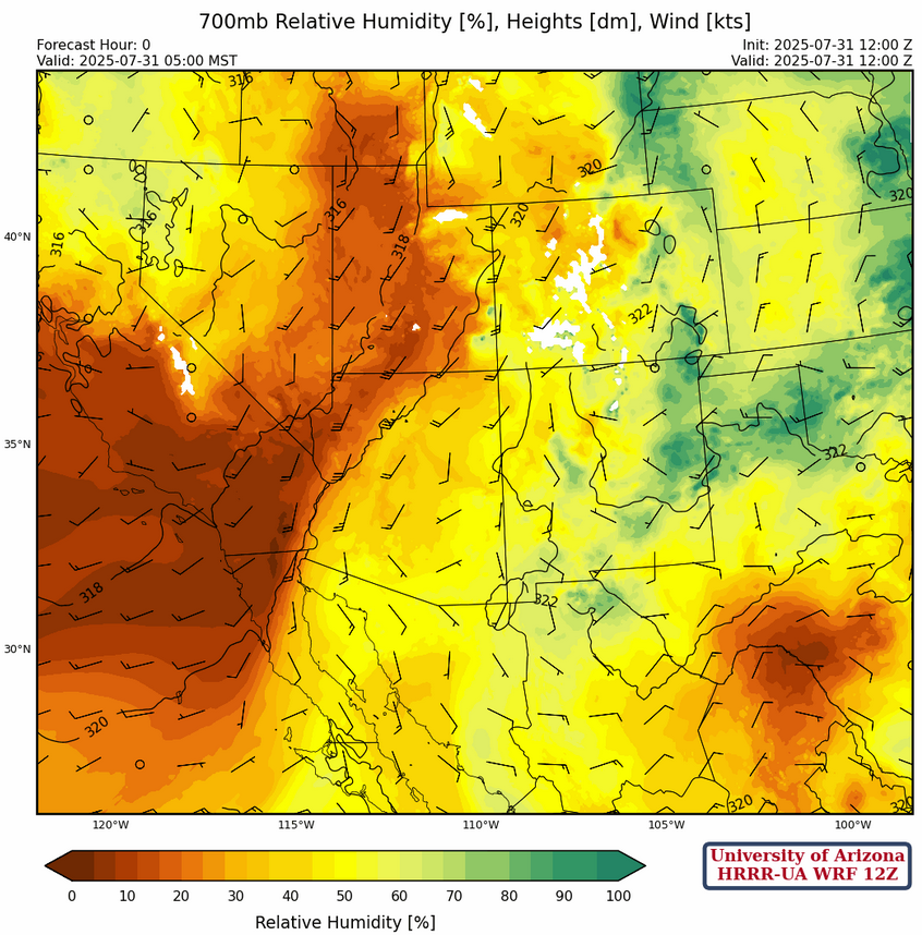
At 700mb, a moisture axis is from the spine of the Sierra Madre’s northward to Deming and then northeast to the Texas panhandle. Winds are from the southwest in advance of the west coast trough over western and northern Arizona but light southerly elsewhere in Arizona. The storm motion will be from either propagation or gust fronts.
Today
The model forecast sounding for yesterday predicited Tucson to have about 200 [J/kg] convective available potential energy (CAPE) associated with the storms that were present. Today the model forecasts CAPE of 390 [J/kg] at the time of storm initiation. Ignoring the microburst winds near the surface there is very little winds aloft to move storms except outflows and propagation.

The simulated radar reflectivity and 10-meter wind maps below show the storms near and east of a line from Tucson to Globe, then extending east into central and western New Mexico.
Tomorrow
Model forecasts show very little CAPE (~150 [J/kg]) as the ridge is building over the region and flow from the northwest pushes dry air into the region. That said, low-level monsoon moisture is hard to get rid of and isolated thunderstorms are forecast over mainly the mountains of the eastern half of Arizona and most of Mexico.

Outlook
Thunderstorms on Saturday will be confined to the mountains of southeast Arizona and mainly central and eastern New Mexico. The total precipitation graphic on the right shows the heaviest precipitation in the mountains over the next 3 days. We also see the I-25 corridor from El Paso to Albuquerque will see very little precipitation.

The GEFS plume forecasts don’t show much into the first week of August. The couple of ensemble members forecast heavier precipitation that may be related to gulf surges kicked off by hurricanes passing south of the Baja. We’ll need to see how the tropical storm situation associated with Gil plays out.

If you’re playing along, today is the last day to make predicitons for August in the Southwest Monsoon Fantasy Game.
Discussion written by Pat Holbrook