
Yesterday’s Weather
A little more activity in southwest New Mexico and southeast and eastern Arizona but the storms tended to stay near the mountains. Microbursts with the storms were generally below 30 knots. The storms along the spine of the Sierra Madre mountains were similar to wednesday with additional development to the north along the U.S./Mexico border by Douglas extending westward to 60 miles south of Nogales then further west to the mountains east of Chaborca. The monsoon flow has shifted further east in New Mexico then into Oklahoma.
Analysis
At 250 mb, the TUTT low is west of Monterrey, Mexico and has been moving slowly north. The weakening “TUTT 2” low over Florida has been guided by the ridge to the north and has moved northwest to Pensacola. Another “TUTT 3” low is moving westward across the Atlantic several hundred miles north of Puerto Rico.

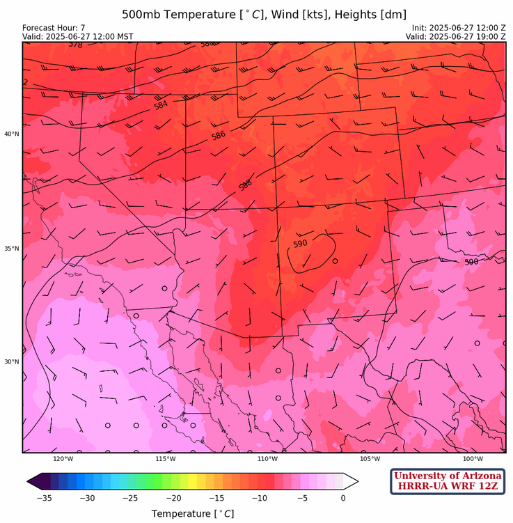
At 500 mb, temperatures have cooled slightly over both states and dewpoints have risen slightly over both states as well. Winds aloft are light and variable.
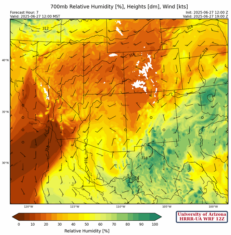
At 700mb, the moisture axis has shifted to the west, covering southeastern Arizona and the southern half of New Mexico. Temperatures over New Mexico have risen by about 1 degree C and dewpoints have dropped by around 1-2 degrees C since yesterday. Dewpoints in Arizona have risen, and temperatures remain around the same as yesterday, though drier than in New Mexico. The high pressure over southern central Arizona remains at the same location.
Today
There’s not much difference between today and yesterday in terms of thunderstorm location with one exception. The 700mb relative humidity forecast today shows the mid-level moisture increasing across central Pima county. Some mountain storms are possible associated with this moisture especially in northern Mexico near Puerto Peñasco given the sea breeze circulation in the northern part of the Gulf of California. Winds will generally be upslope/downslope as synoptic flow has weakened. Scattered thunderstorms in New Mexico will be isolated to areas of high elevation and have relatively low precipitation accumulation totals.
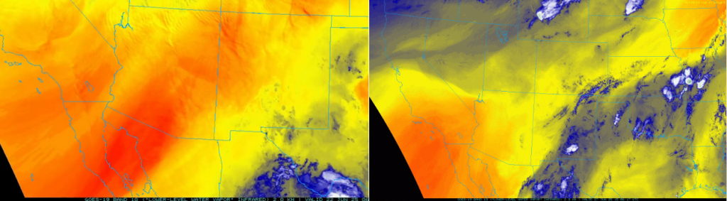
The low-level water vapor image today (right) shows Arizona and New Mexico has much more moisture compared to last weekend on Sunday (left). We’re going in the right direction towards monsoon at least.
Tomorrow
Saturday appears to be the day with the least thunderstorm activity across the region. The forecast simulated radar reflectivity and CAPE for 3pm tomorrow show this trend especially when comparing to today.

Outlook
The tropical system in the Eastern Pacific has become better organized this morning as it moves slowly westward.
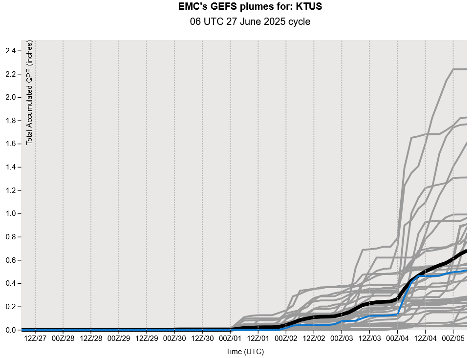
Even higher surface air temperatures are expected over the weekend going into next Monday, but some relief may be on the horizon. The Global Ensemble Forecast System (GEFS) plumes for Tuscon are shown below, and more ensemble members are agreeing that there will be significant precipitation around the 3rd/4th of July. Although the tropical system may help with an increase in moisture, the overall synoptic flow is expected to turn to the east. Such a synoptic flow will likely bring moisture into our region next week and start the 2025 monsoon.
Discussion written by Pat Holbrook