
Yesterday’s Weather
When is an increase in storms across the region no big deal? When the storms are mainly in the mountains. That is what occurred across most of the region yesterday. But there are exceptions to the rule; the Fort Huachuca area and Sierra Vista was one of them where over an inch of rain at half the rain gauges there.
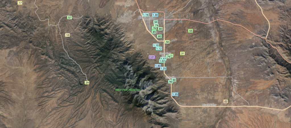
The rainfall totals were the result of storms firing in a “train” formation, one after another, as at least three different storms moved over the region. The satellite imagery lopp below shows the storms that hit Sierra Vista on the US/Mexico border. To the south in Sonora, an Mesoscale Convective System (MCS) developed over the state and moved to the Gulf of California.
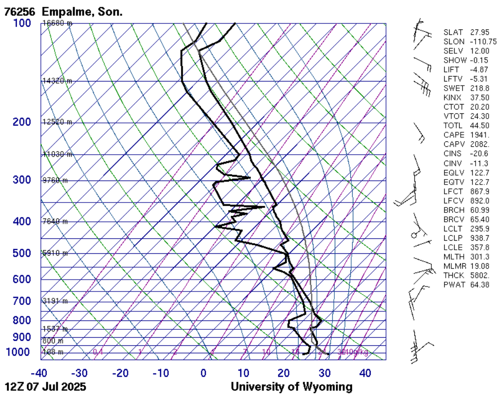
The Empalme, Sonora (Guaymas) sounding shows the moisture up to 850mb. It’s not technically a gulf surge, more like a large outflow from the MCS, but this does show deep moisture is close by.
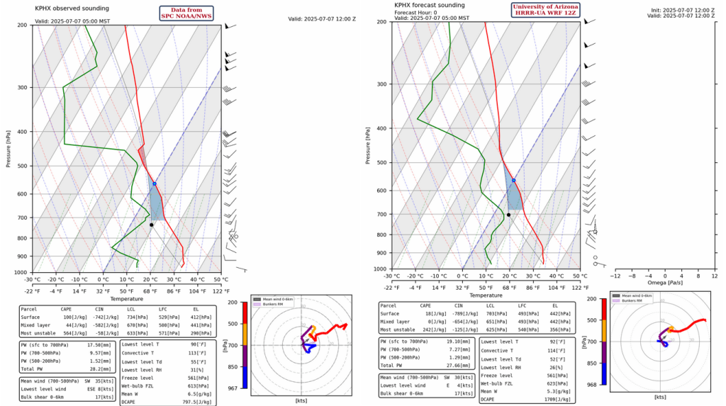
The Phoenix sounding below shows an increase in low level moisture below 850 mb along with slight cooling and additional moisture above 700 mb, which should be fuel for mountain thunderstorms. Notice how the forecast initialization, on the right below, is missing this low-level moisture.
Analysis
The 200mb high pressure is east of Guaymas, Sonora and has moved northwest as forecast by yesterday’s model runs. The subtropical jet is from California east into New Mexico and is being displaced further north while weakening.
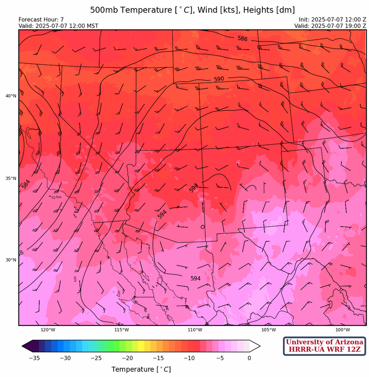
At 500mb the high pressure ridge is elongated from central New Mexico to northwest Mexico with a couple of centers in New Mexico and south of the border near Nogales. There is anticyclonic (clockwise) flow at 10 to 15 knots across the region, increasing to 25 knots in western Arizona.
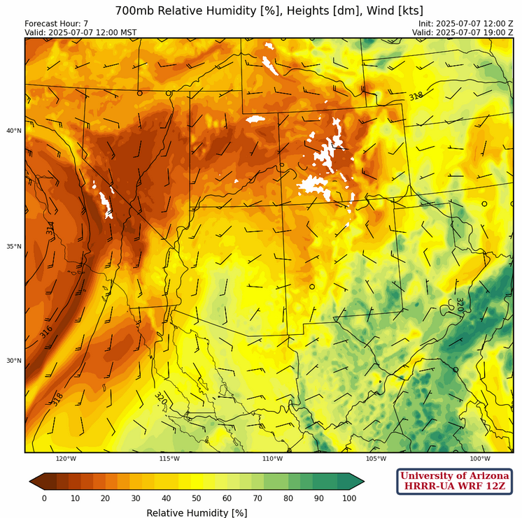
The high pressure at 700mb is located near Tucson with southerly flow to the west and westerly flow across New Mexico. Light and variable winds are across southeast Arizona to southern New Mexico.
Today
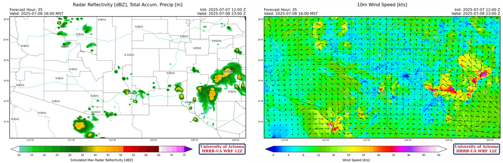
In Arizona this afternoon, storms are expected over the mountains in Santa Cruz, eastern Pima, and Cochise counties. Stronger storms are expected near the international border with Mexico due to the strong MCS currently decaying in Sonora. Some of these storms may also make their way up to Pima and Cochise counties. A very similar pattern is expected over New Mexico today as in previous days, with storms over the mountains throughout the state. Some storms may drift into the valleys and downbursts and some hail may be associated with stronger storms.
Tomorrow
Below is a sounding for Nogales, AZ for the early hours of tomorrow morning. While there is strong CIN at the surface, mountain storms would have quite a bit of CAPE to use and grow with. With missing near surface moisture in the model initializations today, and another MCS forecast at a more northerly position in Sonora tonight, the enviroment in northern Sonora is primed for a large precipitation event.

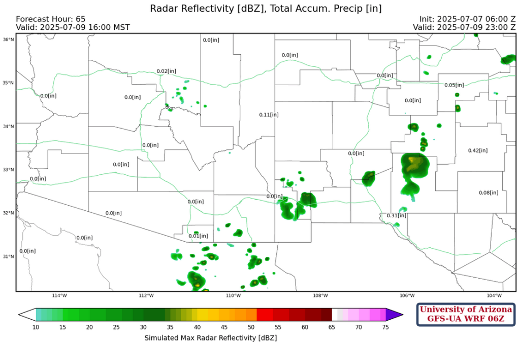
New Mexico may see a slight decrease in storms, with storms mostly over the eastern half of the state. Southeastern New Mexico may see some downbursts. Deep moisture is very close in northern Mexico, just south of Arizona, so that any push to the north will result in more thunderstorm activity than the models are currently showing. Arizona is expected to see a similar pattern tomorrow as today, with some storms traveling farther north than today.

Outlook
Wednesday will be the day with the least activity with the best storms in eastern New Mexico and southeast Arizona. Model forecasts are showing an increase in moisture into the low deserts on Thursday, but oddly not showing much of an increase in thunderstorm activity.
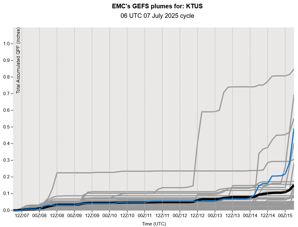
The GEFS plume forecasts below show a ramp up in storms next week, but remember there’s not much confidence with these long range forecast yet.
Discussion written by Pat Holbrook