
Yesterday’s Weather
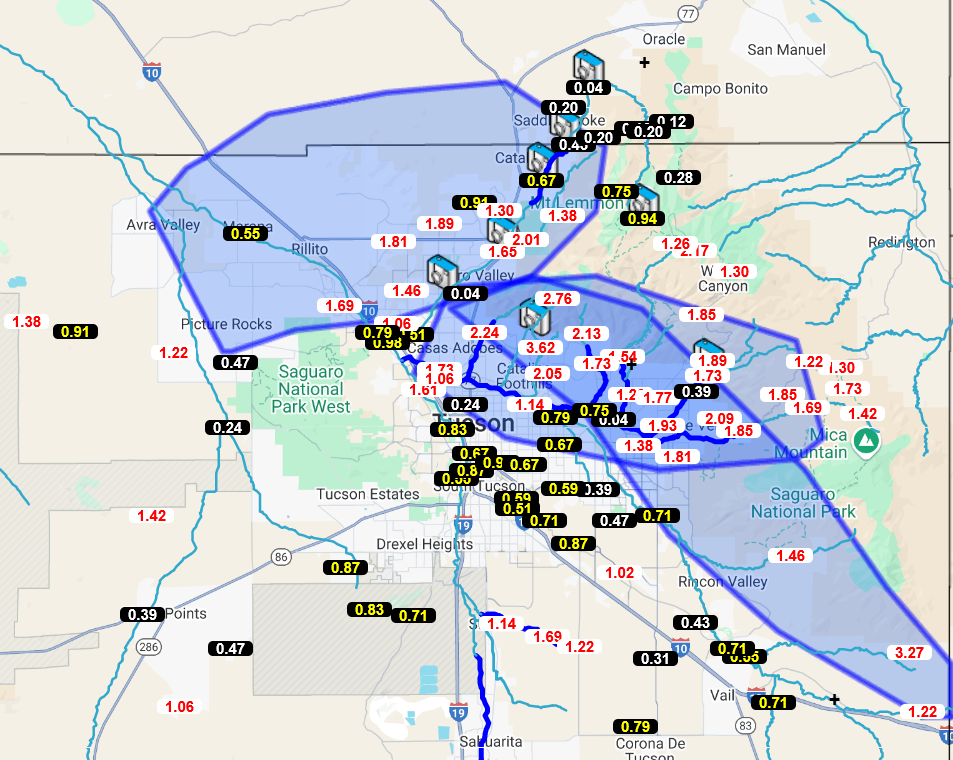
We needed it, as they say! The rain gauge data from the Pima County Regional Flood Control District alert map shows a large area with 1-to-2-inch rainfall totals across central and eastern Pima County.
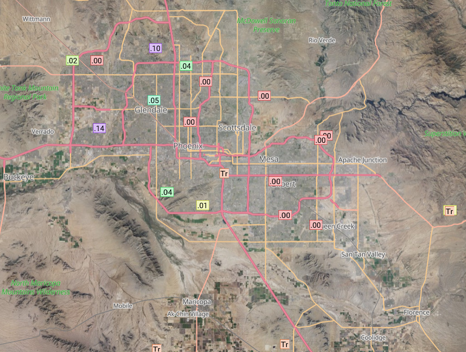
But the storms didn’t move too far north along I-10 with most areas around Phoenix just getting blowing dust and a few drops of rain. South Mountain had .04 inches, as shown on the Rainlog.org map.
The general impression is that the model forecasts underestimated the rain totals in Cochise County, but overall model performance was excellent.

Last night’s visible imagery showed the strong storms in Pima and Cochise Counties with weaker storms northwest to Flagstaff. New Mexico has dried out with only a few storms in the mountains.
Analysis
Water vapor imagery still shows tropical upper tropospheric troughs (TUTT) off the coast of Baja California and in the Gulf of Mexico right at the coast on the international border. The TUTT out in the Atlantic has weakened.

A Mesoscale Convective Vortex developed over eastern Pima county and is moving slowly west. Convergence associated with the MCV kept storms going overnight. Though the remnants of this circulation, along with an inversion in the boundary layer (a “cap”), will inhibit any convection today for Pima County.
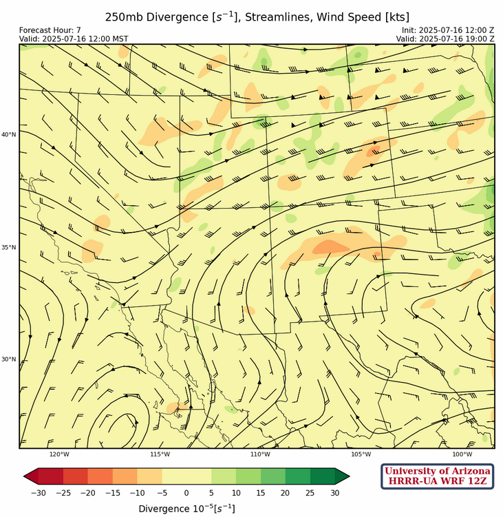
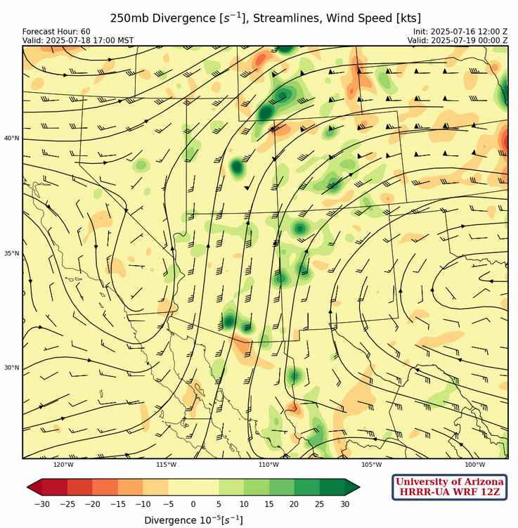
At 250mb, the low off the west coast of the Baja Peninsula and high pressure over West Texas are giving southerly flow over Arizona and westerly in New Mexico. A trough over Nevada and California is also promoting the westerly flow in Utah and Colorado.
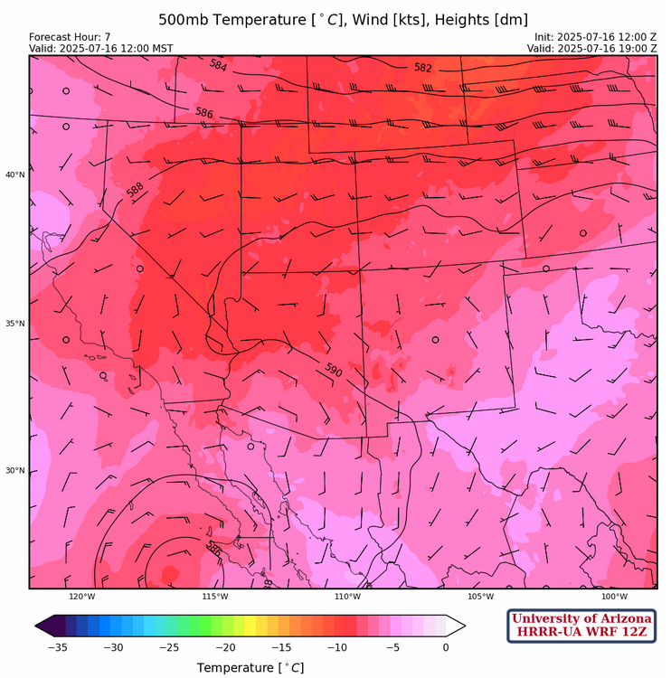
The low at 500mb is near the spur of the Baja Peninsula with generally southeast flow into Arizona. This is bringing warmer air into the state.
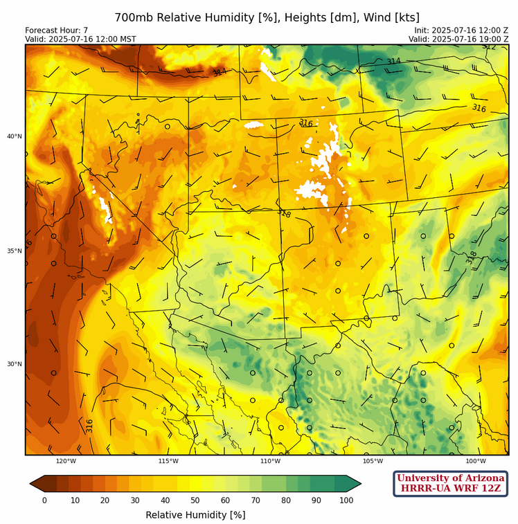
At 700mb, moisture is wrapping around the low from north central Mexico extending into southeast Arizona and west to the northern Baja Peninsula. Additional moisture is along the Mogollon Rim to the White Mountains. New Mexico has mostly dried out with southerly winds across the state.
Today
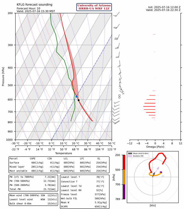
The focus of convective activity will be over the Mogollon rim and White mountains today as moisture, heating, and upper-level divergence are favorable in these areas. The sounding from Flagstaff for this afternoon shows no limiting factors for convection.
There will be showers ahead of the MCV as it moves further west, but surface-based Convective Available Potential Energy (CAPE) over southern Arizona will be negligible. Some storms will occur west of Phoenix to the Arizona/California border.
Tomorrow
The flow around the low pressure west of the Baja will bring warm air aloft to cap most convection. Isolated storms will be near mountains with a little more activity in New Mexico.
Outlook
The upper low moves northward to near San Diego on Friday and will aid in the development of thunderstorms over the eastern half of Arizona.
The speed of mid- to upper-level flow the storms will reduce the risk of flooding, as thunderstorms will move off quickly.

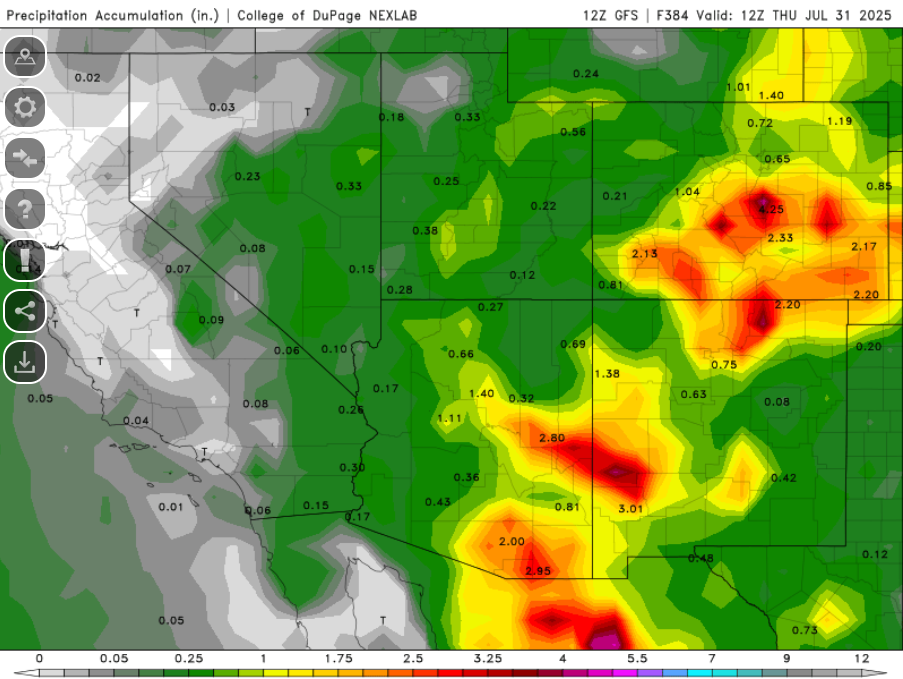
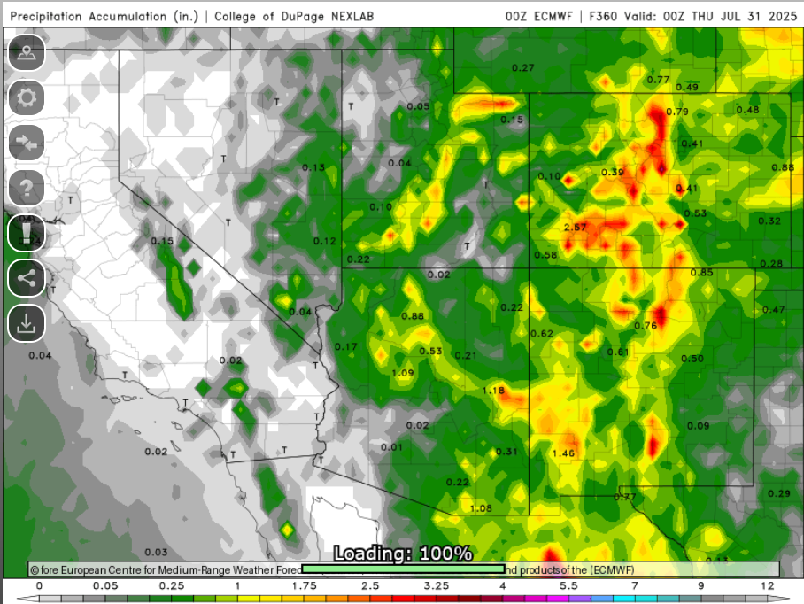
No plume data is available today from EMC, but GFS model forecast precipitation for the rest of July is below.
But don’t be too optimistic as ECMWF is a lot dryer.
Discussion written by Pat Holbrook and Patrick Bunn