
Yesterday’s Weather
Yesterday afternoon’s radar reflectivity shows thunderstorms were mainly near the mountains and storms that did move off the mountains only produced light rainfall in the valleys, except for far northeast New Mexico,.
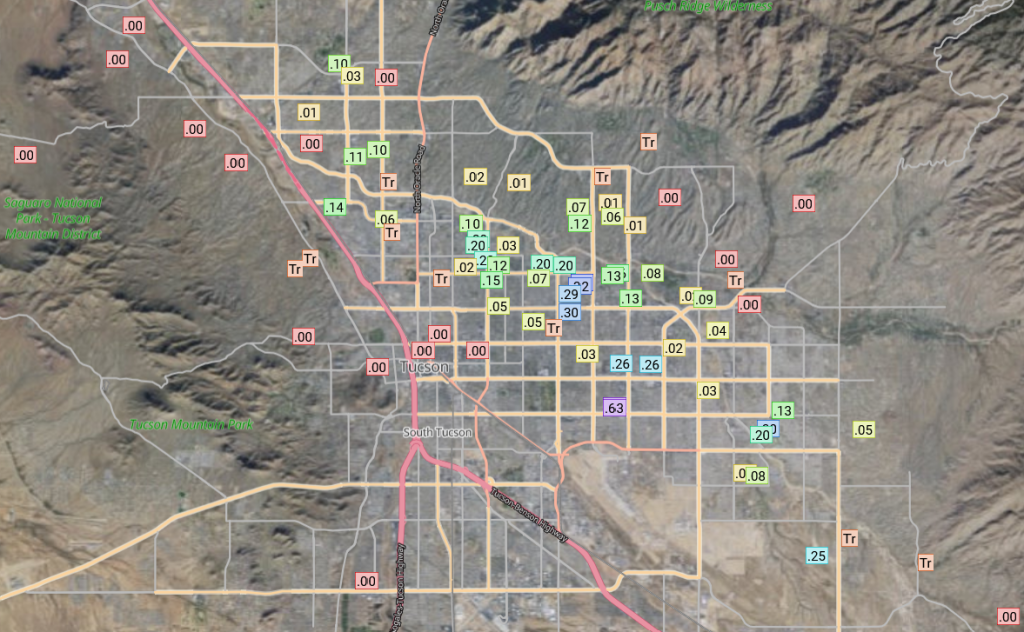
The Rainlog rainfall totals below shows the precipitation in the Tucson metro area. Most totals were less than two tenths of an inch.
Analysis
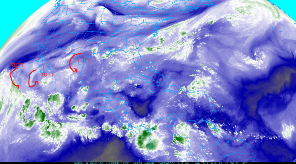
A tropical upper tropospheric trough (TUTT) are shown below, mostly moving to the west and southwest underneath the ridge.
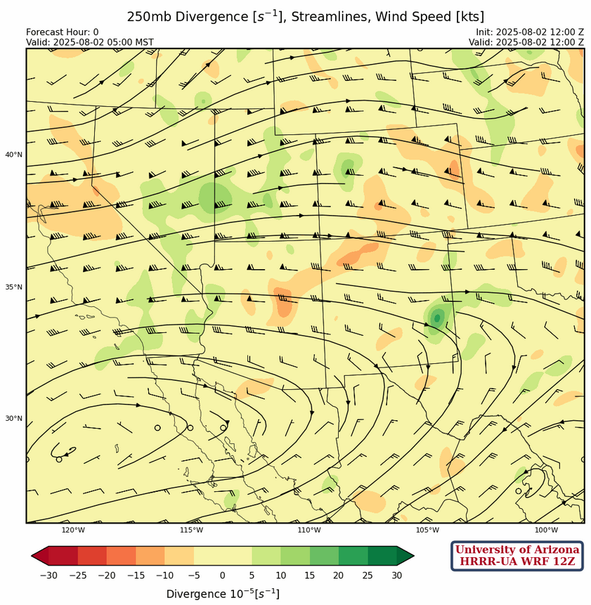
At 250mb, the sub-tropical high pressure ridge is southwest of San Diego and the ridge axis extends east into West Texas. There is a col over Texas associated with the TUTT low and an east coast ridge is centered over northern Florida/southern Georgia. A strong jet axis has moved a little further north and runs from San Francisco to northern Colorado.
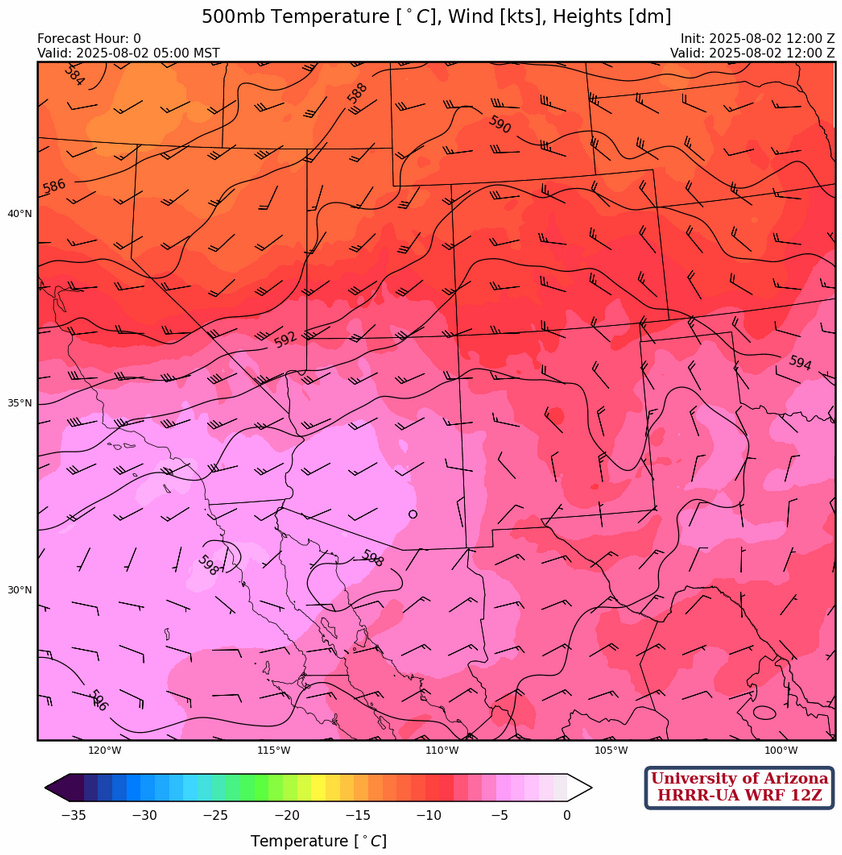
The ridge center at 500mb has formed near Nogales this morning with an east-west ridge axis extending from West Texas to the Pacific Ocean. Winds are westerly across Arizona with weak flow to the south increasing to 15 to 20 knots over northern Arizona. In New Mexico the winds become more northerly behind a trough in the Great Plains.
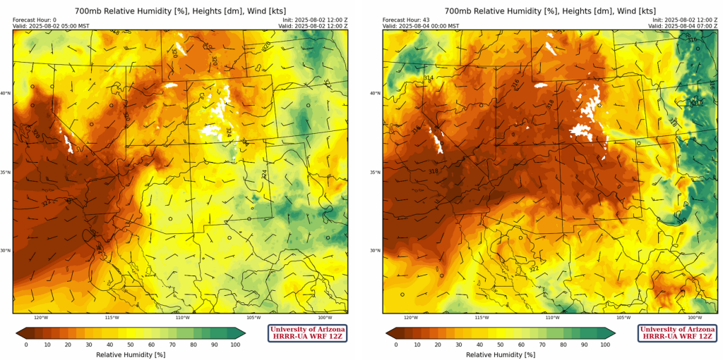
Today’s HRRR-UA WRF 12Z model initializationat 700mb is below on the left with the 42-hour forecast for midnight Monday morning is below on the right. Dry air is moving into both states on the northside of the ridge and this should limit thunderstorm activity to the southern part of Arizona and New Mexico tomorrow.
Today
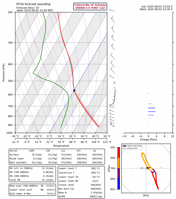
The HRRR-UA WRF 12Z model forecast sounding for Tucson this afternoon shows less moisture than yesterday and warming between 500 and 380 mb. Convective available potential energy (CAPE) values are less than 100 [J/kg].
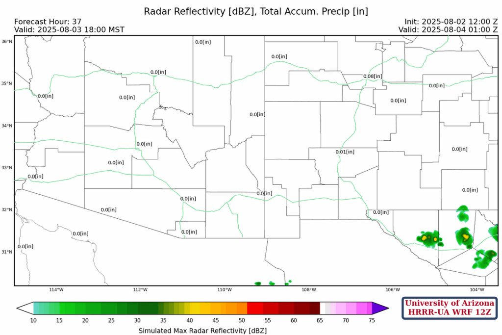
Enough CAPE was on the forecast soundings at Nogales, San Simon, and El Paso to support thunderstorms over and near the mountains. The forecast radar for this afternoon shows the isolated thunderstorms with weak microbursts over southeast Arizona and New Mexico.
Tomorrow
Looking at all the observed soundings in the southern portion of the region there wasn’t any CAPE except east of El Paso where a few thunderstorms will develop over the mountains.
Outlook
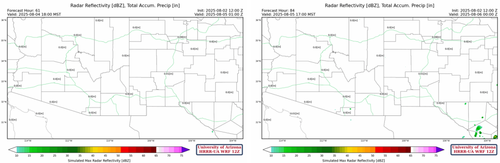
Forecast radar reflectivity for Sunday and Monday is shown below. Kind of sad for being in the middle of the monsoon.
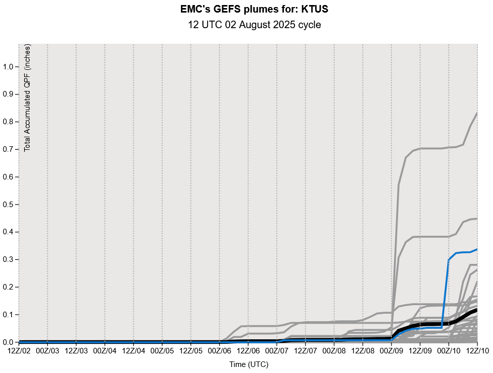
The GEFS plumes for Tucson show there is potential for monsoon to restart in about a week.
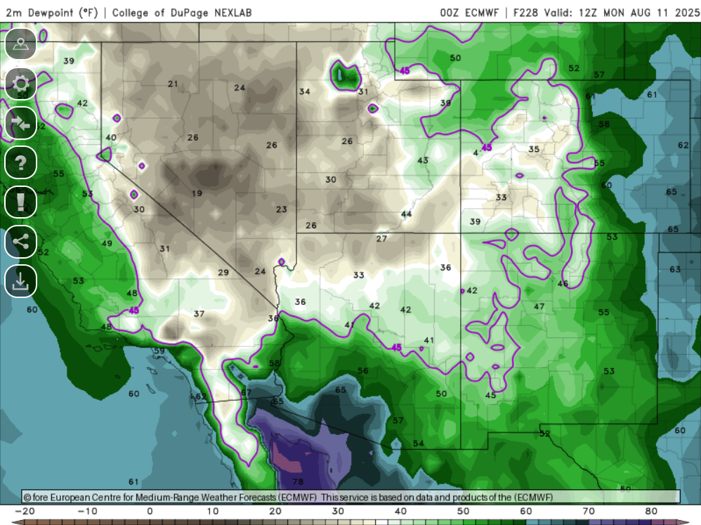
The ECMWF surface dewpoint temperature for Monday August 11th shows an apparent gulf surge bringing monsoon moisture back into Arizona.
Discussion written by Pat Holbrook