
Yesterday’s Weather
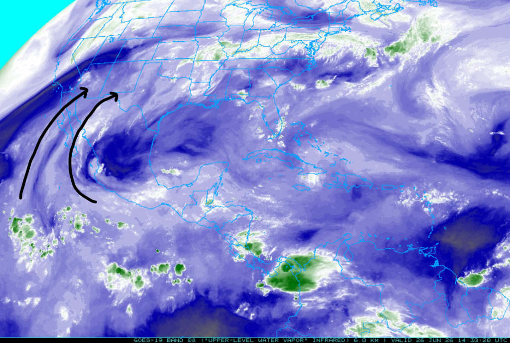
The moisture axes that have been predominant over the last 10 days are changing. The moisture axis further west is bringing in less moisture than yesterday, and the one on the east has shifted further east.
The 12Z HRRR-UA WRF (left) forecast total precipitation through 5 am this morning versus observed precipitation (right). The heaviest rain was just southeast of Benson, where a location had three individual storms that accumulated just over an inch.
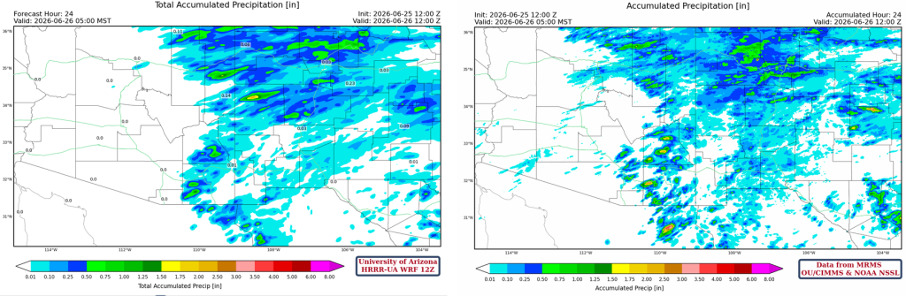
The forecast location of the storms in Pima County was too far east, and storms did form in Pima and southeast Pinal Counties. This is similar to what occurred on June 17th, only there was less moisture yesterday. Why the model had the same problem with storm locations in both cases is unknown, but it may be due to a lack of upper-air soundings from Tucson. The HRRR model is used to initialize the WRF, and it has a similar problem of placing storms too far east.
Analysis
The visible satellite and radar overlay animation below looks very similar to yesterday’s, with morning clouds over western Arizona (La Paz, Mohave, Maricopa, and Yavapai counties). The showers are moving quickly northeast, and there have been occasional lightning strikes with the storms. The red flag warning, combined with lightning strikes from these storms, indicates that the potential for fires to start remains high.
Surface moisture continues to move eastward out of Arizona.

The 5 am observed sounding from Phoenix this morning (below, right) shows a drop in precipitable water of 4.8mm (0.18 inches) since yesterday, and only slightly overestimated in the HRRR-UA WRF 12Z forecast initialization, so not enough to cause forecast issues (below, left).

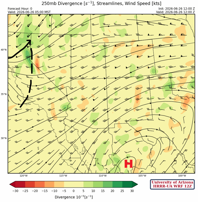
The monsoon ridge at 250 mb has moved slightly eastward as the polar jet stream dips into California. There is a broad area of strong westerly winds over Arizona and the rest of the southwest.
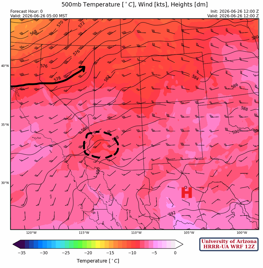
At 500 mb, the polar jet is still tracking south, pushing the monsoon east and south into Texas. There is one spot of cold air aloft over western Arizona associated with the showers.
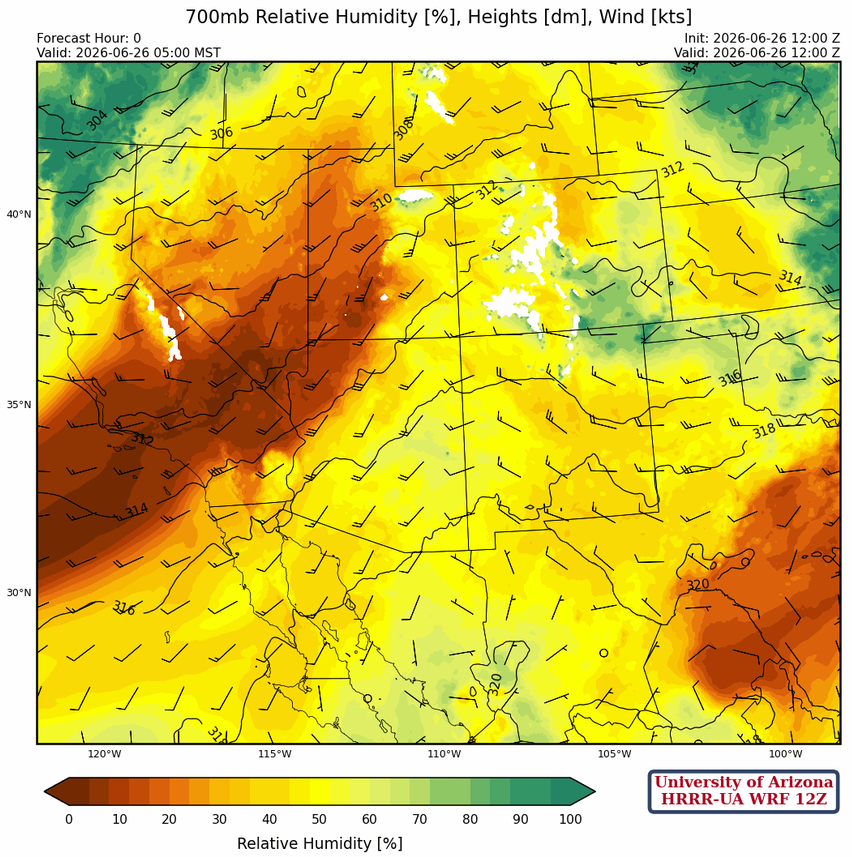
At 700 mb, very dry air is moving into northwest Arizona and will continue moving southeast. Wind speeds this morning, with the dry air, have increased to 40 knots and will be over 50 knots this afternoon. The winds decrease to 20 knots in southeast Arizona. These winds are at 10k feet and, once mixing occurs in the afternoon, will be realized at the surface, with canyons amplifying the effect.
Today
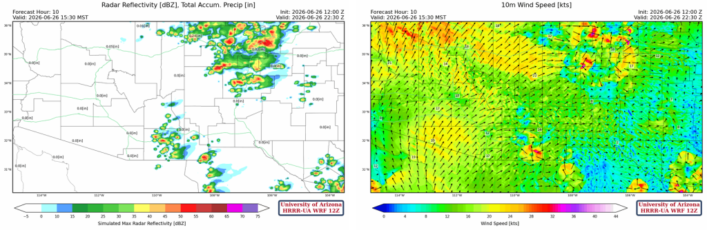
The 12Z HRRR-UA WRF forecast soundings below are from Lake Havasu City and the Navajo Monument for this evening at 6:30 pm. Both show strong westerly winds, with thunderstorm potential at the Navajo Monument. Therefore, the risk of lightning-caused fires is lower in the northwest and higher over the Navajo Nation into northwest New Mexico.

HRRR-UA WRF 12Z shows storms developing in the eastern third of Arizona and New Mexico, with insufficient rain to put out any fires.
Tomorrow
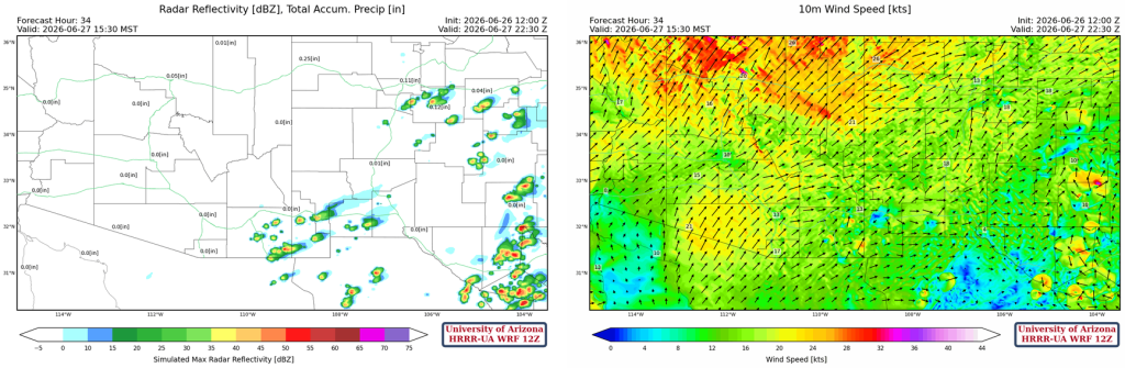
Winds remain strong across Arizona and most of New Mexico. The only thunderstorms would be in eastern Cochise County. Winds remain strong, so any ongoing or new fires will be hard to contain.
Outlook
By Sunday, thunderstorms will be confined to the eastern half of New Mexico. Overall, winds will subside.
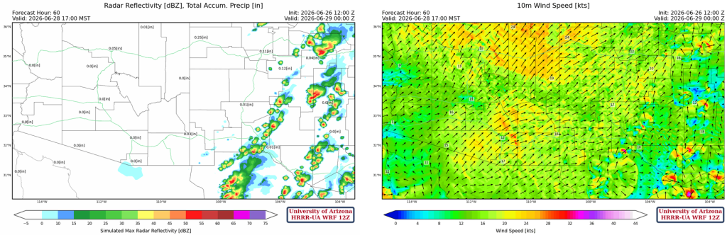
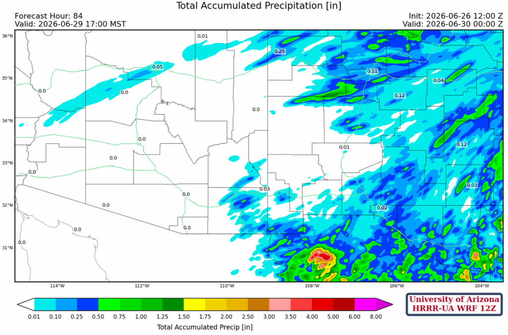
The total storm precipitation forecast for Monday is below. Not enough wetting rain to help firefighters.
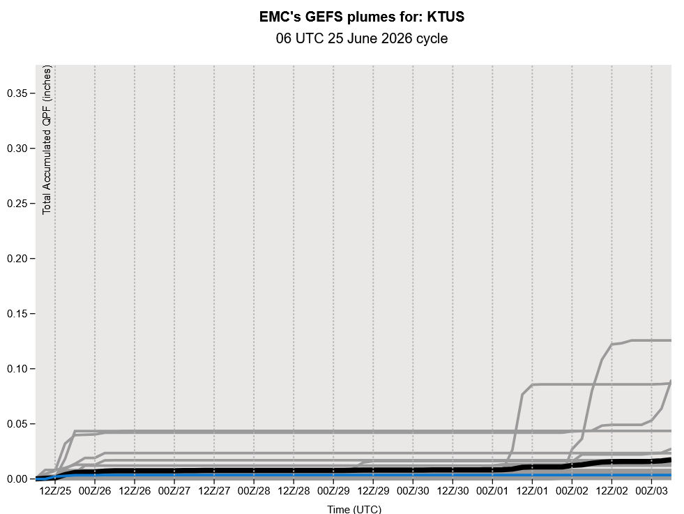
The ensemble precipitation forecast from the GEFS global model is below. Maybe the monsoon moisture is back for Independence Day, though it’s not looking promising, and that far out in the forecast, it is likely just trending toward climatology. We’ll again pause discussions for the weekend and resume on Monday.
Discussion written by Pat Holbrook and Patrick Bunn