
Yesterday’s Weather
Another Mesoscale Convective Complex (MCC) formed in Sonora yesterday, close to the position of the MCC on August 9th. Isolated mountain storms were over the rest of southeast Arizona, the Mogollon Rim, then into New Mexico. Stronger storms were also in the plains of eastern New Mexico.
Nogales and the Sierra Vista to Douglas area benefited from the MCC storm, with totals ranging from 0.1″ to 0.4″ respectively. Otherwise in Arizona, only Sedona and the mountains near there received measurable rain.

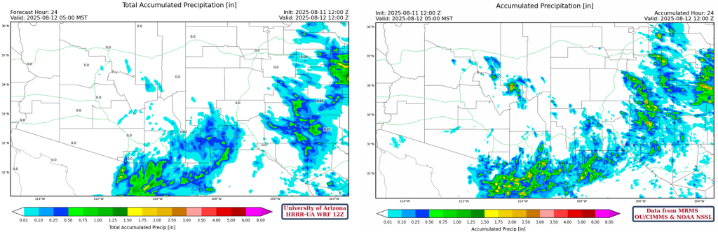
Yesterday’s HRRR-UA WRF 12Z 24-hour accumulated precipitation was similar to the MRMS observations. Good overall pattern, though some of the intensity is missing in the forecast on the Mogollon Rim and in Sonora/Chihuahua.
Analysis
The 50°F isodrosotherm (annotated green line of equal dewpoint temperature) extends from Lake Havasu City eastward to the Mogollon Rim north of Phoenix, and southeast to Lordsburg and El Paso then northward across the eastern third of New Mexico.

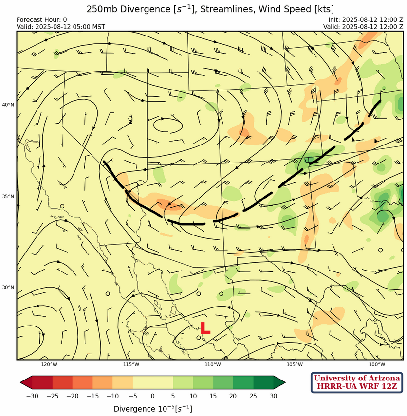
A newly developed tropical upper tropospheric trough (TUTT) is over the south of Baja California and another TUTT low is over the northwest Carribean sea. The TUTT ober Baja is depressed south due to the long wave trough (annotated in orange) over the western U.S.

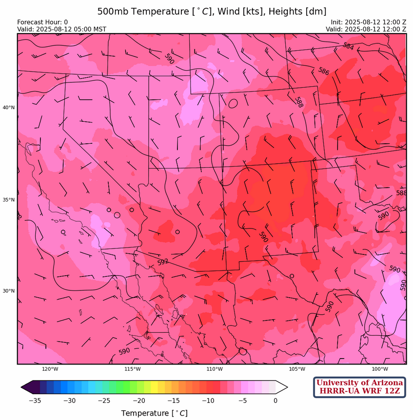
In the observed sounding for Phoenix at 5am this morning precipitable water dropped to ~1.3inches (32mm), but temperatures at 500mb have cooled to about –8.3°C today.

At 250mb, the trough in Idaho/Wyoming has dropped to the south and is across central Arizona and New Mexico. Winds have become easterly to the north of the trough and westerly south of the trough.
A high pressure ridge has developed at 500mb over California, between the ridge and the trough over the Great Plains. Weak northerly flow is over the region with cooler air filtering into the region. The coldest air is over New Mexico extending into southeast Arizona.
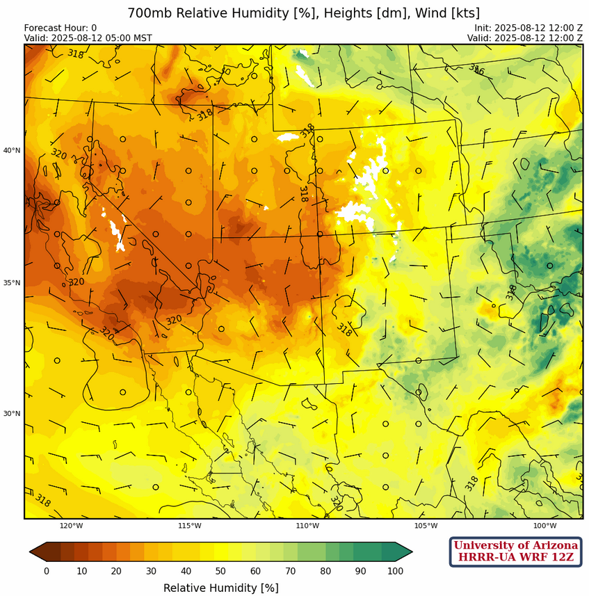
At 700mb, dry air has moved into the northern part of Arizona with an overall decrease in moisture across the region. Note that the higher humidity values in New Mexico are an artifact of cooling from yesterday’s storms rather than an increase in moisture.
Today
The forecast sounding for Tucson this afternoon has no significant CIN and a profile that looks favorable for thunderstorm development. But..
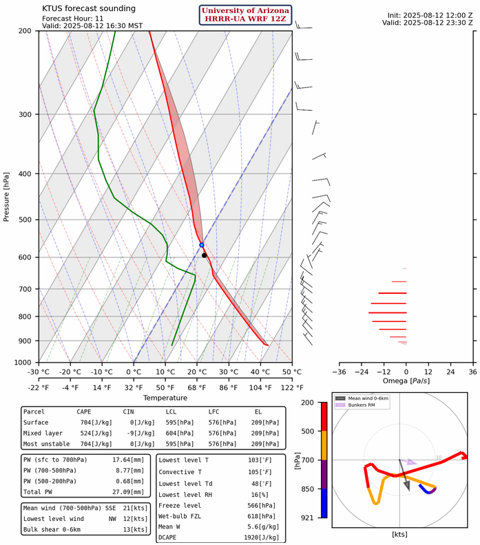
…oddly enough, the HRRR-UA WRF radar reflectivity forecast for the same time period has some storms to the south along the Interational border and in the east counties, but none for Tucson. The sounding shows an inversion layer between 580mb and 650mb that clouds likely can not rise through. Phoenix may get some light showers overnight, from some residual storm cells initiating from the outflow off the Mogollon Rim.
Tomorrow
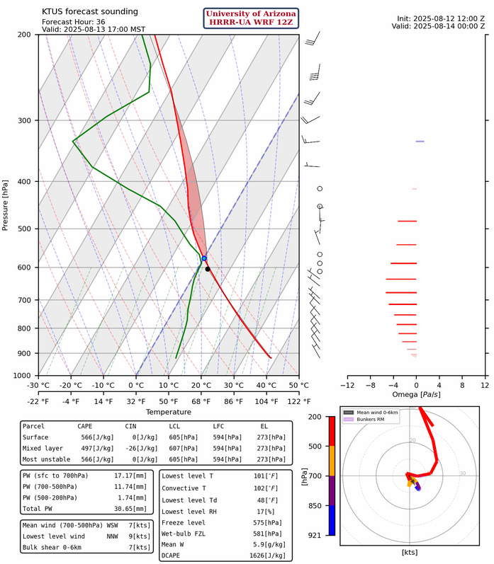
The HRRR-UA WRF 12Z forecast sounding has a little more convective inhibition (CIN) for tomorrow than today, but not enough to be a limiting factor. Also, the stable layer (inversion) around 600mb reduces to being about 10mb thick, which is another positive.
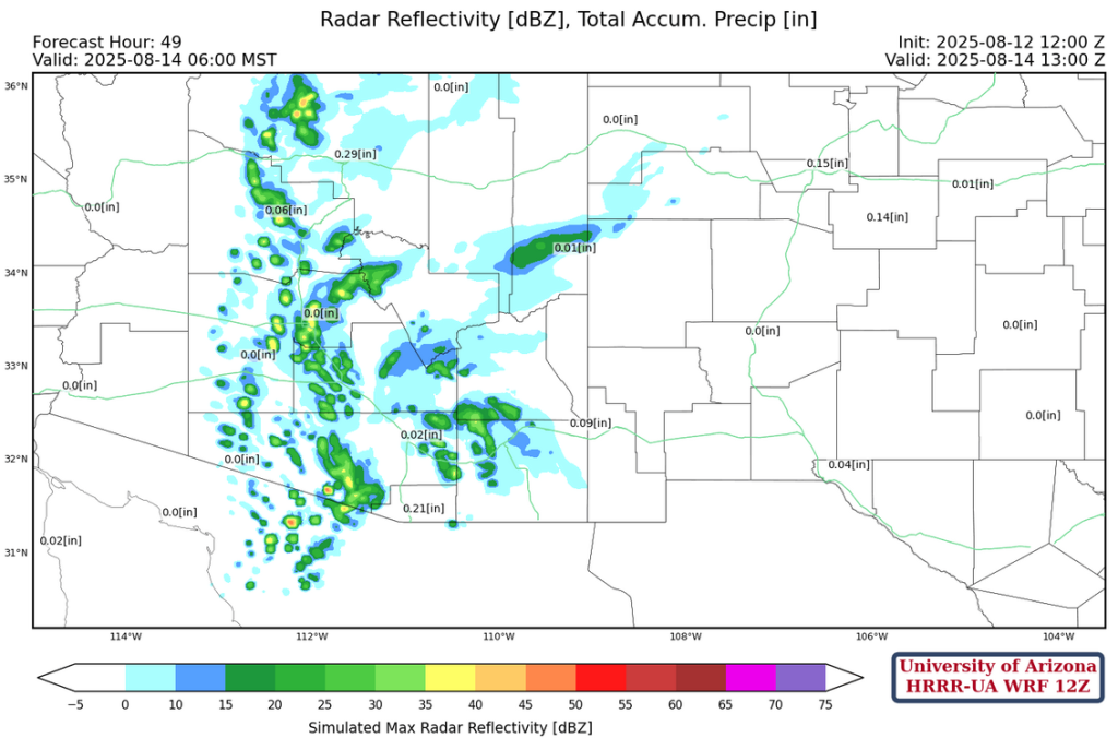
The afternoon radar reflectivity forecast for tomorrow shows the thunderstorms finally in the Tucson valley with strong gusty winds, heavy rain, and blowing dust!
The strong winds continue up to Casa Grande and Phoenix with a haboob possible.
Outlook
Overnight Wednesday to Thursday showers will develop in the wake of the storms in Tucson and will move into Phoenix as shown in the radar reflectivity forecast below. Its probable that a mid-level vortex will develop and most of central and southern Arizona will be mostly cloudy with subsidence in the wake of the vortex.
This is essentially an up day Wednesday, down day Thursday, scenario. Due to the rain cooled air and the clouds from thunderstorm activity on Wednesday, Thursday’s storms will be around the edge of the mid-level vortex.

Friday is more active again as shown in the forecast radar reflectivity below. Though, this is a 84-hour ahead forecast so uncertainty is high; especially given the activity over the next two days.

Discussion written by Pat Holbrook and Patrick Bunn