
Yesterday’s Weather
Like Friday, Arizona was mostly quiet with a few storms along the Mogollon Rim, White Mountain, and the Chiricahuas. Dewpoint temperatures dropped in the low deserts as mixing of dry air aloft occurred and unlike Friday the low-level moisture inflow has been cut-off. New Mexico had storms mainly in the mountains coming off the Rockies to the north, while Mexico had activity along the spine of the Sierra Madres.
The 24-hour total precipitation accumulation from yesterday’s HRRR-UA WRF 12Z forecast is shown below on the left with the observed rainfall totals on the right (MRMS; satellite, radar, and gauge derived). Some of the intensity in Mexico is missing, but otherwise good.

Analysis
The tropical upper tropospheric trough (TUTT) is in the northwest Gulf of Mexico and is moving slowly west. Another TUTT is around 30°N latitude north of Puerto Rico and is also moving west.
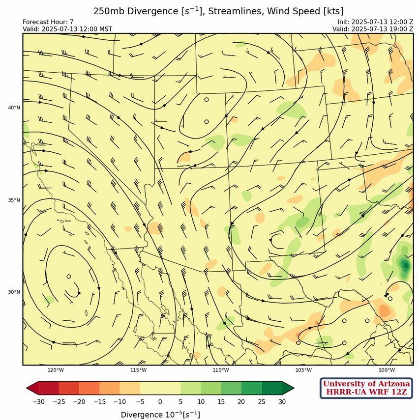
At 250mb, the high pressure ridge southwest of San Diego is in about the same position as yesterday and the ridge on the East Coast has moved to southern Georgia. A broad trough divides the two ridges and extends from Minnesota southward to New Mexico to a col south of the Big Bend. The New Mexico portion of the trough is starting to cut-off from the main flow and will result in northeast flow over Arizona.
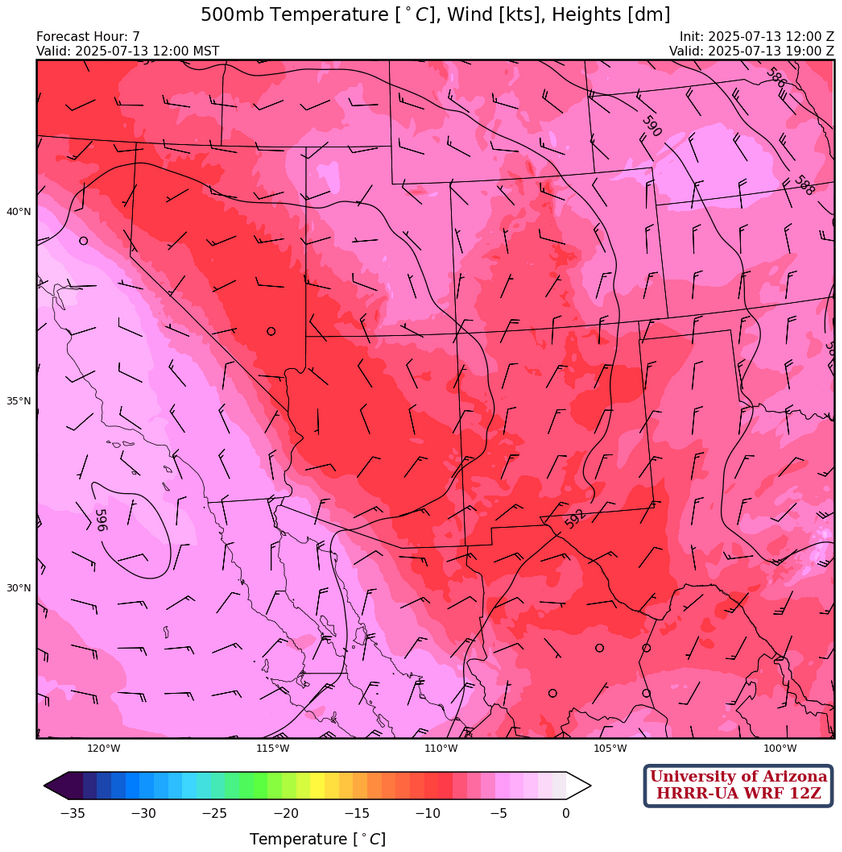
The ridge at 500mb has moved very little and is just west of San Diego. What has changed is winds are northerly over New Mexico. The trough over the Midwest extends down into Oklahoma and further south into central Texas. Temperatures have dropped over Arizona a few degrees.
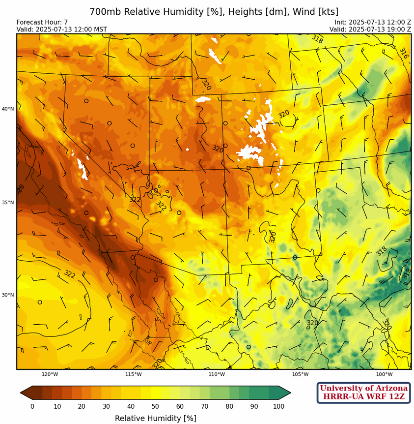
Lower down in the atmosphere at 700mb, winds are less than 10 mph across the region and generally westerly in New Mexico and variable in Arizona. Highest moisture values are in southern Arizona and New Mexico.
Today
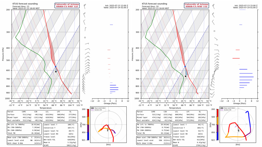
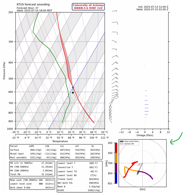
Low level moisture has been depleted in Arizona due to mixing with dry air aloft and no replacement from the Gulf of California. Thunderstorms will develop over the mountains of New Mexico, Eastern Arizona, and along the international border and move a tad west of south. These thunderstorms will be accompanied by gusty winds up to 35 mph as shown in the forecasts below.
The inverted-v sounding would produce stronger microbursts if there was more moisture. The forecast has positive omega values (Pa/s) nearest the surface showing descending vertical motion (the blue bars on right side of the graphic) and DCAPE values are about 1700 J/kg, meaning dust storms are possible with these dry downdraft winds. Precipitation amounts will be higher in the mountains of Cochise and Santa Cruz counties.
Tomorrow
There is not much difference in the moisture values, so storms will develop in the same locations…although a little stronger southwest of Flagstaff.
A significant change from yesterday is in the hodograph below compared to today’s hodograph indicating that storm motion will now be more to the southwest. The hodogrpah is in the bottom right corner of the graphic below and shows how wind speed and direction changes with height (colored line by pressure level). Wind gusts and potential for dust storms will be similar to today.
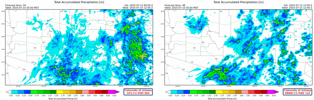
GFS-UA WRF 6Z (below left) has more 48-hour total precipitation accumulation than the HRRR-UA WRF 12Z (below right). The GFS-UA WRF is the preferred solution given it shows some precipitation in the Tucson metro area, which fits better with the change in wind direction seen in the progression of forecast soundings from today to tomorrow.
Outlook
Although the forecast radar looks the same as the previous two days the precipitable water values below increase significantly from a surge up the Gulf of California on Wednesday. Though, model forecasts are still not indicating storms moving off the mountains and we will probably need one more day for the valleys to get storms.
The total precipitation forecasts for the GFS and ECMWF through 06Z July 29th are below. The ECMWF has less precipitation than the GFS but neither model gets too normal for the month of July.

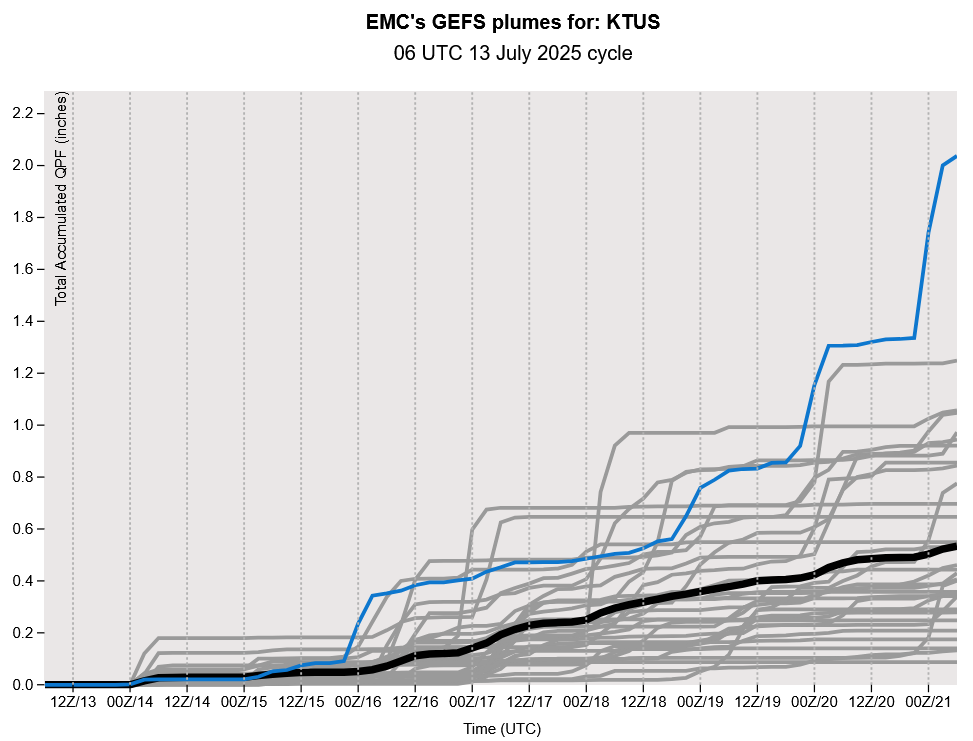
The GEFS plume forecast for Tucson confirms the other model forecasts.
Discussion written by Pat Holbrook and Patrick Bunn
Here is today’s article in the Daily Star about changes to Tucson weather balloon launches: https://tucson.com/news/local/subscriber/article_d3a072fa-287f-4ef2-83ca-c9ac7aae17de.html
Mike Leuthold started the UA WRF weather forecast system in 2003 and spent over 20 years developing it into the system we run today to produce these weather forecasts. His work at the University of Arizona established collaborations with state agencies and regional utilities that support the UA WRF system to this day, as well as the contracts that fund these discussions. We hope this article helps show how important the work of the National Weather Service is and how critical the staff and balloon launches are.