
Yesterday’s Weather
Yesterday, moisture flowed from Mexico into southeast Arizona then northward into west central New Mexico and then eastward from there, as indicate by the green annotated line on the GEOS19 visible satellite image below. The thunderstorms, represented by the lightning flashes, have the cirrus from the storms blowing eastward by strong westerly winds.

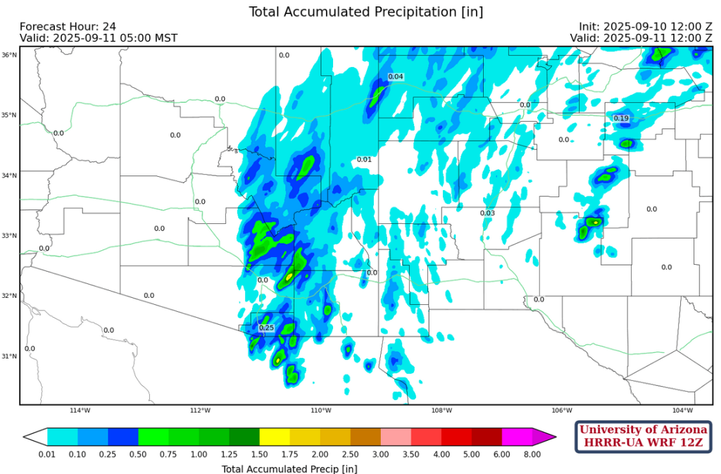
Shown below are the 24-hour accumulated precipitation forecast from yesterday’s HRRR-UA WRF 12Z (left) and equivalent observations from the MRMS system (right). Although the model forecasted the location of the storms in New Mexico well, it was too light with actual precipitation totals. The likely reason for this is a lack of upper air observations along the path of the monsoon moisture flowing in from northern Mexico, Sonora/Chihuahua.

Analysis
Surface dewpoint temperatures from this morning show areas of 50°F or higher are contained to the southern part of Arizona and eastern New Mexico.

The observed sounding from Phoenix at 5am this morning has three inversions as indicated by the red annotated arrows (below, right). The one nearest the surface may be a result of a very low-level increase in moisture. The second one at about 720mb is is located where the mid-level clouds/moisture are moving in from the south. The one furthest from the surface is at the top of the boundary layer, located at about 600mb. On the HRRR-UA WRF 12Z initialization (below, left), the precipitable water is similar to the observation at 23mm (0.9 inches). The top of the boundary layer is 50mb lower on the observed sounding and the forecast initialization smoothed out the increase in moisture at that level.

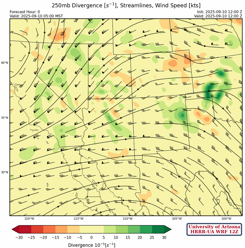
At 250mb, eastern Arizona is in a broad area of divergence associated with the trough and ridge pattern, to our respective north and south. The wind speed is 75 knots in western Arizona decreasing to 50 knots along the same streamline in eastern Arizona. This pattern shifts a little to the east tomorrow as winds become more from the southwest as the trough moves into northern Nevada.
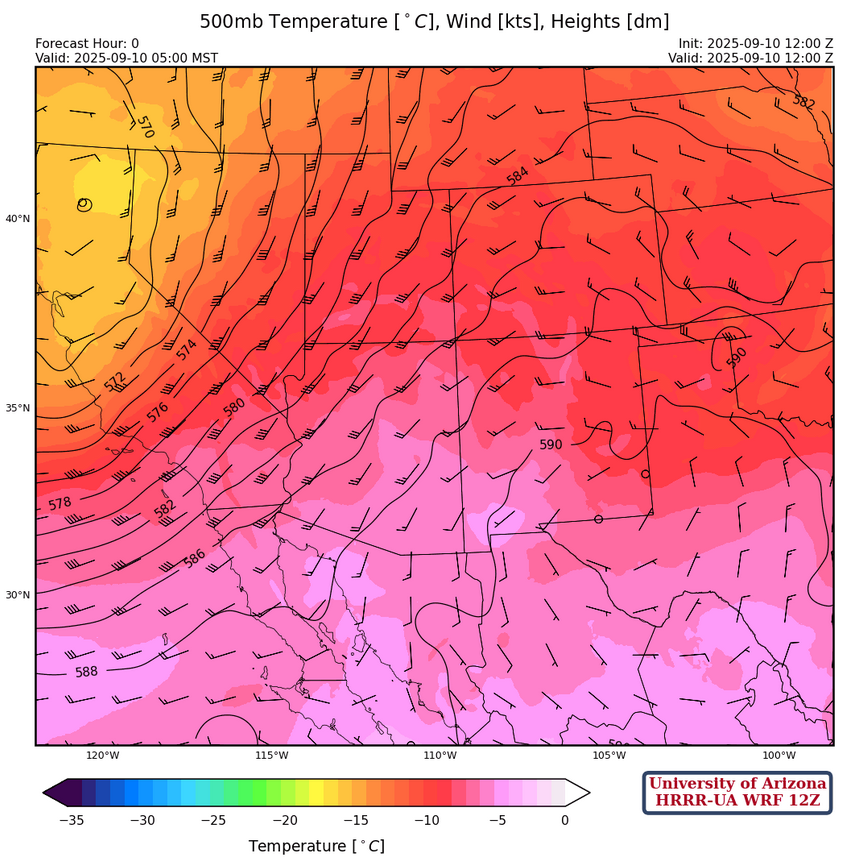
The low-pressure trough is over northern California at 500mb, with the high-pressure ridge in Mexico and Texas east of El Paso. Flow is from the south to southwest across the region with wind speeds at 15 knots in southeast Arizona and most of New Mexico, increasing to almost 50 knots in northwest Arizona. The wind pattern does not change much over the next few days, even as the low-pressure drops south into central California and the ridge moves eastward into the Abilene area of Texas.
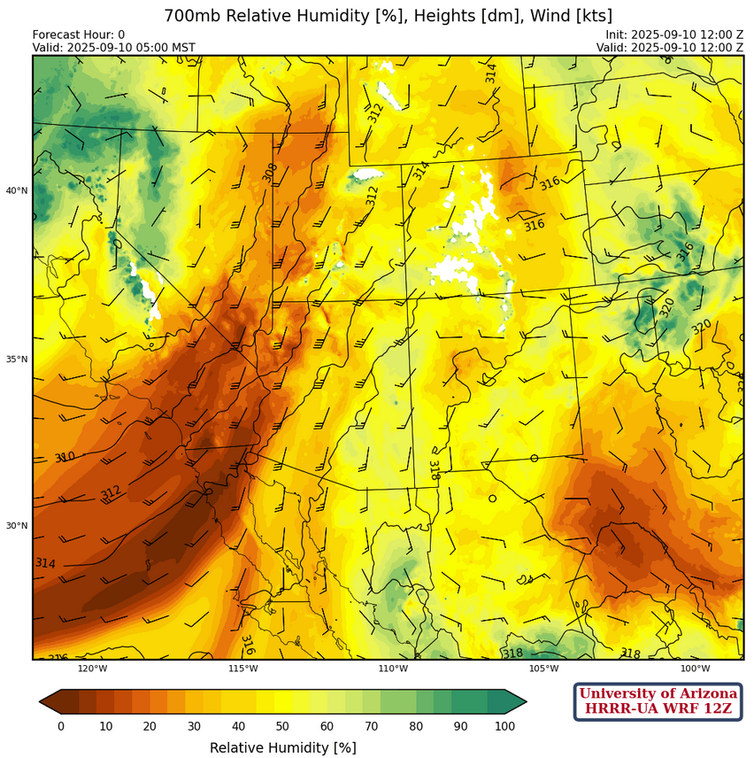
At 700mb, the moisture axis extends from the central Gulf of California northward into southeast Arizona then eastward into New Mexico. Dewpoint temperatures are near 2°C in southeast Arizona, but over the next few days will increase due to advection of moisture in Mexico.
Today
The HRRR-UA WRF 12Z forecast sounding for Tucson 3pm (left) and Nogales at 1:30pm (right) show no Convective Inhibition (CIN) and plenty of Convective Available Potential Energy (CAPE) for storms to develop this afternoon and evening.

The simulated radar reflectivity and 10-meter wind speed forecast from HRRR-UA WRF 12Z is shown below. The model forecasts the western edge of the storms to move west about 20 miles by evening. Microburst winds of 40mph or more will be associated with the storms along with blowing dust. Strong winds are forecast to approach the eastern edge of the Phoenix area in the evening, around 9pm.
The motion of individual thunderstorm cells will be to the north at 15 mph, so localized heavy rain is possible, although enough rain for flash flooding may not occur. Once again, the model forecast may be negatively impacted due to the lack of upper air observation data from Tucson south into Mexico. Remember that the precipitation values yesterday were underestimated and if a similar underestimation happens today flash flooding will be more likely.
Tomorrow
Tomorrow’s forecast radar reflectivity is very similar to today, but wind gusts are not as strong. Heavy rain will fall in the mountains in eastern Pima and Pinal counties and likely produce flash flooding from training storms over the higher elevations. Will Phoenix miss out on storms both days? Probably, as the storm propagation is to the north east.
Outlook
The moisture axis, as well as the storms, shift to the east on Friday as the low-pressure trough passes by to the north of Arizona. The heaviest precipitation will be in Graham, Greenlee, and Cochise counties.

The GEFS plume forecasts show there will be another chance of rain next week, but it will probably be in New Mexico and, with little monsoon moisture to tap, rainfall totals will be low.

Discussion written by Pat Holbrook and Patrick Bunn