
Yesterday’s Weather
The afternoon visible satellite images from yesterday only shows a few storms in New Mexico along with some flat cumulus over the mountains. In Arizona, the smoke from the Grand Canyon fires is still visible along with high clouds over the western part of the state. Dewpoint temperatures were in the 20s/30s in Arizona and 40s/50s in New Mexico.
The recent observed soundings from the Tucson site has some suspect data at the lowest level. The dewpoint temperature (green line) and ambient air temperature (red line) at the lowest level are problematic, showing a significant increase in temperature values compared to the other near surface values. Usually, these two temperatures are from a ground sensor near the upper air site. Since the release location is on the white painted roof of the NWS office, the super-adiabatic lapse rate is perhaps a reflection of this location rather than the actual weather.
The last frame of the animation above shows the high clouds over northwest Arizona are from the moisture above 400mb and the circulation from the trough on the west coast .
Analysis
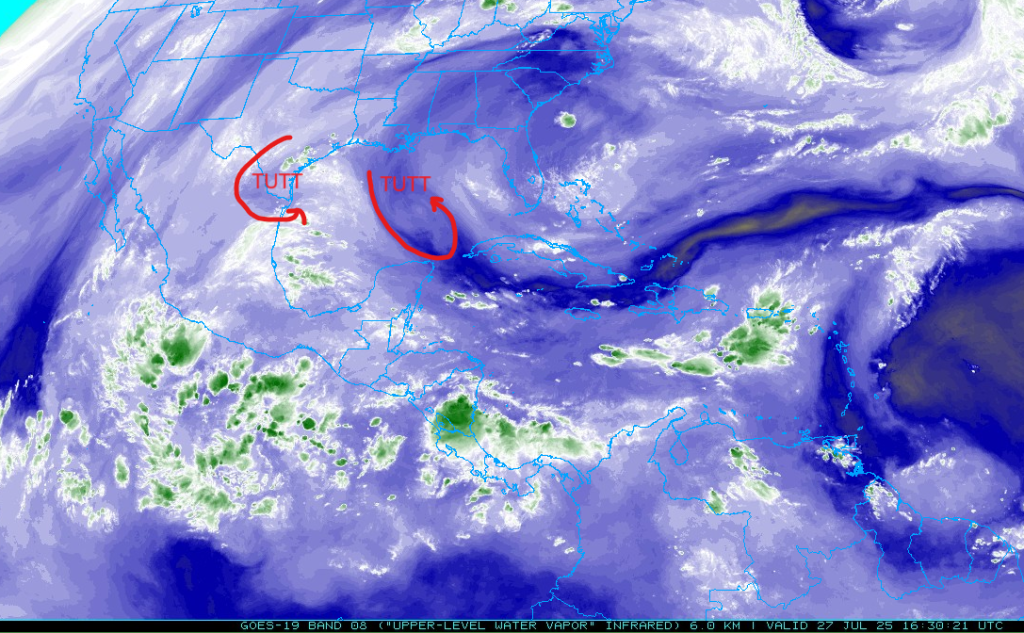
There is a tropical upper tropospheric trough (TUTT) southwest of Brownsville and it is moving slowly southwest. A newly formed TUTT is over the east central Gulf of Mexico is also moving west.
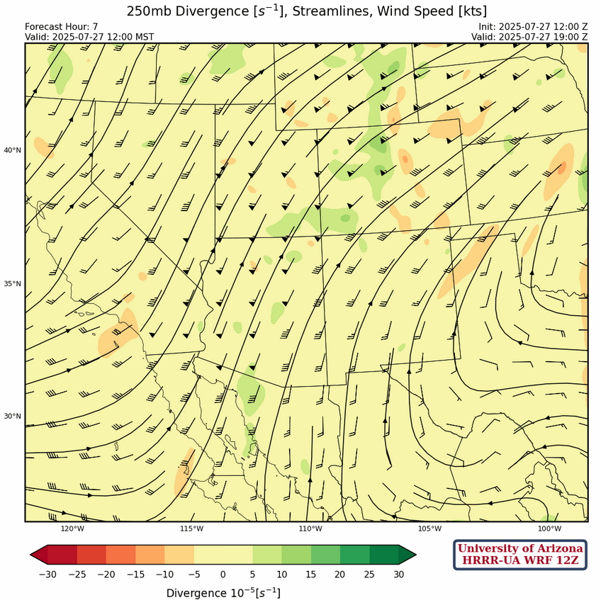
At 250mb, a broad trough is off the west coast of California with southwest winds over 50 knots in Arizona. The high pressure ridge has shifted a little further south and is now centered near the Georgia coast with the ridge axis extending northwest to Kentucky then southwest to Oklahoma. Winds across New Mexico are also from the southwest around 20 knots.
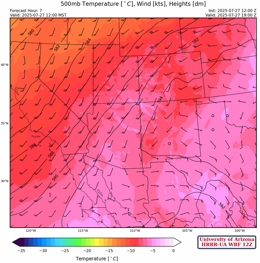
The west coast trough dominates the circulation at 500mb across the region with southwest winds across Arizona and the western New Mexico. A north-south oriented trough from Del Rio south into Mexico is a reflection of the TUTT southwest of Brownsville and is bringing an easterly wind flow across that portion of the region.
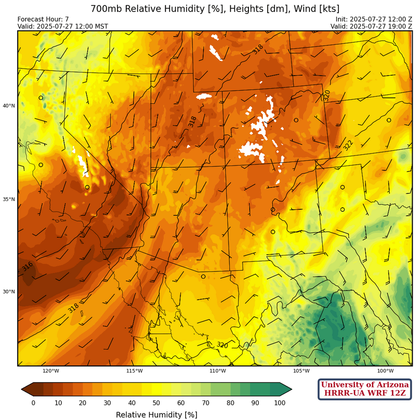
Dry air remains across Arizona at 700mb with southerly wind flow. An inverted trough approaching New Mexico from Texas will increase moisture levels across southern and eastern New Mexico.
Today
Moisture is increasing over eastern New Mexico, and the low-level flow should pull the moisture into western New Mexico later in the day. Note the outflow out of these storms will assist the westward movement of low-level moisture. The general weather pattern is a retreating (westward movement) of the trough near the west coast and building of the ridge.
Tomorrow
Gulf of Mexico moisture moves into eastern Arizona tomorrow, due to the retreating west coast trough, and the building ridge from the east. Storms are further west, but moisture values are not as high due to mixing between the Gulf of Mexico moisture and that the dry air in the low-level deserts.
The inverted-v sounding from San Simon tomorrow evening (shown below) is indicative of strong wind gusts associated with storms; omega is positive showing downward vertical motion and downdraft convective avaible potential energy (DCAPE) is 1300 [J/kg].
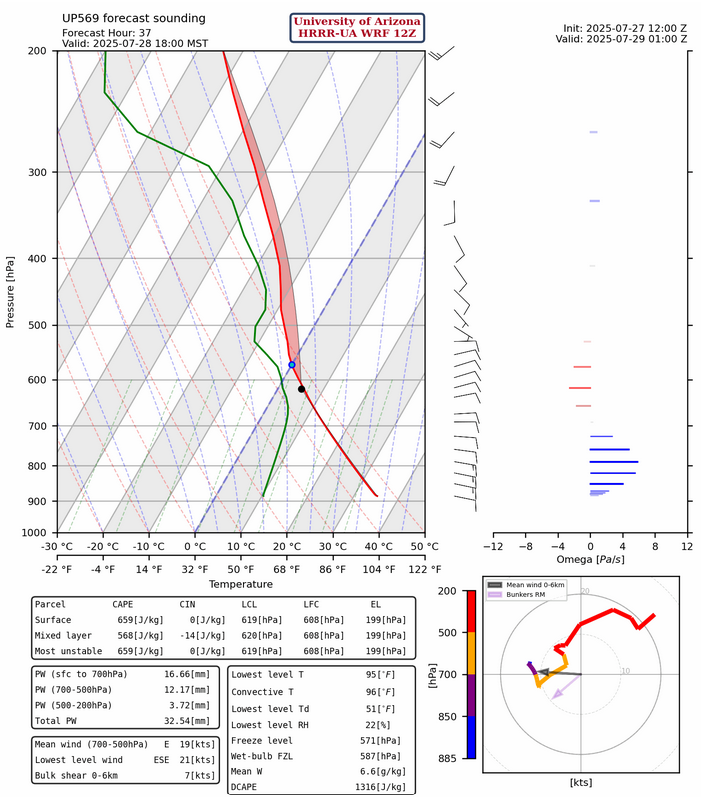
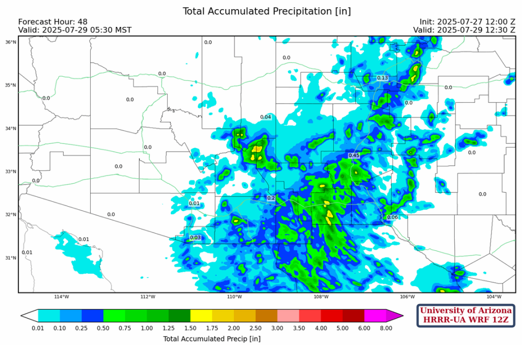
Note that the surface dewpoint temperature is only 50F, so rainfall amounts will be light as shown with the 48-hour rainfall accumulation.
Outlook
The Gulf of Mexico moisture runs out of gas due to interacting with the dry air in the low deserts but the Gulf of California begins to surge moisture into the lower deserts to replace it. Are the storms south and east of Pima county using surge moisture? If so, this could be a raucous evening in Tucson.
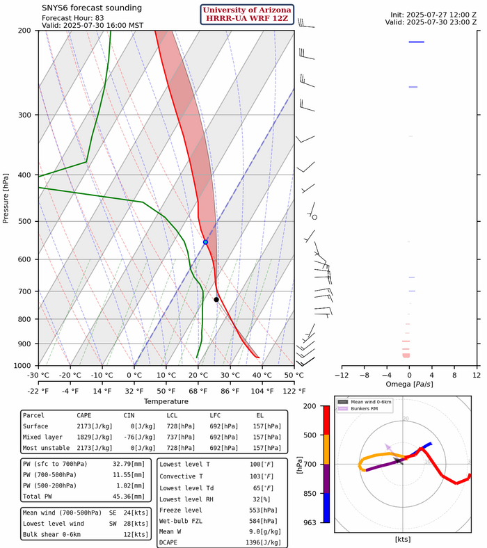
Below is the model forecast sounding from Lukeville. The surge moisture is below 850mb and convective available potential energy CAPE values are over 1500 [J/kg], but that can’t be realized at that location unless the stable later between 600 and 700mb can be overcome.
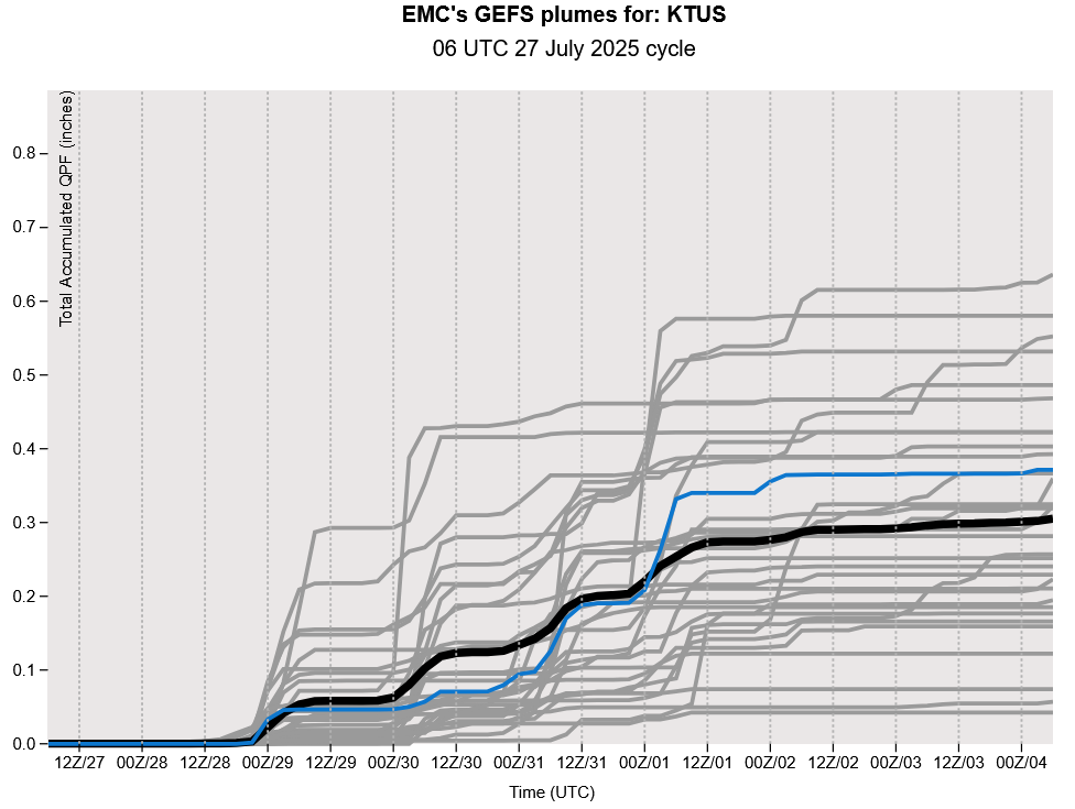
GEFS plume forecasts for Tucson show about 5 precipitation events through August 2nd then drying out again. Long range model forecasts at 500mb suggest the monsoon may not shutdown like last week’s long range forecasts. More in tomorrow’s discussion, and you can join in the conversation at the 11am weather briefing.
Discussion written by Pat Holbrook and Patrick Bunn