
Yesterday’s Weather
Yesterday there were fewer thunderstorms than the last few days. The storms that did form were shifted further east as dry air moved into the state between the ridge to the southm and the trough on west coast to the north.
Only 3 rain gauges reported measurable rain across Arizona. New Mexico did not fare much better as the MRMS precipitation observations below on the right show.

Analysis
The only tropical upper tropospheric trough (TUTT) influencing our weather situation is to the north of Mazatlán moving to the west southwest.

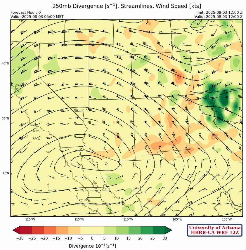
The sub-tropical high pressure ridge at 250mb is located over the northern Gulf of California. The jet stream flows north into northern California, extending to southern Idaho, then southeast to Colorado. Winds are strongest in northern New Mexico with wind speeds of 50 to 75 knots from the northwest decreasing to 35 knots over central Arizona. The winds are weak near the ridge and will shift into southeast Arizona in a couple of days.
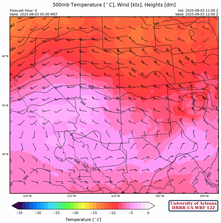
At 500mb, temperatures are very warm across the western half of Arizona and southern California with –3°C at Flagstaff this morning. Such warm temperatures would limit any convection getting up to this level. The ridge axis extends from it’s center over the northern Gulf of California eastward into west Texas. Winds are westerly at 20 to 25 knots across northern Arizona and New Mexico, weakening and becoming northerly to less than 10 knots along the international border.
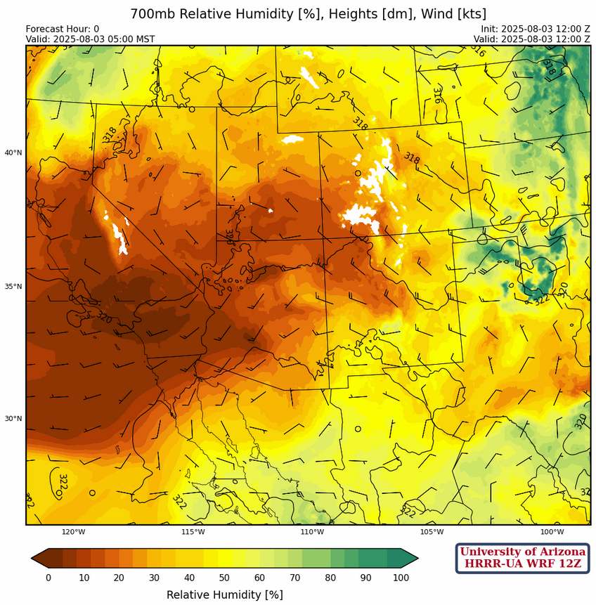
Dry air is present across Arizona at 700mb and will also move into the eastern half of New Mexico today. Phoenix this morning had a dewpoint temperature of –23°C and this will mix through the rest of the boundary layer, lowering surface dewpoint temperatures even more.
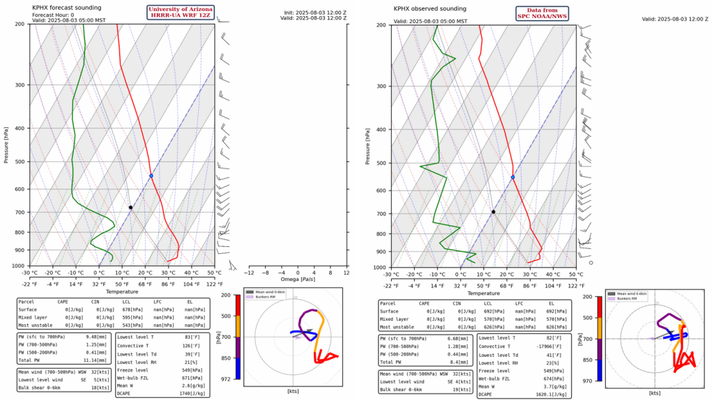
The forecast initialization (left) and observed (right) sounding for Phoenix are shown below. The lack of moisture is apparent from the separation of the red and green lines. The atmosphere probably can’t even make any cumulus and temperatures will be near the record high. Extreme heat warnings are in place for Tucson and Phoenix, and this is forecast to continue for the next four days.
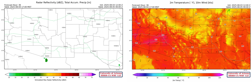
Today
Just a few storms in far southeast New Mexico today otherwise hot weather will continue across the region; about 110°F for Phoenix and 107°F for Tucson.
Tomorrow
Except for a storm south of Nogales, a mostly blank radar forecast for the rest of the region. Still hot, around 112°F for Phoenix and 107°F for Tucson.
Outlook
As the ridge shifts to southeast Arizona the circulation will bring in mid-level moisture across the region, resulting in high based storms with very little precipitation reaching the ground. Precipitable water remains low across the region.

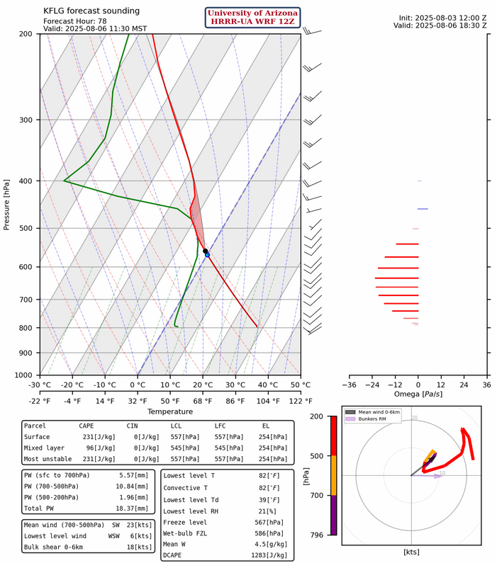
The Flagstaff forecast sounding below shows cloud tops will only be able to get up to 400mb.
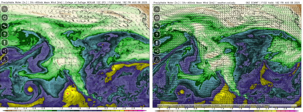
The 12Z GFS model forecast for Friday August, 8th at 11am shows a surge of moisture as a result of a tropical system passing to the south of Baja. The 06Z ECMWF forecast is not quite as aggressive with the precipitable water, but similar. National Hurricane Center has 50% chance of cyclone formation in the next 7 days.
Discussion written by Pat Holbrook