
Yesterday’s Weather
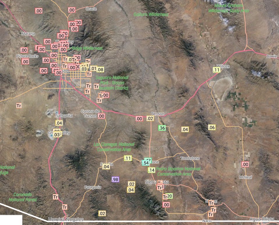
Storms were mostly confined to southern Arizona, especially in the mountains of eastern Santa Cruz and western Cochise Counties. The Rainlog data below shows mostly light rain although a few storms along highway 90 near Fort Huachuca produced heavy rain in the valleys prompting a flash flood warning in that area. Tucson saw trace amounts of rain although some gauges did get nearly .04 inches. Mid-level clouds were prevalent, possibly aided by remnant moisture from Flossie, but vertical motions were weak, and storms stayed near the mountains.
Analysis
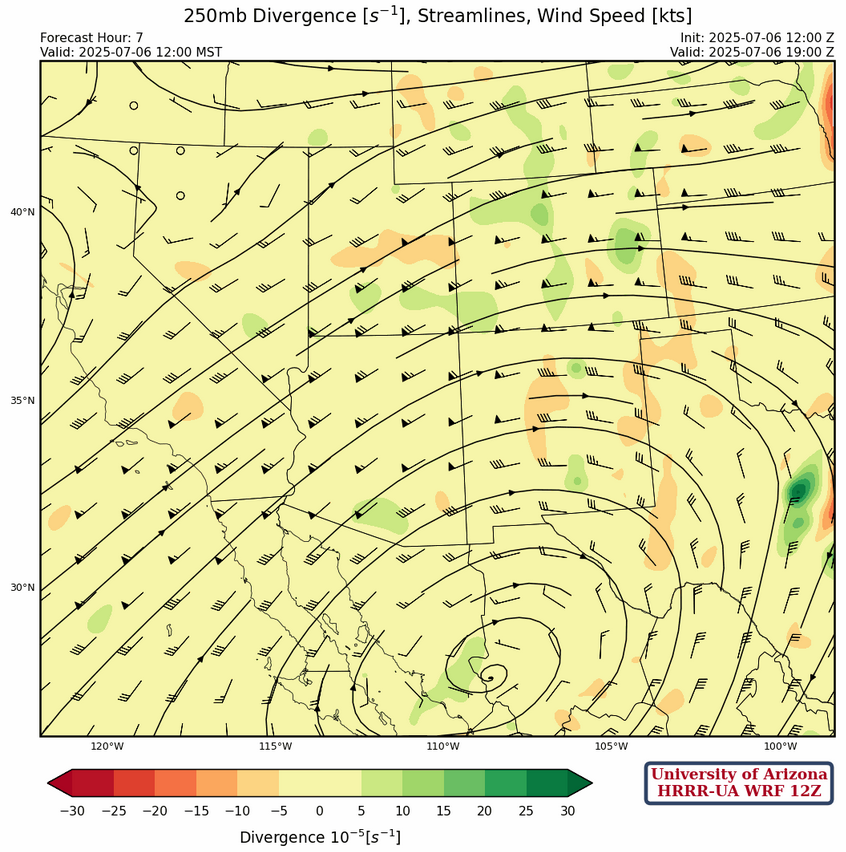
At 250mb, the tropical upper tropospheric trough (TUTT) appears to extend from a low east of Jamaica northwest into the Gulf of Mexico, then southwest into Mexico near Guadalajara. High pressure is over central Mexico with the jet stream from southern California to central Utah and then east into Colorado.
The high pressure is slowly moving northwest as the low pressure off the west coast moves west. Model forecasts show the high pressure will be over the northern Gulf of California by Tuesday.
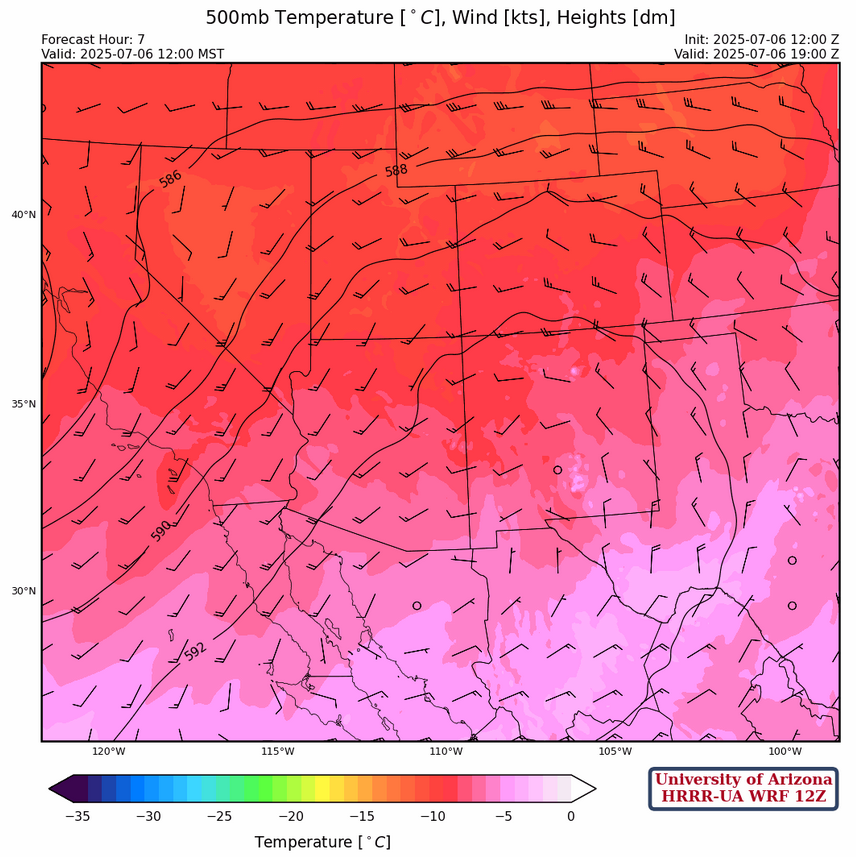
The high pressure at 500mb is near Guaymas, Sonora with the ridge axis extending into southern New Mexico. This high pressure will follow the 250mb high towards the northwest. Temperatures have remained the same in the region.
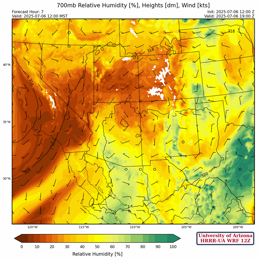
Moisture at 700mb is still retreating southward, and the only significant remaining moisture is in southern Arizona and New Mexico. A disturbance in the southern Gulf of California appears to be weakening and is not expected to push moisture northward.
Today
In New Mexico, more widespread thunderstorms are expected today over the mountains, with microbursts associated with the stronger storms possible. Some of these storms may drift off the mountains and go into the valleys in eastern New Mexico.
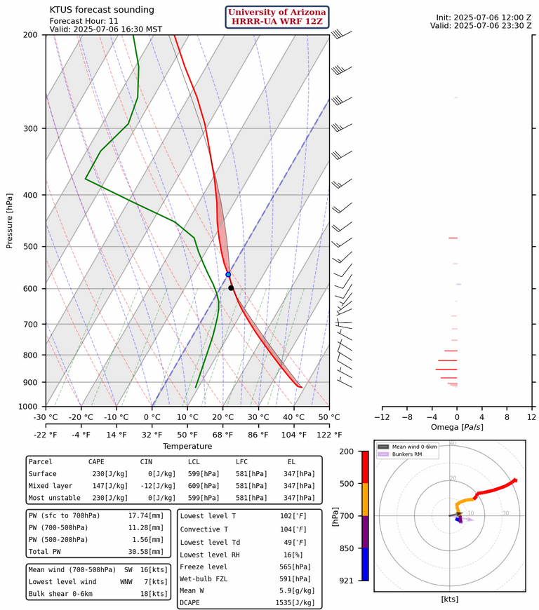
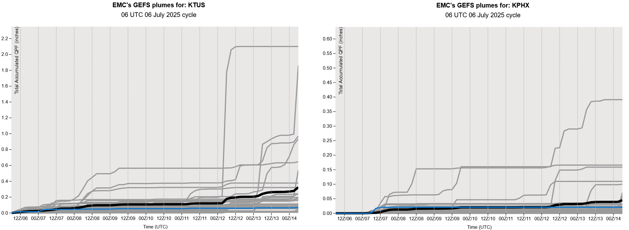
In Arizona, storms are expected over the mountains in the same regions as yesterday, eastern Pima, Santa Cruz, and Cochise counties. While it is possible that a storm may drift into the valleys, most likely any rain in the valleys will come from the anvil of a mountain storm and therefore light accumulations. The forecast sounding for Tucson shows low CAPE today at 4:30pm, but 1500 J/kg of DCAPE shows the potential for 30 mph microburst winds. Precipitable water (PW) is at 30mm (1.2″) showing the lack of deep moisture. We need about 40mm (1.5″) for deep convection and stronger thunderstorms.
Tomorrow
There is a potential for more activity tomorrow in Arizona. More storms are expected to form over the mountains of eastern Pima, Santa Cruz, Cochise, and southern Graham counties. Storms are also expected to form over the White Mountains. These storms are once again expected to stay over the mountains, with the strongest chance of rain in the valleys coming from drifting anvils. There is still always a chance that a storm may form over a valley, but this chance is low. A similar story for New Mexico, “mountain hugging” storms with downbursts associated with some of the stronger storms.

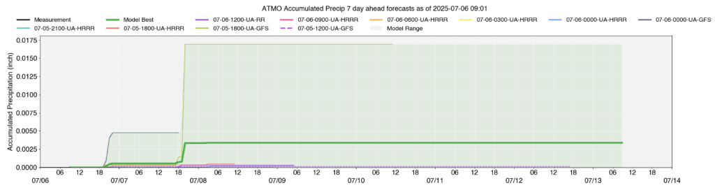
Total accumulated precipitation map for the next two days. Very little rainfall is expected in Arizona, unfortunately.

Outlook
The upper-level high pressure is moving into central Arizona hopefully on its way to the four corners region by the middle of the week. This would support storms moving off the White Mountains into southeast Arizona. However, the missing ingredient is moisture. Easterly flow associated with the monsoon will become established in Mexico by the middle of the week and should aid in some moisture pushing into Arizona at the mid-levels. So, there should be an increase in storms in Arizona, at least in the mountains. Phoenix should remain dry.
Discussion written by Pat Holbrook