
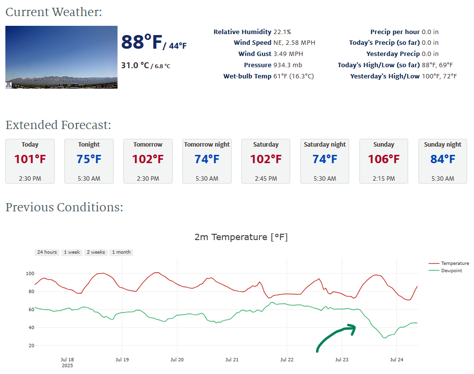
Yesterday’s Weather
Thunderstorms were over the eastern half of New Mexico with the strongest ones over the mountains of the northeast part of the state. Low dewpoint temperatures are west of an El Paso/Santa Fe line. Arizona had a few storms in the eastern portion of the Mogollon Rim and White Mountains.
Dry air has moved into Arizona with dewpoint temperatures in the 30s across most of the low desert (blue numbers in graphic below).

The weather station on top of the Physics and Atmospheric Sciences building shows how the dewpoint temperature dropped dramatically yesterday
Analysis
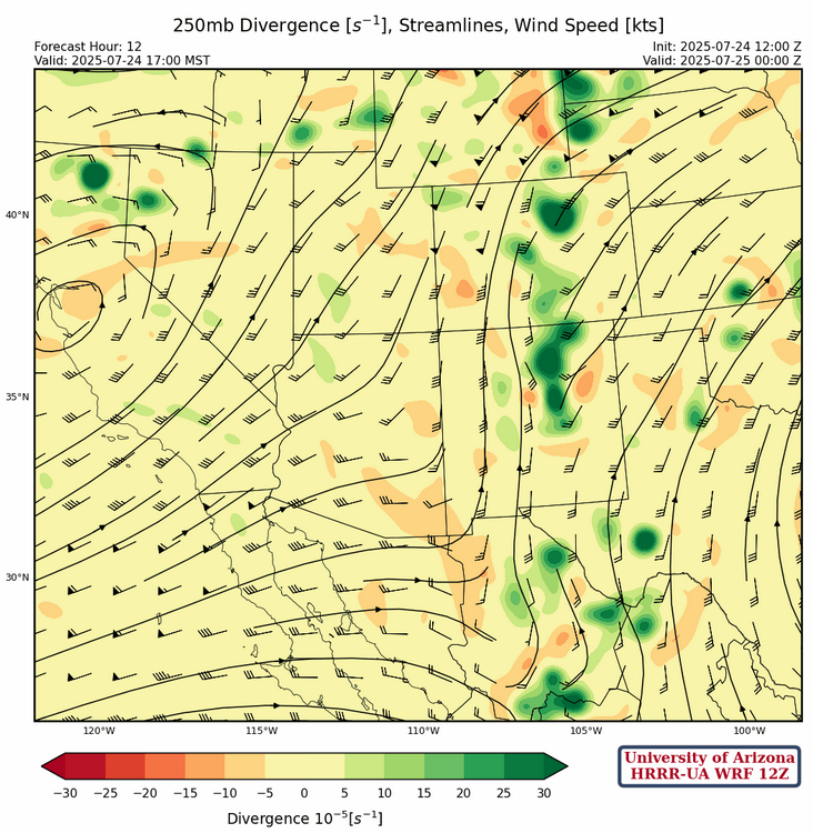
The tropical upper tropospheric trough (TUTT) to our south in Mexico has continued to move north and east, and appears to be more of an open wave now. Divergence associated with this TUTT low should aide in convection in eastern New Mexico this afternoon. Another TUTT is moving through the Florida straits north of Cuba. A maritime cold-core low pressure system has been cut off from the polar jet stream and is now off the off the California coast moving eastward.

The 250mb forecast below is for 5pm this afternoon, instead of 12pm as is typically shown. The green contours show deep convection in eastern New Mexico associated with the favorable divergence pattern set up by the TUTT to the south, as it shears out and leaves the area. Arizona is under the influence of the cold-core low with strong westerlies.
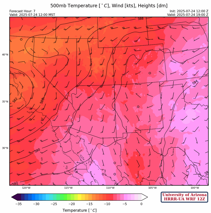
At 500mb, the subtropical high pressure (monsoon ridge) is centered just off the coast of North Carolina, with the ridge axis extending down to south central Texas. The cutoff lows circulation extends across Arizona although temperatures around –10°C over northern Arizona are not quite as warm as the model initialized temperatures.
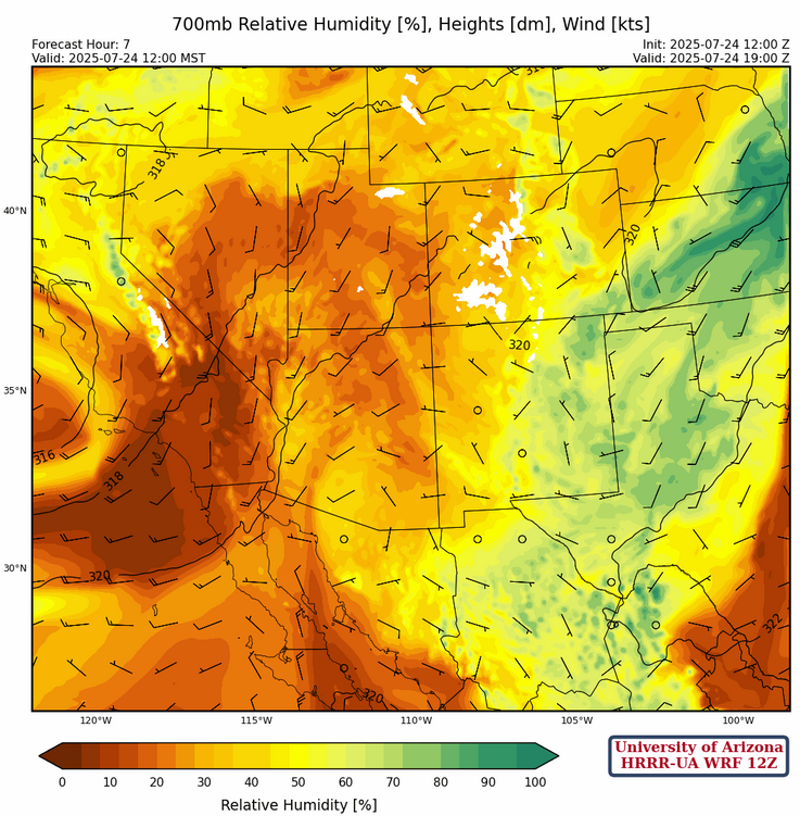
The low-level water vapor imagery (shown above) is in good agreement with the 700mb HRRR-UA WRF 12Z model initialization. The only significant moisture is in eastern New Mexico.
Today
Forecast radar reflectivity (below left) and 10-meter wind speed (below right) show strong storms forming in the eastern mountains of New Mexico then moving into Texas by late evening. Arizona will remain dry and hot.
Tomorrow
Even less activity over the region as the dry air remains in place. The few thunderstorms that form over New Mexico will be over and near mountains. Arizona will have a similar dry day to today.

Outlook
Saturday will be another dry and hot day with only a few mountain storms in New Mexico.

The good news is moisture from the Gulf of Mexico is poised to move back into the region on Sunday with an increase in storms over western half of New Mexico. Some storms may eke their way into Cochise County.

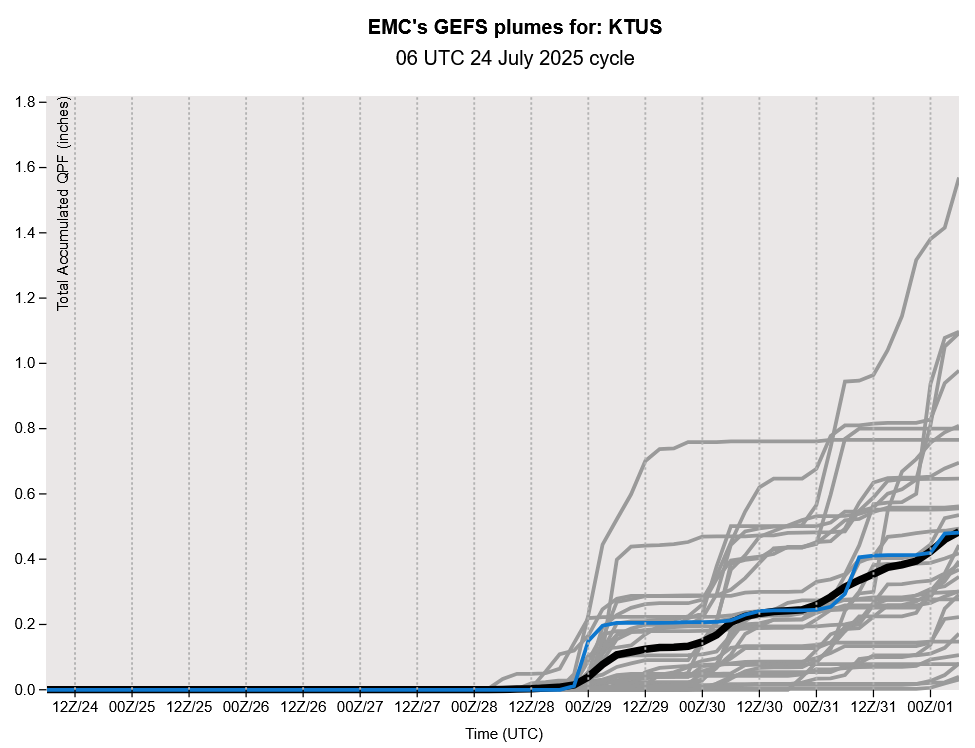
GEFS plume forecasts show the monsoon moisture coming back into Arizona next week…but which day? Tuesday or Wednesday.
Discussion written by Pat Holbrook and Patrick Bunn