
Yesterday’s Weather
Yesterday, convection initiated on the Mogollon Rim, White Mountain, and west central mountains of New Mexico. Thunderstorms moved west to southwest off the terrain and moved down into the valley into the Sun Corridor, impacting I-10. Yesterday’s HRRR-UA WRF 12Z radar reflectivity forecast was quite good (below, left) and matches the observed radar images well (below, right).
There was a a lot of lightning on the leading edge of the thunderstorms coming off the Mogollon Rim and in the cores of the storms, but not a lot of rain to show for it. There were a few spots that had heavy rain, but in the Tucson and Phoenix the rainfall was mostly light. Strong outflows were associated with the thunderstorms, wind gusts over 40mph were common and the Phoenix airport had a maximum gust of 69 mph. The cold cloud top temperatures in the infrared satellite images below indicate the storms reached the top of the troposphere. Storms moved rather quickly which limited the threat of flooding.
Rainlog data for both the cities of Tucson (top) and Phoenix (bottom) shows that most of the precipitation was light.

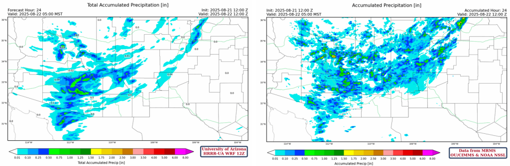
The gridded 24-hour accumulated precipitation map below from MRMS (below, right) shows that the precipitation was the heaviest closest to the mountains in eastern Maricopa and Pinal counties and confirms the Rainlog precipitation amounts in the cities. Note the absence of storms in eastern New Mexico extending west to Cochise County. The HRRR-UA WRF 12Z forecast (below, left) had the general pattern correct, though some of the finer details of the precipitation was not represented in the forecast.
Analysis
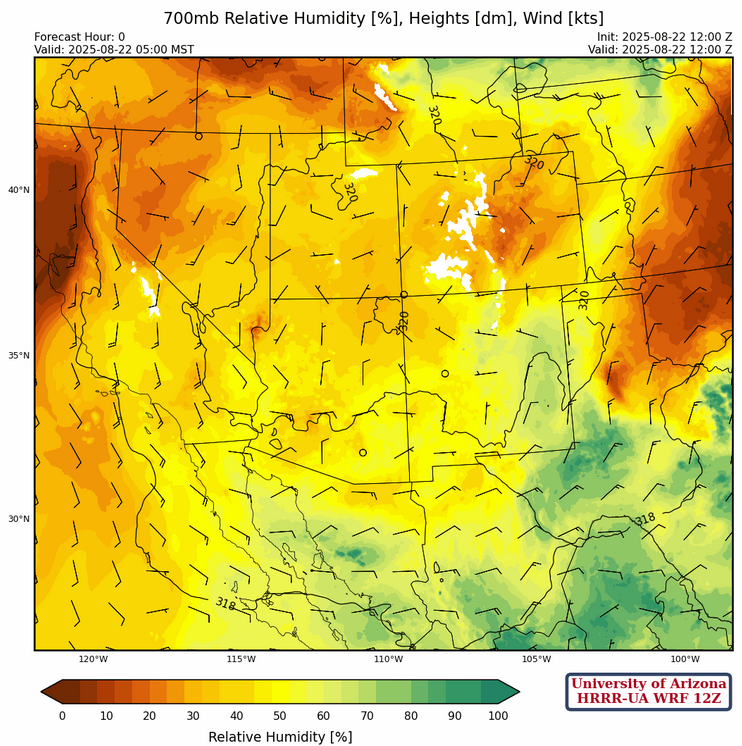
The surface dewpoints show drying has occurred in eastern New Mexico southwest to southeast Arizona due to the circulation around the four corners high.

No 5am sounding is available from Phoenix this morning and the Flagstaff sounding was late and may not have been in the 12Z model initializations. The only other sounding in the region was from El Paso. No soundings were available in Colorado, and the combined lack of soundings makes it hard to pinpoint the center of the monsoon ridge.
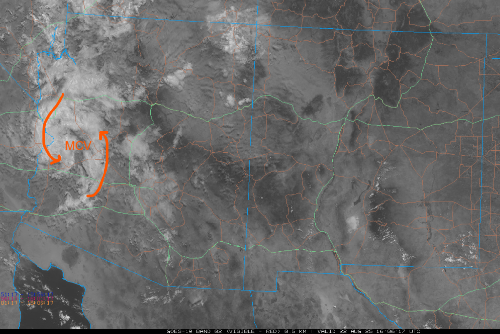
The visible satellite picture for this morning shows a clearly defined Mesoscale Convective Vortex (MCV) from last night’s storm’s over western Arizona moving west into Colorado. New Mexico and southern Arizona were mostly clear.
The tropical upper tropospheric trough (TUTT) and TUTT lows are as indicated below on the upper-level water vapor image. The northern part of the TUTT in the southern part of the United States and Mexico is becoming more diffuse over time.

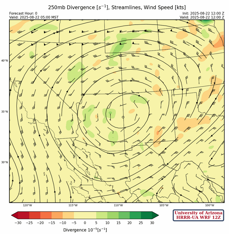
At 250mb, not much has change from yesterday with anticyclonic flow dominating the region. Note the divergence (green contours) over Arizona which should aide in storm development again this afternoon.
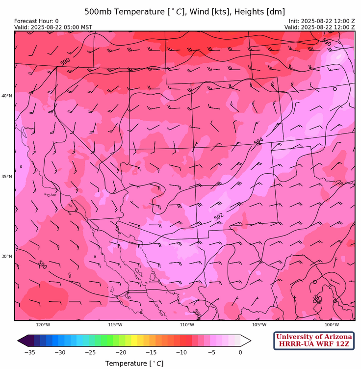
The ridge at 500mb is near the four corners region with winds of 20 to 35 knots over eastern Arizona and a little more from the northeast than yesterday. Like yesterday, storms will be moving too fast to produce flooding in the valleys unless there is training of storms (one after another over the same location).
At 700mb, El Paso had a dewpoint temperature of 0°C this morning, down from 4°C yesterday morning. The drying of the air this level will shut down thunderstorm activity in El Paso and into eastern Arizona today. The Flagstaff sounding did have about the same precipitable water values as yesterday, so there has not been much change in that part of the state.
Today
Today there is less Convective Avaialbe Potential Energy (CAPE) in the forecast sounding for Phoenix at 3pm (left). There’s a lot of warming above 450mb in the forecast sounding for Tucson at 7pm. These features in the forecast soundings point to less activity in Phoenix, and low topped storms in the Tucson area.
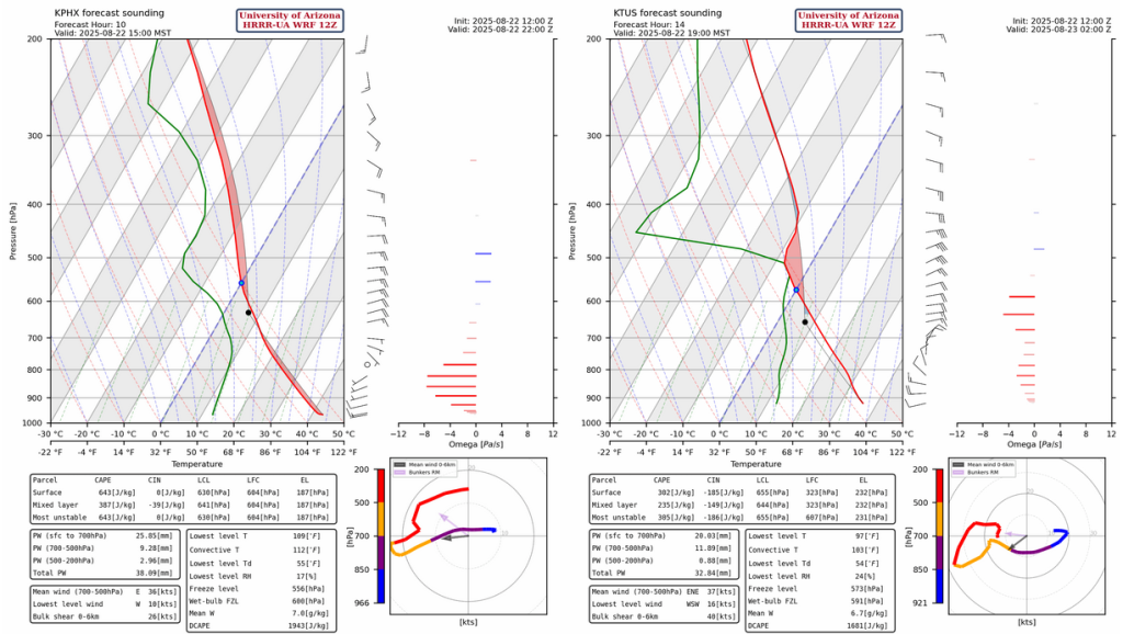
The HRRR-UA WRF 12Z forecast radar reflectivty shows less activity upstream from Tucson and Phoenix at 4:30pm with better storms west of Phoenix by 8pm. The storms move west to California by midnight with a few storms redeveloping over the mountains north of Phoenix after midnight. Yesterday’s HRRR-UA WRF 12Z forecast for this afternoon was much more aggressive with thunderstorms than this morning’s forecast. It’s backed off likely due to the dry air and subsidence around 450mb.
Tomorrow
The combination of dry air in southern/central Arizona and the subsidence alot from the ridge will restrict storm formation to northern Arizona. Flagstaff is forecast to get 0.5″ of rain tomorrow, and as much as 45 kts wind gusts.
Outlook
Sunday is forecast to also have limited storms although there will be a few more in southwest Arizona.

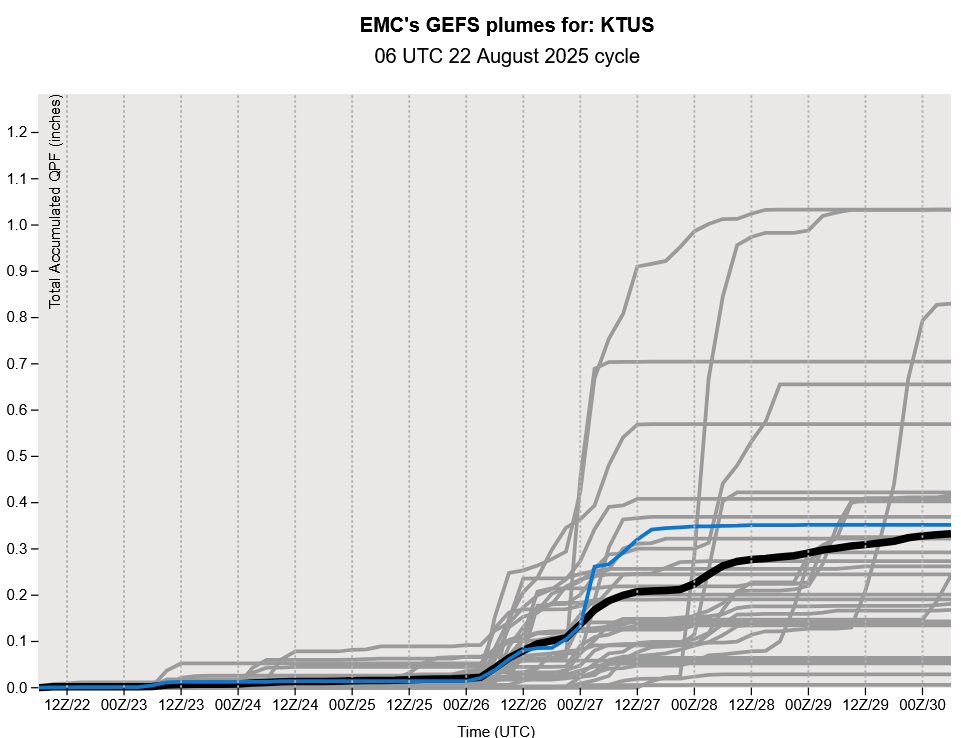
Monday morning, at the end of the HRRR-UA WRF 12z forecast, a Gulf Surge develops. This will increase storms mainly in Pima county, but at this far of a gorecast horizon is quite uncertain still.

GEFS plume forecasts show an increase in precipitation next week, likely on as a result of the moisture brought in by the surge.
Discussion written by Pat Holbrook and Patrick Bunn