
Yesterday’s Weather
Dry air suppressed convection across the region, with the best storms in eastern New Mexico. Even the storms in Mexico reflected the drying trend with deep convection much further south compared to previous days this week. Of note is the southward moving storms in the White mountains and west central New Mexico. The mixed layer depth was close to 500mb in this area and this pattern should repeat itself for the next few days with strong microbursts possible.
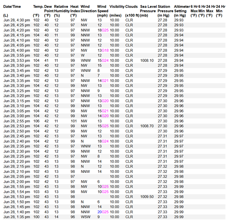
Temperatures continued to climb and combined with dry air in the deserts the upslope afternoon winds felt like a blast furnace.
Analysis
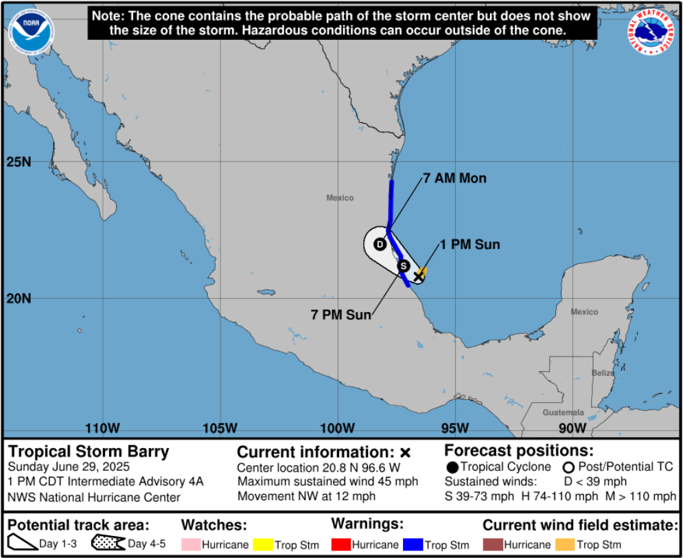
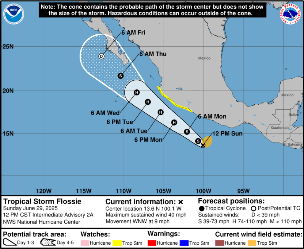
We have two tropical storms; Barry in the southern Gulf of Mexico and Flossie is moving along the southwest coastal area of Mexico in the Pacific. Combined they will result in a synoptic push of moisture into the region.
At 250 mb, winds remain dominantly westerly. The nearest tropical upper tropospheric trough (TUTT 1 in previous discussions) is sitting over Texas. Another TUTT low (2) has begun to dissipate over Georgia, and a third TUTT low (3) is off the coast of Florida. A low pressure system is in the Pacific, west of San Francisco, moving east.
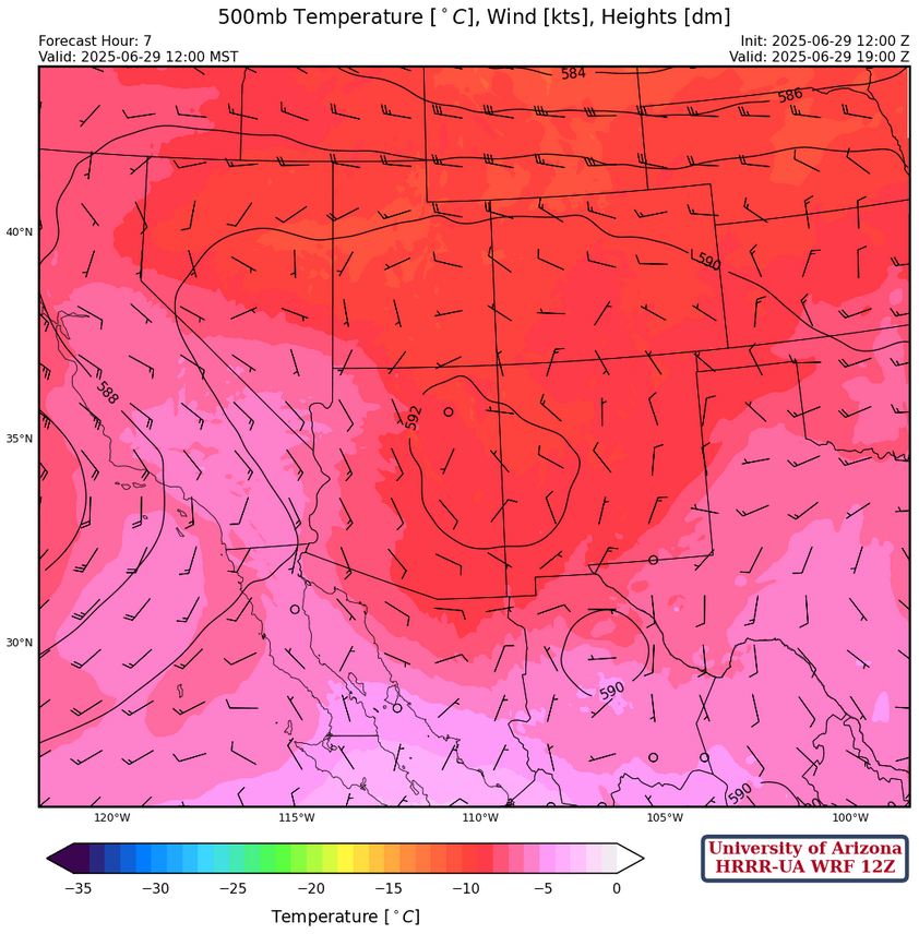
At 500mb, a ridge is in northwest New Mexico with anticyclonic (clockwise) flow over both states. Southern Arizona New Mexico is in easterly flow. This is the start of the “monsoon ridge” building, which sets up favorable flow to bring moisture into the region from the south.
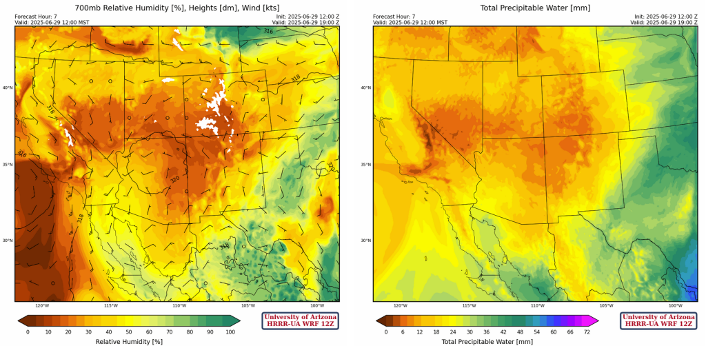
At 700 mb, high pressure is over southern Arizona and eastern Texas with a trough from Kansas southwest to El Paso. Wind flow is southerly in western Arizona becoming northerly in eastern Arizona and western New Mexico generally around 10 to 15 mph. Despite this flow being favorable, moisture is lacking for the time being.
Today
Some storms are expected over the mountains in New Mexico today. Strong winds will be associated with these storms, with gusts of up to 45mph. Storms will form over the mountains in eastern Arizona, but the majority of the precipitation will evaporate before it can hit the ground. These storms will also produce microburst winds around 40 mph. Temperatures will be warmer than yesterday across both states.
Tomorrow
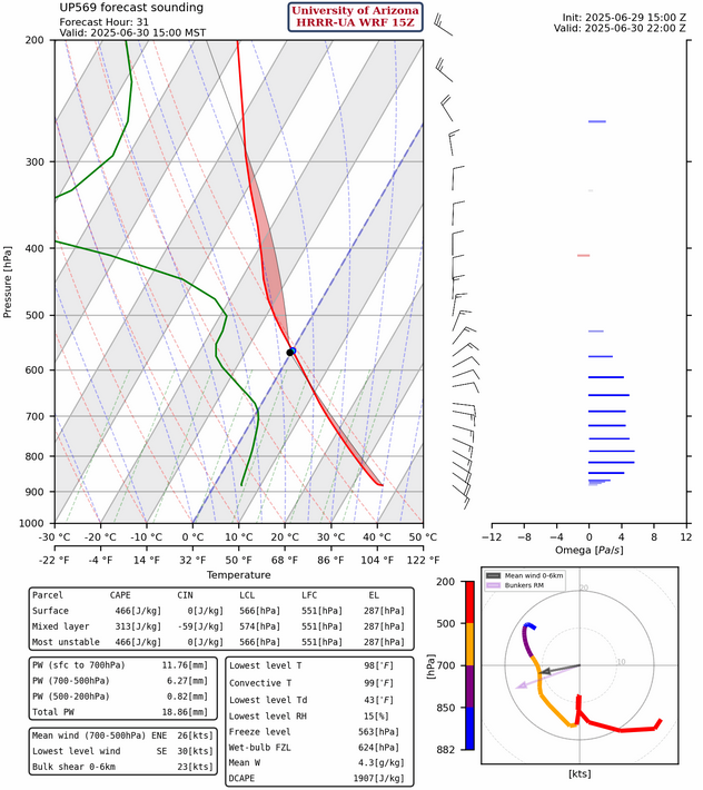
Extremely high temperatures are expected tomorrow across Arizona, hitting around 110°F in Tucson and 115°F in Phoenix. Storms are expected over New Mexico and the southeastern corner of Arizona. Strong gusty winds are expected with some of these storms, stronger than yesterday and moving out to the deserts in the evening. Peak winds in New Mexico could reach up to 50 mph, whereas the strongest winds in Arizona are expected around the mountains at around 45 mph weakening to 30 mph in the lower deserts. The strong winds are a function of the inverted-v soundings as indicated by the forecast sounding for San Simon below (note the DCAPE at 1900 [J/kg], and the positive omega values [Pa/s] in blue showing downward vertical motion)
Outlook
The combination of the tropical systems and the front off the coast of California dropping down into New Mexico will produce a favorable environment for a Gulf surge. 10 meter wind speed and 2m dewpoint forecasts below show the surge start at midnight on Tuesday evening.
Forecast storm tracks for Barry and Flossie are below.
Discussion written by Pat Holbrook