
Yesterday’s Weather
The satellite imagery from yesterday shows areas of thunderstorm activity across the northern half of New Mexico and Arizona with additional storms in the Ajo/Lukeville area. Storms wound down during the evening hours, but as midnight approached the storm began to fire again along the international border and moved north to I-8 by 2 am and to I-10 by 5am. Additional storms in the Phoenix metro area around 2am with additional storms redeveloping during the early morning hours.
Rainlog data is below with the heaviest precipitation in the mountains southwest of Prescott and along I-10 on the south side of the Phoenix metro area.
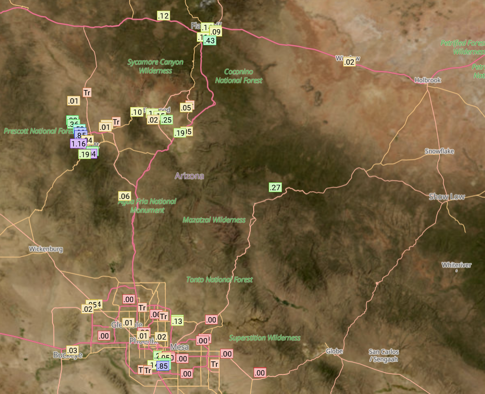
The gridded 24-hour accumulated precipitation observations from MRMS is in good agreement with precipitation observations from Rainlog. The HRRR-UA WRF 12Z forecast from yesterday missed some of the intensity of the strongest storms in Yavapai/Coconino/Mohave counties, but otherwise it got the overall pattern of the MRMS precipitation observations correct.

Analysis
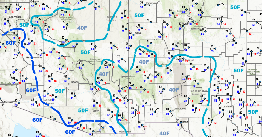
This morning higher surface dewpoint temperatures are west of a line from Phoenix to Tucson, while dry air still exists over southeast Arizona and southern New Mexico. Some moisture has returned to western Cochise County and thunderstorms may form there this afternoon.
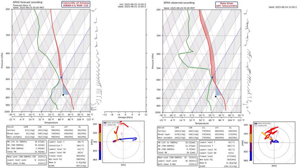
The observed sounding for Phoenix at 5am sounding (below, right) is somewhat contaminated by thunderstorms in the area near the launch site, so the HRRR-UA WRF 12Z model (below, left) initialization precipitable water of 1.3 inches is much lower than the 1.75 inches observed. By afternoon the forecast precipitable water value is closer to 1.5 inches in Phoenix. Note that the Yuma sounding has nearly 2 inches of precipitable water at 12Z!
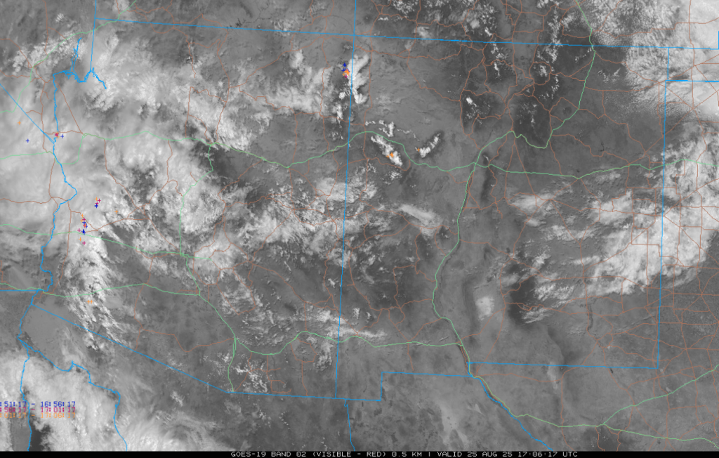
This morning’s visible satellite image with lightning annotated shows the storms near the Colorado River Basin from north of Yuma spreading northward into eastern California and western Arizona. A few storms that passed through Phoenix this morning are in the Mogollon Rim area north of Phoenix.
The tropical upper tropospheric trough (TUTT) in the Gulf of Mexico has been re-positioned as shown below after being disrupted by Hurricane Erin. The newly formed tropical storm Juliette is a little further west than indicated and the surface cyclonic center is underneath the upper-level anticyclone.

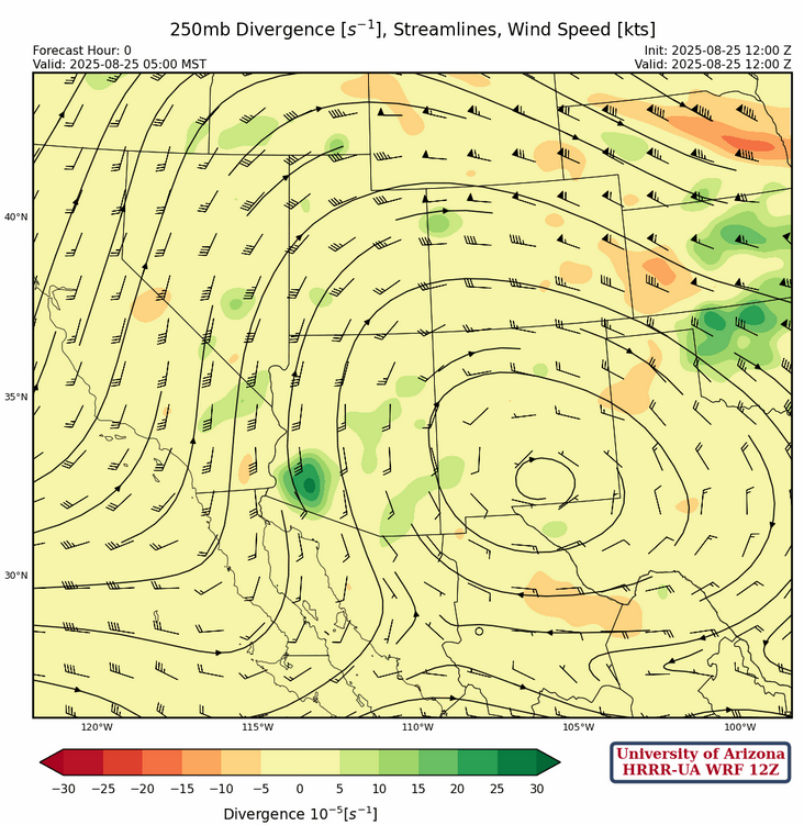
The sub-tropical high pressure at 250mb has shifted east to southern New Mexico allowing for divergence to occur in southwest Arizona. Note some divergence exists all over southern Arizona and this will aide in the development of the thunderstorms this afternoon.
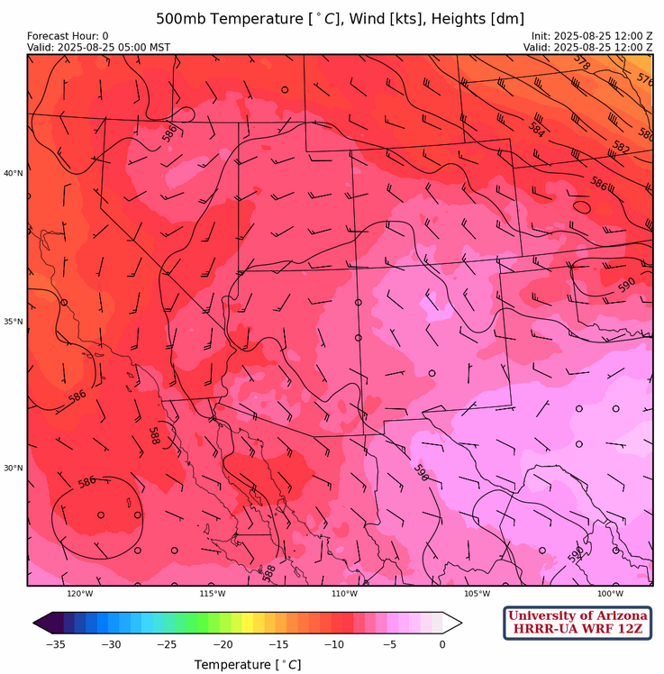
At 500mb, there’s generally southeast wind flow across Arizona becoming northwest in northern New Mexico. Temperatures in Arizona are cold, close to –8°C over the central and western part of the state.
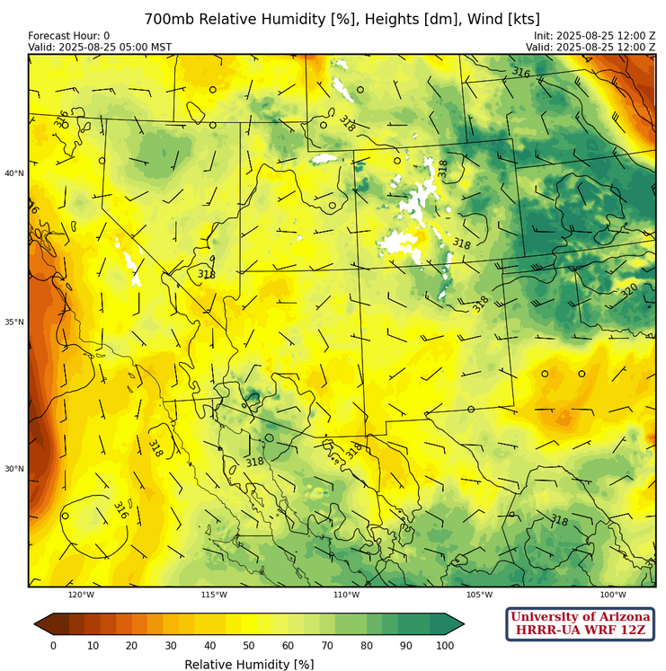
At 700mb, there’s more moisture everywhere today especially in western Arizona associated with the thunderstorms. Still, there is a dry “tongue” of air across Cochise County east into New Mexico.
Today
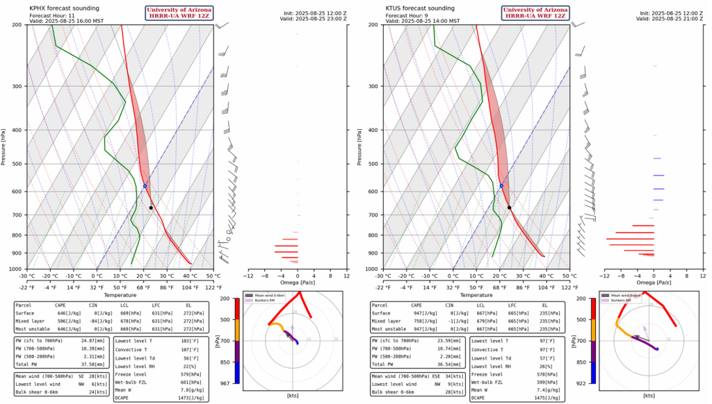
The forecast sounding for Phoenix at 4pm (below, left) and Tucson at 2pm (below, right). Both soundings support strong thunderstorms today with a combination of strong gusty winds, blowing dust or haboob, small hail, and flooding.
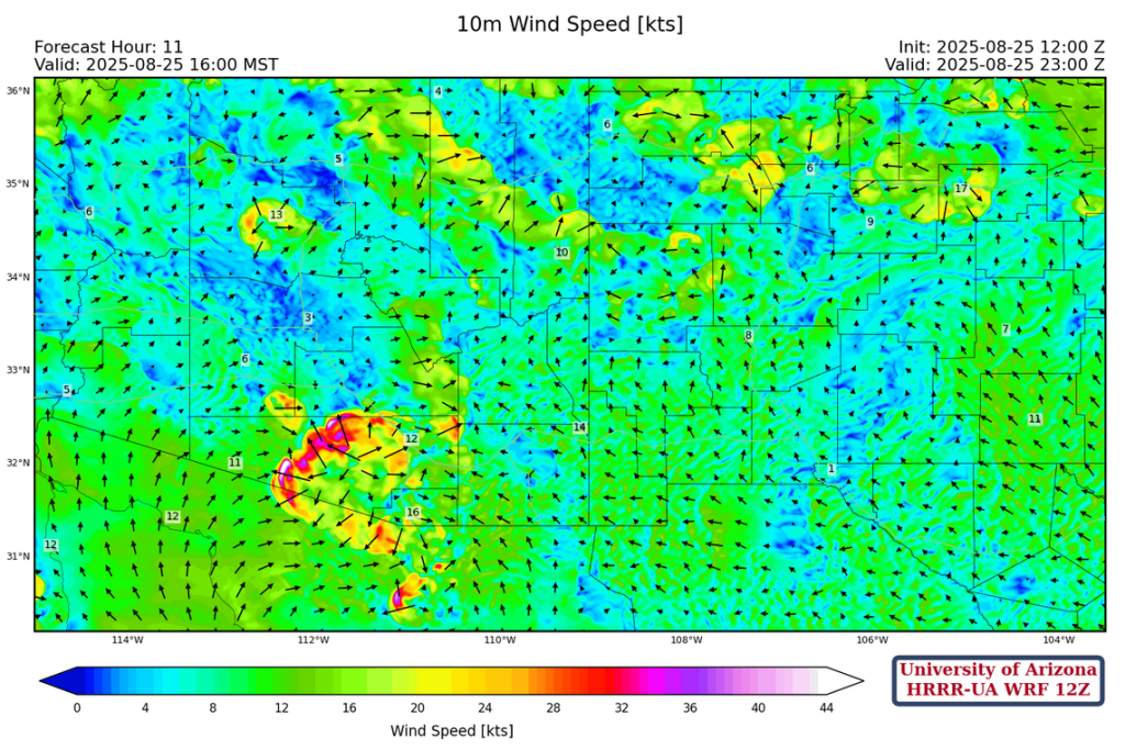
The HRRR-UA WRF 12Z (below, left) forecast shows the storms beginning in Pima and Santa Cruz counties around 1-2 pm then moving northwest. A couple of issues; previous model runs (00Z, 06Z, 09Z) moved this group of storms into Phoenix in the late afternoon, but the 12Z model run has the storms moving further west missing Phoenix. Storms form later in the evening and move into Phoenix, but the discrepancy between the observed and model initialized sounding this morning add significant uncertainty to forecast accuracy. Over in Cochise County, the moisture has moved into the western third of the county and development should occur there also. Also, the HRRR-UA WRF 15Z forecast (below, right) has more activity in the Tucson metro area this afternoon than the 12Z model run. The 15Z model run also misses Phoenix with these storms, but does show storms moving into Phoenix around 9pm.
The forecast 24-hour total precipitation is below from HRRR-UA WRF 12Z (left), and 15Z (right).

40mph gust are forecast along the I-10 corridor between Tucson and Phoenix, blowing northwest towards the Phoenix metro area.
Tomorrow
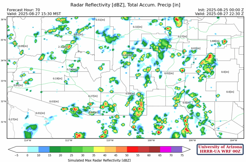
Initially the storms form in the eastern part of Arizona on Tuesday, Cochise and Graham county, with storms propagating towards Phoenix and Tucson during the day. This normally does not happen the day after an active day, but the atmosphere is very wet and would not need much heating for storms. We’ll need to see tomorrow morning forecast before being able to be more confident about what will likely happen.

Outlook
Into the weekend, a decrease in statewide thunderstorm activity is forecast bringing us back to a low-grade monsoon pattern.
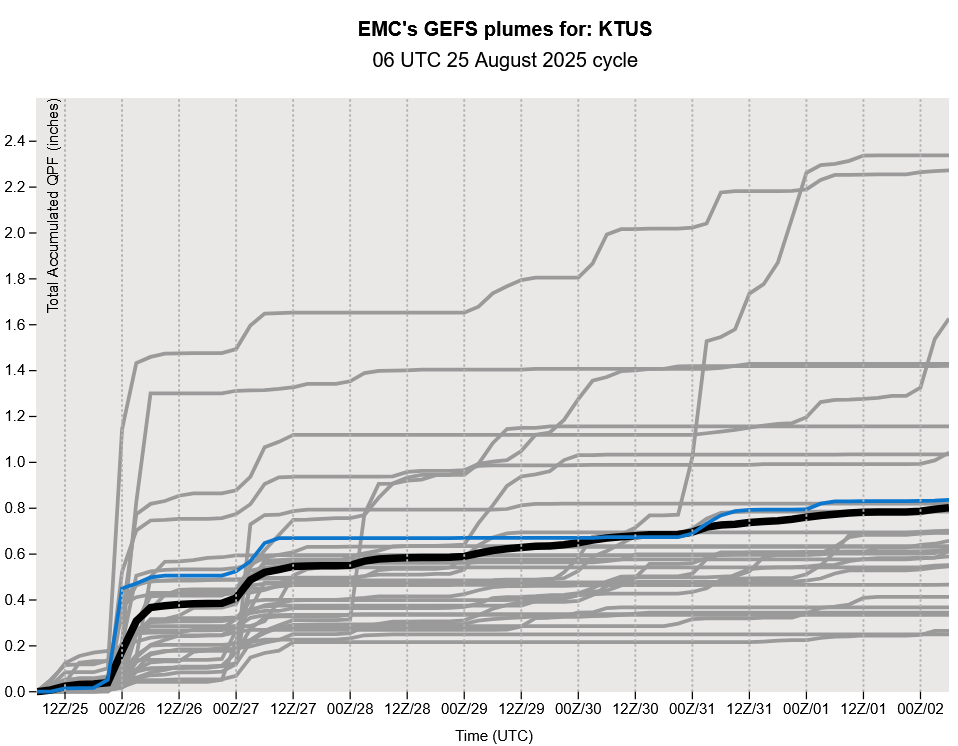
The GEFS plume forecasts, show we probably have one or two more precipitation events next week when the jet stream drops south and interacts with the monsoon moisture. Long-range model forecasts hint at storms on September 2nd and 3rd though these are not technically monsoon thunderstorms from an atmospheric dynamics viewpoint, since the wind direction is doesn’t have an easterly component and the pressure pattern is not associated with the sub-tropical high.
Discussion written by Pat Holbrook and Patrick Bunn