
Yesterday’s Weather
Storms developed in New Mexico along the leading edge of the returning low-level moisture. Biggs Army Airfield north of El Paso received .45 inches of rain and some hail. Visibility was less than a mile and wind gusts to 45 mph, while El Paso International Airport had wind gusts to 49 mph. Some of the storms approached the Arizona border east of the Chiricahua mountains. Except for smoke from the Grand Canyon fires, Arizona enjoyed another day of hot and dry weather.
Analysis
A tropical upper tropospheric trough (TUTT) has continued to move westward as is near Durango, Mexico, while another TUTT is in the west central Gulf of Mexico and is moving faster to the west. A tropical wave extends along a north-south line in western New Mexico southward into Mexico and is associated with the higher surface moisture content in the region. Another TUTT low has developed near the Antilles north of Cuba, but this one isn’t as influential to the short term forecast.

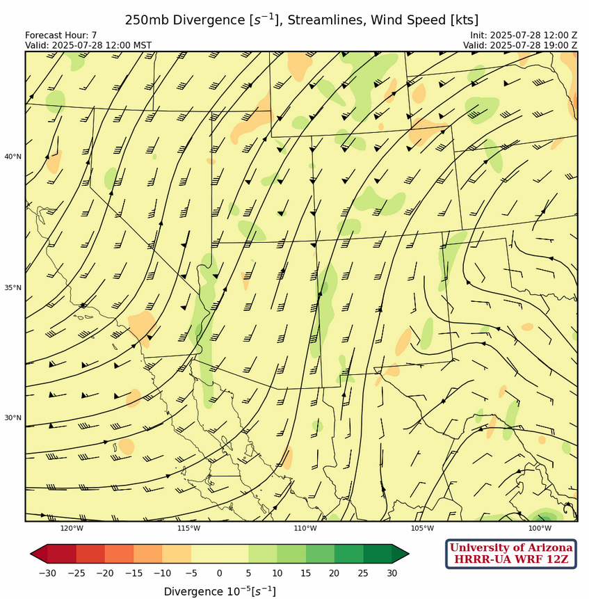
At 250mb, the center of the sub-tropical high pressure ridge is near the tri-state region. The ridge axis extends eastward off the Virginia coast to the west into eastern New Mexico.
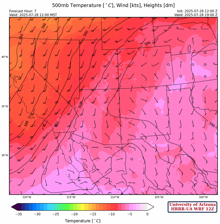
At 500mb, the tropical wave is from the Arizona/New Mexico state line in west central New Mexico southward to the boot heel of New Mexico then south into Mexico. Winds are easterly to the east of the wave at 10 to 20 mph becoming southerly at 20 to 30 mph in western Arizona.
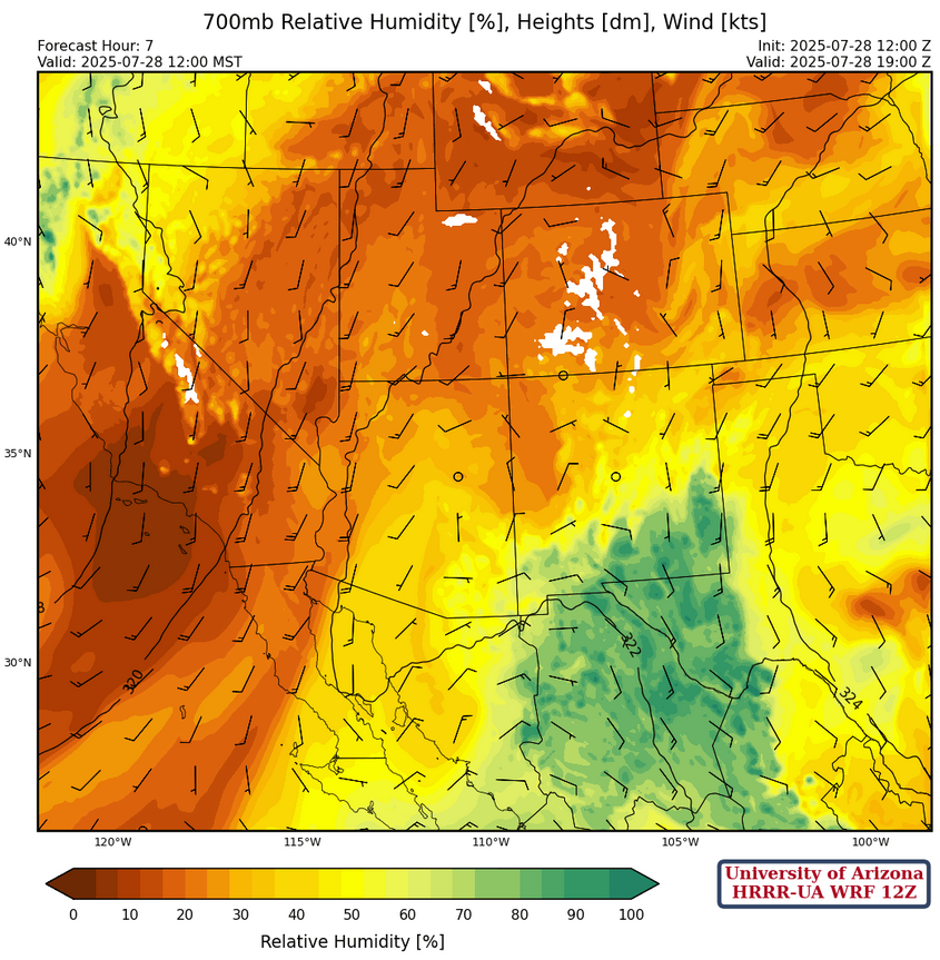
At 700mb, the moisture that accompanies an inverted trough is striking. An inverted trough moves along the southern side of the subtropical high-pressure system. It’s “inverted” as its orientation is flipped 180 degrees from typical low-pressure systems that dip down from the north, and it moves west instead of east. The area of moisture associated with the inverted trough will move west over the next few days with thunderstorms developing from the increase in moisture. The battle zone with this moisture will be with the dry air in the low deserts as the inverted trough moves westward. Mixing should result in low 50°F dewpoint temperatures. Not quite monsoon level moisture, but enough for storms.
Today
The forecast soundings for Tucson this afternoon, shown below, have enough convective available potential energy (CAPE about 250 [J/kg]) to support thunderstorms that will be moving into the area from the east. The thunderstorms will be associated with gusty winds to 45 mph and blowing dust, as downdraft convective available potential energy is forecast above 1200 [J/kg].

The storms fizzle out as they try to move out into the desert areas. Most of the precipitation in New Mexico is in the western half of the state.
The heaviest precipitation seems to be forecast for Cochise County this afternoon.

Tomorrow
Various model forecasts show an Mesoscale Convective System (MCS) along the Arizona/New Mexico state line forming in the wake of tonight’s convection. As it moves northward into central New Mexico, it should enhance convection ahead of it’s path through that area on Tuesday afternoon. In Arizona, northerly winds behind the MCS will result in fewer storms. The microburst potential is less.
Outlook
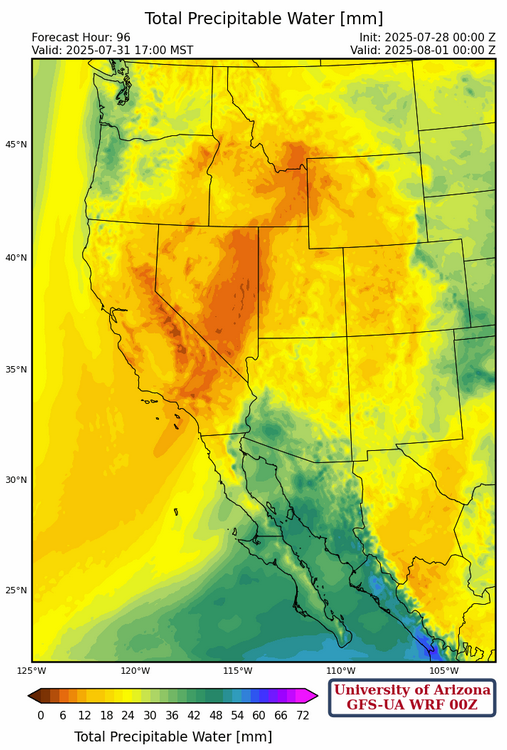
On Wednesday, most of the storms are concentrated in eastern Arizona extending into central New Mexico. There is still not enough precipitable water for more than a low grade monsoon.

What’s needed is a good gulf surge and the GFS hints at this happening on Thursday with precipitable water above 35mm (about 1.5 inches). The ECMWF forecast is similar for the same time. The bad news is that the region drys out by the weekend.
Discussion written by Pat Holbrook and Patrick Bunn