
Yesterday’s Weather
Model forecasts did a decent job with precipitation yesterday, although storms were a little further west in Graham County. Some of the intensity of the precipitation in Chihuahua, Mexico was missing also.

The visible satellite picture does not show storms in Cochise County by the time the sun goes down, but the storms to the north moved southward and produced a nice lightning show in the evening. The best lightning show was in Cochise county and eastern New Mexico.
The rainlog.org plot below shows where precipitation fell yesterday; this was the only recorded precipitation in Arizona.

Analysis
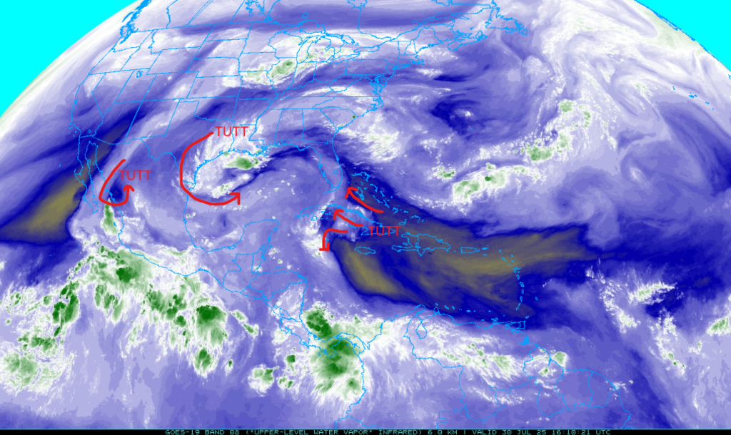
The tropical upper tropospheric trough (TUTT) near Los Mochis this morning was originally southwest of Brownsville yesterday. The TUTT low in the Florida straits has now moved into the west central Gulf of Mexico, while a new TUTT is forming in the Carribean Sea south of Jamaica.
The 50°F (green) and 60°F (blue) dewpoint temperature dashed lines are shown below on a map of surface observations from this morning. The moisture moving into the Yuma area is not from a surge and most of the higher dewpoints may be from thunderstorm outflows along the international border. The overall amount of moisture available for storms has not changed much.

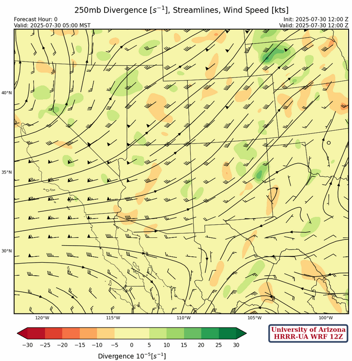
The high pressure sub-tropical ridge at 250mb remains in the same location as yesterday in northern Alabama. Westerlies continue across Arizona, although the wind speeds have dropped a little and some upper-level divergence is in southeastern Arizona. The TUTT low to our south in Mexico, looks to be too far east in the forecast initalization by about 60 miles or so. That may mean we have more divergence aloft than what is currently forecast for both this afternoon and tomorrow afternoon.
Is that the four corners high northwest of Albuquerque? Not quite, it will be short-lived as the west coast trough pushes it southward by the weekend. We’re in a strange situation where the sub-tropical high is impacting the east coast with extreme heat warnings in effect, and then another sub-tropical high is building of the Baja coast to the southwest. Winds remain weak over Arizona and the only saving grace is that a degree or two of cooling will occur in southeast Arizona today and tomorrow.
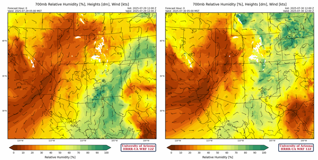
Comparing yesterday’s (below left) to today’s (below right) model initialization at 700mb, there is more of the dry air over Arizona and slightly drier in New Mexico. I generally like to look for a 0°C dewpoint temperature or higher at 700mb to understand where thunderstorms can form. The higher the dewpoint temperature, the better chance of flash flooding. This criteria will exclude the western 2/3 of Arizona while New Mexico should still be good for thunderstorms except for the far northwest.
Today
Forecast soundings for Tucson and Nogales for this afternoon are shown below. Neither shows significant convective available potential energy (CAPE), but if the divergence aloft is more than forecast in the layer above the lifting condenstation level (LCL; black marker), a lifted parcel will cool enough to support taller storms. This is more likely tomorrow than today, but the location of the TUTT low to the south adds a fair amount of uncertainty for both days.
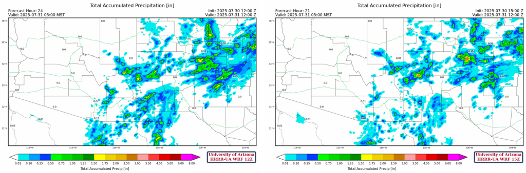
The forecast simulated radar reflectivity and 10-meter wind speed show some storms form around Tucson and in the White mountains in the afternoon. The White Mountain storms produce a strong outflow boundary that will sweep into Pima and Cochise Counties by evening generating a few more storms.
Precipitation values will be light, only mountain areas getting more that 0.25″.
Tomorrow
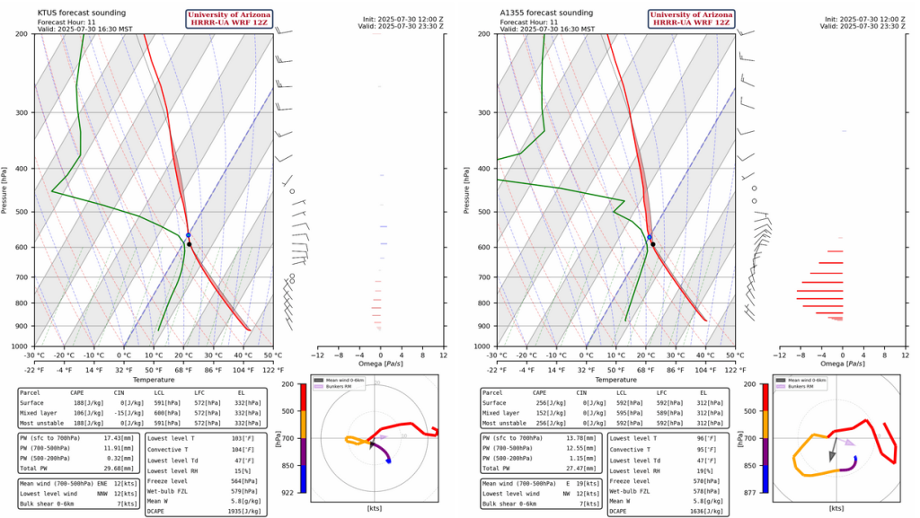
The forecast sounding at 2:30pm for Tucson today (left) and tomorrow (right) are shown side by side. Tomorrow’s sounding has more CAPE with only a slight increase in dewpoint temperature in the boundary layer. The difference is that today there are easterlies in the mid-level 700-500mb and becoming more from the southwest at 250mb. While tomorrow it shifts to westerlies in the mid-level, as the west coast trough moves east and a “new” sub-tropical high builds. The pattern still looks to have divergence aloft and we would expect the storms to be stronger tomorrow.

The forecast simulated radar reflectivity shows stronger storms and more outflow winds.

Outlook
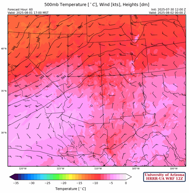
The “new” sub-tropical high at 500mb builds over southern Arizona bringing hot and dry weather back to the region for about 5 days. Some isolated storms will still be in southeast Arizona and New Mexico, but this is a significant drop off in activity from Thursday on.
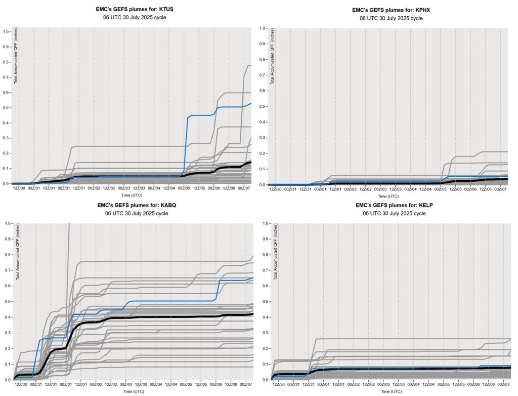
The GEFS plume forecasts are below. Not much other than in Albuquerque.
Discussion written by Pat Holbrook and Patrick Bunn