
Yesterday’s Weather
The satellite imagery animation below shows the deep convection in New Mexico east of the Arizona/New Mexico border yesterday. Also shown are the lightning associated with the storms; the lightning is generally on the west side of the storms and anvils blowing northeast. In Arizona, scattered showers and an occasional thunderstorm occurred east of Flagstaff south to Nogales line. These storms vertical development was limited because of very little Convective Available Potential Energy (CAPE) above the lifted condensation level.
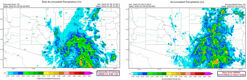
Yesterday was a model forecast bust day in southeast and south-central Arizona, because storms did not fire in Graham or Cochise counties. The pattern and intensity of the precipitation in New Mexico was good with the spiral shape from the inverted trough and cyclonic (anti-clockwise) vortex it set up.
Analysis
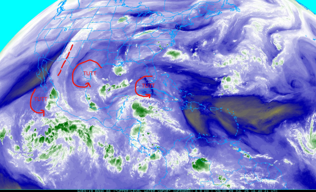
The inverted trough in New Mexico yesterday is no longer moving west and seems to be a little further east of it’s position yesterday. The tropical upper tropospheric trough (TUTT) off the coast of Baja has moved southwest into the Pacific Ocean, while another TUTT in Mexico has moved southwest of Brownsville. This TUTT in Mexico and Texas has a larger circulation than any of the previous TUTTs this season. A smaller TUTT is passing through the Florida straits into the Gulf of Mexico.
The eastern and central Pacific basins are becoming more active as shown in the tropical outlook below. These storms aren’t close enough to the west coast of Mexico to send any mositure towards the Southwest U.S., but future storms could and this is a sign of increasing potential.

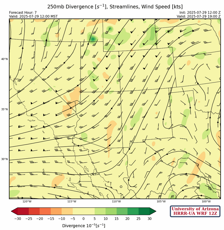
At 250mb, the parade of TUTT lows continues around 30N from the Pacific east to Florida. The center of the sub-tropical high pressure ridge is in northern Alabama with a ridge axis extending east into the Atlantic Ocean and southwest into Texas. A broad trough continues over the western states with a trough axis from California southeast into the northern part of the Gulf of California.
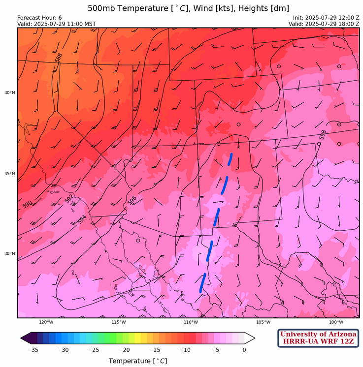
The inverted trough axis at 500mb, marked in blue below, is between the broad southerly flow on its east side and northerly flow on its west side. In Arizona, the northerly flow becomes southwesterly across the northwest portion of the state. The inverted trough acts more like a dividing line between the ridge in Arkansas and the west coast trough.
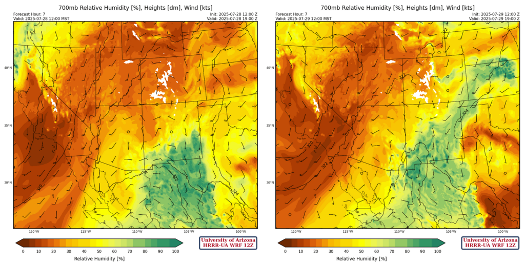
At 700mb, we compare yesterday to today. The left panel below is yesterday’s HRRR-UA WRF 12Z model forecast for noon yesterday and the right panel is today’s. Arizona seems slightly dryer and a good chunk of the original moisture in Mexico has been pulled northward into New Mexico and Kansas. The dry air with the west coast trough seems less intense today.
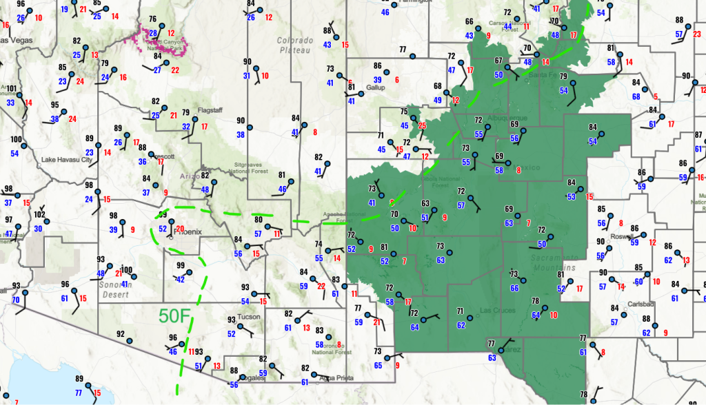
The surface observations for the region are shown below with the 50°F dewpoint temperature line annotated. The biggest increase is in dewpoint is for southeast Arizona east and south of a line from Phoenix to Sasabe.
Today
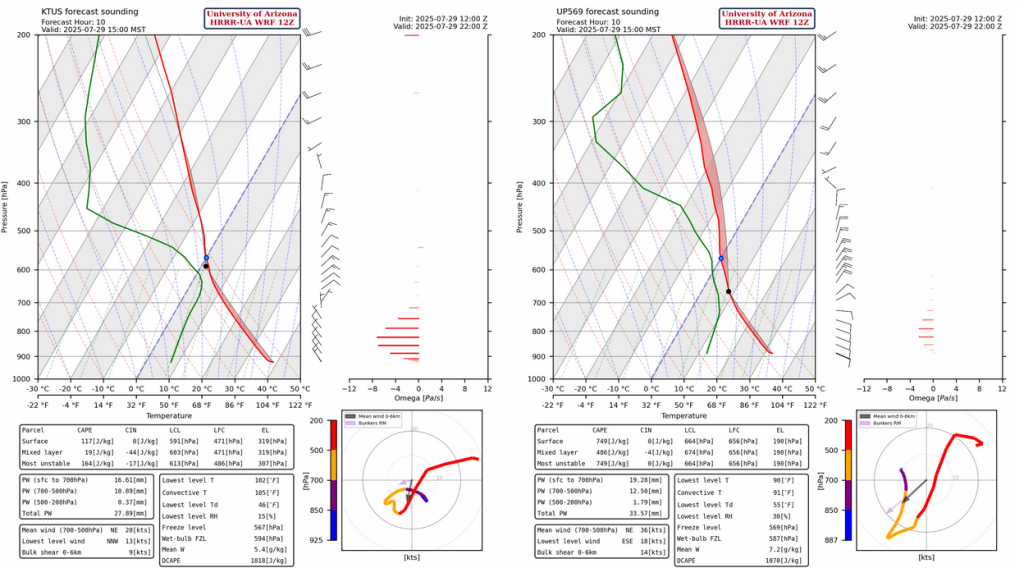
The model forecast soundings for this afternoon for Tucson and San Simon with storms affecting the San Simon area, but little CAPE in Tucson.
The HRRR-UA WRF 12Z forecast simulated radar reflectivity for this afternoon is below and there’s not much activity in the state although there are a few storms northeast of San Simon. These storms move southwest and cover most of the eastern half of Cochise County by midnight.
Precipitation totals are light, but it should be a good lightning show.

Model forecasts do not indicate microbursts over 30 mph, so potential for blowing dust will be limited.
Tomorrow
Tomrrow the forecast shows more activity in southeast Arizona and some stronger wind gusts in western New Mexico and eastern Arizona.

The soundings for Tucson and San Simon are below and similar to yesterday although slightly less CAPE in the Tucson sounding. Still appears to be another low-grade monsoon day.

Outlook
Thursday seems the best day this week for more widespread storms in the eastern part of Arizona and western New Mexico. Strong microbursts will be associated with storms along with blowing dust. Central and eastern New Mexico will be drier than it has been over the month.

GEFS plume forecasts for Tucson, Phoenix, Albuquerque, and El Paso are below. Half an inch of rain for New Mexico to Texas through the end of this week, but another dry spell from Saturday on.

Discussion written by Pat Holbrook and Patrick Bunn