
Yesterday’s Weather
It’s difficult to find thunderstorms in Arizona on yesterday’s satellite imagery, except along the International Border and in New Mexico mainly near El Paso and Las Cruces. The rest of New Mexico had isolated storms, and the loop shows the storms that developed late in the evening in the White Mountains and moved southwest across Graham and northern Cochise County.
The 24- hour accumulation comparison below has observations from MRMS on the right and HRRR-UA WRF 12Z on the left. Pretty good overall, just some storms missed in the forecast at the eastern edge of New Mexico.

Thatcher, in the valley near Safford, received 0.19 inches and one of the RAWS sites near Mount Graham had 0.44 inches. On the New Mexico side east of Morenci, one location had 0.60 inches.
Analysis
The surface observations from this morning shown below have isodrosotherms annotated (lines of equal dewpoint temperature). It will be hard to have thunderstorms develop north and west of the 50°F dewpoint isodrosotherm. The 60°F dew point temperatures at Tucson this morning was the same as yesterday but through afternoon mixing dried out to a low of 35°F.

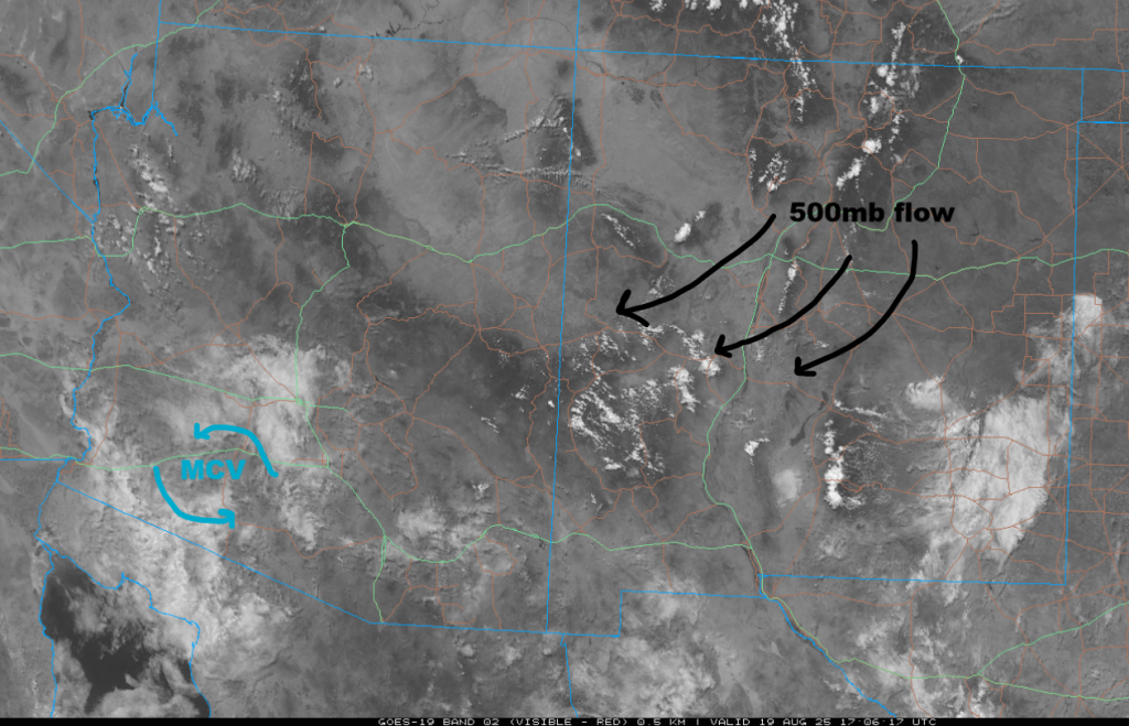
The Mesoscale Convective Vortex (MCV) that was well south of Nogales yesterday has moved to southwest of Lukeville this morning. Broad anticyclonic flow is across the region with the circulation center in northwest New Mexico.
Precipitable water in the observed sounding from Phoenix at 5am has increased by about a quarter inch, due to mid-level moisture. Just above the surface moisture is a dry layer, so the surface dewpoint temperature will likely drop to again in the afternoon. Will the dewpoint drop to 35°F again in Tucson this afternoon, though? We’ll answer that later. The HRRR-UA WRF 12Z initialization has some issues, first is an underestimation of precipitable water, just 22mm (0.86”) in the model and 29mm (1.1”) observed. There’s also a pronounced dry layer near the surface in the model initialization, though it does mix out in the first few forecast hours.

Hurricane Erin has had problems with vertical wind shear and the anticyclone has been displaced a little to the east of the low-level center and thus is only a 90 kts storm. The tropical upper tropospheric trough (TUTT) to the west of Erin has shifted into the southeast part of the United States this morning. Another TUTT low has formed in southern Texas and is moving southwest.

The high pressure ridge at 250mb has moved into southeast Arizona as the trough retreated into the Pacific. Anticyclonic flow is dominating the region as can be seen in the 250mb HRRR-UA WRF 12Z initialization below. Over the next 72 hours the ridge will move to the four corners, while the TUTT low in south Texas moves westward to the middle portion of the Baja Peninsula.

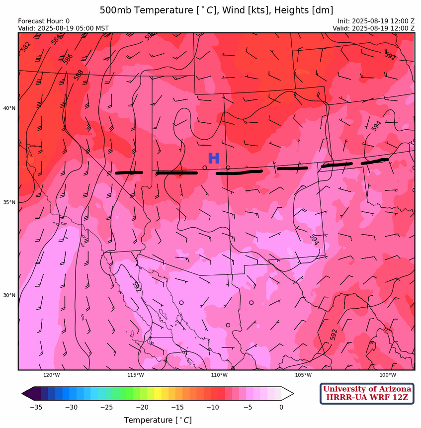
At 500mb, the ridge has moved near to the four corners with a west to east ridge axis from central California east to southern Kansas. East winds south of the high pressure center the are still on the order of 10 to 15 knots and as the ridge strengthens over the next few days the winds will become stronger.
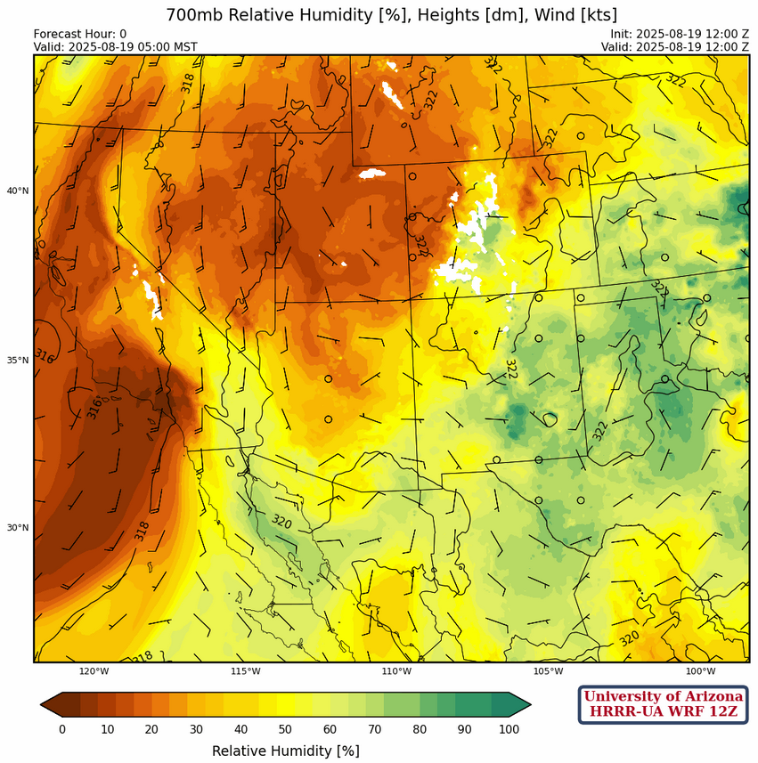
There has been an increase in moisture at 700mb in eastern New Mexico and along the Colorado River valley. Slightly drier air is in central and northern Arizona.
Today
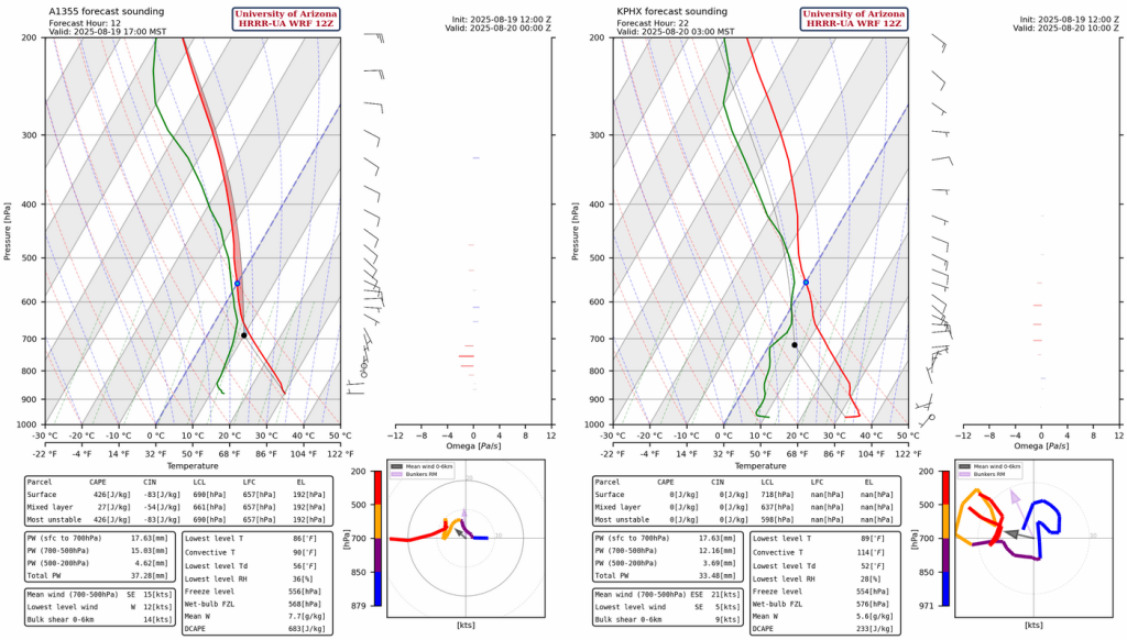
The Phoenix and Tucson forecast soundings for this afternoon don’t have significant Convective Available Potenital Energy (CAPE) in either of the valley locations, but Nogales (below, left) has a CAPE value of 426 [J/kg] with about -50 [J/kg] of Convective Inhibition (CIN). One feature that was in all the forecast soundings was mid-level moisture at night, probably due to dissipating thunderstorms moving in from eastern Arizona, as shown in the Phoenix sounding forecast for 3am below on the right.
Thunderstorms will begin developing around 2 pm in southeast Arizona, but are forecast to dissipate as they move to the low desert overnight. The flow is too easterly for a true “Rim Shot”, but the flow may change and have a more northerly component over the next few days.
Tomorrow
Tomorrow is forecast to be the best chances for Tucson valley to get thunderstorms, although with the increasing east wind flow any day is possible.
Outlook
On Thursday, the storms finally move off the mountains and into the Phoenix metro area. Thunderstorms will be accompanied by winds up to 45 mph south of the Mogollon Rim. Pinal, Santa Cruz, and Cochise counties remain mostly dry as there are strong east winds forecast at the surface and aloft the atmosphere dries.

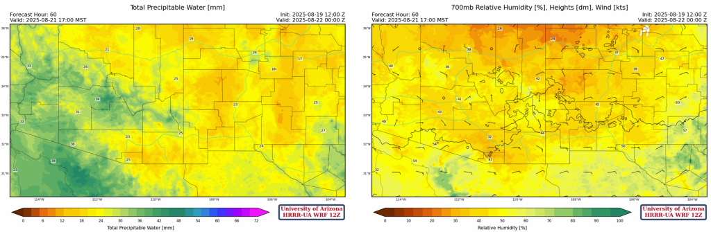
The precipitable water and 700mb relative humidity forecast below shows the drying predicted for New Mexico and southern Arizona.
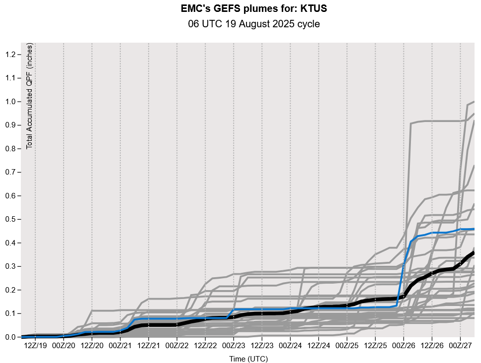
The GEFS plumes show the low grade monsoon pattern continues through the week, but maybe more activity next week as we head towards the end of August.
Discussion written by Pat Holbrook and Patrick Bunn