
Yesterday’s Weather
The satellite picture below shows the difference between a Mesoscale Convective Complex (MCC) and Mesoscale Convective System (MCS). The MCC in the Great Plains is about three times the size of the MCS south of Arizona. The other feature is the upper low at the southern end of the Baja, which aided in the development and movement of the MCS.
Most of the rain in the state was in the mountains along the Mogollon Rim, White Mountains, and along the international border. A few of the storms hit the rain buckets in the Bisbee and Fort Huachuca area. The MCS has weakened and the remnant Mesoscale Convective Vortex (MCV) can be seen in the cloud cover on the satellite picture below about 30 miles south of the border. A large deck of altocumulus and sprinkles accompanies the MCS.
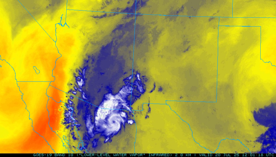
Finally, the radar below is from the Yuma radar and the signal over the northern Gulf of California is from a gulf surge trapping the radar beam…not precipitation. Wonderful to be in Puerto Penasco this morning with a temperature of 85°F, dewpoint of 80°F, and a gusty southeast wind at 28mph.
Analysis
The tropical upper tropospheric trough (TUTT) is moving northwest up the Gulf of California with another TUTT is off the coast of Texas. Another TUTT is in the Atlantic well east of Florida.
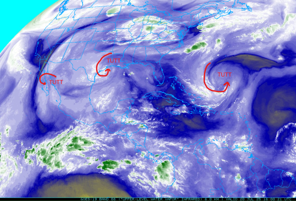
At 250mb, the TUTT moving northwest up the Gulf of California is weakening. As it moves north it will eventually just be a part of the shear axis that extends to Las Vegas. This shear axis moves very little for the next several days.
The temperatures at 500mb have cooled about 1°C over Arizona and remaining about the same in New Mexico. The ridge is centered over Oklahoma and ridge axis extends west to central New Mexico. The upper-level low over San Diego has not moved from the San Diego area.

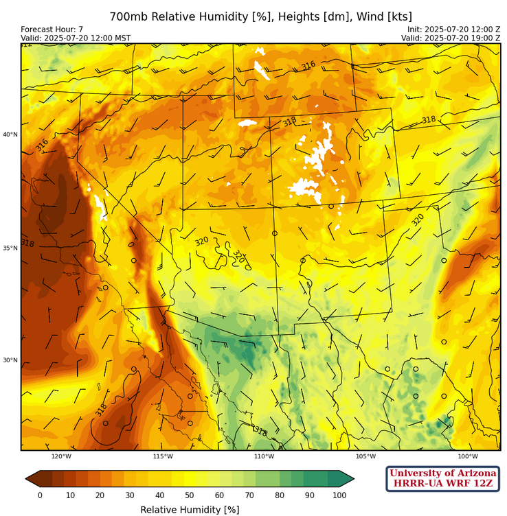
At 700mb, the MCV just south of the border is associated with a large area of clouds and some light rain as it moves northward. Winds are light and variable across te southern hallf of Arizona and westerly in New Mexico.
Today
The cloud cover has extended well north into the eastern two thirds of Arizona. Meanwhile, the Gulf Surge is entering far southwest Arizona this morning with dewpoint temperatures increasing to the 60s°F.
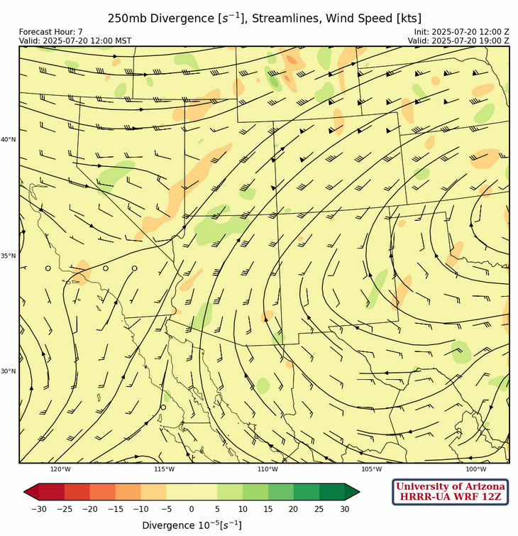
Dewpoint temperatures are too low to support convection this afternoon for the rest of the low desert. Strong convection is going to be limited to areas that get decent surface heating, such as southeast Arizona and western New Mexico, as depicted in the forecast radar reflectivity below.
Tomorrow
The ”down” day today allows the atmosphere to get ready for tomorrow. The gulf surge will resupply the desert with moisture and fewer clouds will allow for more surface heating. Model forecasts show strong convection developing in southeast Arizona in the afternoon and moving northward to the Phoenix area in the evening. The GFS-UA WRF forecast radar is consistent with previous and current HRRR-UA WRF runs now, but will Tucson airport get that much precipitation? Certainly, a day when the flash flood potential is high.
The most recent four UA WRF forecasts that go out to midnight tomorrow night show a spread of 0.11, 0.16, 0.53, 1.2 inches at the Tucson airport (shown below). The flash flood potential is emphasized since all of these totals are possible in different parts of the valley.

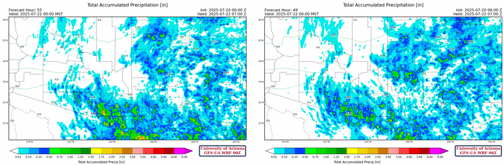
Will Phoenix get some? Probably should expect a tenth of an inch or so in the city without the flash flooding potential.
Outlook
On Tuesday, the focus shifts to northern Arizona with storms forming along the Mogollon Rim into southwest New Mexico, moving northward to Flagstaff and hopefully the Grand Canyon to rain on the fires. We’ll need to see what the situation is like after the stormy day tomorrow.

Discussion written by Pat Holbrook and Patrick Bunn