
Yesterday’s Weather
Storms were on the mountains in the Mogollon rim eastward to the White Mountains then into New Mexico where they became a little stronger and moved off the mountains in the eastern part of the state. A MCS developed south of the border with a few storms in the Bisbee area south into Mexico. Moisture from the previous night’s storms moved into the low deserts. The western half of Arizona had only a few storms in the mountains to the north.
Analysis
The observed Phoenix soundings below are from yesterday and this morning at 5am (12Z). More moisture is in the layer below 700mb today than yesterday with cooling noted below 850mb. Moisture in the 500 to 700mb layer appears to be the same, and the inversion at 470mb yesterday has dropped to near 500mb.

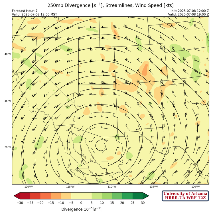
At 250mb, the anticyclone in Mexico has moved north of Guaymas, Sonora just south of the border with the ridge axis extending east to a col in Arkansas then to another ridge off the Delaware coast (a col is the intersection of a trough and a ridge). The subtropical jet has moved even further north to northern California eastward to northern Utah.
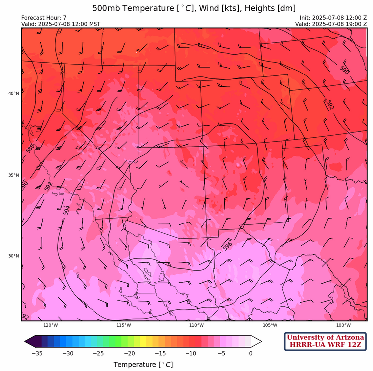
The high pressure ridge axis at 500mb is across southern Arizona eastward into New Mexico. The circulation is bringing warmer air into eastern California and slightly cooler northerly winds in New Mexico.
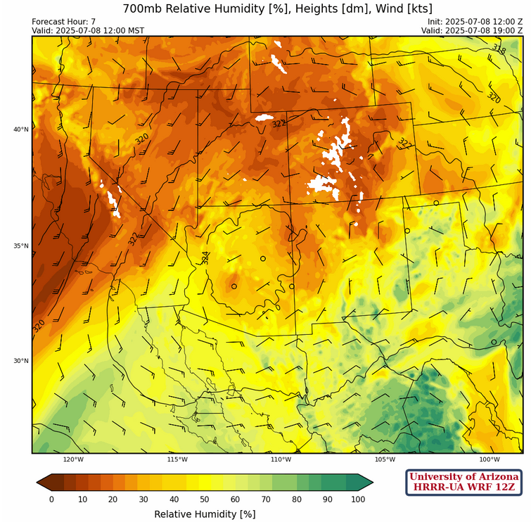
At 700mb, the high pressure is centered around Graham County with mid-level moisture moving around the circulation. Deep easterly flow is now in-place over Mexico.
Today
Although the low desert areas and Phoenix have moistened, there has been too much low-level cooling for surface-based CAPE. Storms are expected over the mountains in Arizona extending into eastern and southern New Mexico, with some storms potentially traveling into the valleys in eastern New Mexico.
Microbursts may be associated with stronger storms. As shown in the forecast sounding below for Tucson, storms that develop in Graham and Cochise counties may push into Tucson area during the evening. If so, these will bring generally light rain and gusty winds to 40 mph with DCAPE forecast between 1800-2000 J/kg.

Tomorrow
A similar, but weaker pattern is expected over both states tomorrow. New Mexico is forecast to see some rain over the mountains in the east and south. Microbursts may be associated with some of the stronger storms. Arizona is forecast to see some more isolated storms over the White Mountains and over the mountains of Santa Cruz, eastern Pima, Graham, and Cochise counties. Extremely high temperatures are expected over Arizona tomorrow, reaching around 110°F in some areas.
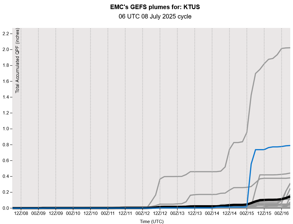
Outlook
As shown by the GEFS plume forecasts below, the monsoon is basically out of here for about a week. Moisture is close to the south of us, and any MCS down there could push moisture into the state for an uptick in storms that these plumes do not capture.
Discussion written by Pat Holbrook