
Yesterday’s Weather
Arizona had extremely hot temperatures yesterday with light and variable winds below 500 mb. Skies were mostly clear outside of a few clouds over the White mountains.
Over eastern New Mexico, a cold front passed through bringing colder and moister air to the region. The cap was too strong to allow any convection to form.

In southwestern New Mexico, smoke from the Trout fire and other fires near Silver City is blanketing the area from the southwest towards Lordsburg and Deming. This smoke has also drifted northwards in the low levels due to weak winds, while upper-level winds have driven the smoke south.
Analysis
At 250 mb, the jet stream has moved farther north with lighter winds across the region. The outflow from former hurricane Erik is also to the south. The water vapor satellite shows the large anticyclone associated with Erik, the very dry air over western Arizona, as well as the trough approaching the Pacific northwest.

At 500mb, the high pressure is centered over southeast Arizona with temperatures in Arizona little changed from yesterday around –5C. New Mexico temperatures have cooled to around –8C compared to yesterday. At 700mb, the monsoon moisture is now showing up and extending from Mexico into central New Mexico.

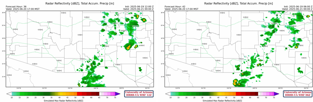
Today
Arizona will remain generally cloud free and hot due to subsidence aloft. The Phoenix sounding from 5am shows no significant moisture or CAPE. Just 11mm (0.44 inches) of precipitable water, we need at least 30-60mm to get thunderstorms going.

But things are changing…the trough in the Pacific northwest will swing by to the north and drive out the extreme heat. It is already affecting the monsoon flow as monsoon moisture is working into New Mexico which will result in high based storms in the mountains.
The forecast sounding for Albuquerque shows some moisture at nearly 500mb. Although this sounding only shows CAPE at 350 J/kg, the Roswell sounding shows 1400 J/kg of CAPE from a mixed layer parcel.

Storms will develop on some of the mountains in New Mexico, but will only produce light precipitation and lightning.

Tomorrow
The trough passing by to the north of the Southwest will push the monsoon moisture south and east in New Mexico. There will be more widespread thunderstorms with somewhat of an increase in precipitation at the ground. Some of these storms may also affect the Chiricahua mountains in Cochise county. The rest of Arizona remains dry but not as hot.
Outlook
An increase in storms in New Mexico extending into southeast Arizona. Still the majority of Arizona remains dry looking to the weekend. As for temperatures, Arizona will see a ten degree F drop from today’s values thanks to the trough.
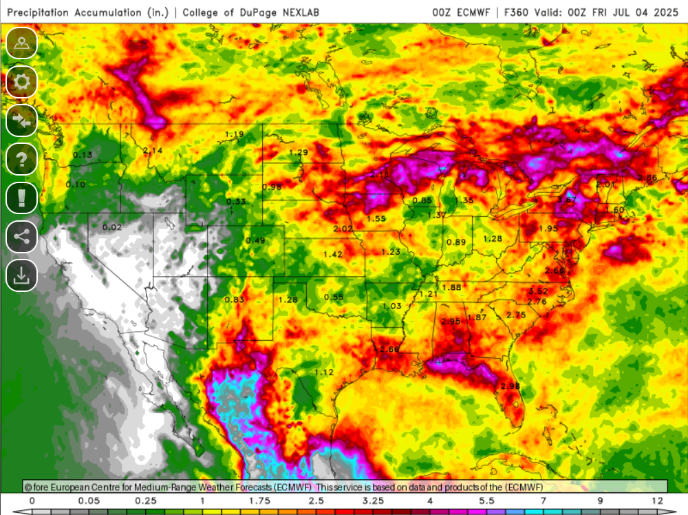
So the New Mexico version of the monsoon has started, and Arizona will have to wait possibly into July. The total precipitation accumulation from the ECMWF model as of July 4th is below.
Discussion written by Pat Holbrook