
Live Weather Briefing
Find the recording of the July 14th 2025 weather briefing here.
Yesterday’s Weather
Storms developed as expected yesterday across the western half of New Mexico then along the Mogollon rim, the White mountains and south to Graham and Cochise counties and west to Santa Cruz County. Heavier rain was in the mountains, but rain buckets in southern Cochise and Santa Cruz counties recorded a quarter to three fourths of an inch. Blowing dust with visibility less than a mile was generated by 45 to 50 mph outflows from the storms…much higher than DCAPE values from soundings forecasts yesterday. Storms did not move into either Phoenix or Tucson. The satellite picture showed a lot of cirrus with the storms.
Analysis
The tropical upper tropospheric trough (TUTT) over the northwest Gulf of Mexico has a better-defined circulation today. The TUTT in the Atlantic has sheared apart from its original position extending southwest into the central Carribean Sea. The shear axis extends northwest to the Gulf of Mexico TUTT then southwest into south central Mexico then into the Pacific.

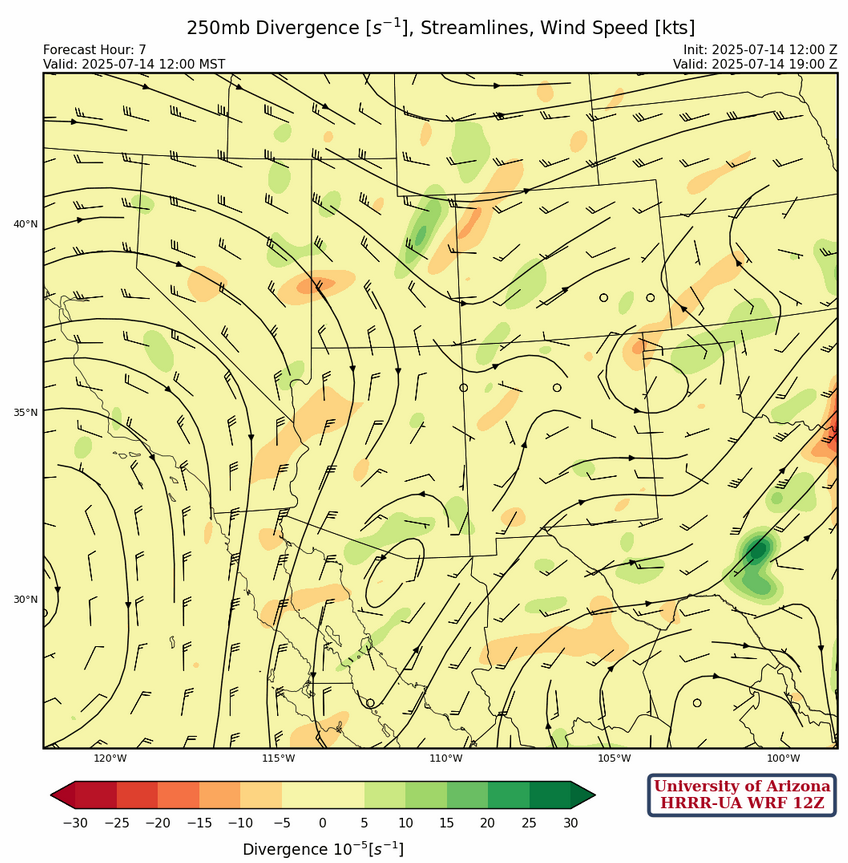
At 250mb, the high pressure ridge off the west coast has drifted further west allowing a trough to form from Nebraska southwest to southeast Arizona. A broad ridge is over central Mexico extending eastward into Georgia.
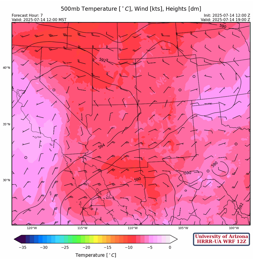
The high pressure ridge at 500mb is over central Nevada this morning with strong northeast flow over the southern half of Arizona. Temperatures have cooled with the Phoenix temperature at –8°C.
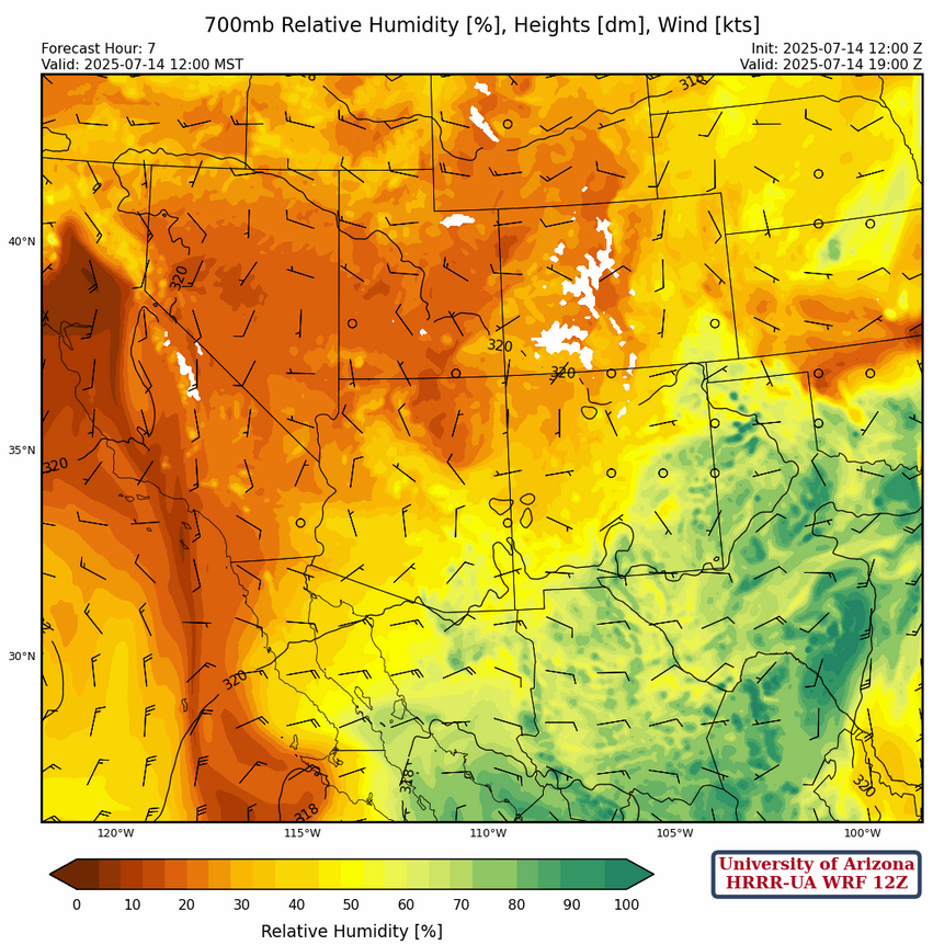
At 700mb, the ridge axis extends across central Arizona to central New Mexico with easterly winds at 5 to 10 mph below the ridge axis becoming 15 to 20 mph in northern Mexico.
Today
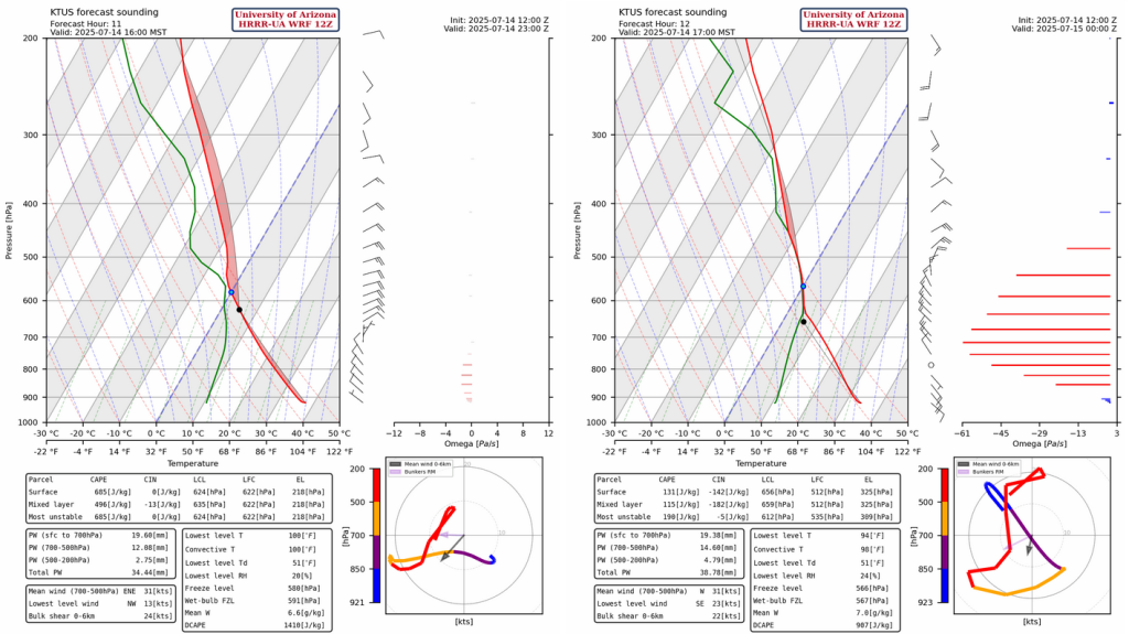
The HRRR-UA WRF 12Z forecast for this afternoon in Tucson at 4pm shows about 500 J/kg Convective Available Potential Energy (CAPE) and very little Convective Inhibition (CIN). The hodographs show storm motion is to the southwest. DCAPE values are 1400 J/kg.
Two HRRR-UA WRF simulated radar reflectivity forecasts are below from 1:30pm through the evening to 1am. Convection initiates on the mountains and begins to move off them to the west-southwest in the early afternoon around 3pm. The 15Z forecast (right side below), has thunderstorms start slightly further north of Tucson then move into the metro area by 4pm.
Tomorrow
Thunderstorm outflow from tonight’s storms will bring higher dewpoints and CAPE from the Gulf of California as shown in the forecast graphics below.
Storms will be a little later in the day compared to today; forming in the early afternoon, but only moving into Tucson around 6pm and up to Casa Grande by 8pm. It’s possible that Phoenix will get the storms, but neither the HRRR or GFS UA WRF forecasts bring precipitation into the valley of the dust.
Outlook
By Wednesday, flow shifts to southeasterly and with a cooled lower layer from storms and outflow, so not much thunderstorm activity happening. There are hints that scattered night storms will develop from Tucson to Phoenix. Total precipitation map below is through to Friday evening at 11pm.

The main thunderstorm activity is over the next two days, so in tomorrow and Wednesday’s discussion we will comment more on the longer range outlook.
Discussion written by Pat Holbrook and Patrick Bunn