
Yesterday’s Weather
Yesterday, there were isolated thunderstorms were in southeast Arizona and southern New Mexico. A Mesoscale Convective System (MCS) developed in northwest Mexico and spun up a Mesoscale Convective Vortex (MCV) in Sonora as indicated on the infrared satellite imagery loop below. Otherwise, the rest of Arizona was mostly rain free although a few light showers did develop in Pinal and Pima counties but for the most part ended after sunrise.
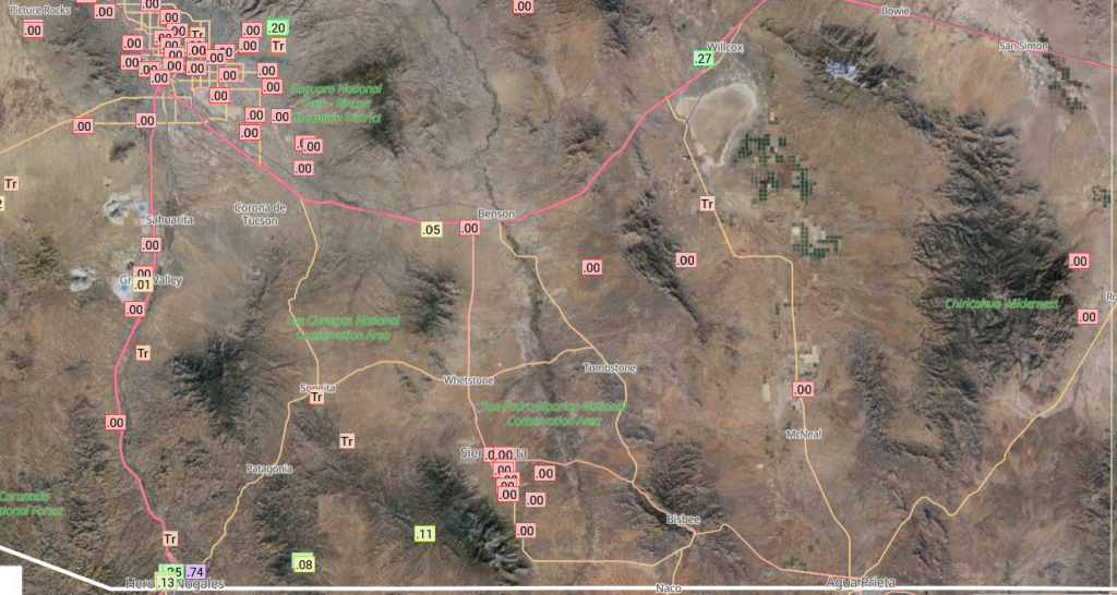
Rainlog data shows only a few buckets received rain, with the heaviest rain just northeast of Nogales.
The HRRR-UA WRF 12Z forecast (below, left) got the 24-hour accumulated precipitation in Arizona correct when comparing to MRMS data (below, right), but missed some of the 0.5″ or greater totals in southwest New Mexico.

Analysis
Surface dewpoint temperatures show drying in most of Arizona except for southeast Arizona. New Mexico has an increase in moisture along the southern section of the state.

Visible satellite imagery from this morning shows the mid-level clouds left over from last night’s MCS in Sonora now moving westward across southern Arizona.

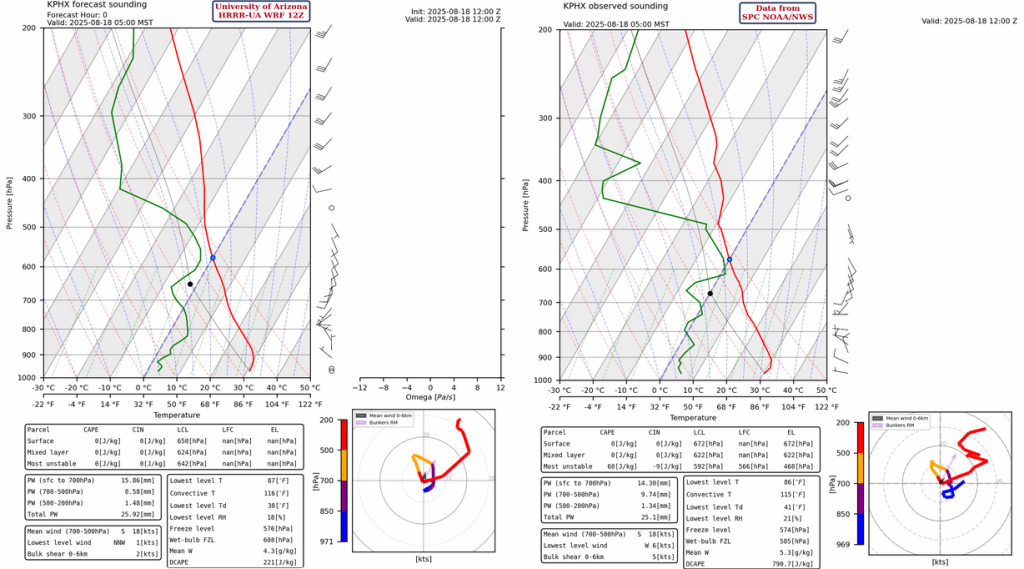
The observed sounding from Phoenix at 5am (below, right), shows moisture between 500mb and 600mb, likely at the level the light showers were located, and a dry and stable atmosphere below that. Precipitable water continues to drop and now is near 1 inch (25mm). Comparing the observed sounding to the HRRR-UA WRF 12Z initialization for the same time and location (below, left), show a good match to the observations.
Hurricane Erin is dominating the circulation north of Hispaniola with a couple of tropical upper tropospheric troughts (TUTTs) west and east of the hurricane. Two anticyclones (clockwise high pressure circulations) are present; one associated with Erin and the other over northwest Mexico.

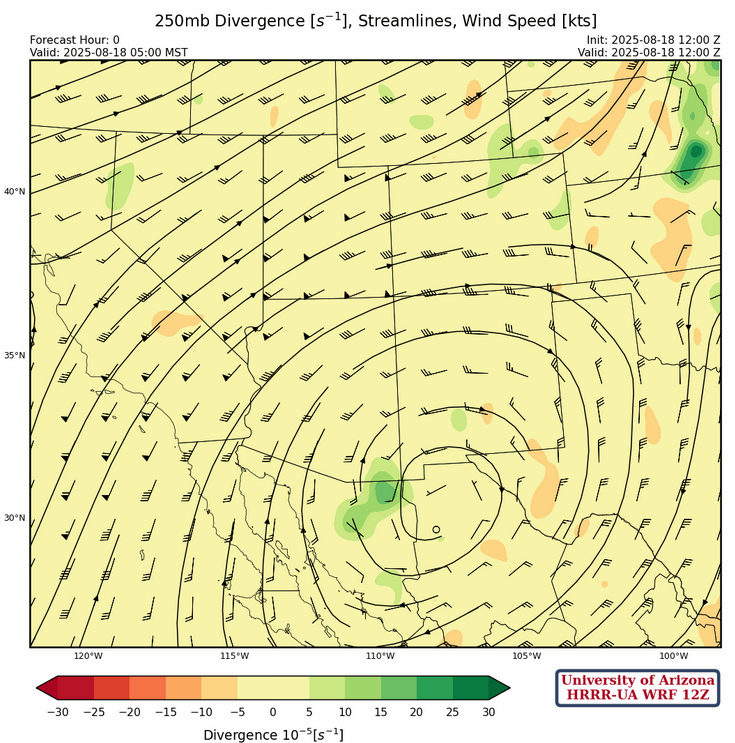
At 250mb, the high pressure ridge may be a little further west than indicated in the initialization for the HRRR-UA WRF 12Z forecast. The flow squeezed between the ridge and the trough off the west coast is creating a jet core of 60 knot winds from southern California into Utah.
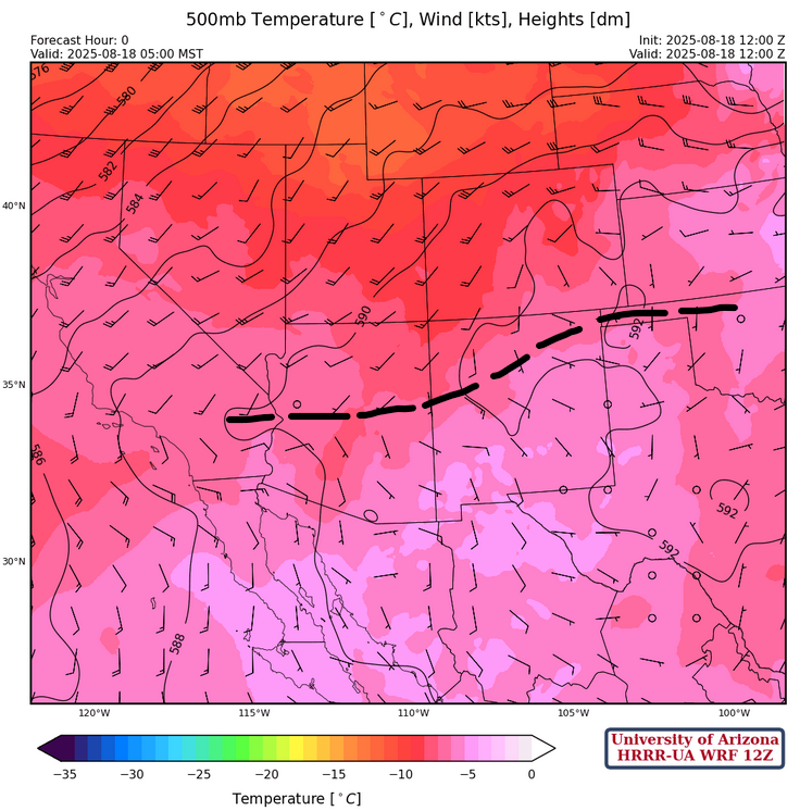
At 500mb, most of the region has light easterly winds as the ridge is moving towards the four corners region. The ridge axis, annoated in dashed black, extends from central Arizona to northern New Mexico. Temperatures have warmed slightly across the region.
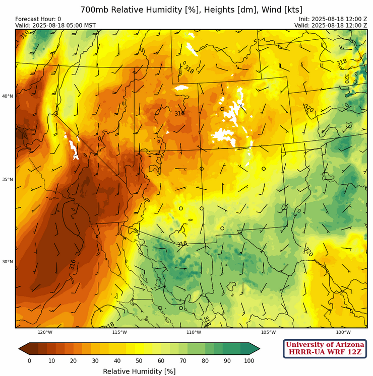
At 700mb, moisture is present in southern Arizona and New Mexico while drying has occurred across the northern half of Arizona and New Mexico. Winds are still light across the region giving very little steering flow for storms that may develop this afternoon.
Today
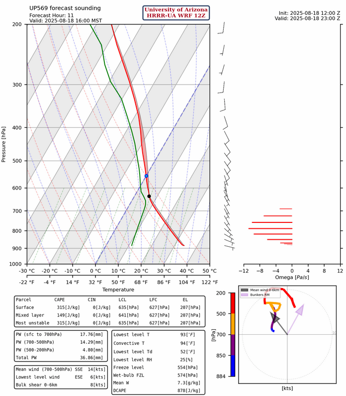
There is no Convective Available Potential Energy (CAPE) on the forecast soundings for either Phoenix or Tucson this afternoon, so likely a down day in those metro areas. The sounding below is for San Simon, on the southern border of Arizona and New Mexico. It does have CAPE of about 300 [J/kg] with a most unstable/surface based parcel, but only half that from a more representative mixed-layer parcel.
The radar reflectivity forecast for this afternoon shows thunderstorms will form in the far eastern counties in Arizona, the central and western part of New Mexico. Mid-level winds are forecast to increase from the east and a few light showers will move out of Graham County towards Phoenix overnight.
Tomorrow
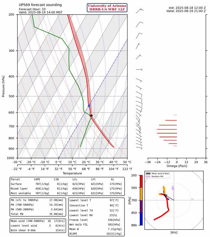
Finally, some decent CAPE showing up on Tuesday at San Simon although the CAPE is still weak at both Tucson and Nogales and non-existent at Phoenix. The mid-level wind flow will push storms that do form towards the west.
The forecst radar reflectivity for tomorrow shows increased activity over the eastern counties of Arizona, but mainly stopping at the edge of the deserts where no CAPE is present.
Outlook
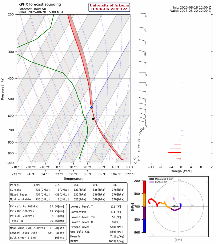
The pattern is changing and beginning Wednesday the easterly flow will push the storms off the Mogollan Rim and White Mountains to the west and move into the valleys and low deserts. The Phoenix sounding below shows a CAPE value of 750 [J/kg] and only a small amount of Convective Inhibition (CIN).
The afternoon storms in the Tucson area will move westward into central and western Pima county while the storms along the Mogollon Rim will wait until evening to push into Pinal and Maricopa counties. The flow pattern does not change much for Thursday or Friday, so any day it will be possible to get storms in both Phoenix and Tucson.

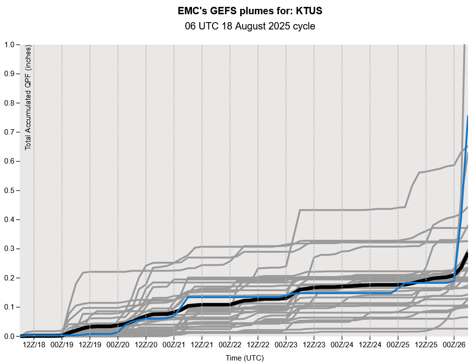
Not much change in the GEFS ensemble plume forecast: a few days of activity, then nothing.
Discussion written by Pat Holbrook and Patrick Bunn