
Yesterday’s Weather
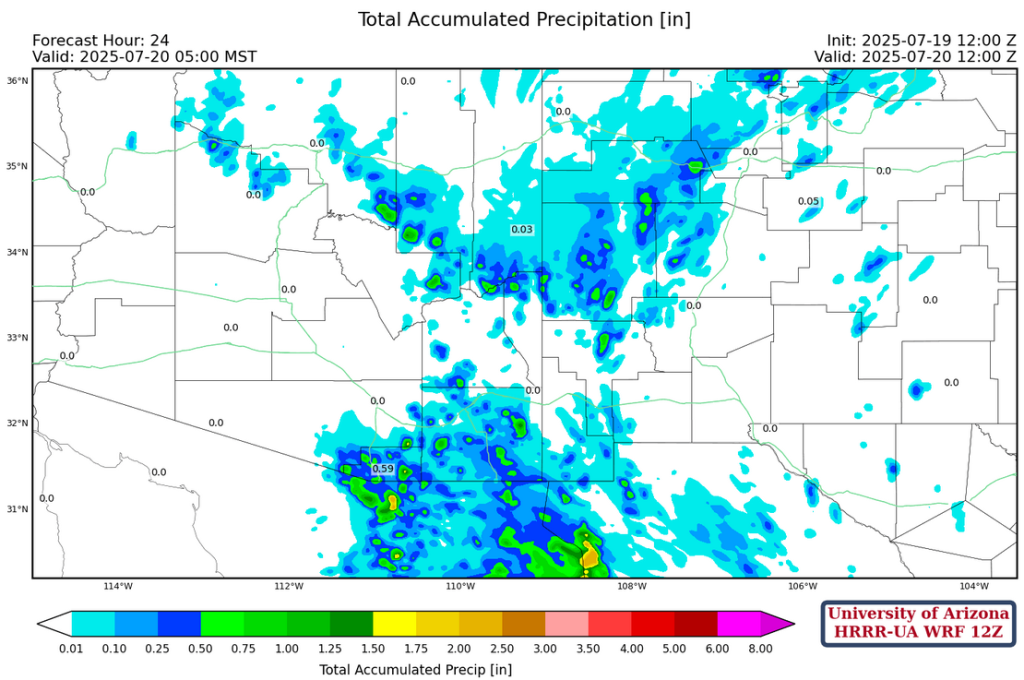
Model forecasts did a good job with the convection in southeast Arizona and New Mexico as shown in the radar images below. The area of storms continued to move west to the Pima County line, with a few developing along outflows in the Green Valley area, Outflows from these storms pushed as far west and north as Casa Grande and Phoenix after midnight.
Analysis
The tropical upper tropospheric trough (TUTT) in Mexico is weakening along the west side of the Sierra Madre’s and becoming a shear line with strong southerly winds to the east of the shear axis. The strongest winds can be inferred from the water vapor imagery below, where the divide between moist and dry air is in western Arizona. The other TUTT, now in the southern Gulf of California, is accompanied by a large are of convection.
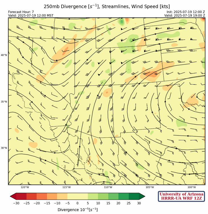
At 250mb, a ridge is over southern Oklahoma with ridge axis extending west to central Arizona. The TUTT off the spur of Baja has become an open wave connecting with the trough further north.
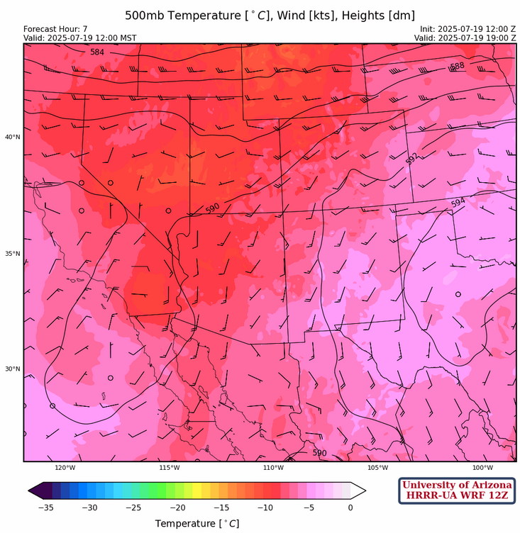
The high pressure ridge and ridge axis at 500mb are in about the same position as the 200mb ridge/axis. Temperatures are colder in western Arizona than eastern Arizona and New Mexico. No soundings were available from KABQ, KPSR, KTUS, or MMGM this morning, so understanding today’s flow pattern is more a lot more uncertain. Flow is light from the east over most of the region and southerly at 20 knots over western Arizona. What remains of the TUTT that was over northern Baja California yesterday is now over San Diego.
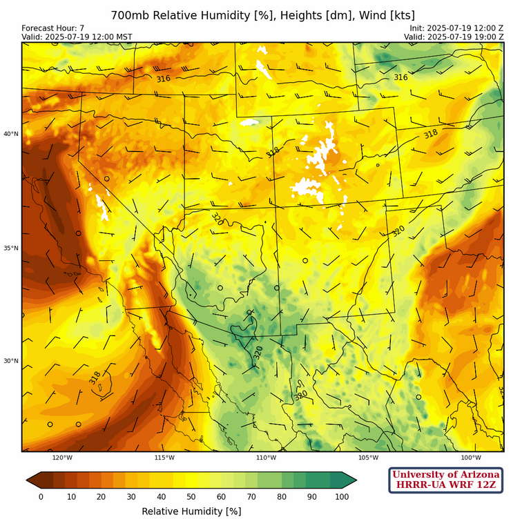
The monsoon circulation at 700mb is from the spine of the Sierra Madre’s northward to southern Arizona then northeast into central New Mexico and then to Kansas. Low pressure is near San Diego while a ridge is over Texas with the ridge axis extending west across into northern Arizona.
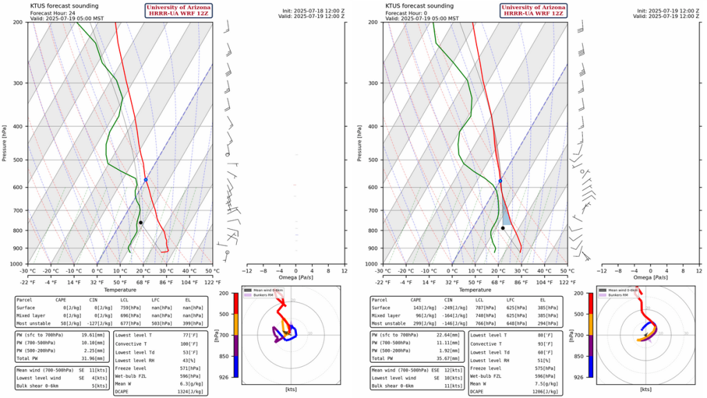
Yesterday’s HRRR-UA WRF 12Z model forecast sounding for Tucson is on the left, and this morning’s HRRR-UA WRF 12Z is on the right. The forecasts agree with only a minor differences in winds in the layer between 700mb and 500mb, and 3mm more of precipitable water.
Today
Today is going to be a repeat of yesterday, except the storms will be further west in Arizona. Storms start earlier near and over the mountains, and a second group of overnight storms will move into southeast Arizona overnight.
Precipitation in the valleys will be light.
Tomorrow
Overnight, storms will move across southeast Arizona and the Phoenix area, then into northern Arizona by late afternoon. This will inhibit convection in the low deserts, including Tucson. Afternoon storms still form in far southeast Arizona and New Mexico.
Outlook
On Monday, low-level moisture increases. HRRR-UA WRF forecasts precipitable water to increase to 46mm (1.8″), which is plenty for deep convection. The GFS-UA WRF doesn’t have as much moisture as the HRRR-UA WRF for eastern Pima, Santa Cruz, or Cochise counties.

It will be a battle of the models on Monday as the HRRR-UA WRF shows some heavy rain in the valleys (half an inch for Tucson!). Meanwhile, the GFS-UA WRF has much lighter precipitation totals, if there’s any rain at all. Typically, we favor the HRRR forced UA WRF forecasts because of its data assimilation algorithm that ingests recent radar and satellite observations to kick off the model (initialization) in a way that is as close to the current observed conditions as possible.
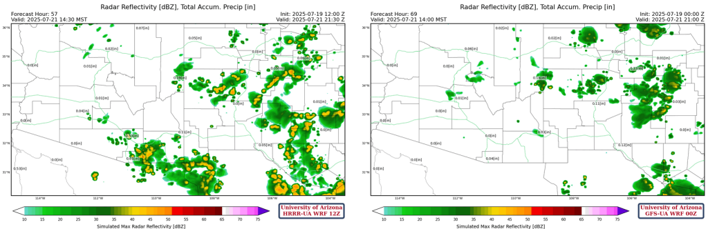
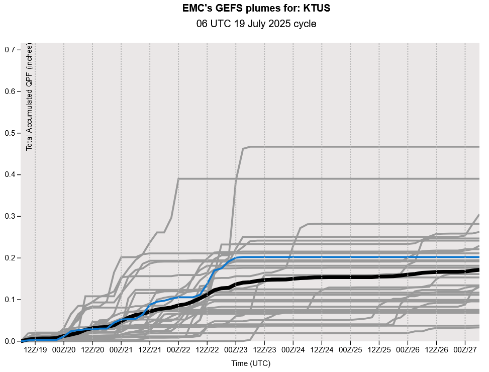
However, if we compare these two model runs to the GEFS plume forecasts below, the HRRR-UA WRF would be an outlier. These are 3-day ahead forecasts, so there’s a fair amount of uncertainty. Tomorrow’s forecasts should tell us more.
Discussion written by Pat Holbrook and Patrick Bunn