
Yesterday’s Weather
Arizona skies were quiet yesterday except for smoke associated with fires in northern Arizona at the Grand Canyon and a cumulus cloud or two around Naco; visible satellite imagery shows both features.
A few storms did pop up in northeast and southeast New Mexico, but little rain was produced as shown by MRMS observations.

Analysis
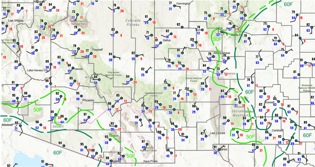
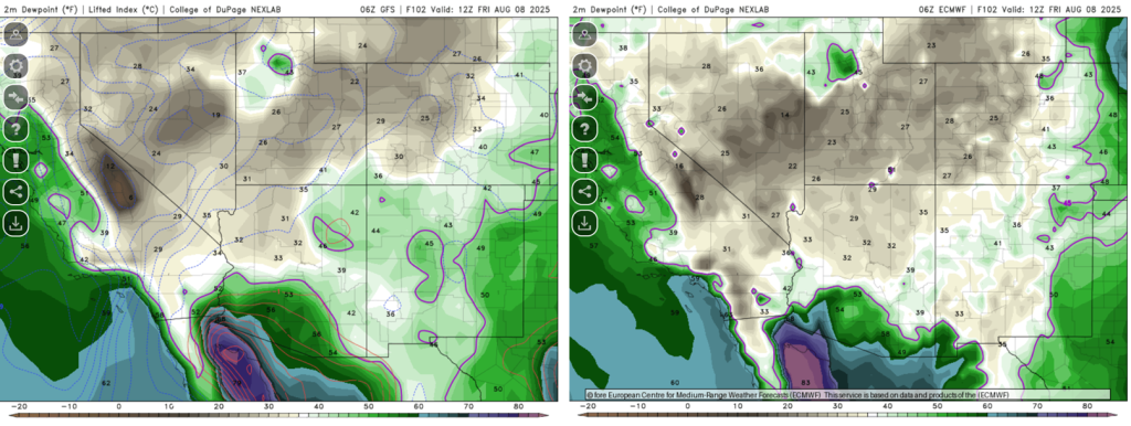
The surface dewpoint temperatures below show low-level moisture moving into southwest Arizona overnight.
The low-level moisture is a result of a Mesoscale Convective System (MCS) outflow in Mexico, as seen in the satellite picture below from 10pm last night. The low-level moisture should mix out during the day, but it would not be surprising if thunderstorms formed south of the international border from Nogales to Lukeville.

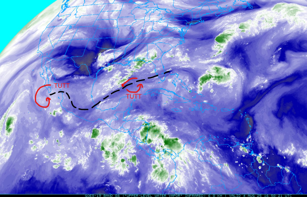
A tropical upper tropospheric trough (TUTT) axis is indicated by the dashed black line below with broad easterly winds to the north of the axis. TUTT lows are off the southern tip of Baja and a new one developing over the central Gulf of Mexico.
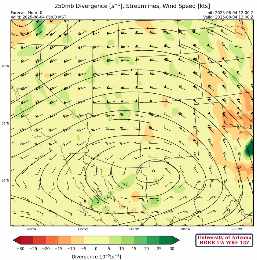
At 250mb, the center of the ridge is south of Douglas with a west-east ridge axis from northern Baja to West Texas. The ridge will drift east over the next few days as a broad long wave trough over the Mississippi valley moves east. The trough off the west coast is moving eastward and will be replaced by another one by the middle of the week. Winds are more westerly and a little weaker than yesterday north of the ridge.
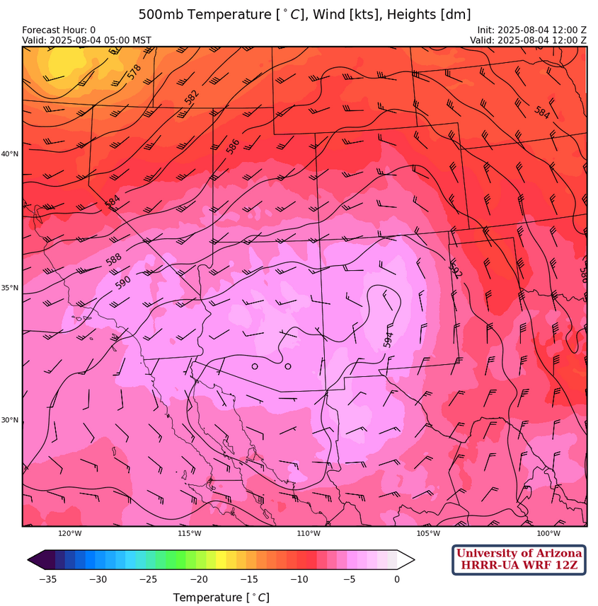
The ridge is centered over southern Arizona at 500mb, with warm temperatures aloft over central Arizona extending into central and western New Mexico. The center of the west coast trough is over Oregon moving east. Flow is westerly 15 to 25 knots over the northern half of the region becoming northerly over eastern New Mexico.
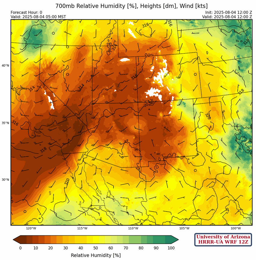
At 700mb, the center of the ridge is near Douglas. The flow is beginning to bring mid-level moisture into southern Arizona from the storms that fire off each day in the Sierra Madre’s of Mexico across southwest Arizona. This flow pattern should get us back into low-grade monsoon pattern as soon as tomorrow.
Today
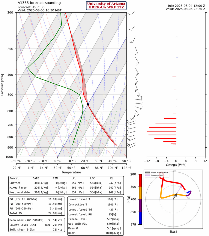
Below are the Lukeville and Nogales model forecast soundings. They show some Convective Available Potential Energy (CAPE) this afternoon, but any storms that form in either location will be on/near the mountains.

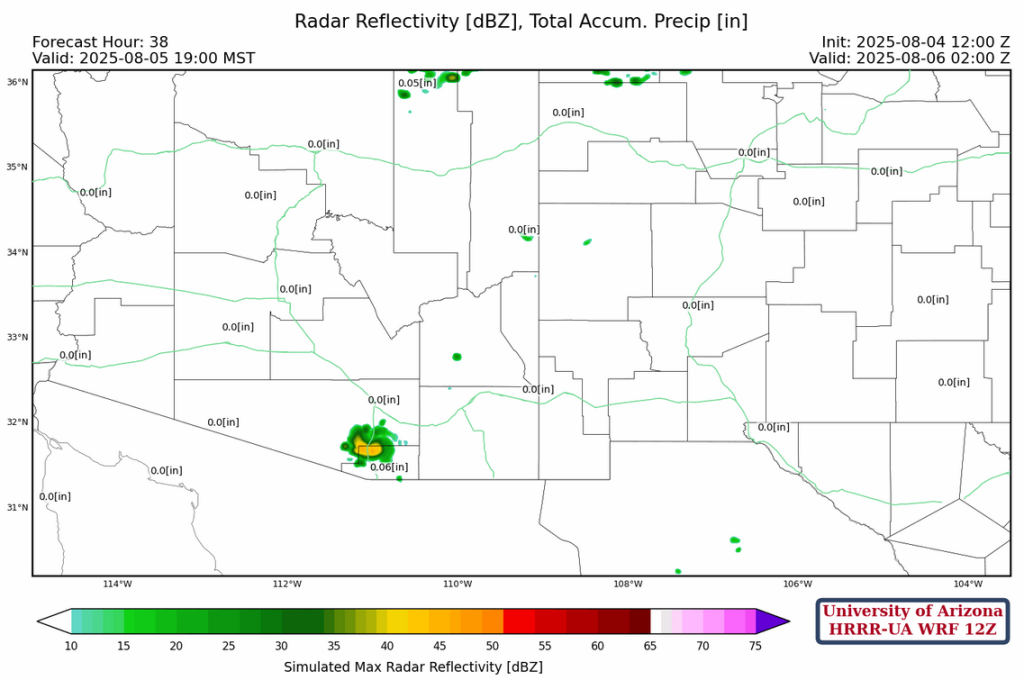
HRRR-UA WRF 12Z model forecast radar shows the storms near Nogales this afternoon and I would expect them storms further west than what the model indicates. Still the storms aren’t expected to drop much precipitation or have significant wind gusts.
Tomorrow
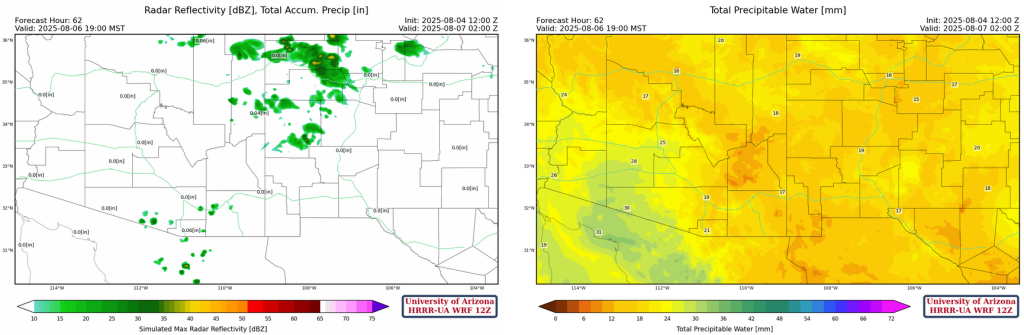
Forecast radar reflectivity and the sounding for Nogales tomorrow afternoon are shown below. Some of the storms move into southern Pima county and there could local wind gusts to 35 mph. There is still not enough moisture in-place for more thunderstorm coverage in the rest of the region.
Outlook
Most of the precipitation on Wednesday is from thunderstorms with bases above 12,000 feet and, therefore, not much chance of getting rain.
There is hope though as both the ECMWF and GFS forecast the return of monsoon dewpoint temperatures above 54°F by Friday, as a result tropical activity in the east Pacific.
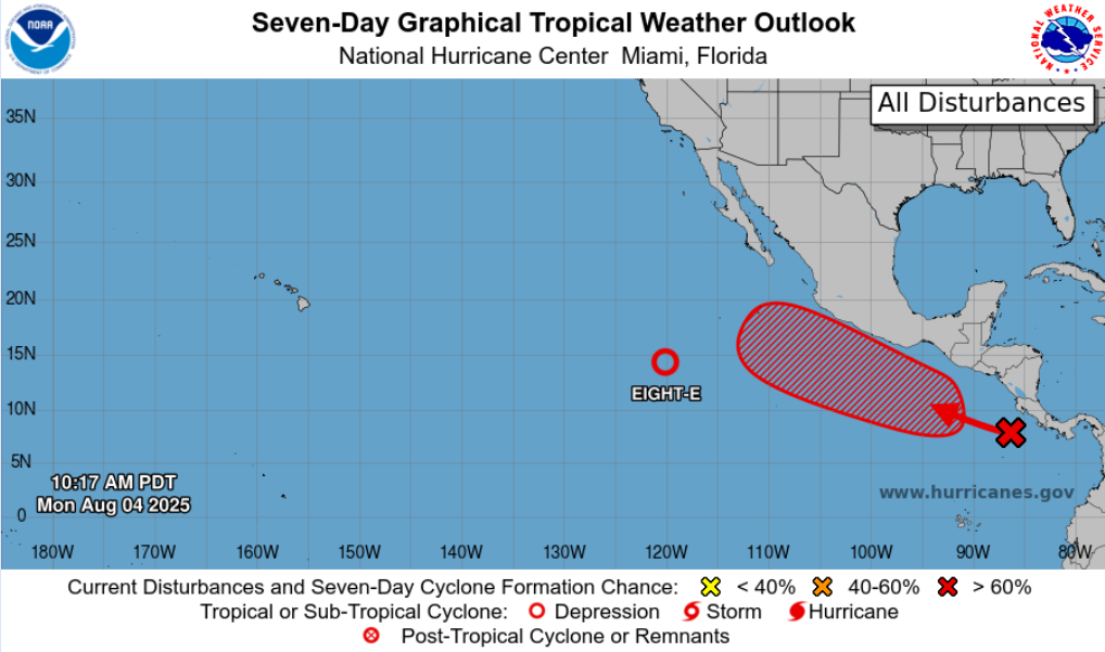
The National Hurricane Center has increase chances of cyclone formation in the next 7 days to 70%.
Discussion written by Pat Holbrook and Patrick Bunn