
Yesterday’s Weather
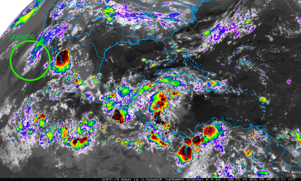
The infrared satellite image we show today is from 10pm last night. It’s a little wider view so that the mid-cloud deck associated by Juliette can be seen along with the Mesoscale Convective System (MCS) in Mexico. Due to strong westerly winds aloft the storms have been ripped from Juliette’s center and pushed northeast into southern California and Arizona. Very little rain has fallen from this system with less than a tenth recorded near San Diego.
Yesterday’s HRRR-UA WRF 12Z 24-hour accumulated precipitation forecast is on the left and equivalent observations from MRMS on the right. The best comparative description is that the precipitation was spotty and light and near the mountains with a little more precipitation in New Mexico. Some of the single-cell storms in northern Sonora near Puerto Peñasco were missed in the forecast.

Analysis
There has been a decrease in moisture in both states as vertical mixing is bringing dry air aloft down to the surface. Note the 50°F isodrosotherm (line of equal dewpoint temperature) in the Mogollon Rim and White Mountains, reflecting the dry air aloft.

The observed sounding from Phoenix at 5am (below, right) shows the dry lower atmosphere in the boundary layer from the surface to 600mb with the moisture from Tropical Storm Juliette above the boundary layer. How does the observed sounding compare to the UA WRF initialization? Not too bad for HRRR-UA WRF 12Z (below, left), especially with the moisture above 600mb.

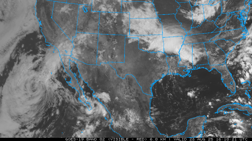
The visible satellite image from this morning at 9am shows the low-level center of Juliette southwest of Baja California. The best chance of precipitation associated with Juliette is in southern California, as the outflow comes onshore near San Diego.
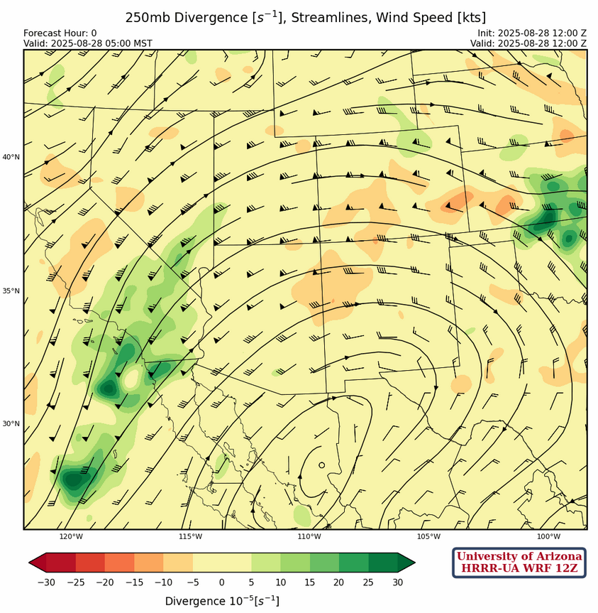
The high-pressure ridge at 250mb is east of Hermosillo with a strong jet stream from Juliette north into southern California and into far northwest Arizona. The ridge will move east into Texas over the next few days.
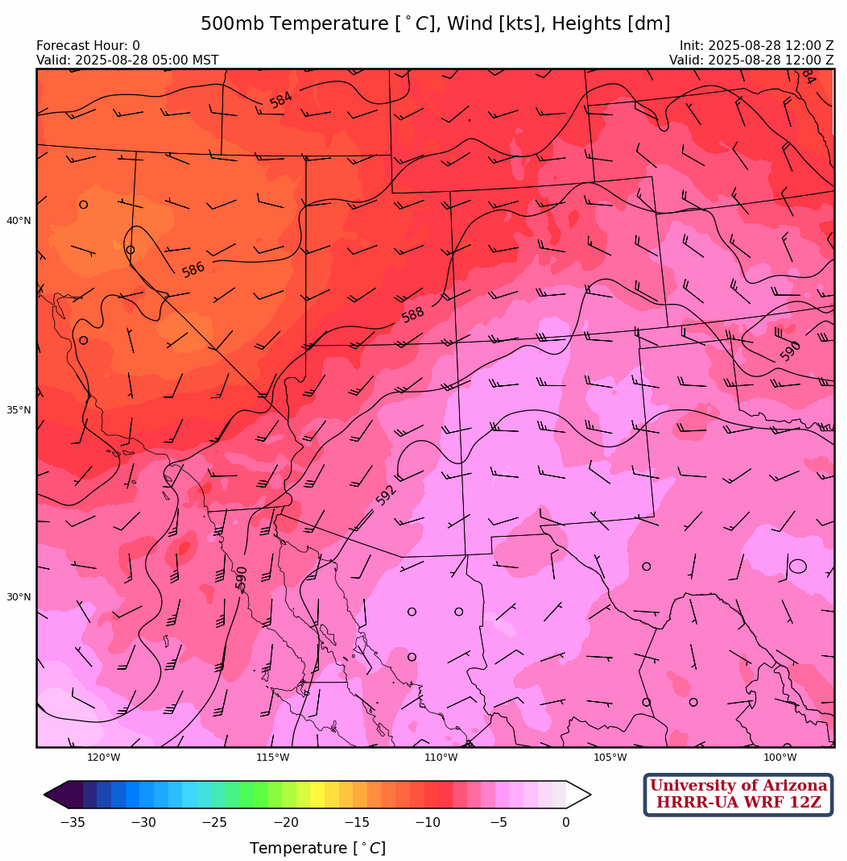
At 500mb, the center of the ridge is over the Big Bend, Texas with the ridge extending northwest to Idaho. A trough is centered over southern South Dakota and another off the west coast. Arizona has mostly light winds aloft with westerly winds in northeast New Mexico.
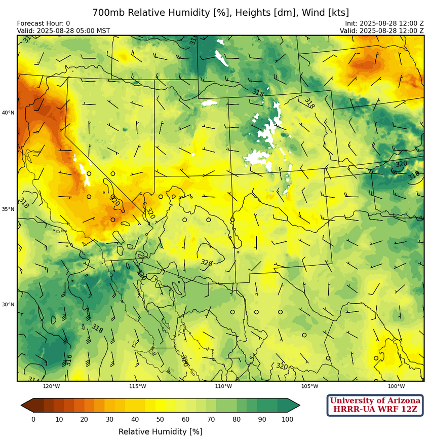
Moisture still clings to southern Arizona and New Mexico at 700mb, with the center of the ridge in northern Mexico. The ridge will move northward over the next few days putting most of the region in broad easterly flow by Sunday.
Today
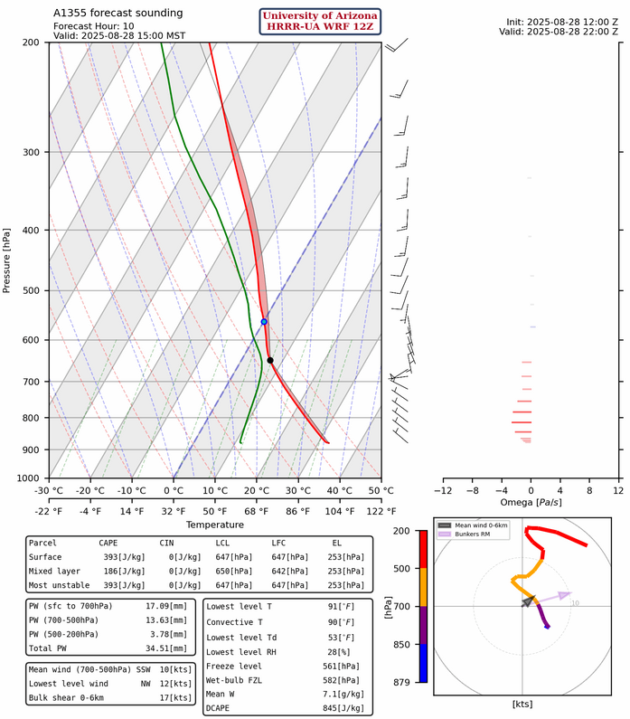
The forecast sounding from Nogales at 3pm is shown below. This is only marginally convective, but still much better than Tucson and Phoenix. The sounding for Nogales forecasts movement of any thunderstorms that form in Santa Cruz County will be to the east.
The HRRR-UA WRF 12Z radar reflectivity forecast shows precipitation is limited to southeast Arizona and the White Mountains extending eastward into New Mexico. Convective initiation is shifting to a little later in the day between 2-3pm and most of the rainfall is limited to the mountains. Precipitation form Juliette is in far northwest Arizona and southeast Nevada.
Tomorrow
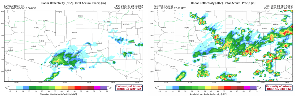
Tomorrow, the forecast shows an increase in precipitation in New Mexico and far southeast Arizona compared to today. But, the storms will be in the same general location with more storms in northeastern New Mexico.
Outlook
Friday night’s storms in northern Mexico spin up a Mesoscale Convective Vortex (MCV) south of Nogales and this moves into the Tucson area during the early morning hours of Saturday. By then the mid-level ridge is north of the region, so easterly wind flow will bring more moisture into the state and there will be more storms on the Mogollon Rim. The flow is not strong enough to push the storms into the valley yet.
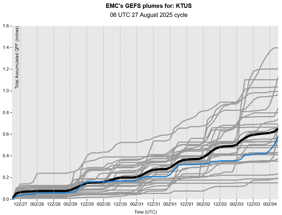
The GEFS plume forecast shows, if you can believe it, the best chance of precipitation appears to be both this weekend and next. Though, by next weekend the sub-tropical high-pressure ridge (the monsoon high) has dissipated. This signals that the dynamics of monsoon, the seasonal shift in wind direction, will be over.
Discussion written by Pat Holbrook and Patrick Bunn