
Yesterday’s Weather
The gulf surge did not make it far into the low deserts yesterday and the mid 40°F dewpoints from Gila Bend to Phoenix metro area do not support deep convection. Only south along the international border is moisture deep enough for strong storms.

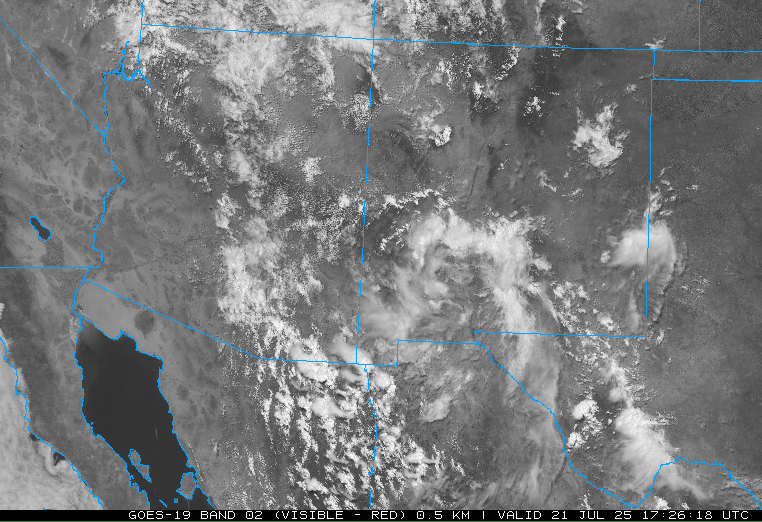
The visible satellite imagery from yesterday afternoon shows a large area of mid-level clouds over the state and only deep convection near the international border and in northeast New Mexico. The big hole in the cloud cover from Tucson to Casa Grande is from dissipation of clouds and cooling in that layer.
Analysis
The tropical upper tropospheric trough (TUTT) in the Gulf of California did not get sheared per model forecasts and has now dropped south of the Baja Peninsula. The TUTT on the coast of Texas has moved inland. There are now two TUTTs in the Atlantic. One, mentioned yesterday, is moving west across the Atlantic north of Haiti, and a newly formed second TUTT is further east in the Atlantic.

A Mesoscale Convective Vortex (MCV) is northwest of El Paso and will focus convection ahead of it’s path in southwest New Mexico today and possibly Cochise County.

At 250mb, a high pressure ridge is over central New Mexico this morning and the ridge axis extends east to South Carolina with a col south of Midland, Texas just west of the approaching TUTT. The 250mb forecast this morning does not show the center of the New Mexico ridge or the col probably due to smoothing.
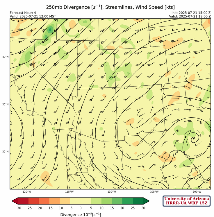
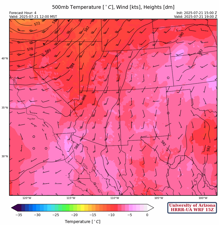
Winds at 500mb are southerly across the state in response to the circulation between the ridge and an upper-level trough centered in Oregon. Temperatures remain relatively cool with –8°C at Phoenix and probably the same across New Mexico, but without the ABQ and ELP soundings we will have to rely on persistence from yesterday.
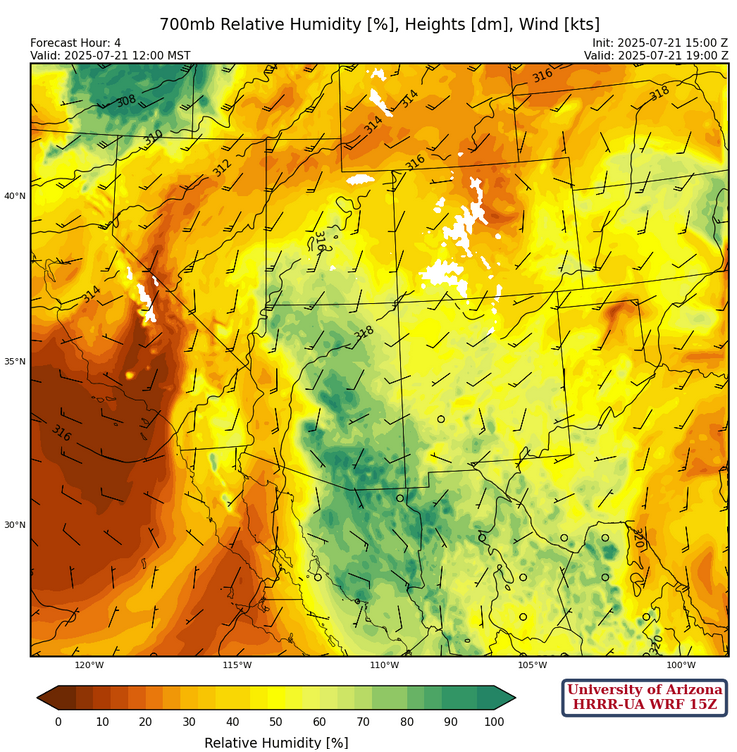
At 700mb, model forecasts did not initialize the MCV west of El Paso. A moisture axis extends north out of Mexico to Phoenix. Dewpoint temperatures are high with Phoenix at 6°C, but the cloud cover is associated with the higher moisture values and that will limit convection.
Today
There are lots of variables for today’s forecast, meaning uncertainty is high. The gulf surge that never was has left the low deserts dry for surface-based convection as the mid-level cloud deck will limit surface heating (see satellite image below of current cloud field). The Tucson area and east should have enough heating for stronger convection with higher mid-level moisture available, and some storms will produce heavy rain.
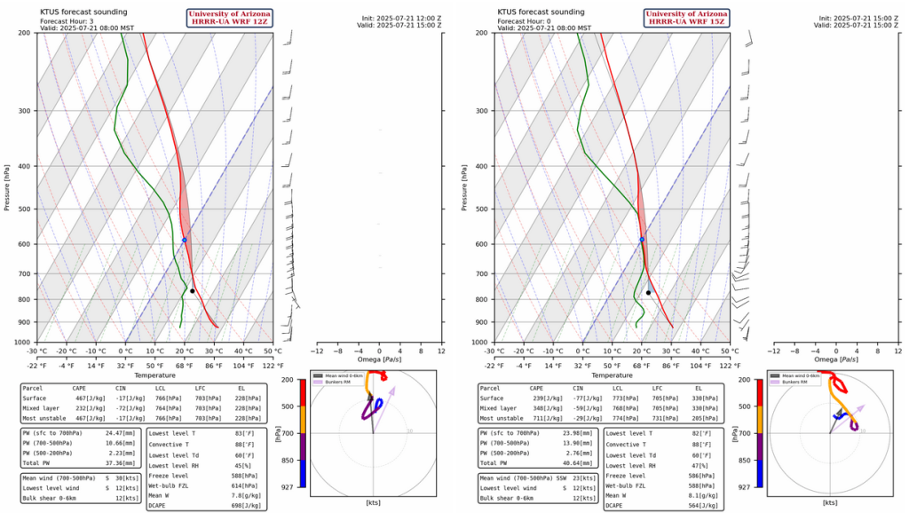
The HRRR-UA WRF 15Z (right below) forecast sounding has a better initialization, compared to the 12Z (left below), as it shows the clouds/moisture around 500mb with the temperatures a couple of degrees warmer. The warmer temperature at 500mb limits deep convection, meaning the HRRR-UA WRF 15Z the preferred forecast for today given this better initialization.
The latest HRRR-UA WRF 15Z forecast radar reflectivity is shown below with convection starting in the late morning and rainfall possible from 2pm on.
The model runs have been inconsistent in terms of rainfall totals at the Tucson airport with the latest HRRR-UA WRF 15Z model run showing about 0.3″, whereas the HRRR-UA WRF 12Z has 1.1″. As stated above the 15Z has a better initialization, though these slight differences could result in major or localized flooding for parts of Tucson.

As for Phoenix, whatever forms in southeast Arizona today will move up to Phoenix overnight. We’re still hoping this is one of the decent lighter rain events for Phoenix where they get about 0.1 of an inch, with a pulse in the late afternoon around 5pm (shown in radar above) and another pulse at night (shown in radar below).
Tomorrow
Storms form from Tucson and further north, with the main focus on the Mogollon Rim/White Mountains, and east into New Mexico. The international border has less precipitation and may be a reflection of dry mid-level air moving into the state. Both HRRR-UA WRF 12Z and 15Z model forecasts runs show Gila Bend getting a quarter to half inch of rain tomorrow; HRRR-UA WRF 15Z is the preferred forecast and the one that shows 0.5″. There’s another round of precipitation in HRRR-UA WRF 15Z for Tucson tomorrow, also around 0.5″. However, there’s a strong dependence on what happens today, so we’ll have to see how the forecast changes or not tomorrow morning.

Outlook
Dry air moves into Arizona given the dewpoint forecast for Wednesday afternoon below. Only northern Arizona and the northern half of New Mexico have enough CAPE to support storms.

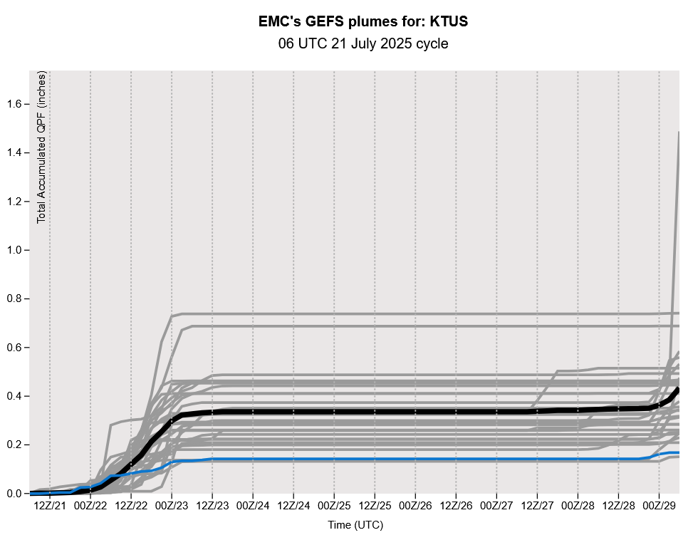
The GEFS plume forecast below shows a dry spell into the weekend.
Discussion written by Pat Holbrook and Patrick Bunn