
Yesterday’s Weather
The satellite imagery from yesterday shows deep convection in Pima County, western Arizona, and in southern New Mexico. Other storms were in the mountains in both states. Anvils from the mountain storms limited the solar radiation and the valleys could not reach the convective temperature.
Rainlog data shows precipitation mainly in the mountains from the Flagstaff area south to Prescott valley.
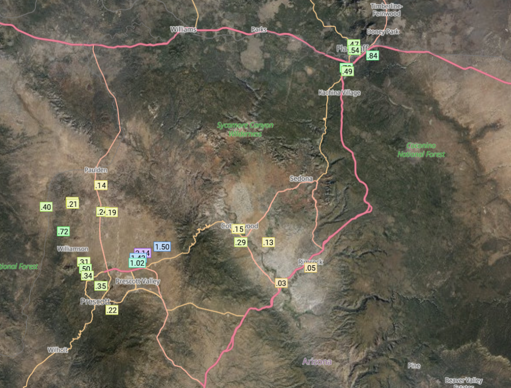
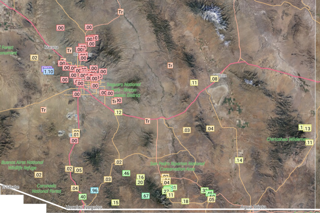
Tucson got little to no precipitation; what did fall was on the Tucson mountains. The rest off southeast Arizona got some accumulations including Nogales, Sierra Vista, and the Chiricahuas mountains. Phoenix had no precipitation.
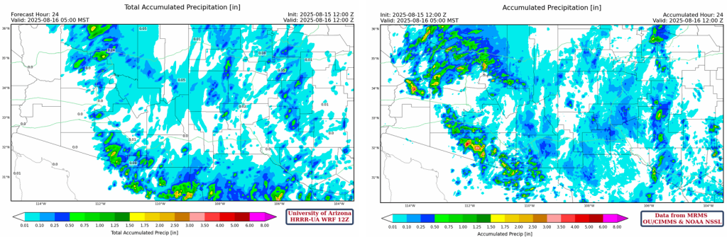
The HRRR-UA WRF 12Z forecast from yesterday (left) and the observed precipitation totals from the MRMS system (right) are shown below. This is a good estimate of the gridded rainfall data and shows that the valleys did not have much precipitation in either state. Strong storms in La Paz county casuing over 4″ of rain were missed in the forecast, as well as lighter totals in Mohave county. In eastern Pima County, while storms were forecast, their intesity was underestimated by the forecast.
Analysis
Not much change in surface moisture today compared to yesterday. Although, the strong southerly surface winds in western Arizona have decreased indicating the moisture surge is over and the higher dewpoint temperatures will be mixed with drier air aloft during the day with no replacement from the south.
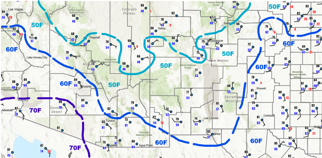
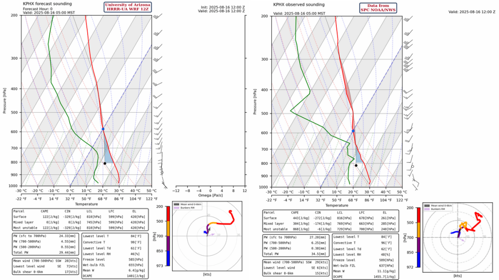
The observed upper air sounding for Phoenix at 5am this morning, shows there is a significant drying above the boundary layer and a couple of degrees warming. Both of these conditions point to less thunderstorm activity today. The low-level winds will push storms that form on the mountains to the northeast. The HRRR-UA WRF 12Z model initialization is underestimating precipitable water by about 5mm (~.25in) and low-level wind structure is too southerly.
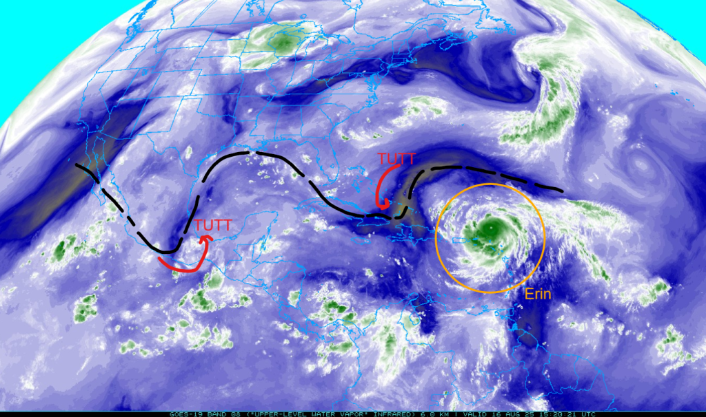
Major Hurricane Erin continues to move westward accompanied by a tropical upper tropospheric trough (TUTT) to its west. Another TUTT low is over Oaxaca, Mexico.
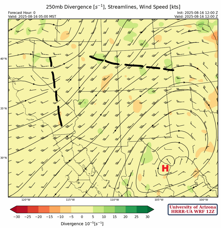
There are a couple of short waves rotating about the trough centered in southwest Idaho at 250mb, and a high-pressure ridge over Big Bend, Texas. Winds are southwest, generally 30 to 40 knots across the region. The ridge is forecast to move into Arizona by Tuesday as the trough retreats to the west.
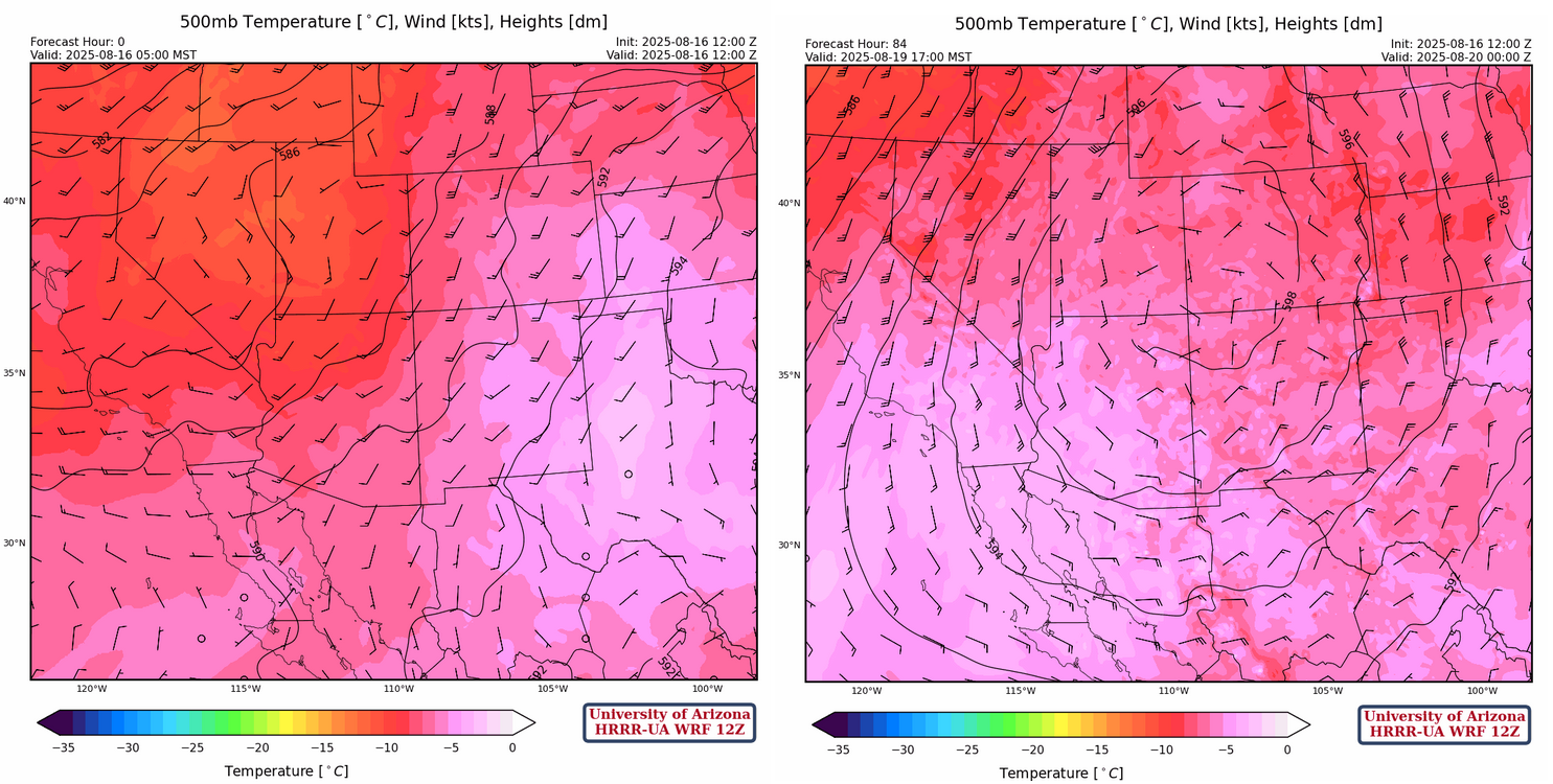
At 500mb, the HRRR-UA WRF12Z initialization (below, left) shows the ridge is over western Tennessee with a ridge axis extending into Oklahoma. The western part of the United States is dominated by a broad trough across the region. Winds across the region are from the southwest at 10 to 20 knots. High pressure will build over the four corners by Tuesday (below, right).
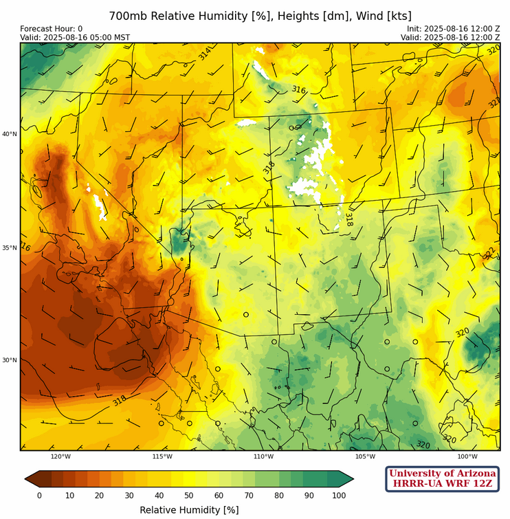
At 700mb, there was an eastward push with the dry air in California moving into western Arizona, but otherwise no significant change in moisture for the rest of Arizona compared to yesterday. New Mexico has a slight increase in moisture. The tropical system in the hill country of Texas is now forecast to move north to Dallas and not affect New Mexico.
Today
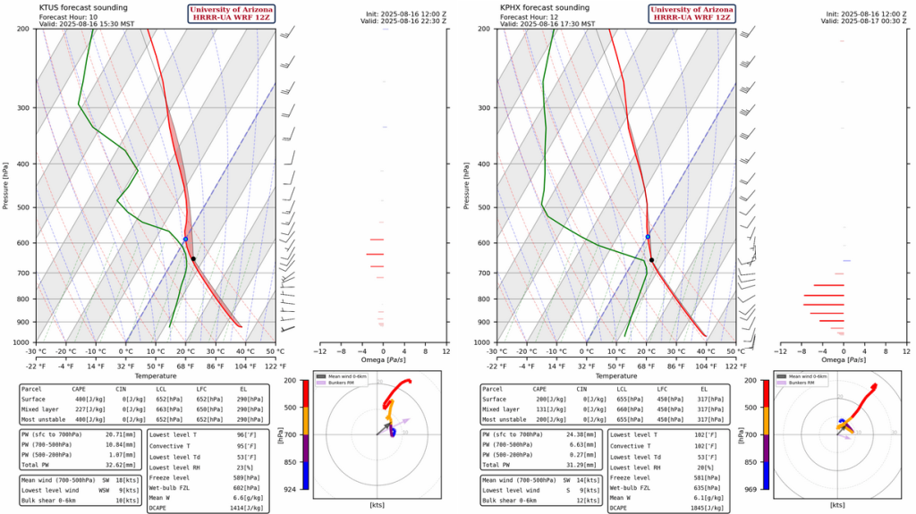
The forecast soundings for Tucson at 3:30pm (left) and Phoenix at 5:30pm (right) are shown below. The forecast Convective Available Potential Energy (CAPE) is too low for thunderstorms development near Phoenix and the southwest wind flow is not that great either. Tucson, on the hand, has better CAPE but with weak winds in the mid-levels, storms may not move too far away from mountains. The slow movement will promote locally heavy rain.
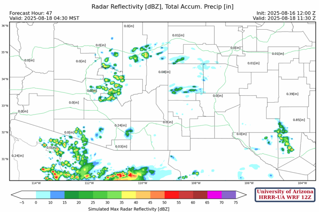
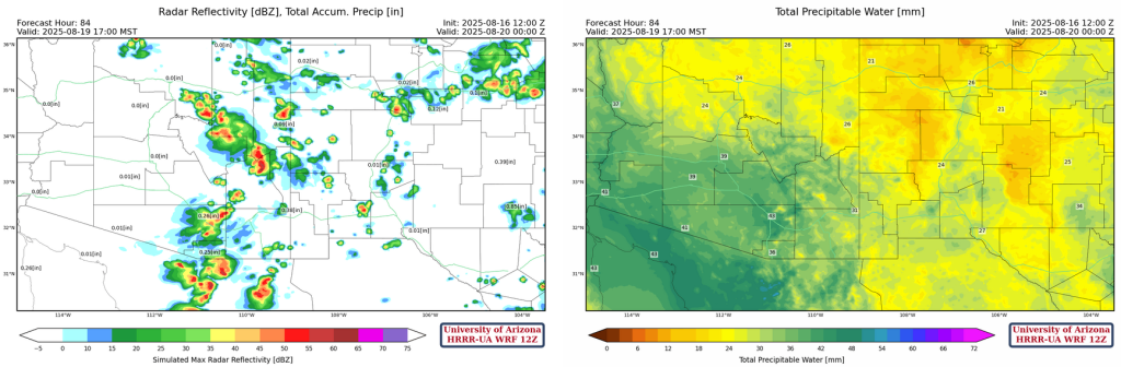
The forecast radar reflectivity shows the focus of precipitation over southeast Arizona, with northern Arizona and western New Mexico getting precipitation in the sky islands. Stronger storms develop in eastern New Mexico and move eastward into Texas. Microbursts near storms will be less than 35 mph.
Tomorrow
Southeast Arizona again seems favored for thunderstorm activity moving into the valleys as Tucson airport picks up a few more hundredths. But, in the rest of the region the thunderstorm avtivity should be restricted to the sky islands. Tomorrow’s chance of heavy rain in the valleys is less than today.

Outlook
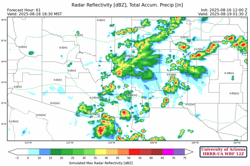
The high pressure should be moving to the four corners by Tuesday, and this will result in showers and thunderstorms developing Sunday night and moving northwest Monday morning as shown on the radar reflectivity forecast below. A Mesoscale Convective System (MCS) is forecast to move across northwest Mexico, and the outflow from the MCS will push moisture back into the low deserts on Monday.
Due to boundary layer cooling, the moisture in the low deserts will not be available to produce storms there until Tuesday. Thunderstorms will be confined to eastern Arizona and western New Mexico on Monday. The four corners high will then be moving into its climatological location with deep easterlies below the ridge.
By Tuesday afternoon all ingredients should be in-place for thunderstorms to move into Tucson valley and then into Phoenix on Wednesday. Precipitable water is forecast at about 43mm (1.6″) on Tuesday in the Tucson valley.
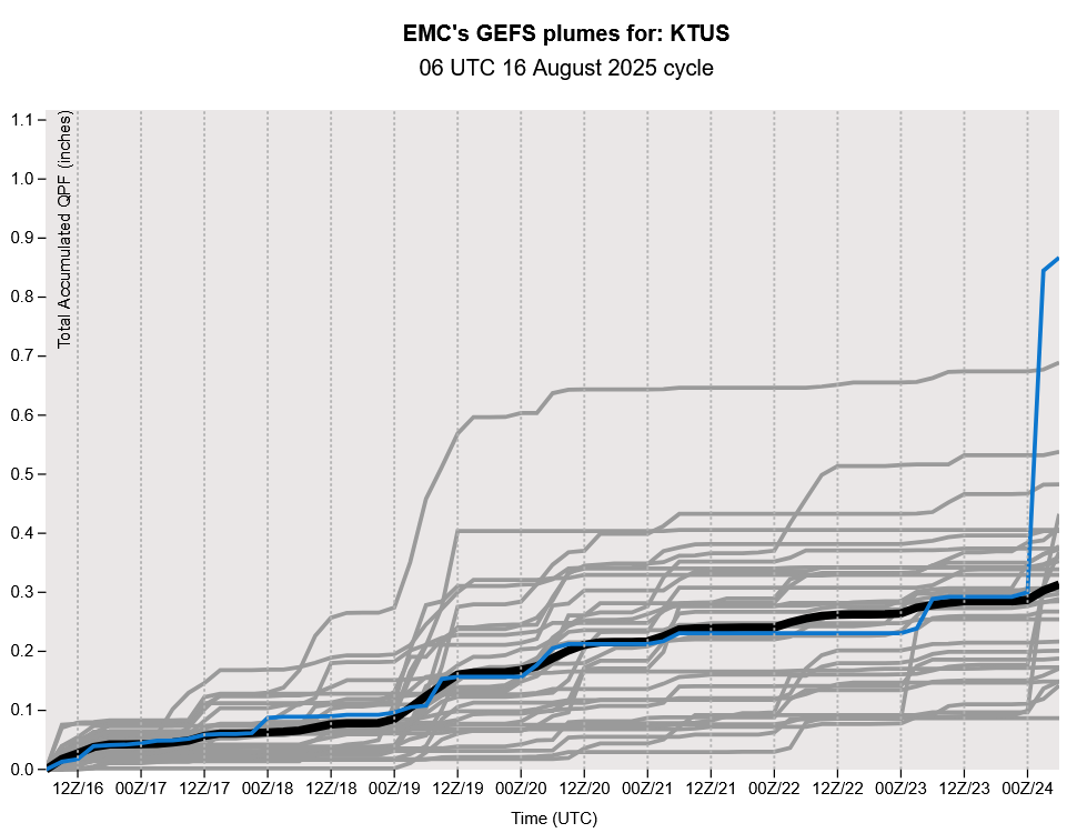
The GEFS plume for Tucson supports a similar interpretation; a chance of storms in the valley today with storms staying away until the first part of next week.
Discussion written by Pat Holbrook and Patrick Bunn