
Yesterday’s Weather
A few thunderstorms developed in Santa Cruz County with a couple of rain buckets receiving precipitation. The visible imagery with lightning data showed the paucity of storms across the region. New Mexico was drier than the previous day and could not make storms even in the mountains.
Analysis
Surface station observations for this morning shows that we did not get a reinforcement of low-level moisture from the thunderstorms in Sonora yesterday. In New Mexico, the dry line is snuggled along the eastern mountains and will move east during the day. Roswell forecast soundings dry out as the dry line moves east during the day.

The tropical upper tropospheric trough (TUTT) axis is indicated as the black dashed line below with three TUTTs as indicated. Two tropical lows are annotated in green; one west of Manzanillo and the other south of Guatemala. These two lows may or may not develop into tropical systems, but should assist in the movement of moisture into Arizona as soon as Thursday.

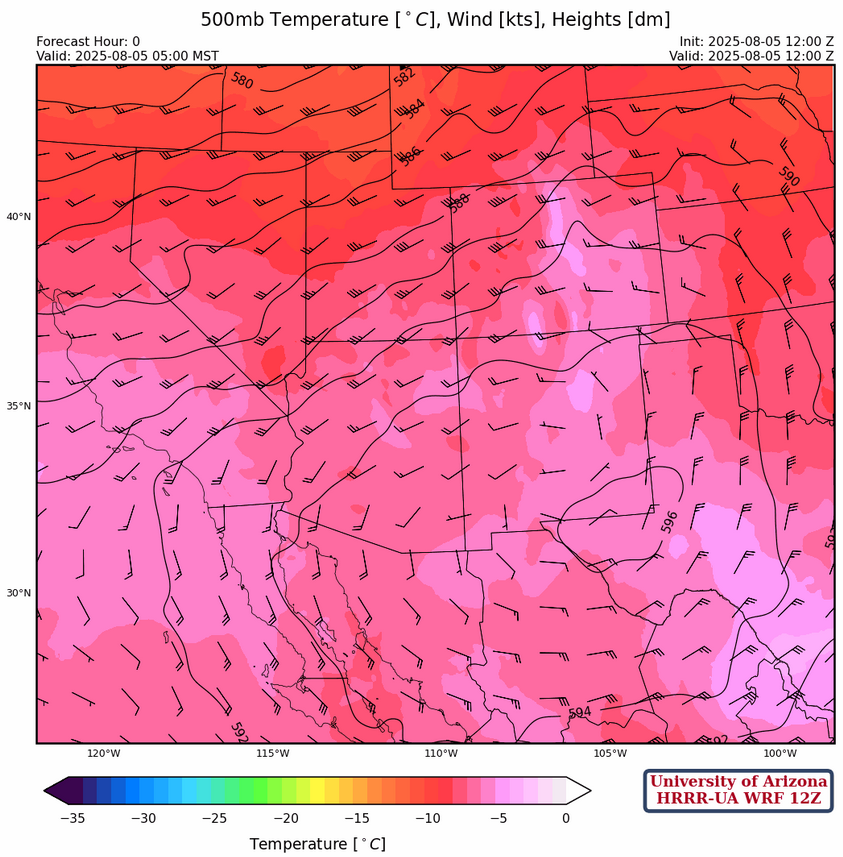
The sub-tropical ridge at 250mb is parked southeast of Douglas this morning. The general circulation has not changed much since yesterday with westerlies across the northern two thirds of the region and wind speeds near 40 knots decreasing to less than 5 knots near the ridge. A chunk of energy from the trough off the west coast is now moving over the ridge in Wyoming and Colorado.

At 500mb, the center of the ridge is displaced from the 250mb center and is now located east of El Paso. Some cooling is noted over Arizona probably due to increased moisture wrapping around the circulation from the storms in Mexico the last two days. Although not perfect this is becoming a more favorable circulation for the monsoon.
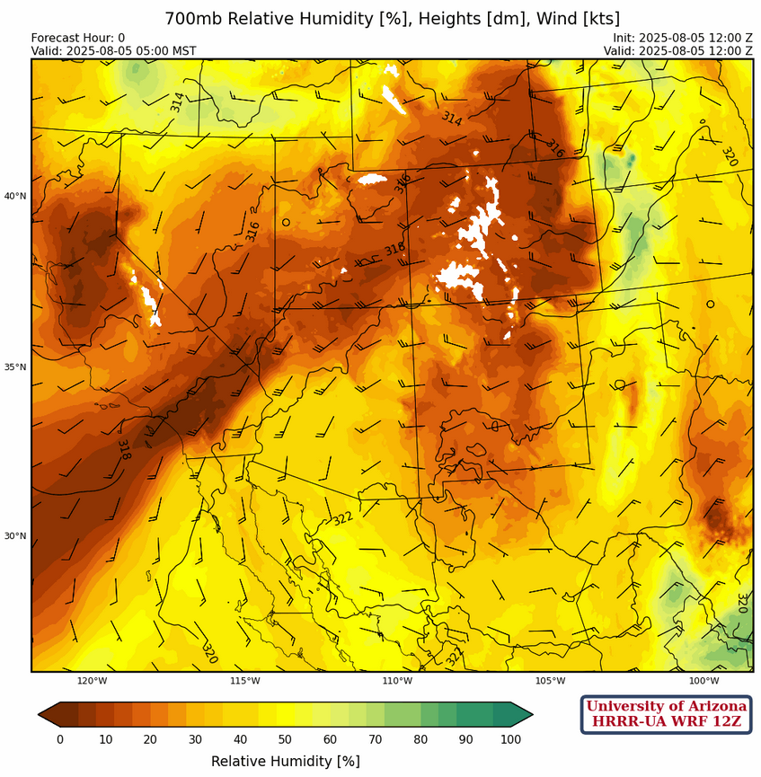
In the 700mb initialization, the increase in moisture is evident over central and southern Arizona as the circulation around the high centered in the boot heel of New Mexico pulls monsoon moisture northward. Over the next several days the day-to-day moisture values increase and decrease some, but the general pattern does not change much.
Today
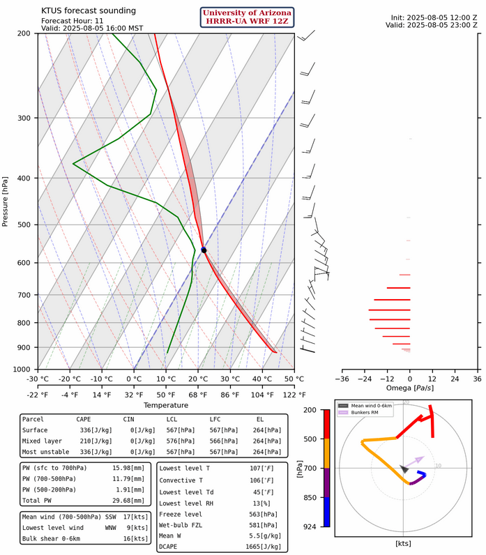
Although mid-level moisture is available for storms to form over the mountains in Arizona, Convective Available Potential Energy (CAPE) values are not that impressive at 200 [J/kg]. Storms will have to deal with the dry air in the desert valley, a very hostile environment for the little moisture that is available.
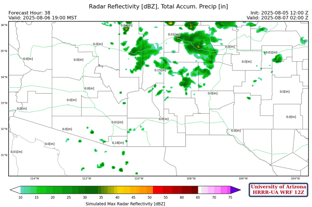
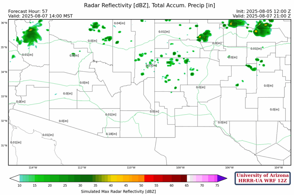
The HRRR-UA WRF 12Z forecast radar reflectivity this afternoon shows storms extending from Nogales to the Catalina mountains north of Tucson. Other more isolated storms will form in the rest of the mountains in eastern Arizona. No significant wind gusts are expected.
Tomorrow
No increase in surface moisture is expected, while mid-level moisture in southern Arizona today moves north and increases precipitation in northeast Arizona and northwest New Mexico. Southern Arizona is left with popcorn thunderstorms that form and die rather quickly with the near record-breaking heat and are only good for a a lightning bolt or two and a few drops of rain. These storms will last until midnight.
Outlook
Through Thursday more near record breaking heat is expected with thunderstorms in the northern half of the region. No significant rain will occur; the threat is from the dry lightning associated with any storms that do develop.
The question for later this week is: what initiates the gulf surge forecast by the models into southern Arizona on Thursday? Is the surge coming from the storms/low near Manzanillo or from the developing tropical system further to the southeast. The developing tropical system will move off the coast more than shown below, but the general idea is there. Either way, the overall pattern shows the return of good monsoon moisture with increased thunderstorm activity!

The moisture surge forecast is shown below. Note that a surge arrives a day earlier at Empalme (Guaymas), Mexico, so all eyes will be on the morning sounding tomorrow.
Discussion written by Pat Holbrook and Patrick Bunn