
Yesterday’s Weather
Yesterday’s infrared imagery shows thunderstorms developed in western New Mexico and moved into southeastern Arizona. These storms were stopped their tracks by dry air over the rest of Arizona. The most notable weather produced by the storms was a dust storm/haboob that began in western New Mexico and moved west across Cochise County. The NWS gave a great description in their dust storm warning that was issued:
“At 4:45 PM MST, a wall of dust was located along a line from 16 miles north of Benson to 6 miles north of Bisbee, moving southwest at 35 mph.”
The distance from Benson to Bisbee is about 50 miles! The dust blew into Tucson during the evening prompting dust advisories, although the wind speeds weren’t as intense as when it reached Tucson.
The 24-hour accumulated precipitation forecast from yesterday’s HRRR-UA WRF 12Z (below, left) is compared to the equivalent observations from MRMS (below, right). More rain fell than forecast where it rained in western New Mexico and Cochise County. Model forecasts are only as good as the data input and in this case the amount of moisture in these areas was underestimated, potentially due to the lack of upper air observation data in this area.

Analysis
The outflow from the storms in southeast Arizona spread west and north to Phoenix and Gila Bend before midnight and almost to the California border before winding down in the early morning hours.

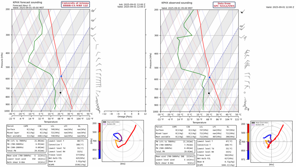
Both the observed sounding at Phoenix from 5am and the HRRR-UA WRF 12Z initialization are similar with an increase in precipitable water of 0.20 inches (5mm) compared to yesterday. The forecast initialization has the low-level winds a little too strong versus the observed sounding. With the convective temperature of 108°F in these soundings and forecast high of 105°F, surface-based convection is unlikely. Storms may move in off the Mogollon Rim in the evening due to the northeast wind flow.
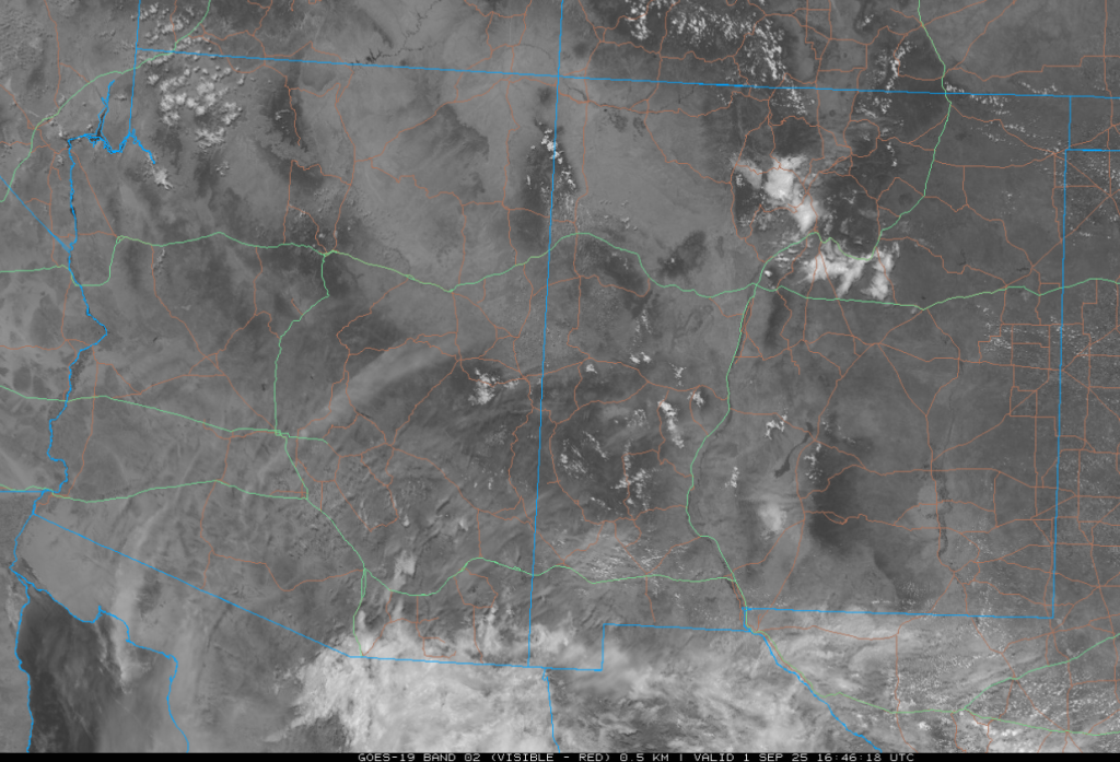
The GOES-19 visible satellite image from this morning shows there is a lot of mid-level clouds in southern Arizona/New Mexico extending southward into Mexico. These are forecast to burn off by around 11am, though additional cloud cover is forecast to move in from the south.
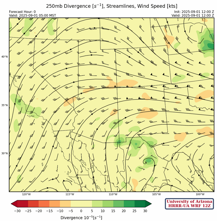
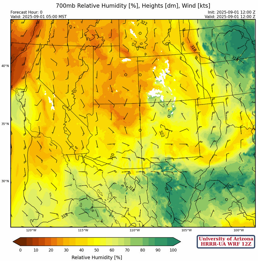
At 250mb, the center of the ridge remains in southern Texas with the ridge axis moving north. This pattern means southern Arizona is south of the ridge with southerly to southwesterly winds.
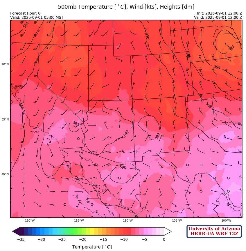
The ridge is over the Mogollon Rim at 500mb, with the ridge axis extending north to Idaho. The southern half of Arizona has easterly winds.
At 700mb, southern Arizona is still has easterly winds aloft, so any storms that form will move westward. The circulation around the high pressure north of the White Mountains will bring dry air into the region from Colorado and Wyoming though the week.
Today
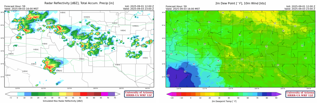
As mentioned earlier Phoenix can’t get to the convective temperature today, however Nogales and Tucson could. Nogales has higher Convective Available Potential Energy (CAPE) forecast values at 2pm (below, left) compared to Tucson at 3:30pm (below, right), and is more favorable for convection than yesterday.

The forecast soundings above point to storms forming, but the forecast radar reflectivity shows the model does not develop these storms. Surface heating versus the cloud cover moving in from the south is the key. Even if the mid clouds evaporate there will be cooling at that level which reduces CAPE, so the model predicting no storms seems correct. For the rest of the region, isolated storms will develop in the sky islands.
Tomorrow
Tomorrow, easterly winds are forecast to get even stronger over southeast Arizona, and storms will form in Pima and Santa Cruz counties and move west to the California border by midnight. Both Tucson and Phoenix remain high and dry again.
Outlook
The result of Tuesday’s easterly winds in southeast Arizona is apparent with the low dewpoint temperatures forecast in the southeast part of the state on Wednesday. Storms form again west of Tucson, but only get as far west as Why and Ajo. The mountains will have storms across the northern half of the state with the Kingman area seeing the better storms and stronger outflows.
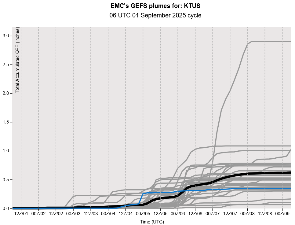
The GEFS plume forecast for Tuscon indicates that there’s one last shot at monsoon storms from September 4th through the 7th, as a tropical system moving to the Baja Peninsula pushes one last shot of moisture over the Arizona. The 3 inches of rain predicted by one ensemble member forecast is bogus; we will likely see a half inch or so.
The long-range GFS and ECMWF forecasts are similar in the predicting the location of the tropical system by Thursday. At 5am, September 4th, it’s predicted to be just off the coast of Baja California before heading east onshore.

Discussion written by Pat Holbrook and Patrick Bunn