
Yesterday’s Weather
There were near record high temperatures in parts of Arizona yesterday with a few cumulus clouds in the far southeast. No lightning was indicated, but it’s possible there was virga in the Chiricahua mountains. New Mexico had storms as forecast mainly in the central mountains and far northeast. The stronger storms in the northeast New Mexico were able to move off the mountains, moisture associated with thunderstorms in northern Mexico has advected into eastern Arizona.
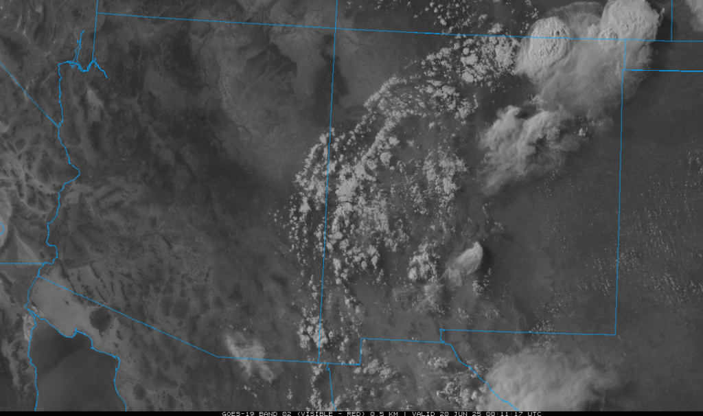
There is also smoke associated with a wildfire in Mexico that has made its way into southern Arizona and Tucson (see the picture taken just after sunset from my house looking west)

Analysis
At 250mb, northerly winds yesterday have given way to light and variable winds aloft, with more of a westerly component. Strong westerlies have moved into California associated with the upper level trough along the west coast.

At 500mb, the high that was previously over Arizona and New Mexico been pushed to the east over Texas and Louisiana by the west coast upper level low. There is still warm air aloft, but an incoming trough should cool things off.

At 700mb, there is moisture present in southern through central New Mexico, similar to yesterday. This moisture will once again bring storm chances into the region over the mountains. Some of this moisture moved into Arizona from the decaying thunderstorm complex east of Hermosillo yesterday and is reflected on the Phoenix 5am sounding below.

The next sounding is from Albuquerque. Albuquerque has more moisture and a weaker cap, whereas Phoenix does not have nearly as much moisture and a significantly stronger cap. There are chances for thunderstorms in Albuquerque, but not in Phoenix.

Today
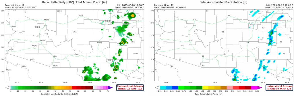
For the foreseeable future, the Arizona monsoon will not show up. There will be scattered thunderstorms with light precipitation and lightning over the mountains in New Mexico once again. Some moisture from storms in Mexico yesterday could also cause thunderstorms over the mountains in southeastern Arizona, but the precipitation from these storms will most likely not make it to the ground. Temperatures will not be as high as yesterday in Arizona, there will be a drop of 5-10 degrees from yesterday. New Mexico will experience very slight cooling with temperatures dropping a few degrees. The smoke from the fire in Mexico does not appear to be as strong today as yesterday. Below is a radar and hourly precipitation forecast for this afternoon. Note…the models don’t show any storms over southeast Arizona, but there should be some activity. The CAPE forecast is also shown for this afternoon.

Tomorrow
In New Mexico, more widespread thunderstorms, precipitation, and lightning over the mountains tomorrow, with stronger possibilities of storms over the deserts as well. Temperatures will once again drop around 5 degrees Arizona as the trough continues to push through. This trough also shifts the moisture axis east and south in New Mexico.

Outlook
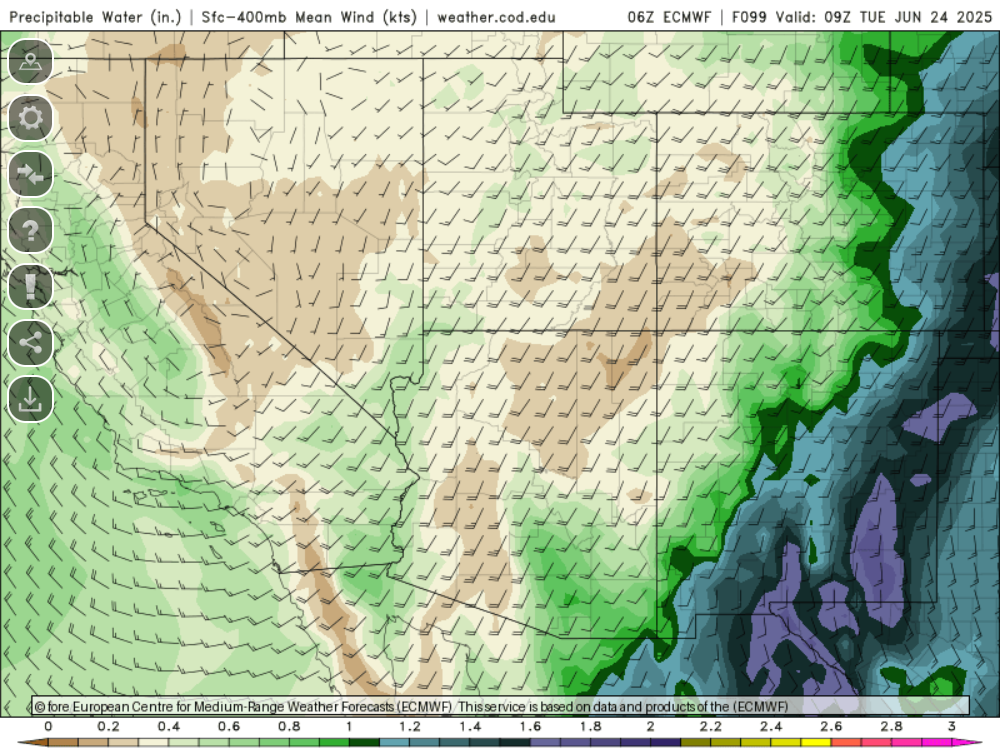
The moisture axis should remain in-place through Sunday but will shift westward by Monday. The GFS seems to be more aggressive with the moisture next week as the ECMWF is drier. Looking at the precipitable water forecast for Monday it looks like the monsoon has arrived, with precipitable water above 40mm in southeast Arizona.

But the ECMWF shows some moisture increase by Tuesday next week, but it is not as much as the GFS. This is probably due to how the moisture that was associated with former Category 4 Erick is handled in the model.
Discussion written by Pat Holbrook