
Yesterday’s Weather
Yesterday was a more widespread soaking for Arizona, with good totals in Tucson, Phoenix, Prescott, and Flagstaff. The Rainlog 24-hour totals are shown below for each of these locations.

The GEOS-19 infrared images show convection starting in western Arizona near the Colorado River in the early afternoon. The anvil tops blowing to the east, with storm motion more north-eastward. Thunderstorms reached Phoenix and Tucson around 6pm, with a lot of lightning as shown by the annotated flashes. The cloud tops were low, shown by the absence of the deep red colors in the infrared images, reflecting the strong southwesterly jet winds aloft blowing the tops off the cells.
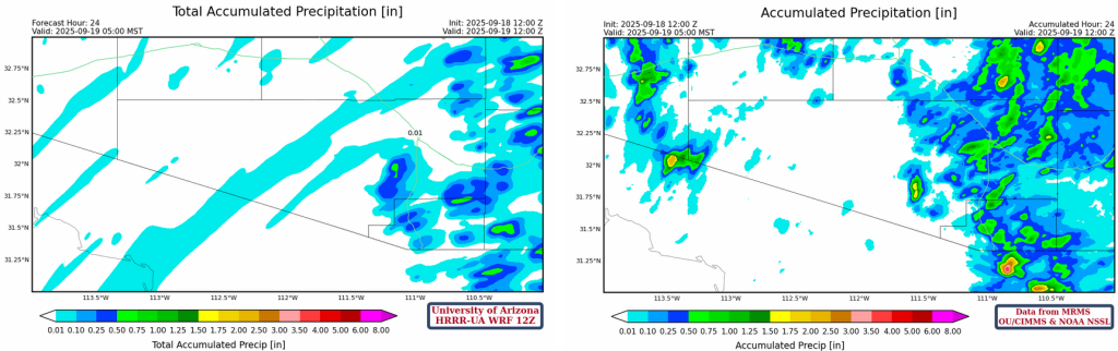
Another not great performance from the forecast models. The HRRR-UA WRF 12Z forecast (left) captured the orographic lift along the Mollogon Rim, but the intensity of rainfall was underestimated compared to the MRMS observations on the right. The thunderstorms along the western part of Arizona were missed, as were the thunderstorms that moved from the southwest into western Pima County and up into Graham County.
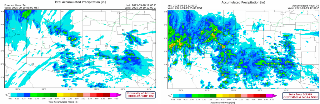
Focusing on Pima County, the forecast doughnut hole of precipitation around the Tucson valley, again, was a miss. Though not as spectacular as the microburst on Wednesday 17th, yesterday was a more persistent type of rainfall, which tracks with the storms having lower tops and likely weaker updrafts. This event, now on day two, is clawing back some of the much-needed rain missed from earlier in the month and season. Even the airports in Tucson and Phoenix got 0.5” and 0.23”, respectivly. But what about today, will there be a day three of the event?
Analysis
The surface dewpoint observations from this morning at 8am, show that there’s a lot of moisture in place thanks to the two most recent days of rain, with only the most northerly part of Arizona and New Mexico with dewpoints less than 50°F. The southwesterly moist flow is keeping the low deserts in a favorable environment.

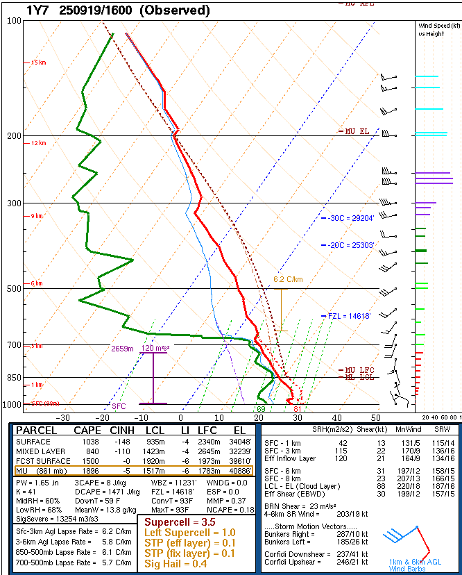
The observed soundings from Phoenix and Tucson are only being launched at 10am making it difficult to understand the vertical structure of the atmosphere in southern Arizona. The only sounding available is from Yuma at 9am, which shows an eye-watering 1800 [J/kg] of Convective Available Potential Energy from the most unstable layer, and 1.65” (42mm) of precipitable water. There are a few inversions though, and critically one at 700mb, just above the moist boundary layer.
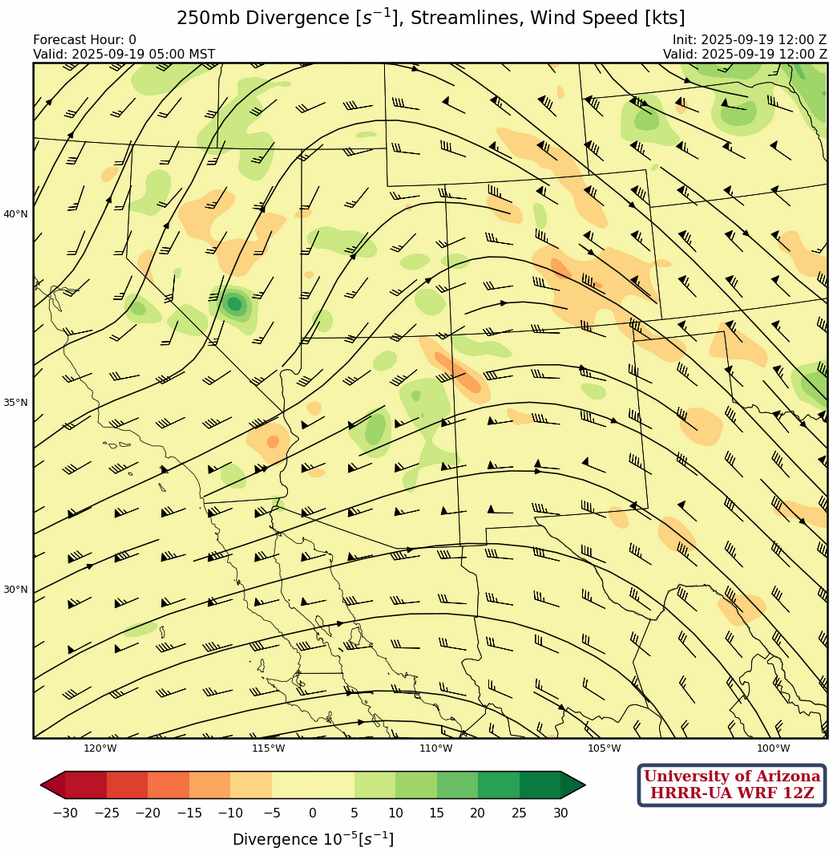
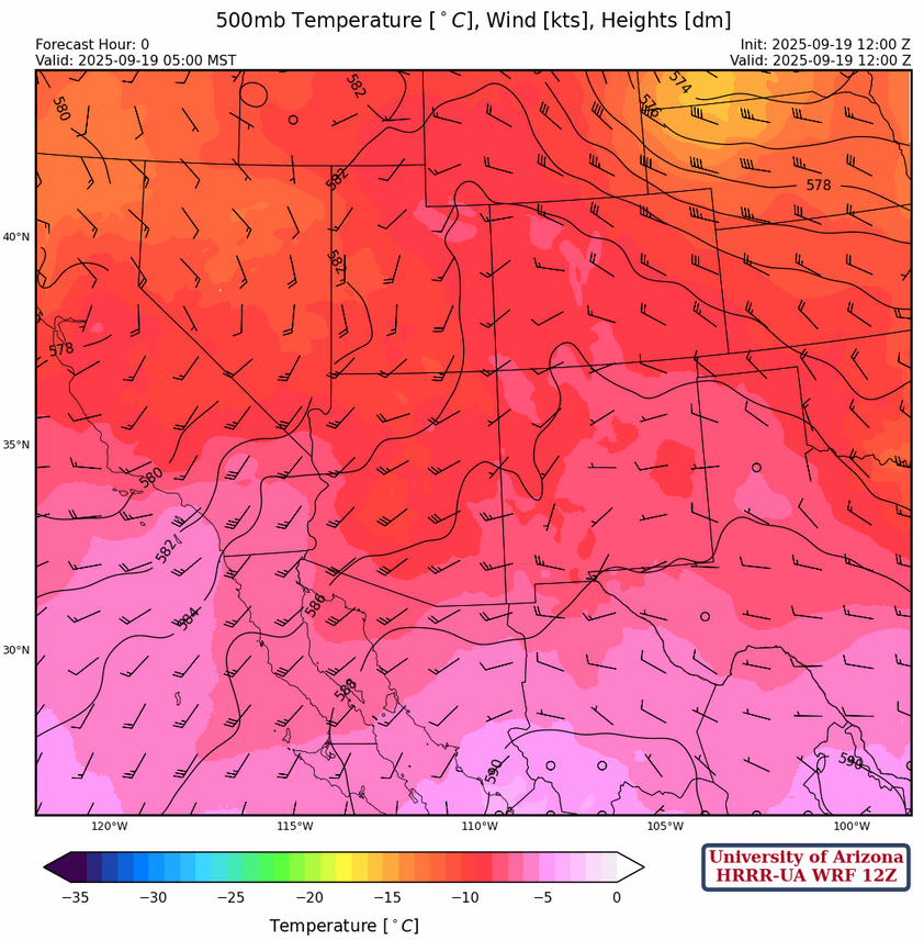
At 250mb, with the sub-tropical high-pressure ridge off the tip of Baja California, we are still under the influence of a 75 knots southwesterly jet that is being pushed along by a trough off the west coast and has divergence as it approaches another trough affecting the Midwest. Weak upper-level divergence is over the Mogollon Rim and White mountains.
The wind speed in Arizona at 500mb is about 30 knots from the southwest weakening to 10 knots in New Mexico. Temperatures are cooler (-10°C) in Arizona compared to New Mexico.
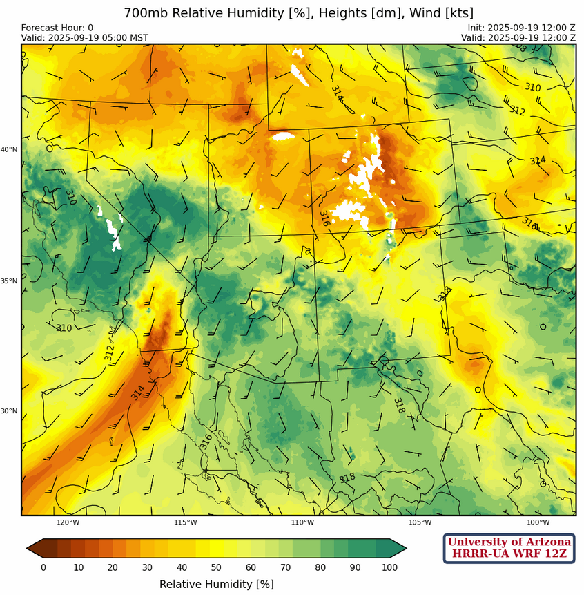
At 700mb, moisture is in a similar pattern to the surface observations and most of Arizona and southwestern New Mexico south-southwesterly flow. Moisture decreases during the day and a ribbon of dry air, currently in Southern California, pushes into the northwest of Arizona by tomorrow.
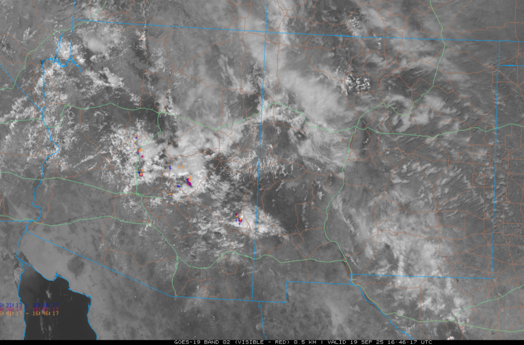
This morning’s GOES-19 visible satellite picture shows remaining clouds from yesterday’s activity in central Arizona near the Mogollon Rim. The annotated lightning shows the increasing terrain is helping keep the updrafts going. These clouds should move off by the early afternoon as the system is pushed east by the jet.
Today
The HRRR-UA WRF 12Z forecast soundings for Tucson and Phoenix at 5pm have plenty of Convective Available Potential Energy (CAPE) and precipitable water for storms to develop, though the wind profile is almost unidirectional (to the east).

The HRRR-UA WRF 12Z radar reflectivity forecast for this afternoon shows storms initiate in the early afternoon in eastern Pima and Cochise counties. Tucson metro area could get a cell pass through in the early evening, as could Flagstaff. Phoenix remains quiet, despite the moisture and CAPE in place.
Tomorrow
A similar set up for tomorrow and Sunday, though the ridge axis is moving east, so the activity follows. Still Tucson and Phoenix could get a single fast-moving cell, but most of the activity for Arizona is in Cochise County and New Mexico.
Outlook
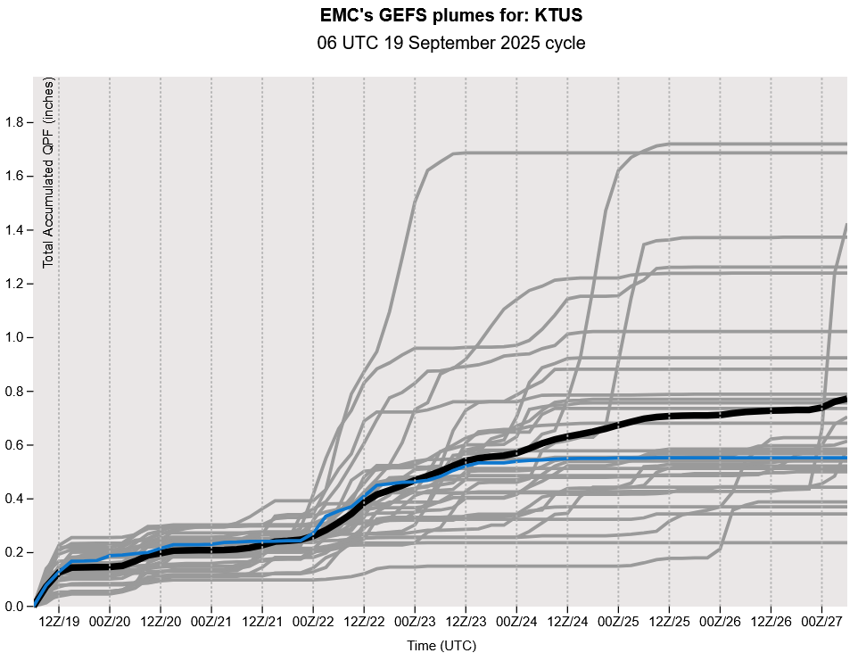
Looking to next week, the GEFS plumes show another increase in precipitation chances. The trough, currently off the west coast, dips down to Southern California and forms another southwesterly jet between it and another trough for the Midwest.
Discussion written by Pat Holbrook and Patrick Bunn