
Yesterday’s Weather
A down day yesterday as only a few storms developed along the international border from the “boot heel” of New Mexico westward to Nogales and the Tohono O’odham nation. The drying trend continued over the rest of the region. Some mid-level moisture moved into southern Arizona from the remains of Flossie.
The dynamic definition of the monsoon start, three days of average dewpoint temperature above 54°F, has been achieved as shown by the recent conditions at UofA campus. This means the monsoon start date using this method was July 2nd this year.

Analysis
Anticyclones are noted across central Mexico and with the tropical storm off the east coast. An elongated trough is between these two anticyclones.
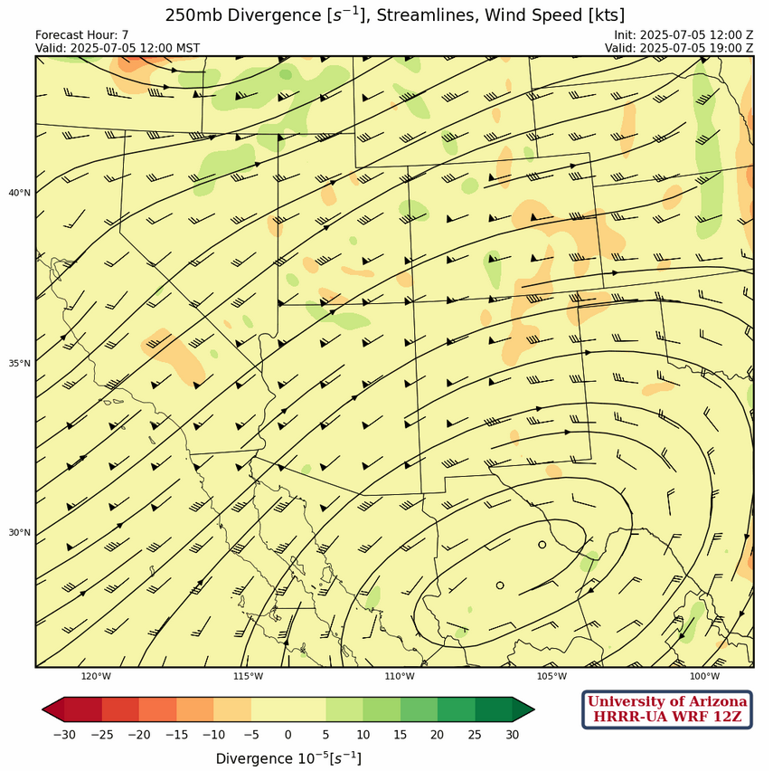
At 250mb, the jet stream moved a little further north with the core of the jet from southern California to northeast Montana. Winds over Arizona are 50 to 65 knots and from the west southwest becoming westerly over New Mexico and decreasing about 10 knots.
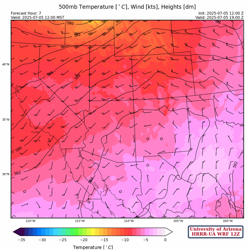
At 500mb, the center of the high pressure “monsoon ridge” has moved a little further south in Mexico and is near Hermosillo with westerly winds at 10 to 15 knots across the region turning more northerly in eastern New Mexico. A low pressure system is off the west coast, west of San Francisco.
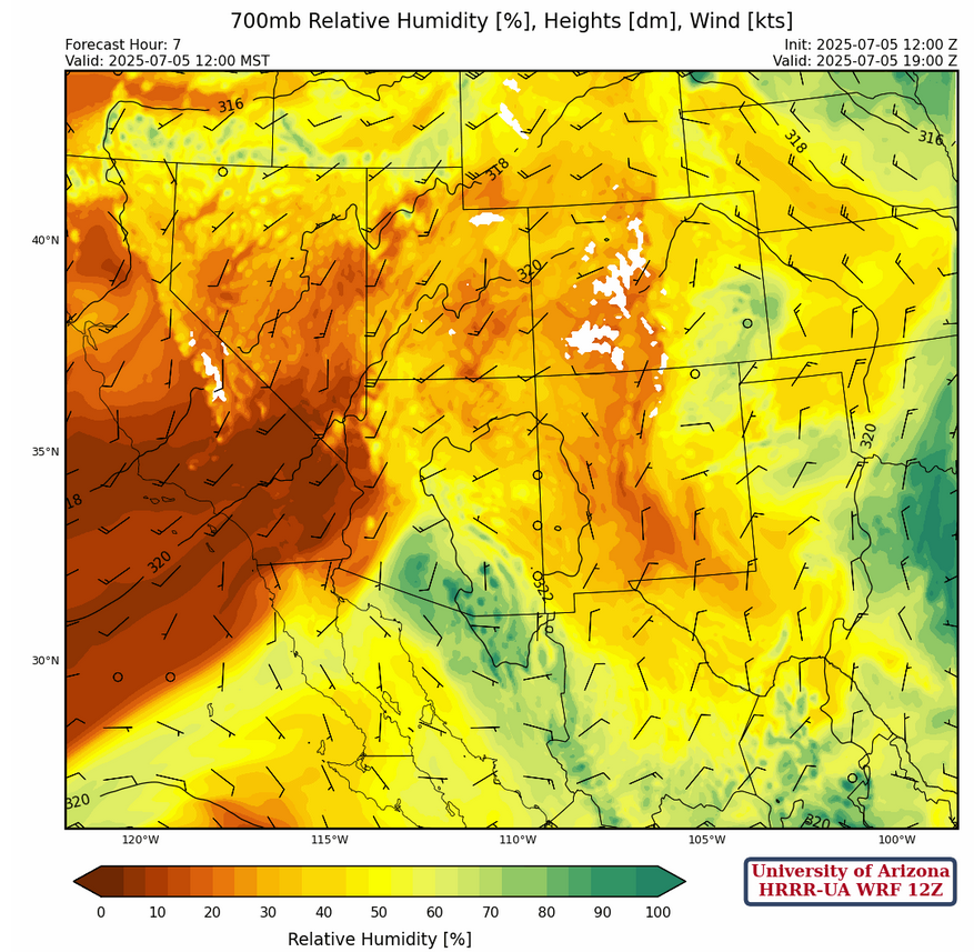
The high-pressure axis is from western Kansas to west Texas then extending west to the international border in Arizona at 700mb. Winds are light southerly with some moisture in eastern New Mexico and southern Arizona. Very dry air is in California.
Today
Some storms will form over the mountains of eastern Pima, Santa Cruz and southern Cochise counties. There may also be a few storms over the White Mountains. Anvils will cover some of the valleys, though the storms are expected to remain over the mountains. In New Mexico, storms are forecast over the mountains in the northeast. Weak microbursts may be associated with some of the stronger storms in New Mexico.
Tomorrow
More widespread thunderstorms are expected over the mountains of eastern Pima, Santa Cruz, Cochise, and Graham counties. Some anvils and storms may move off the mountains, leading to some rain in the valleys. Thunderstorms are forecast over the mountains across all of New Mexico, with some storms moving into the valleys. Throughout both states, microbursts associated with stronger storms are expected given the wind speed forecast below.
Outlook
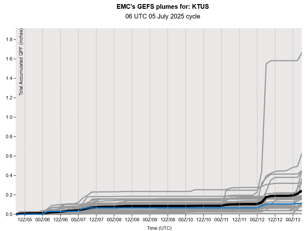
A similar pattern to tomorrow is expected on Monday, with storms over the mountains of southern Arizona and over the White Mountains, and widespread across New Mexico. Drier weather is forecsat early next week in Arizona and temperatures are expected to rise throughout the rest of the weekend and into next week. GEFS plume for Tucson below shows no significant precipitation during the weekdays with an uptick the following weekend.
Discussion written by Pat Holbrook