
Yesterday’s Weather
Yesterday was a story of two metro areas that got rain, but not much if any at the airports.
The 24-hour accumulation data below shows the precipitation in southeast Arizona including Tucson, Nogales, and Sierra Vista.
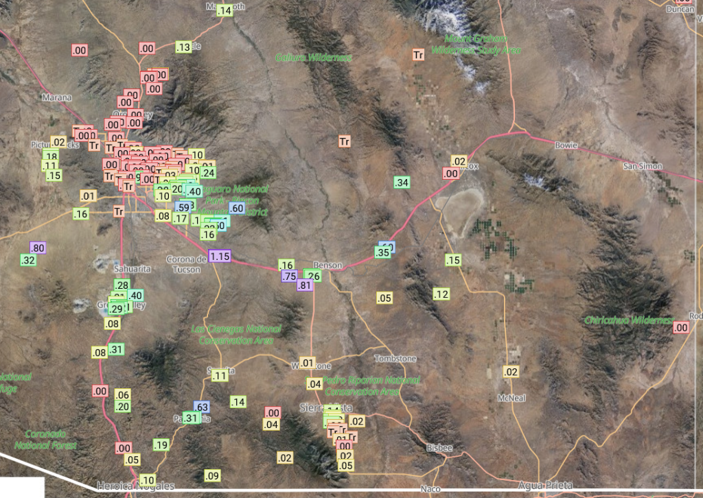
In Tucson the storms came off the mountains (as shown by the satellite loop above), aided by outflows from storms dropping southwest out of Graham County, but stopped as they moved further west across the city. Storms did form over the Tucson mountains and extended westward to central Pima county. Tucson airport got just 0.03″.
In Phoenix, an isolated storm developed west of the northwest of the airport and moved southward to South Mountain. The heaviest rain was near South Mountain with 0.6″, and Sky Harbor aiport got nothing.

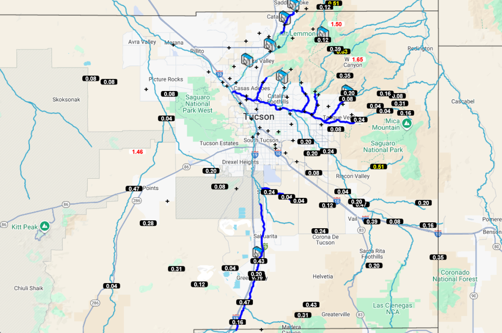
The HRRR-UA WRF 12Z forecast from yesterday (below, left) compared to the observed totals from the MRMS system (below, right) shows the precipitation amounts and location was just about right except for one notable exception. Phoenix, had strong storm pop up that produced 0.5” of rain. There were light showers in the Grand Canyon with relief for the firefighters with higher relative humidity overnight.

Note the stronger storms, with radar echo tops of 45 to 50 thousand feet, are similar to the cloud top temperatures indicated in the infrared satellite image earlier.
Analysis
The surface dewpoint temperatures have not changed much from yesterday. Dewpoint temperatures in Phoenix are higher due to the rain, but unrepresentative of the boundary layer as a whole.

The visible satellite image for this morning shows a Mescoscale Convective Vortex (MCV), the remanet circulation from yesterdays activity, just northwest of Tucson moving towards the Phoenix area. Some light showers are associated with the MCV.

The observed sounding for Phoenix at 5am (below, right) has a little more Convective Avaiable Potential Energy (CAPE) and less convective inhibition (CIN) than yesterday. The problem for today is the steering flow is rather weak and will be affected by the MCV to the south. A good initialization in the HRRR-UA WRF 12Z (below, left) that matches the observed sounding well.

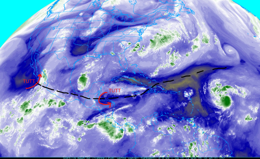
It’s hard to find the tropical upper tropospheric troughs (TUTTs) over Mexico this morning, but from the TUTT low eastward the TUTT axis is well defined. An anticyclone located with Tropical Storm Erin is east of the Leeward Islands.
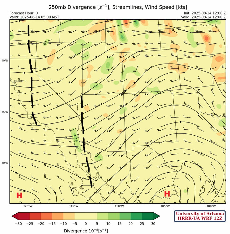
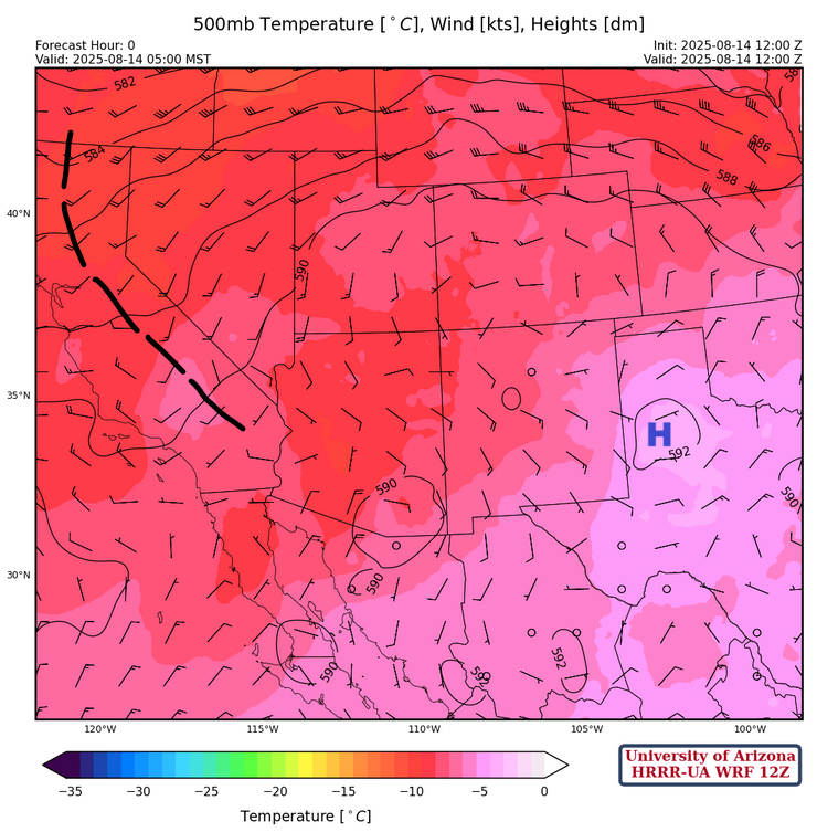
At 250mb, a high pressure ridge is in central Mexico and another ridge is west of the spur of the Baja. A trough has developed between the three ridges and is along the Arizona/New Mexico border. Another trough is over California. Wind flow is west to southwest across the region at 15 to 20 knots.
A high pressure ridge is over west Texas at 500mb, with the ridge axis extending west into southern Arizona. The flow is controlled by the MCV over southern Arizona and New Mexico. The trough in California is resulting in southwest winds across the Great Basin.
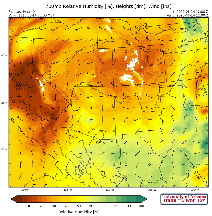
Not that much has changed from yesterday at 700mb except higher moisture values associated with the showers and thunderstorm activity in central and northern Arizona associated with the MCV.
Today
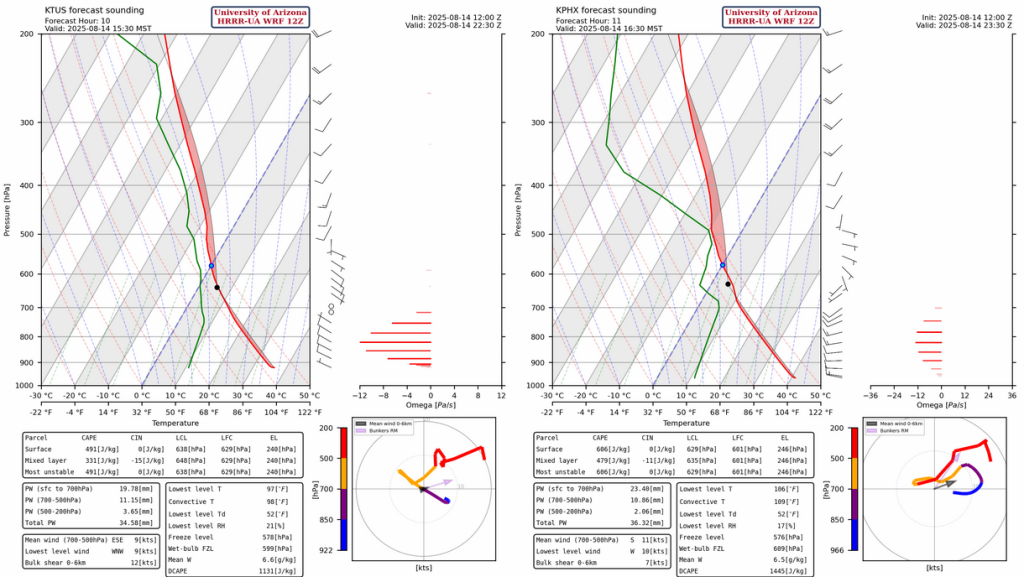
Forecast soundings for Tucson (left) and Phoenix (right) support thunderstorm activity this afternoon, but given the cloud cover can we get to the convective temperature? Tucson it’s 98°F and Phoenix it’s 109°F.
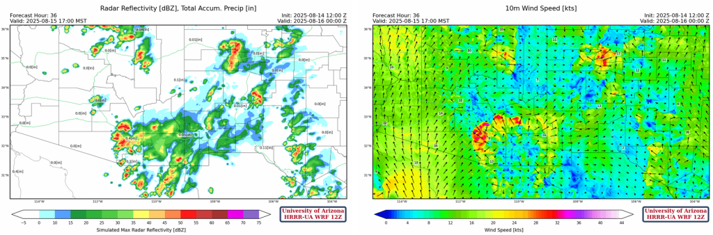
The HRRR-UA WRF forecast radar reflectivity for this afternoon shows a hole from Phoenix to Tucson suggesting the cloud cover will inhibit convection.

But tonight a synoptic surge develops and moisture is pushed into the Phoenix metro area with thunderstorm developing in that area around 9 to 10 pm and spreading southeast into Pinal county overnight.
Tomorrow
With moisture in place from the surge, thunderstorms will fire in southeast Arizona and Tucson and move northwest towards Casa Grande and Phoenix on Friday. Convective initiation starting in the mid-afternoon between 3-5pm and a significant precipitation event for Tucson is forecast.
Outlook
On Saturday, southeast Arizona northeast to the White mountains and east into New Mexico will remain active as indicated by the radar reflectivity forecast at 5:30pm (left). In Phoenix, the effect of the storms over the next two days will limit the thunderstorm threat during the day, but by evening around 8pm thunderstorms will develop over western Pinal County (right).

The precipitation accumulation forecasts for the next three days show significant rainfall in the region, though the exact location and timing are difficult to estimate. Tucson (0.5″-1.0″) is predicited to get more than Phoenix (0.01-0.5″) across the next 72 hours, meaning the potential for flooding is there.

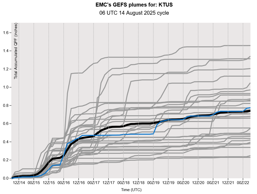
The GEFS plume forecasts show that the storms after Saturday will be much less intense than the next few days as dry air moves into the region.
Discussion written by Pat Holbrook and Patrick Bunn