
Yesterday’s Weather
Thunderstorms fired in New Mexico and were enhanced by divergence from the tropical upper tropospheric trough (TUTT) to the south of New Mexico yesterday. The storms caused hail and wind gusts to 70 mph. Arizona was dry with the only significant clouds were cirrus moving into southwest Arizona ahead of the trough off the west coast. Smoke from the Grand Canyon north rim fires was spreading northeast into southern Utah.
Analysis
The TUTT south of New Mexico lifted to the northeast and is no longer an influential factor. Another TUTT is in the central Gulf of Mexico moving west. Some enhanced storms are associated with it off the coast of Texas.

At 250mb the upper-level low has moved onshore near San Francisco this morning with strong westerlies over Arizona becoming southerly in eastern New Mexico along a shear line left behind by the TUTT.

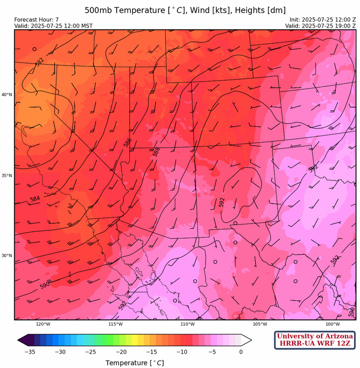
The ridge axis at 500mb has not changed much since yesterday, with the center off the Virginia/North Carolina coast and the ridge axis extending west to Tennessee and southwest into south central Texas. The maritime polar trough on the west coast is dominating the circulation across Arizona and bringing in very dry air with dewpoint temperatures as low as –41°C at Phoenix this morning and –48°C at Las Vegas.
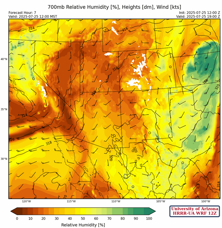
At 700mb, dry air is over the region because of the west coast trough’s circulation. Note the northeast winds along the Texas coast reflecting around the disturbance in the northwest Gulf of Mexico. Although dry for now, moisture will increase in this area and move westward into New Mexico by Sunday.
Today
The satellite picture below is from 10am this morning, almost completely cloud free. This is a rare sight for this time of year. The smoke from the Grand Canyon fires will reappear again this afternoon.

Only an isolated storm is expected in New Mexico today, otherwise hot and dry weather is forecast for the region.
Tomorrow
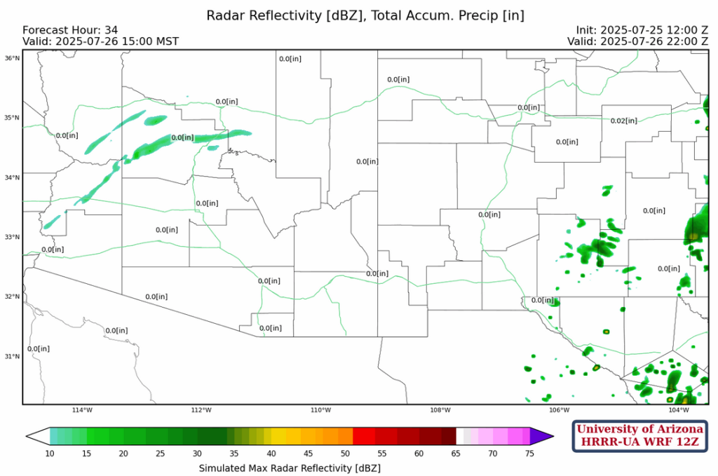
Similar forecast as today with even weaker storms in New Mexico. The radar reflectivity in northwest Arizona is from mid-level clouds producing virga. The storms in New Mexico are probably along the leading edge of the moisture that will be moving in from the Gulf of Mexico.
Outlook
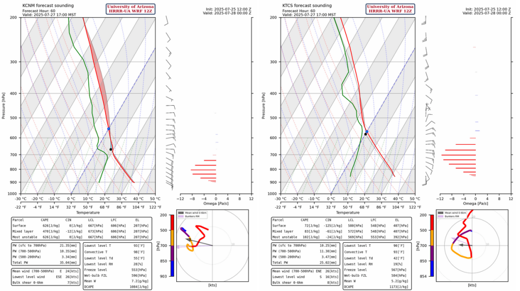
The soundings are from Carlsbad and Truth or Consequences for Sunday afternoon at 5pm and the low-level easterly flow is bringing in enough moisture for thunderstorms as shown in the radar below.
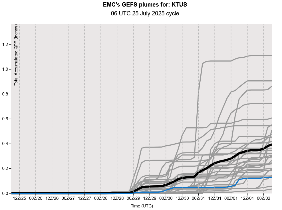
GEFS plume forecasts show the monsoon returning next week. The moisture from the Gulf of Mexico will be in the eastern part of the state Monday but probably only enough for mountain thunderstorms as the low valleys should remain dry.
We’re not going to post a discussion tomorrow given the lack of potential in the current forecast. We’ll resume discussions on Sunday and likely host a briefing on Monday.
Discussion written by Pat Holbrook and Patrick Bunn