
Live Weather Briefing
Find the recording of the June 30th 2025 weather briefing here.
The first 5-10 minutes is missing as I forgot to press record. I’ll remember next time.
Yesterday’s Weather
The strongest thunderstorms yesterday were along a line from northeast New Mexico southwest to far southeast Arizona. The storm motion was to the southwest in New Mexico with microburst winds near 45 mph. Storms tried to develop along the Mogollon rim and the White mountains, but vertical development was limited and only virga or a few drops fell to the ground. Temperatures continued to warm at the surface, reaching 110°F in the Arizona deserts.
Analysis
Tropical storm Barry has moved into Mexico south of Brownsville and has weakened to a remnant low but not before spreading a large amount of moisture into Mexico. Tropical Storm Flossie is still moving parallel to the Mexican coast and should become a Hurricane later today.

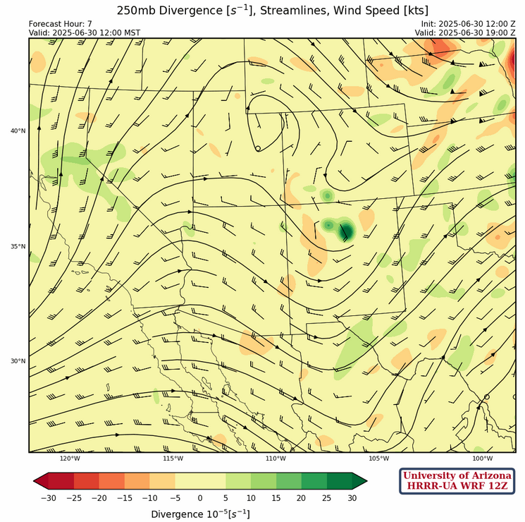
At 250mb, like yesterday, winds remain westerly at 20 to 30 knots with a ridge axis in western Arizona and a trough along the Arizona/New Mexico border. TUTT #1 is dissipating over central Texas, TUTT #2 has dissipated, and TUTT #3 is off the coast of Florida. Anticyclonic flow is centered over the Baja peninsula.
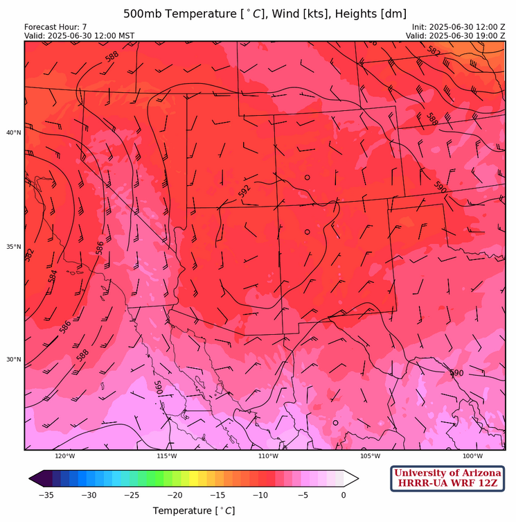
At 500mb, there is a ridge over northeast Arizona and anticyclonic (clockwise) flow over the four corners region. The trough between the Arizona ridge and the ridge in eastern Texas has moved eastward and now extends from central Kansas to the Big Bend in Texas. Temperatures are also rather cold with an area of –10C in Arizona.
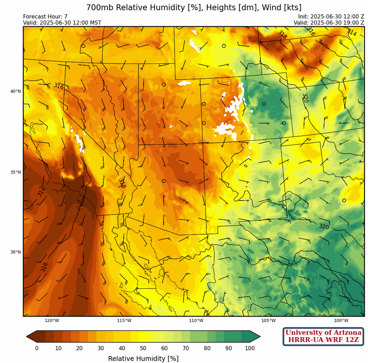
At 700mb, the flow is turning more easterly with mid-level temperatures above 15C in Arizona and western New Mexico cooling to 8C in west Texas. The winds are pushing in moisture from Texas into southern New Mexico and northern Mexico with dew point temperatures higher than 2C . This moisture field extends down to 850 mb with El Paso and Chihuahua dew points near 12C.
Today
Storms will develop in New Mexico in about the same location as yesterday as well the White mountains and possibly the Mogollon rim. The storms will move southward but the main effect will be strong outflow winds as storms in the move off the mountains. The cold temperatures aloft combined with the inverted-v sounding is the reason for the microbursts. Little surface rain will occur in the valleys.

The outflow will move into the low deserts by Tuscon and Phoenix for possibly the first haboob of the season. Simulated radar reflectivity and 10 meter wind speed shown below are from 12:30pm, and the outflows and possible haboob at 7pm.
Tomorrow
The focus of the convection shifts more to the Mogollon rim with storms moving southwest over the low deserts with strong gusty winds. The low desert still does not have deep moisture so the storms will weaken as they move off the mountains, so rainfall accumulations will be low to trace amounts in the lower elevations. The strong winds in the Phoenix metro and further west will be greater than 55 mph in some locations.
Outlook
A gulf surge will bring large amounts of low-level moisture into Arizona. The upper low off the west coast will affect the timing and location of the precipitation as the storms in the early afternoon will develop in the area of deepest moisture. Typically, these storms would move southwest, but the flow from the upper low that will be moving through the region will force storm motion to the northeast. Another haboob for Phoenix is possible. Notice forecast precipitation for Phoenix and Tucson is less than a tenth over these three days.

Discussion written by Pat Holbrook