
Yesterday’s Weather
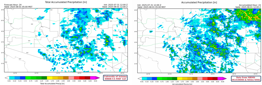
A little more rain in the buckets than expected as evening thunderstorms popped up along outflow boundaries in Queen Creek at 7pm (19:00MST) and northwest Tucson at 9pm (21:00MST). Model forecasts did a reasonable job, accounting for uncertainty in space and time; the locations of convective initiation was good.
Here are the rainfall totals for Tucson (left) and Phoenix (right).
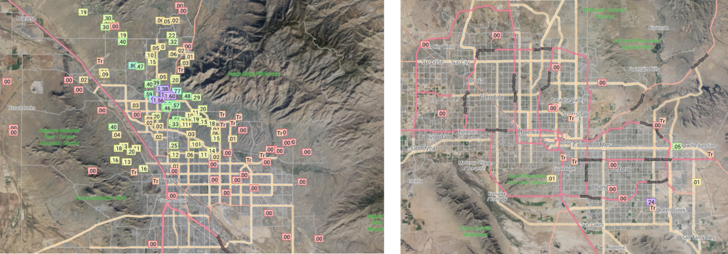
Additional rain fell in Santa Cruz and most of Cochise County. Almost an inch of rain in Safford in Graham County.
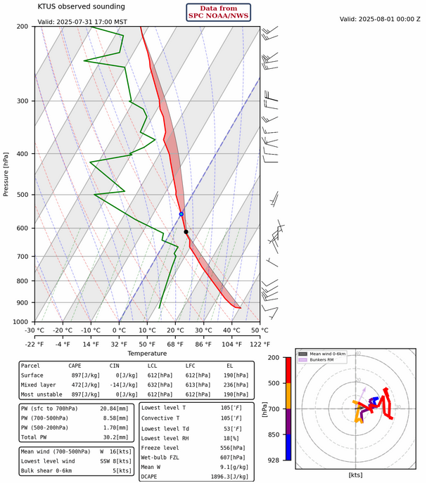
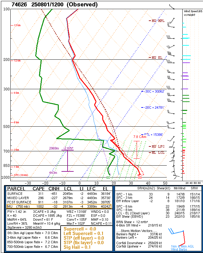
The observed sounding for Tucson at 5pm yesterday (shown below) has mixed layer convective available potential energy (CAPE) at 472 [J/kg] (about double from Wednesday) while the most-unstable (MU) and surface-based CAPE are near 900. This is an artifact of the super-adiabatic lapse rate from the first few data points near the ground which is why using mixed layer CAPE is preferred.
Analysis
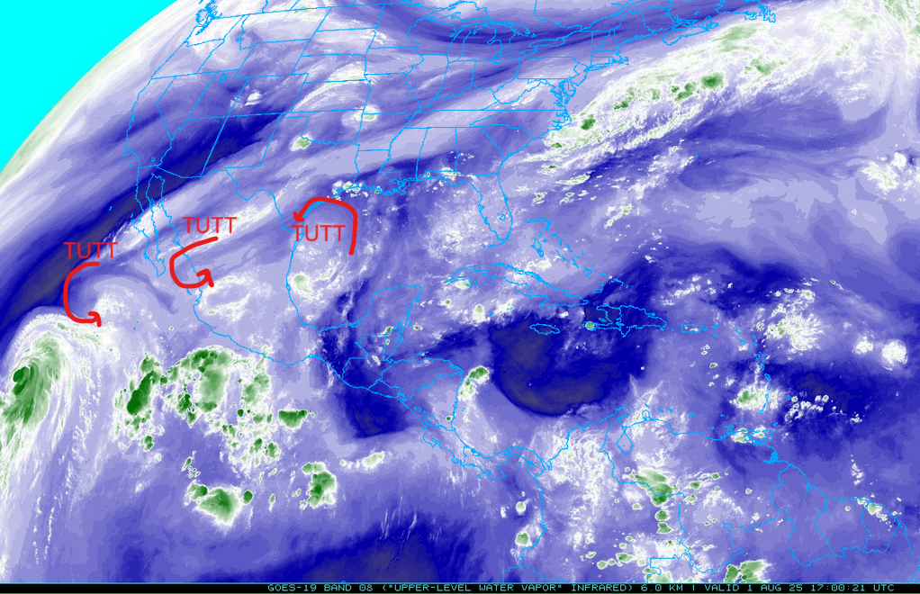
A tropical upper tropospheric trough (TUTT) is southwest of the Baja Peninsula aiding with the outflow of tropical storm Gil. Another TUTT low is over central Mexico while a third one is in the Gulf of Mexico southeast of Galveston.
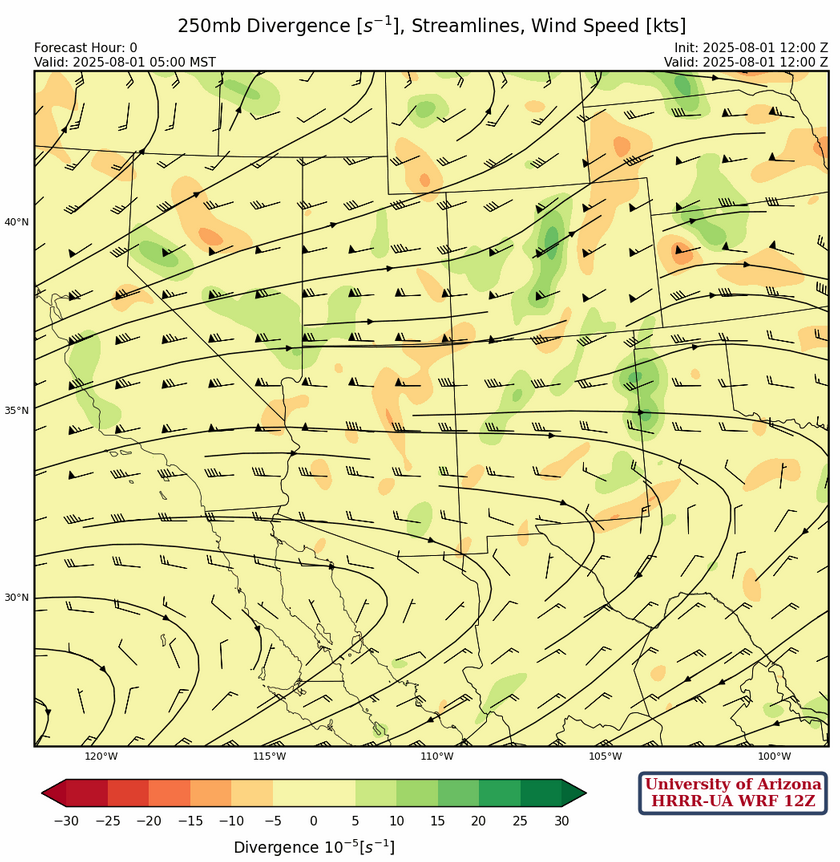
At 250mb, the TUTT over central Mexico will move slowly west and reach the Pacific coast in a few days. A high pressure ridge about 10 degrees west of the spur of Baja has an axis that extends just south of the Arizona/New Mexico then east to Midland, Texas. To the north is a strong jet reaching from central California to Kansas. Arizona and New Mexico wind speeds range from 15 to 20 knots in the south to 50 knots and higher to the north.
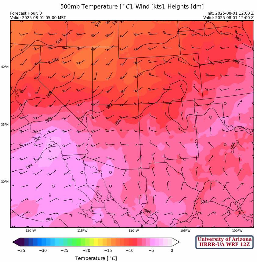
Westerly winds continue over the northern part of the region at 500mb, while in the south winds are generally less than 5 knots. A chunk of energy seems to have kicked out of the west coast trough moving into eastern Idaho and Utah. The 500mb ridge center is over southern Arizona and is forecast to move to the El Paso area in a few days.
At 700mb, not much change from yesterday but over the next few days we dry out a lot over most of the region.
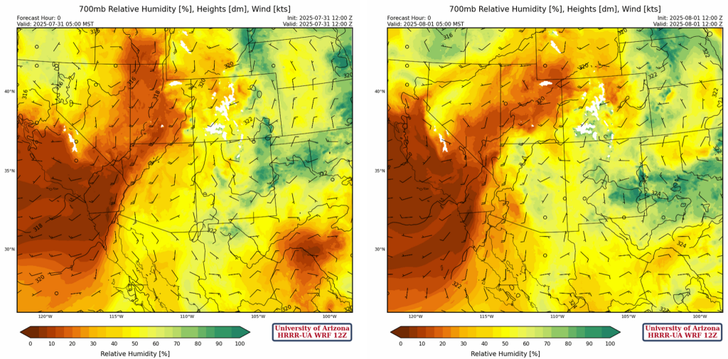
Note the 8°C dewpoint temperature on Phoenix sounding at 700mb is not representative of the atmosphere for today as it will get mixed out by the afternoon. The most unstable CAPE value that indicates a little over 1000 [J/kg], when it should be about 300 [J/kg].
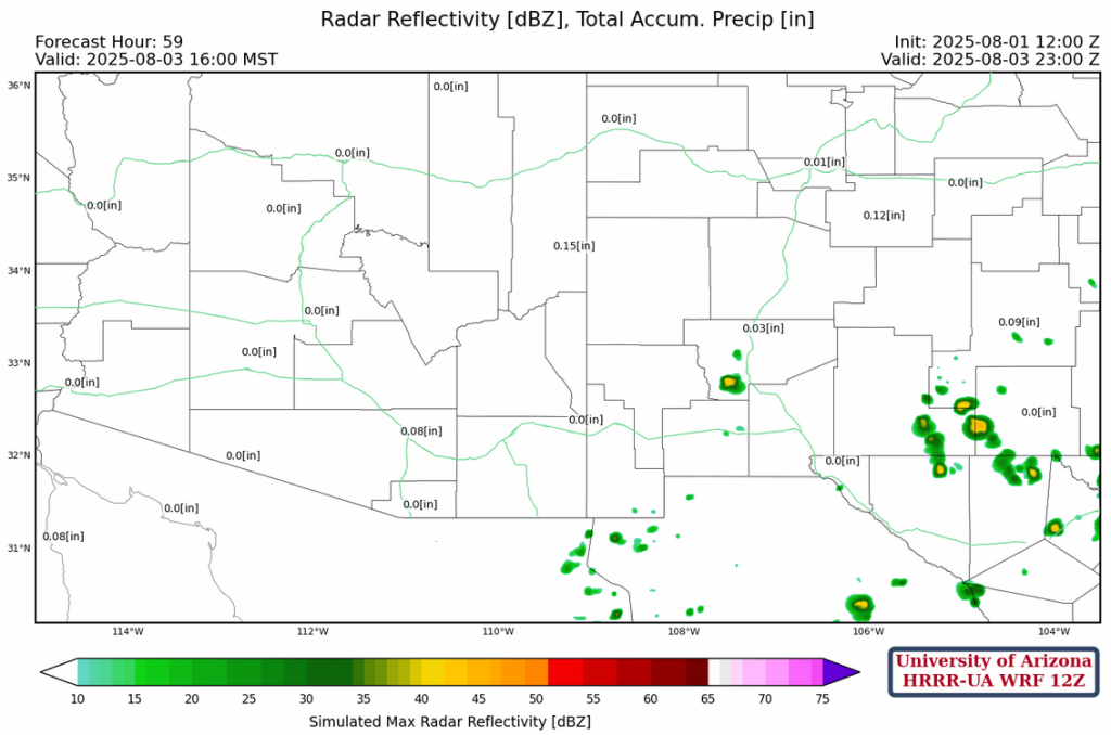
Today
Although the CAPE value looks like yesterday, the lifiting condenstaion level (LCL) is higher, suggesting the model forecast radar for more isolated storms than yesterday is a good forecast. Microbursts with storms should not exceed 30 knots. The thunderstorms will not move much, and like yesterday some localized heavy rain is possible.

Tomorrow
Less activity is expected on Saturday, but generally in the same area. Drier air, combined with subsidence, results in only isolated thunderstorms

Outlook
For Sunday, the 700mb shot of dry air moves over most of the region and would only expect isolated thunderstorms mainly in far southern New Mexico. Arizona may be rain free.
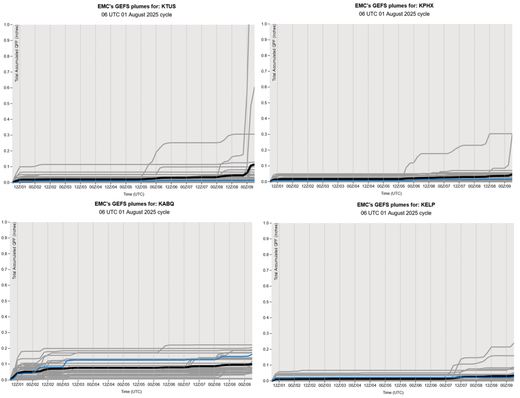
The GEFS plumes show essentially nothing for the next week or so, but activity in northern Mexico could give us an increase of moisture next week.
Discussion written by Pat Holbrook