
Yesterday’s Weather
Yesterday was a mostly quiet day in Arizona with only isolated storms mainly in the mountains over the eastern third of the state. New Mexico had mainly mountain storms in most of the state, but a back door surface cold front was a focal point for thunderstorms in the eastern part of the state. A back door cold front is a weather pattern that affects eastern New Mexico, where a low pressure systems pushes a cold front from the north-northeast down into the eastern part of the state where elevation decreases into west Texas. The thunderstorms associated with this cold front moved east into Texas and overnight formed a Mesoscale Convective System (MCS). Strong wind gusts were observed with these storms of over 50 mph.
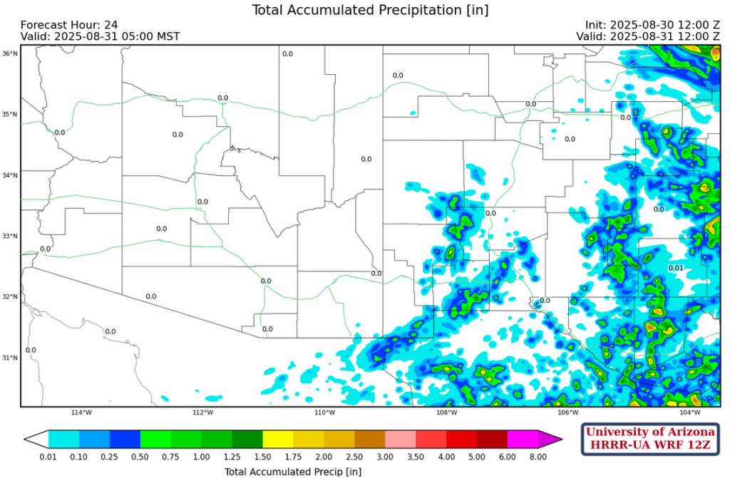
Yesterday’s HRRR-UA WRF 12Z 24-hour accumulated precipitation forecast is on the left and equivalent observations from MRMS on the right. Most of the precipitation in the northern half of Arizona and northwest New Mexico fell between 5am and 10am yesterday and was associated with the storms that occurred Thursday night and Friday morning. Very little new precipitation fell in these areas Friday afternoon through to this morning. As for the rest of the region, the forecast versus observed precipitation was in fair agreement.

Analysis
Dry air is moving into western and northern Arizona and northern New Mexico. Moisture has increased in southern and southwest New Mexico, as shown by the observed surface dewpoint temperatures below.

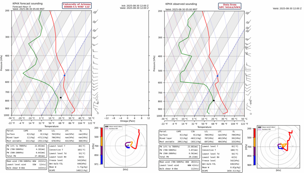
The observed sounding from Phoenix at 5am shows drying as precipitable water has fallen to 1.15 inches. The boundary layer has a cap (inversion) at 600mb. For surface convection to break this cap in the afternoon, the temperature would need to be above 102°F. Max temperature from the sounding is only 99°F. The HRRR-UA WRF 12Z initialization is similar, though the inversion is smoothed out at little in the model vertical levels and precipitable water is slightly less in the initialization, but within the bounds of measurement uncertainty.
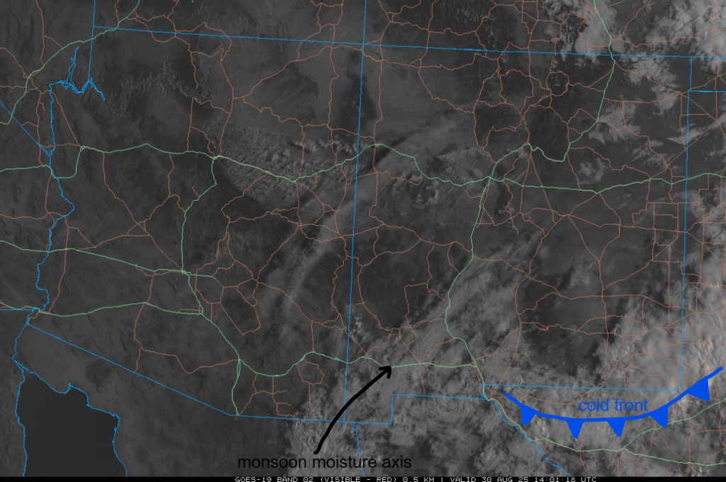
The cold front is a little hard to find on the visible satellite image, but it’s close to the southern side of the cloud shield on the border of New Mexico and Texas, as shown. Also, an axis of monsoon moisture is shown. Tomorrow easterly low-level winds set up and moisture in this axis area will move into Arizona.
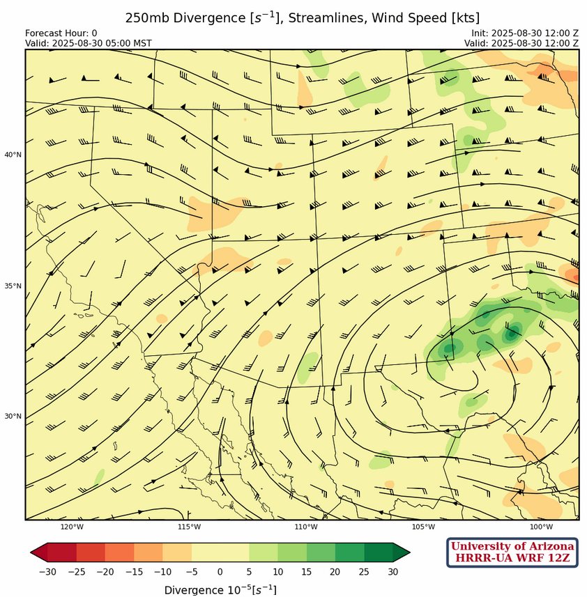
At 250mb, the high-pressure ridge has moved east and is near Midland, Texas. The ridge is being pushed east as the trough in Wyoming moves eastward.
Westerly winds of 20 to 30 knots are across northern half of Arizona and New Mexico at 500mb. Weaker winds are near the two centers of the high-pressure ridge; one center over Texas and the other south of Nogales. Warm air aloft, around -4°C, is over southern Arizona extending into north central New Mexico (pink to white colors on the graphic below). Such warm air will inhibit convective parcels that reach this vertical level.

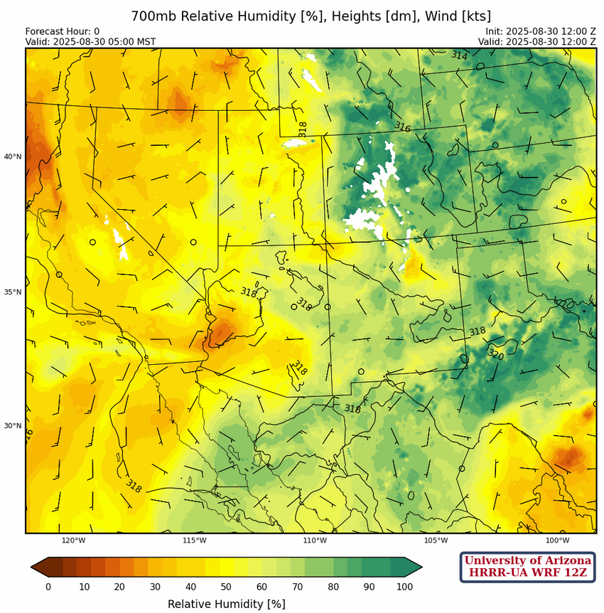
At 700mb, moisture is from west Texas into southeast Arizona this morning and will begin moving westward later today and into southeast Arizona tomorrow. This will help increase thunderstorms in Arizona tomorrow and Monday, but after significant drying occurs for the the remainder of the week.
Today
The HRRR-UA WRF 12Z forecast has storms near the international border in Cochise County, although storms could be as far north as the Chiricahua mountains in the east and Tombstone/Sierra Vista in the western part of the county.
Some isolated thunderstorms are forecast for eastern New Mexico, with scattered areas of greater than 0.5″ precipitation totals in parts of the region.
Tomorrow
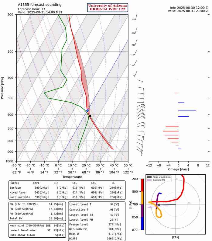
Moisture moves into southeast Arizona from the east. An increase Covective Available Potential Energy (CAPE) is shown in the forecast sounding from Nogales at 2pm, indicating that storms will form in the early afternoon.
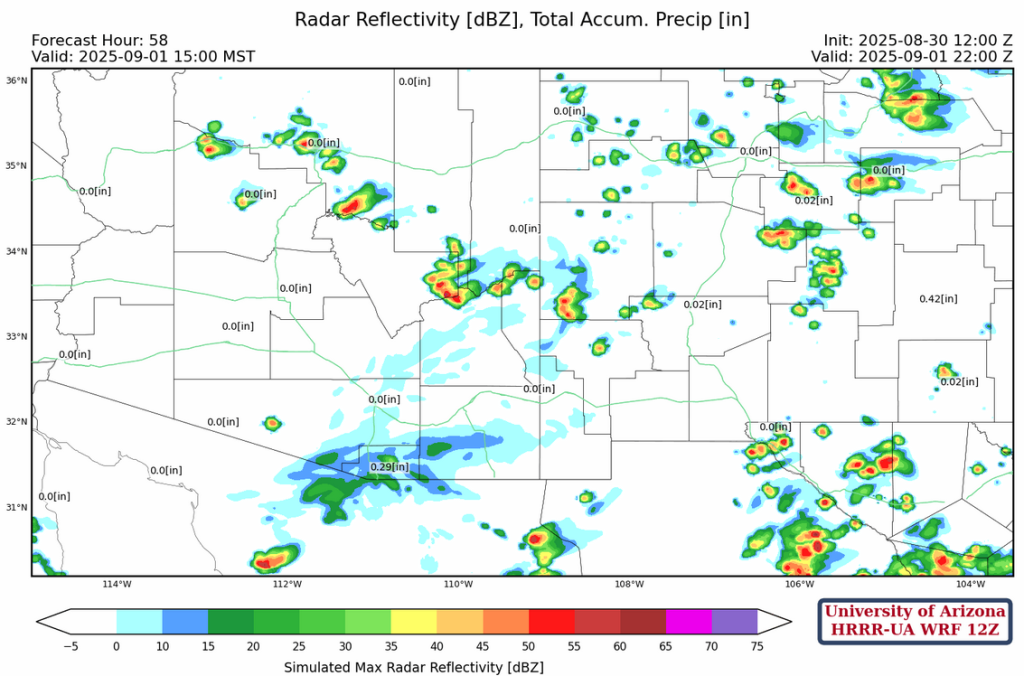
The HRRR-UA WRF 12Z radar reflectivity forecasts thunderstorms forming in Nogales and eastern Pima County in the afternoon, but they don’t quite move into Tucson. Later in the afternoon, storms also form in Graham County and western New Mexico, and sweep south-southwest to the deserts edge by evening. The outflows from these are strong enough to overcome the Convective Inhibition (CIN) and as a result storms then begin to form over the Catalina and Rincon mountains and moving into Tucson.
Outlook
The strong outflows from Sunday night’s storms will reduce CAPE in the lower deserts, so there will be fewer storms on Monday. Also, low-level easterly flow will bring dry air into southeast Arizona, and a Mesoscale Convective Vortex (MCV) will form south of Nogales spreading clouds and light showers over southern Arizona. Some isolated storms do form in the White Mountains northwest to Flagstaff.
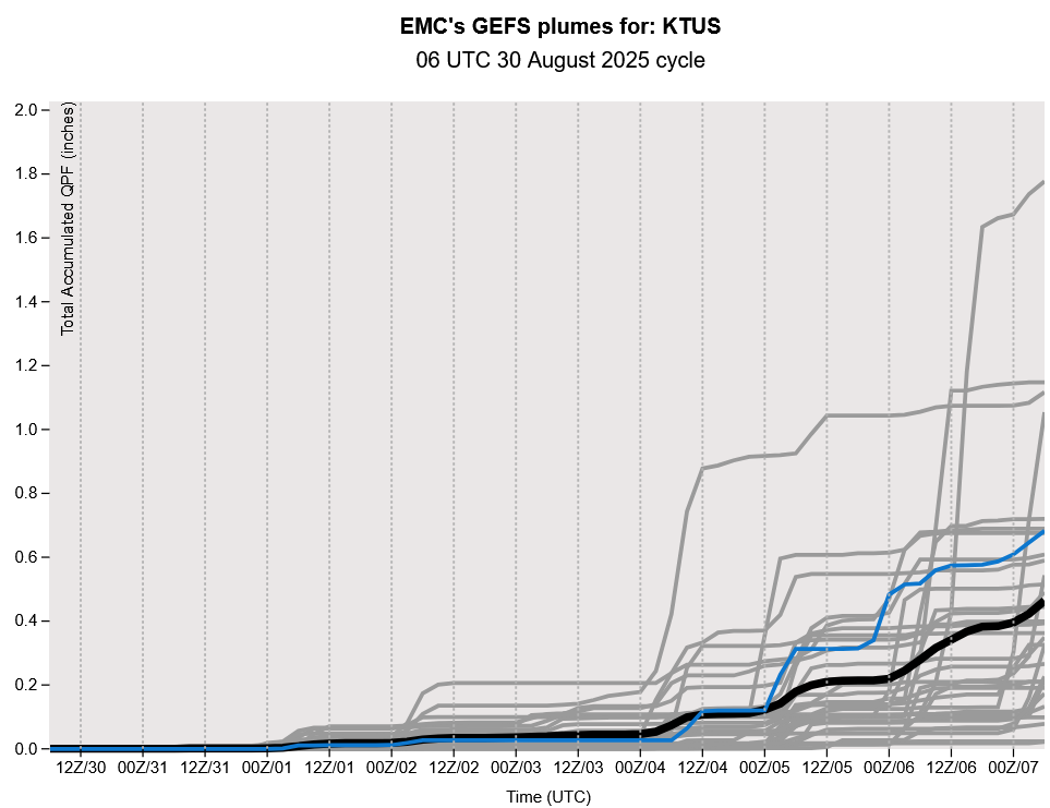
The GEFS plume forecast still estimates minimal precipitation next week with storms affecting the area next weekend as a Tropical Storm moves close to the southern tip of Baja California.
Discussion written by Pat Holbrook and Patrick Bunn