
Yesterday’s Weather
Most of the acivity during the day yesterday was in the northern half of Arizona and New Mexico. Overnight it turned out to be more interesting as thunderstorms developed in Graham and Pima counties around 10pm before finally dissipating around 3am. These storms can be traced back to the thunderstorms that were in northwest Arizona yesterday morning before dissipating in the Phoenix area. Another area of thunderstorms that developed in Nevada last night is now in northwest Arizona moving southeast and slowly dissipating. Upper-level disturbances created these storms and although the storms are dissipating now heating during the day will regenerate the activity this afternoon and evening.
Shown below are the 24-hour accumulated precipitation forecast from yesterday’s HRRR-UA WRF 12Z (left) and equivalent observations from the MRMS system (right). The forecast got most areas of precipitation correct except for the overnight storms around Tucson. The stratiform precipitation associated with Lorena was farther south in Mexico than forecast. The precipitation coverage in New Mexico is more related to anvils blowing off storms and probably did not have the areal coverage or intensity shown in the accumulated precipitation map.

Analysis
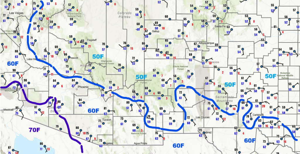
The surface dewpoint observations from this morning show there’s not been much of a change in surface moisture since yesterday. Between Lake Havasu City and Phoenix, a thunderstorm just dropped over a half inch of rain at the Smith Peak RAWS site this morning and the reason is the “dynamic” part of the thermodynamic equation is present. Adiabitc lift ahead of storms coming from the northeast aided the vertical push from the terrain to cause a thunderstorm to drop that amount over Smith Peak.
The observed sounding from Phoenix at 5am is similar to yesterday except that it is drier above the boundary layer and mixing during the day will decrease the rather high Convective Available Potential Energy (CAPE) values. Note that the winds are weak in the boundary layer. Comparing the observations to the forecast initialization of the HRRR-UA WRF 12Z, there is more total precipitable water in the observed sounding (1.67” versus 1.56”), but otherwise a well initialized forecast.

The GOES-19 low-level water vapor satellite picture below illustrates the dry air shown on the soundings across the state. Also shown are the storms over northwest Arizona.

Scattered low-level clouds across the state are not easy to see on the low-level water vapor image, so the visible satellite picture from 7:30am this morning is also shown below. Note the dense low-level clouds across eastern New Mexico.

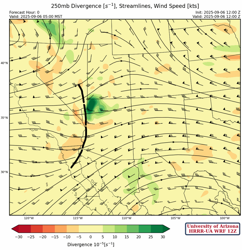
At 250mb, a short-wave trough over northwest Arizona this morning will move east across the region during the day and will be a focal point for thunderstorm activity today. The westerly winds will remain across the state through the week and will help strip out the low-level moisture.
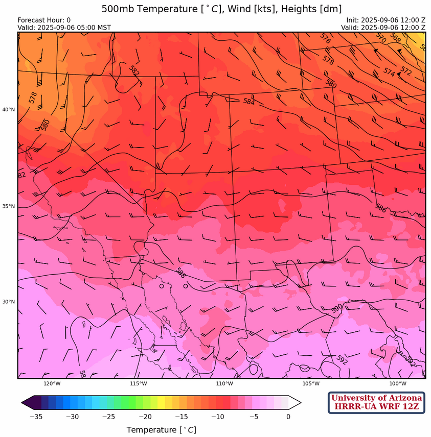
Winds are from the west at 10 to 15 knots across the region at 500mb. Temperatures are near –7°C across central and southern Arizona and New Mexico cooling to –9°C in northern Arizona. Since the flow is westerly, no significant change in temperatures is expected today.
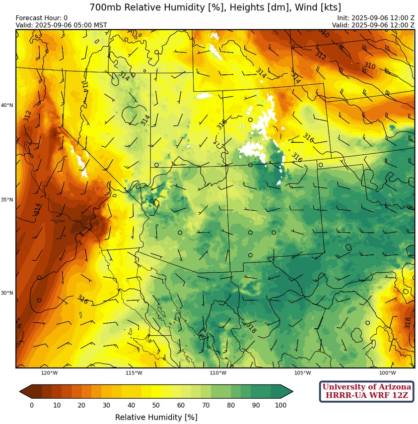
At 700mb, there is still plenty of moisture with dewpoint temperatures this morning still around 4°C across the region, but they should drop a few degrees due to mixing in the boundary layer today.
Today
The forecast soundings for Phoenix (left) and Tucson (right) at 5:30pm look similar again. There is a slight inversion at 600mb, but by afternoon storms should be able to develop on the mountains. Thermal winds at both locations are near zero, so this may be a situation where there is training of storms on the mountains (one after another over a similar spot). The valleys will need outflows to get storms going because the low-level winds are from the west, meaning up-slope for Phoenix and Tucson metro areas.
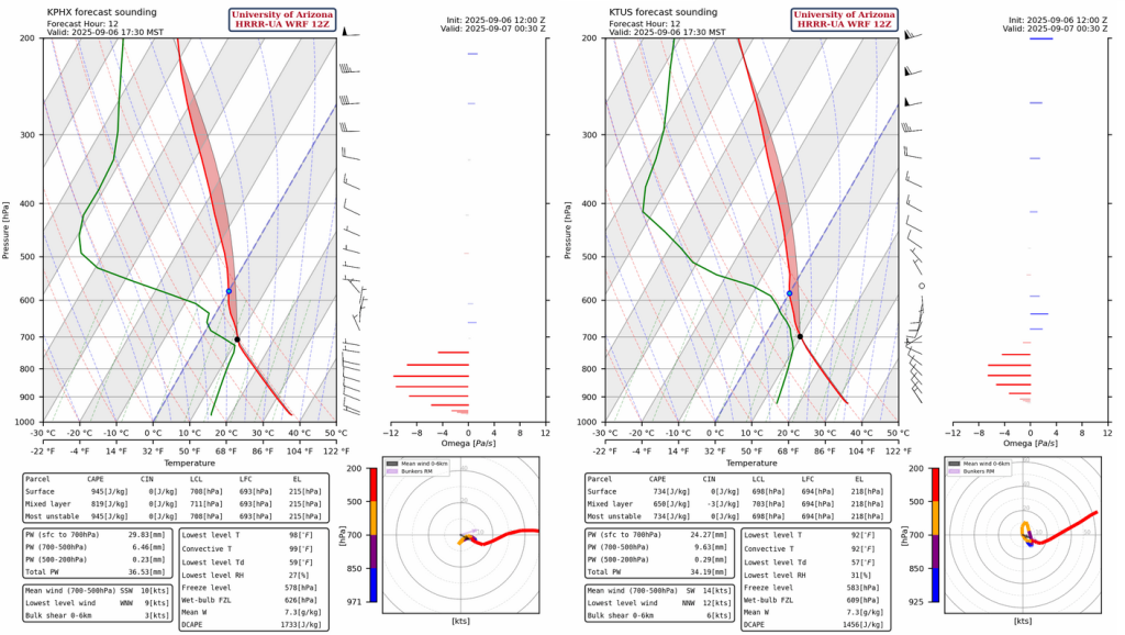
Finally, as typical for this monsoon season, Tucson is too close to call with storms close by but maybe not close enough. The weak mid-level winds could inhibit storm propogation off the mountains. Phoenix appears to be out of luck as any storms the do form in the vicinity, will remain in the mountains.
Total precipitation accumulation through tomorrow morning shows precipitation is mainly on and near the mountains.

Tomorrow
Tomorrow’s forcast shows the monsoon season is winding down. Nogales will probably be the last rain bucket to get monsoon precipitation.

Outlook
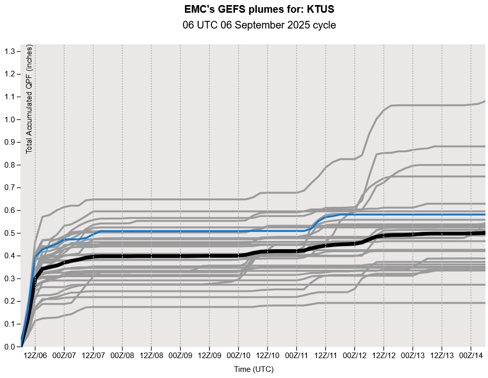
The GEFS plume forecast shows our last shot at precipitation is today. Another system is affecting the state next weekend, but it is not monsoonal. The ECMWF long-range forecast only shows about a tenth of an inch of rain from this system. Through the end of September, the monsoon moisture will remain close to Arizona and any low pressure system in the westerlies can tap this to create thunderstorms.
Discussion written by Pat Holbrook and Patrick Bunn