
Yesterday’s Weather
The visible satellite image loop with GOES lightning flashes overlaid shows where the more significant thunderstorms were yesterday afternoon. Mostly from Nogales north to Tucson, San Manuel, and Oracle.
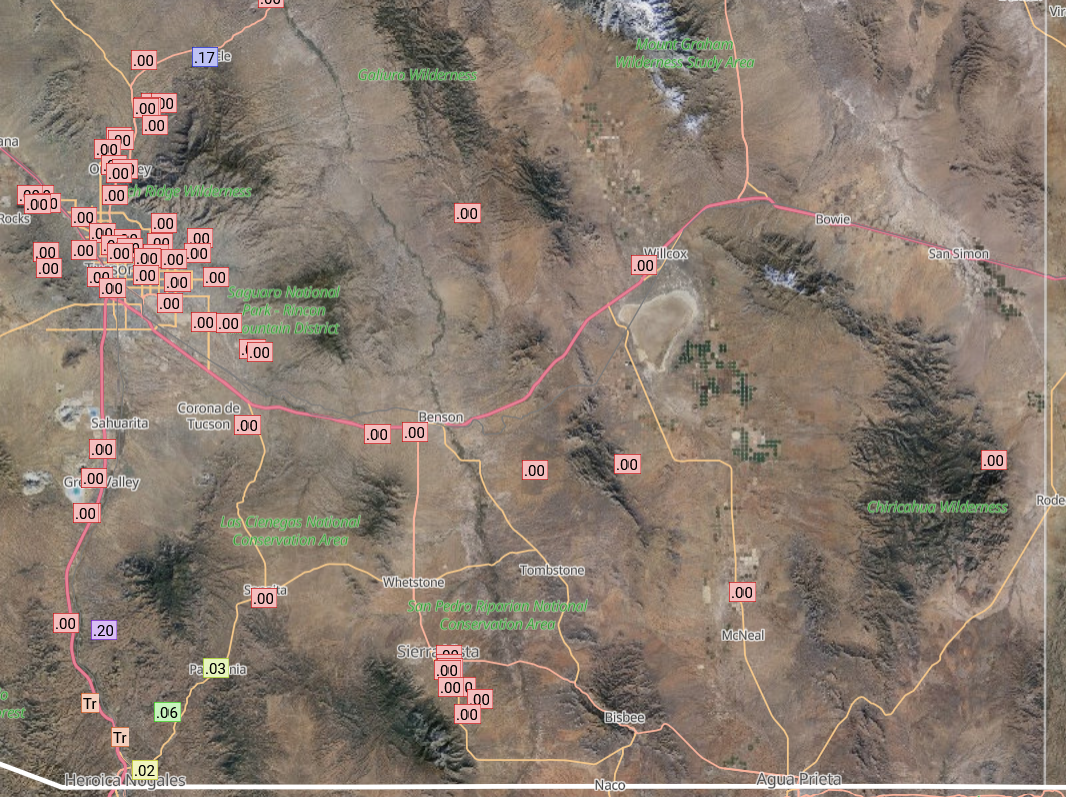
The Rainlog data shows that only a few stations received rainfall and observing the storms yesterday the heavier rain was with some training that was occurring. The storms in northern Arizona and western New Mexico had only a few lightning strikes and just as little rain.
Analysis
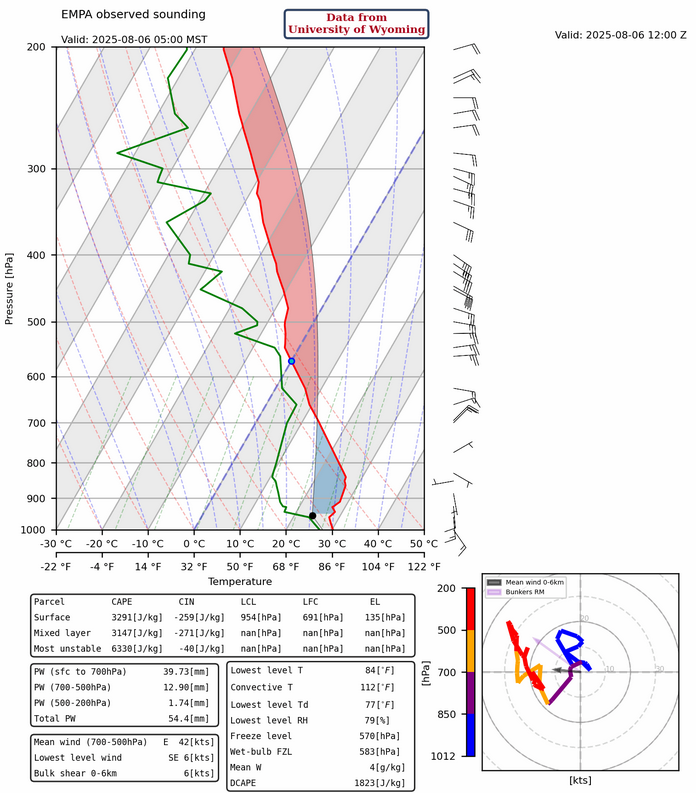
Checking the soundings in Gulf of California, there aren’t any signs of a gulf surge…yet. The Empalme (Guaymas) sounding below has some increase in low level moisture, but was probably due to thunderstorm outflow. A gulf surge would have stronger winds in the layer below the 800mb inversion.
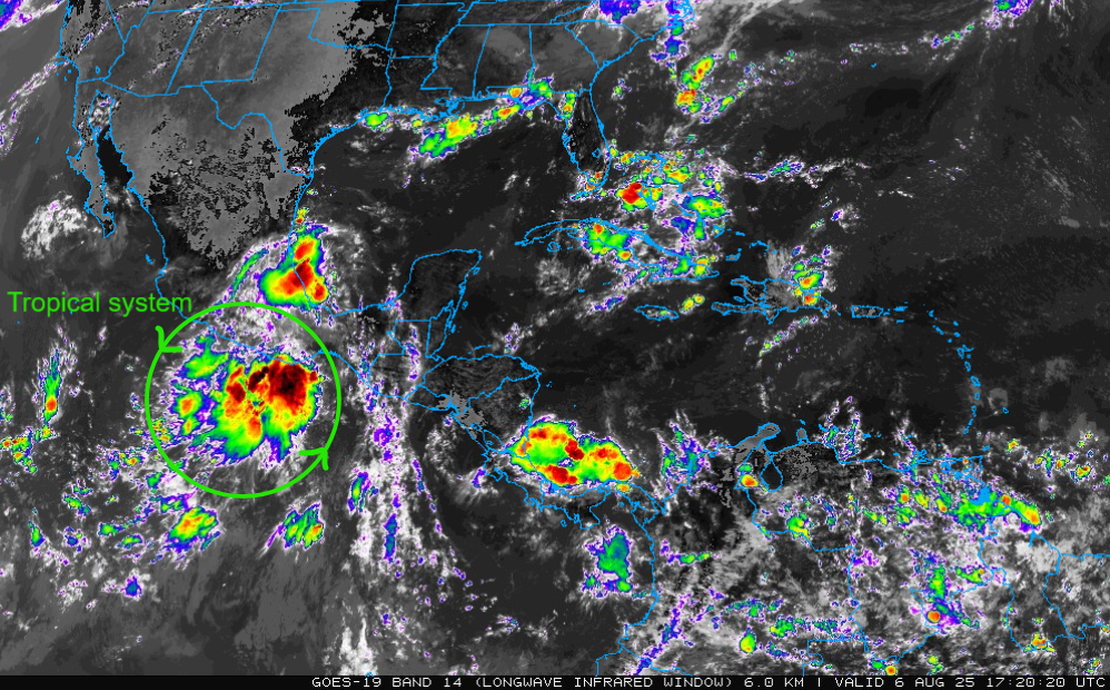
Generally, a gulf surge traveling up the Gulf of California would take about a day to get from La Paz/Mazatlan to Empalme (Guaymas), and then another day to move into southern Arizona. The system that will likely initiate a gulf surge is a developing tropical system southeast of Acapulco (see infrared satellite image below). It will take two days to get into a favorable position for a gulf surge, then two more days for the moisture to move into Arizona. So about August 10th for deep moisture to reach southern Arizona. This doesn’t mean thunderstorms will fire immediately from the surge, but the moisture will be in-place.
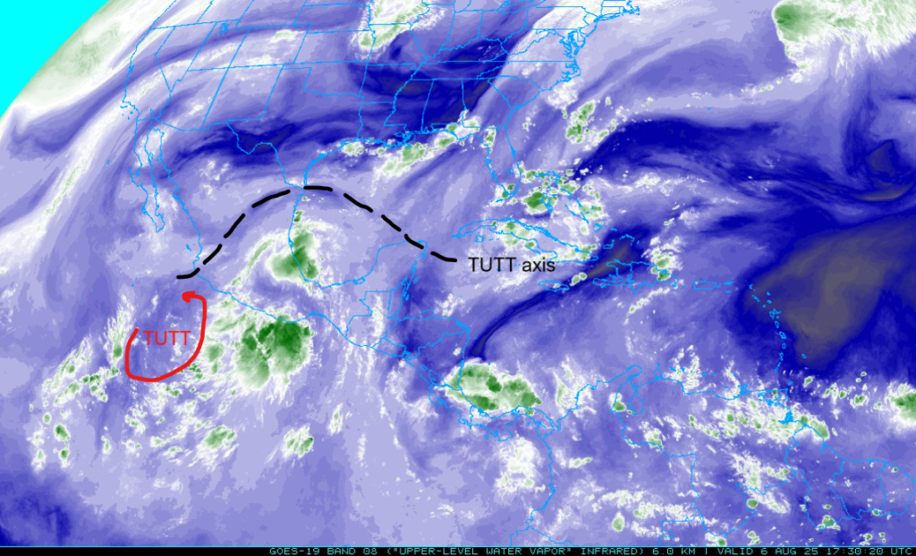
A tropical upper tropospheric trough (TUTT) extends from a low pressure system west of the developing tropical system, northeast to near Brownsville, then eastward across the Gulf of Mexico. Two areas of high pressure are associated with the tropical systems in that area. The two high pressure areas are likely to merge into one large anticyclone over the developing tropcial system within the next 24 hours as it strengthens.
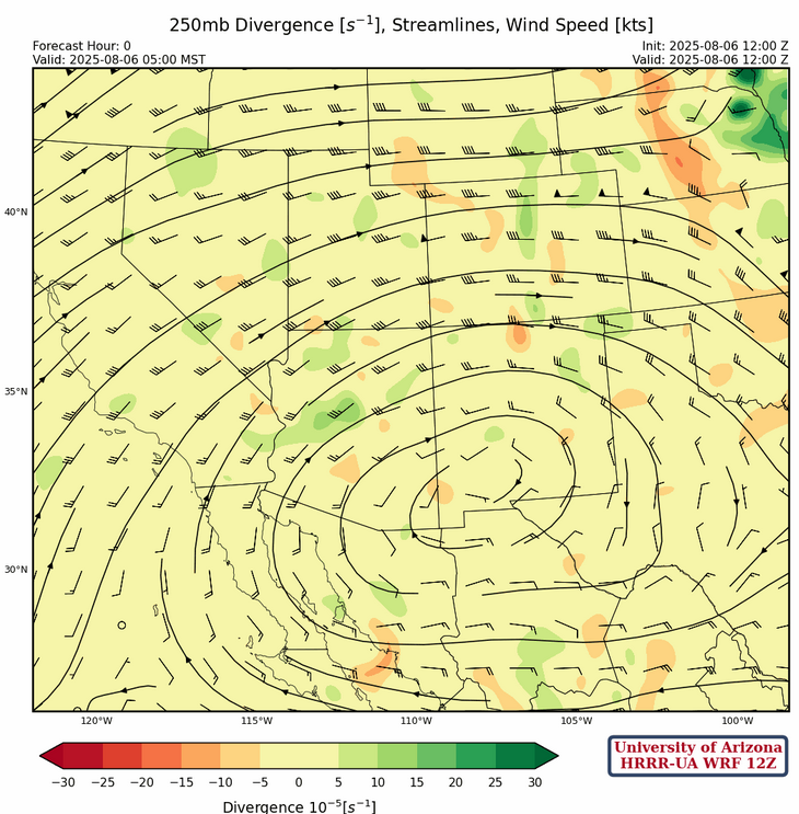
The sub-tropical high pressure ridge at 250mb is over southwest New Mexico along with the two troughs that are dominating the flow pattern; one off the Pacific coast and the other in the Mississippi valley. Westerly winds of 20 to 40 knots are across northern Arizona and New Mexico transitioning to easterly winds across northern Mexico.
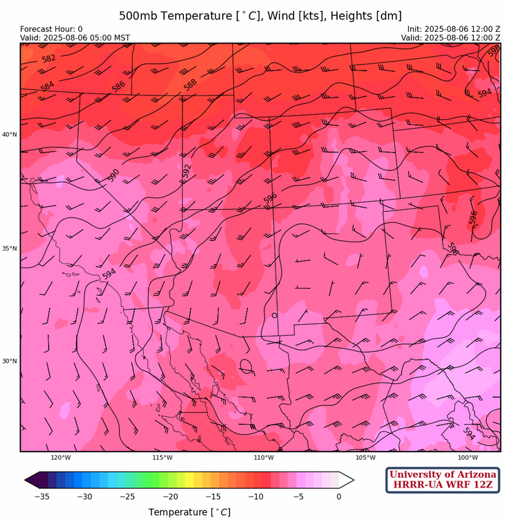
At 500mb, the high pressure ridge is centered over south-central New Mexico with a broad anticyclonic flow over the region. Winds are southerly at 10 to 25 knots over Arizona, and weaker and more northerly over New Mexico. A 30 knot wind maximum is across Mexico from Del Rio west to Guaymas.
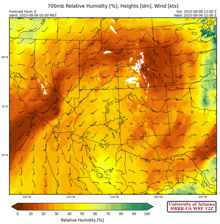
The high pressure ridge at 700mb is over southeast Arizona/southwest New Mexico. With southerly winds in Arizona and westerly winds in New Mexico north of the ridge. Overall moisture has improved some, but any storms forming today will be generally confined to mountains.
Today
In New Mexico, more mid-level moisture today will result in stronger storms. Southeast Arizona storms will be affected by the near record high heat and dry low levels, so they won’t move far away from the mountains.
Microbursts in the 35 mph range are possible.

Tomorrow
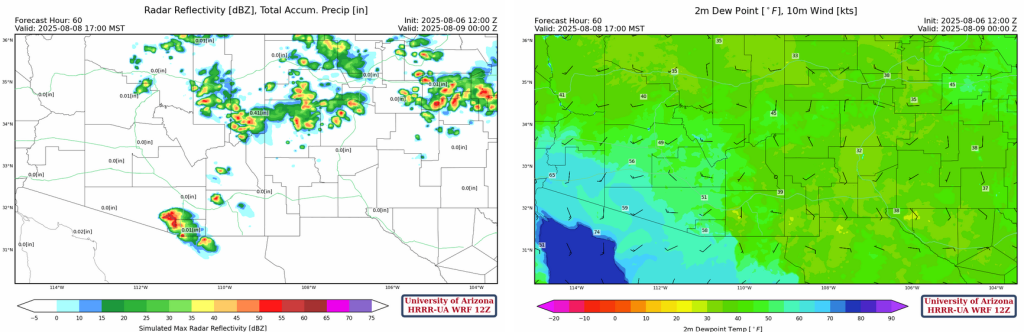
Tomorrow thunderstorms are generally forecast in the same location as today. The storms along the Colorado River are high-based remnants from storms near Nogales this afternoon that rotate around the high pressure. Note the beginning of the surge moisture trying to move into Arizona from the Gulf of California; this will wait there until Friday morning before filling the desert with moisture.
Outlook
The surge moisture is over the low deserts on Friday, but may not produce a significant outbreak of storms due to cooling of the boundary layer. The storms west of Tucson are along the boundary between the surge moisture and the dry air to the east; a reverse dry line like feature.
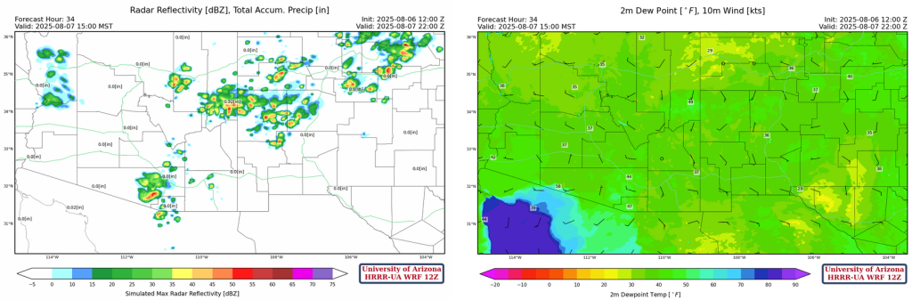
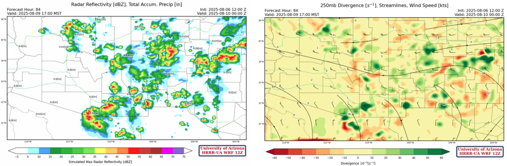
For Saturday, the radar reflectivity and 250mb divergence forecast below shows the most divergence where the strongest storms.
On Friday we will host a live weather forecast briefing to discuss the moisture surge and the associated thunderstorm activity. Look out for the meeting link on Friday morning.
Discussion written by Pat Holbrook and Patrick Bunn