
Yesterday’s Weather
An isolated series of thunderstorms in the mountains near Ruidoso, New Mexico produced flash flooding with 2″ of rain dropping on a burn scar. The resultant flash flood in Ruidoso killed three people. In Arizona, the thunderstorm activity was mostly suppressed except for some isolated storms in eastern Pinal and Pima counties as well as around Flagstaff. Rainfall amounts were slight above a half inch in the mountains, with lesser amounts as the storms tried to move into valley locations. The deserts started drying out without any storms in the Phoenix metro area. Here’s the observed precipitation accumulation from MRMS (rain-gauge-corrected satellite and radar estimated precip totals).

Mexico, once again, had a huge Mesoscale Convective System in the central mountains and it moved west to the Gulf of California from Los Mochis to Guaymas.
Analysis
There has been a general drying trend across Arizona and New Mexico. This should allow for temperatures to climb even more today to near record highs. We are wasting monsoon days with high dewpoints as the precipitation across Arizona is generally below normal and the monsoonal flow has not really started yet.
At 250mb, the high pressure has moved northward to the Phoenix area and the ridge axis extends east to a col in eastern Texas then to a ridge off the mid-Atlantic coast. The position of the high-pressure systems is getting closer to the climatological normal, the “four corners high”. A tropical upper tropospheric trough (TUTT) low seems to be forming southwest of Brownsville, and another is in the northern Carribean.

High pressure at 500mb is over eastern Arizona with a low pressure just off the coast of northwest California. Although the high pressure is in a better position than yesterday it is forecast to move west off the California coast, west of San Diego, in a few days as the low pressure moves from California to the midwest.
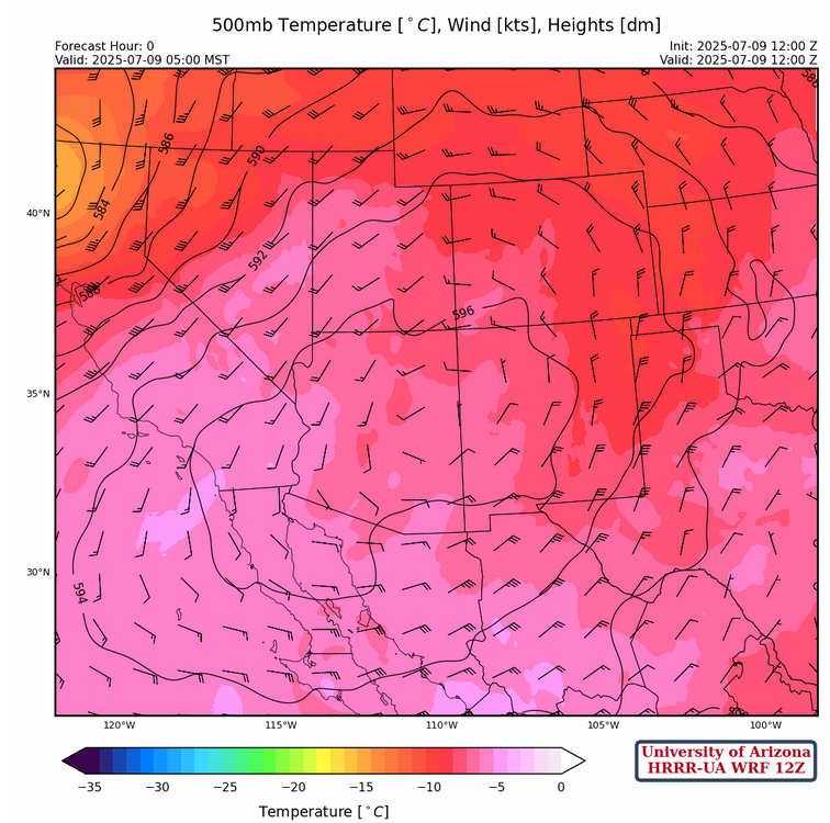
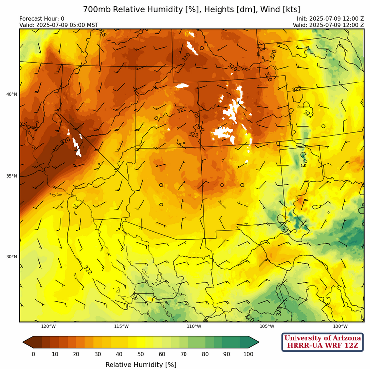
Winds aloft at 700mb are generally less than ten knots as a high-pressure ridge is over both states. Deeper easterly flow associated with the monsoon remains in-place over Mexico.
Today
New Mexico is expected to see a similar, but hopefully weaker, pattern of storms today as yesterday. A few storms could leave the mountains, and some precipitation from anvils drifting off the mountains is possible. Microbursts may be associated with stronger storms.
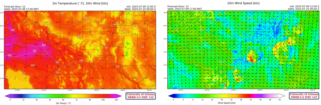
The drying trend across Arizona will lower any chances of rain. Storms are expected to form over the White Mountains, and over the mountains of Santa Cruz, eastern Pima, Graham, and Cochise counties. Today will be an extremely hot day in Arizona, with some regions experiencing temperatures around 110°F in Tucson, and 116°F in Phoenix.
Tomorrow
Dynamic lift from an oncoming low pressure trough will result in a strong line of storms over eastern New Mexico. Heavy precipitation and microbursts will be associated with some of these storms. Arizona is not expected to see many storms during the day, with the only chances being over the mountains of Cochise County.

A push of moisture from the Gulf of California is expected tomorrow night into Friday morning. The model forecasts do not have any storms firing off this moisture, which could be due to colder boundary layer temperatures and an overall downward atmospheric motion from a high-pressure pattern. We will need to evaluate this further tomorrow.

Outlook
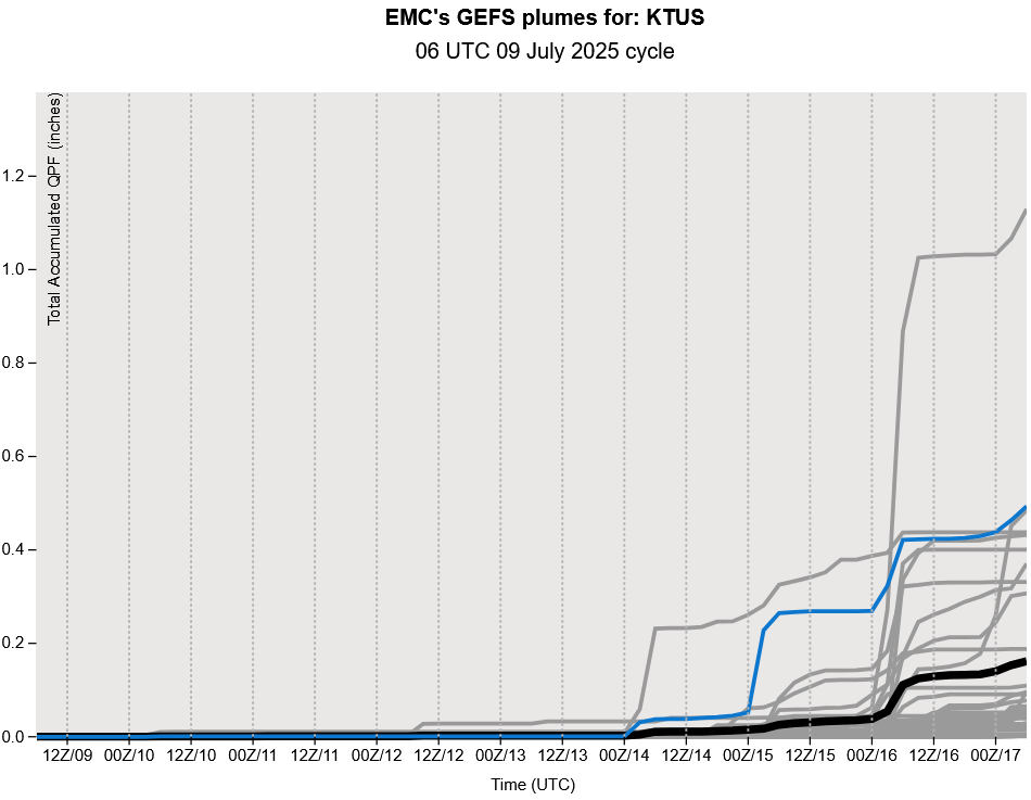
The GEFS plume forecasts have shifted the “return of monsoon” moisture back several days. This does not mean a decrease in storms, just that any storms that do form will be anchored to the mountains. The monsoon moisture remains close and an Mesoscale Convective System will likely push some low-level moisture into the state from Mexico at some point, but with warm temperatures aloft at 500mb storms will tend to be weaker. The low deserts will remain dry until the high moves to the four corners region, though even the long range forecasts aren’t showing that in the next 7-10 days.
Discussion written by Pat Holbrook