
Yesterday’s Weather
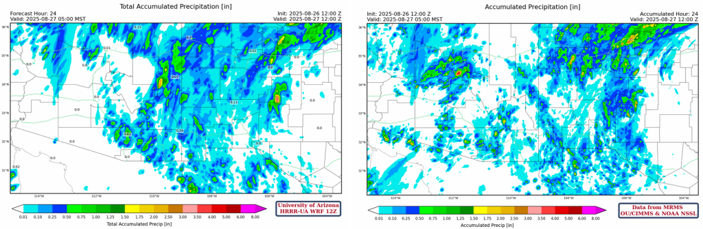
The rule of thumb, “a down day flows an up day”, was true of yesterday as thunderstorms were scattered over the state, but only the anvils dropped rain in the Phoenix and Tucson valleys in the afternoon hours. Thunderstorms did form west of Phoenix around 9pm and dropped rain along/east of I-17 with a maximum of 1.25 inches near Glendale..
Yesterday’s HRRR-UA WRF 12Z 24-hour accumulated precipitation forecast is on the left and equivalent observations from MRMS on the right. The forecast for New Mexico and eastern Arizona was generally good though Cochise County had less than predicted. The late night precipitation from the Phoenix area up to Prescott was also underestimated.
Analysis
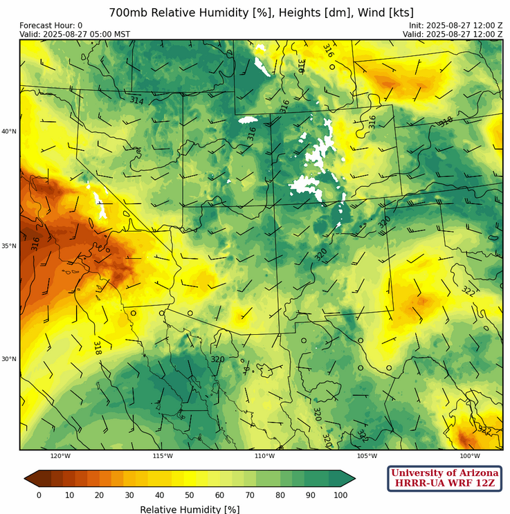
Arizona and New Mexico are blanketed this morning with 50°F dewpoint temperatures or higher. Dewpoint temperatures greater than 60° F are along the Colorado River valley extending eastward to Phoenix, Tucson, and Sierra Vista.

The observed sounding at Phoenix from 5am and the HRRR-UA WRF 12 forecast initialization for the concurrent time are shown below. The forecast initialization is missing the drying occurring around 500mb and the subtle cloud cover indicated at 760mb. This represents the cloud deck that has been moving northward into the state from Mexico.

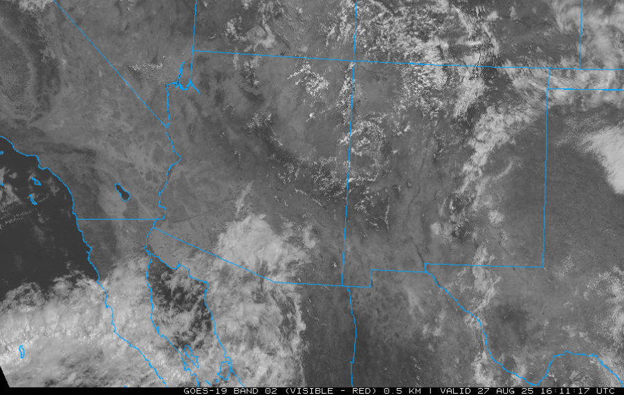
An expanded view visible satellite image shows the mid-level cloud deck moving into Arizona from the southwest that is part of a larger circulation from Tropical Storm Juliette. This is not an ideal direction for moisture to be coming from since only one upper air station can sample the atmosphere (Empalme, Guaymas) with this moisture while most of it is in the Pacific Ocean, we’ll see if observations and, therefore, forecast models can represent it well.
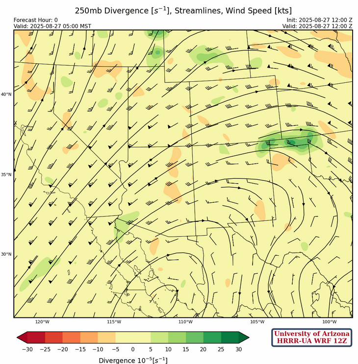
At 250mb, the high pressure ridge west of the Baja Peninsula has moved east of its position yesterday to the central Gulf of California today. The pressure gradient between the high and a low-pressure trough off the west coast has resulted in a strong southwest jet across southern California and western Arizona.
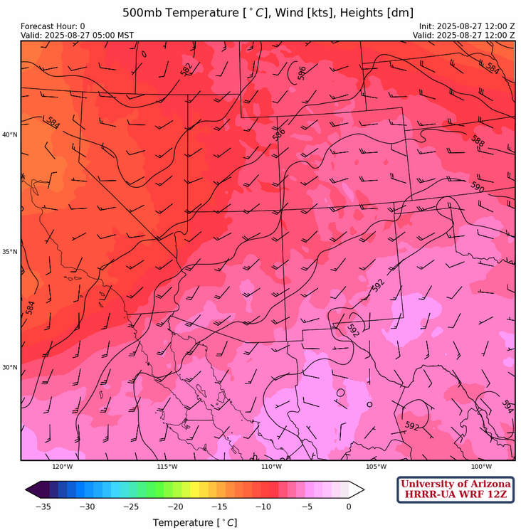
The center of the ridge is in central Texas at 500mb, and the trough is off the west coast. The flow over the region has shifted from southerly to the southwest with a few degrees of warming as supported by the observed Phoenix sounding shown above.
At 700mb, although the relative humidity values appear high the dewpoint temperatures have dropped a few degrees. Moisture in New Mexico remains about the same as yesterday.
Today
The forecast soundings for Phoenix and Tucson at 2pm are similar with not much Convective Available Potential Energy (CAPE), suggesting storm development will happen on the mountains, but they will have a hard time moving into the valleys.

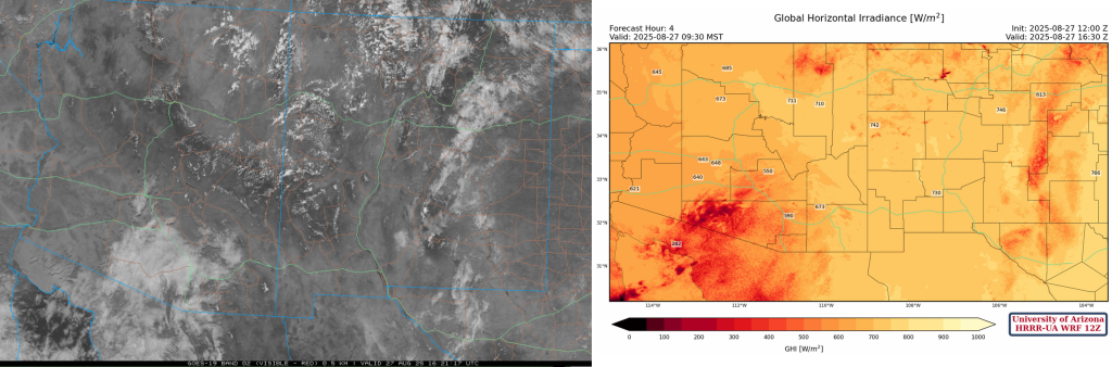
The cloud cover moving in from the south may complicate the forecast, but the HRRR-UA WRF 12Z (below, right) seems to have initialized the clouds well given the visible satellite image from 9:30am (below, left).
The simulated radar reflectivity forecast for this afternoon/evening only shows light storms near mountains in both Arizona and New Mexico. Rain and a few thunderstorms will move into the Yuma area overnight associated with mid-level moisture being pulled into Arizona from Tropical Storm Juliette.
Tomorrow
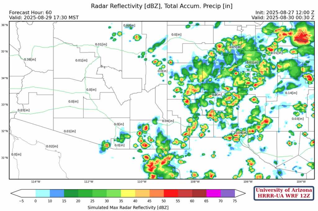
Precipitation related to Tropical Storm Juliette continues moving northward up the Colorado River valley through the day. Additional storms develop due to surface heating in southeast Arizona and the southern half of New Mexico.
Outlook
Moisture increases in southeast Arizona on Friday resulting in an increase of thunderstorms forecast in far southeast Arizona and all of New Mexico. The Phoenix and Tucson metro areas should remain dry.
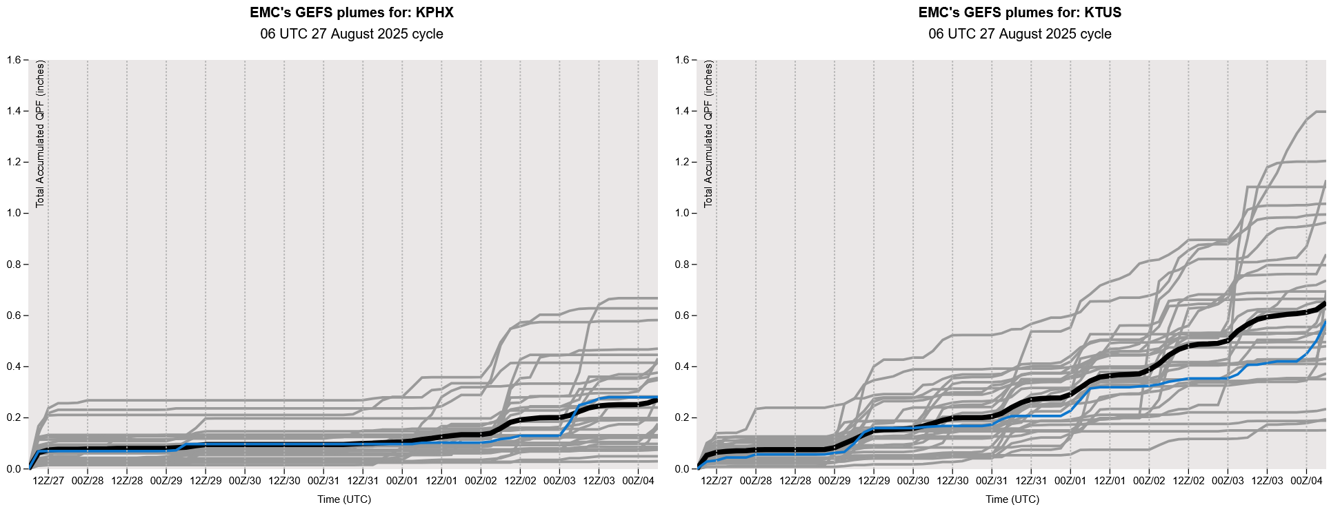
GEFS plume forecasts show that Phoenix should remain dry though the weekend. Some storms may occur in Tucson Friday into the weekend, but most likely staying south and east of the metro area.
Discussion written by Pat Holbrook and Patrick Bunn